
-
 46589 Hits
-
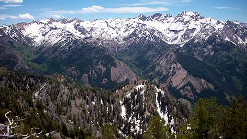
 98.81% Score
-
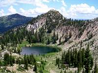
 90 Votes
|
|
Area/Range |
|---|---|
|
|
40.59390°N / 111.7203°W |
|
|
Hiking, Mountaineering, Trad Climbing, Sport Climbing, Scrambling, Skiing |
|
|
Spring, Summer, Fall, Winter |
|
|
11330 ft / 3453 m |
|
|
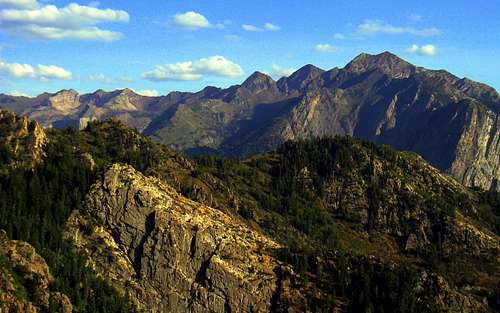
Overview
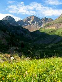
The Wasatch Mountains have a lot of wonderful peaks that have great hiking and climbing routes. Whether you like snow, alpine, or rock climbing, it's all here within a short drive of the city. Big Cottonwood Canyon has many quartzite cliffs in the lower part of the canyon. Little Cottonwood Canyon has numerous granite walls. These two canyons are very close to each other but quite different. There are world-class ski resorts here too. They are at Brighton and Solitude in Big Cottonwood Canyon and Alta and Snowbird in Little Cottonwood Canyon.
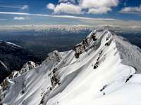
Cottonwood Ridge contains many of these beautiful mountains. It is the main ridgeline that divides Big and Little Cottonwood Canyons. These two canyons provide access to the majority of the Central Wasatch and are the most popular areas near Salt Lake City. It is a great place for people who enjoy scrambling with a little exposure. When you have a chance to get away from the popular peaks you will probably be alone. This is truly amazing, considering how many people live down in the valley below. The ridge runs west to east from Storm Mountain and Broads Fork Twin Peaks to the peaks above Brighton. A large portion of the ridge is above timberline and over 10,000 feet.
The Twin Peaks Wilderness was established by Congress in 1984 and consists of approximately 11,000 acres. It is bounded on the south by Little Cottonwood Canyon, on the north by Big Cottonwood Canyon, on the west by Salt Lake Valley, and on the east by Mineral Fork in Big Cottonwood Canyon.
You can often combine mountain climbs on Cottonwood Ridge. Of course, many people climb each peak separately. If you're in really good shape then you could hike the entire ridge in one day. Most people will need more time and will want to break the ridge up into different segments. I have divided the information into sections that include: The Triple Traverse, Cottonwood Ridge (West), Cottonwood Ridge (East), and the Brighton Area. Thanks to everyone who submitted pages and photos for these mountains.
The Wasatch Range
The Wasatch Range is part of the Rocky Mountains. The Wasatch Range rises to elevations of more than 11,000 feet and stretches for over 200 miles from Soda Springs, Idaho to Nephi, Utah. It starts with the Bear River Range in southeastern Idaho and northern Utah, then the Wellsville Mountains near the city of Mendon, the Northern Wasatch above the cities of Ogden and Bountiful, the Central Wasatch above Salt Lake Valley, and Southern Wasatch, which has the highest mountains, from Provo to Nephi. The Wasatch Range is an imposing and important geographic feature in the western United States. From a geologic perspective, the mountains are a complex mix of igneous, sedimentary, and metamorphic rocks.
From a demographic perspective, these mountains, and their western base, is a corridor known as the Wasatch Front. Over 80 percent of Utah's population lives within 15 miles of the Wasatch range. Salt Lake City lies between the Wasatch Range and the Great Salt Lake. Not only those that live in the areas around Salt Lake City but Logan, Ogden, and Provo have the Wasatch Mountains as a spectacular backdrop each morning. Hiking, rock climbing, skiing, camping, mountain biking, and fishing are a few things that the Wasatch Mountains have to offer. This mountain playground is an ideal place for all kinds of outdoor enthusiasts.
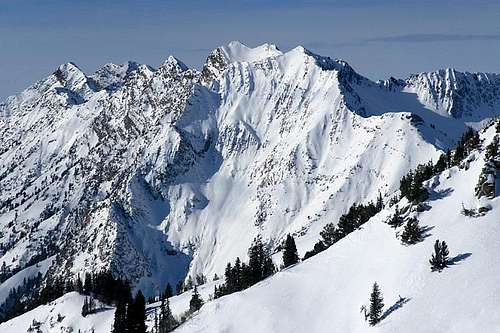
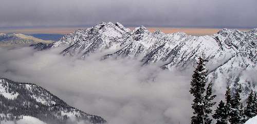
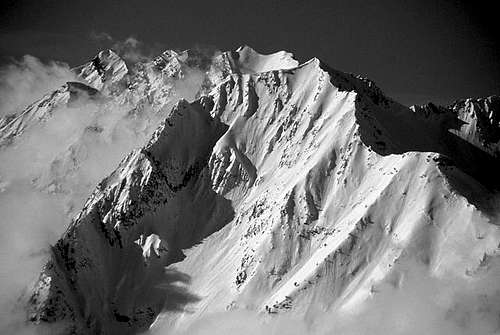 Mount Superior, Monte Cristo, and the Cottonwood Ridge - by 46and2
When to Climb
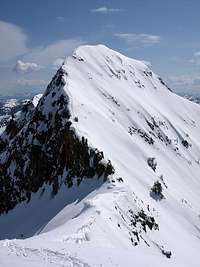
Spring is the best time to do steep couloirs and snow routes. Consolidated snow develops in the high basins. Early in the day, you will have firm and icy snow that allows for a fast ascent. In the afternoon, the snow softens and you will be plunge stepping all the way down. Glissading is the best way to descend most snowfields. This is also a good time to travel to areas with talus and boulder fields because much of the loose rubble will be covered in snow. The foothills are the safest place to hike during spring. South-facing slopes will have small snow patches but will be passable by most people. Many trails will be muddy and wet. Popular mountains to climb in spring are the Triple Traverse Peaks, Storm Mountain, Wolverine and Tuscarora.
Summer is the normal climbing season in the Wasatch Mountains. It lasts from July to September. This is also when everybody else is out hiking and climbing. Like most areas, the season is determined by the amount of snow in the mountains. During a heavy snow year, it may be until late summer for snow to melt from sheltered areas. Going to the higher elevations is the best way to escape the heat. When the city temps are hot, it may be very windy and cold on top of a mountain. North facing slopes offer the most shade during summer. Popular mountains to climb in the summer are Broads Fork Twin Peaks, Sunrise Peak, Dromedary Peak, Mount Superior and Monte Cristo, Kessler Peak, Sunset Peak, and Pioneer Peak.
Fall is a great time to climb. Long hikes and climbs are made easier by the cooler temperatures. The amount of daylight will be shorter though. These mountains have spectacular fall colors which make even the less interesting mountains beautiful. In September, the first big snowstorm of the season usually hits the Wasatch. A period of nice weather usually follows before winter comes. Popular mountains to climb in fall are Flagstaff Peak, Honeycomb Cliffs, and Sundial Peak.
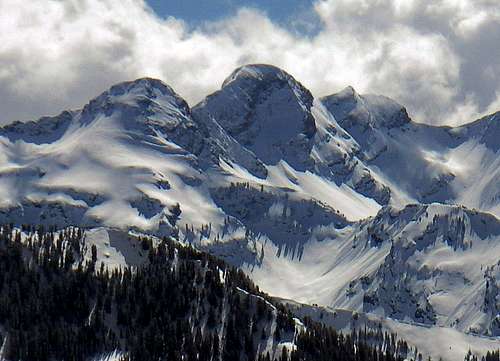
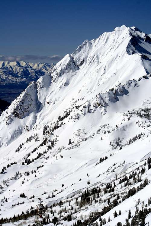
Winter has become a popular time to climb these mountains. This is generally from December through March. In the mountains, the season can extend into April and May. Climbing the high peaks in winter should not be taken lightly because of the continuous threat of avalanches which have claimed several lives. An avalanche beacon, probe, and shovel are recommended, as well as the knowledge to use them. Most mountains in the Wasatch can be climbed in one long day. Popular mountains to access in winter are Mount Superior, Monte Cristo, Flagstaff Mountain and all of the mountains above Brighton.
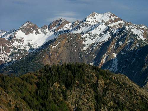 Triple Traverse Peaks: Dromedary, Sunrise, and Twin Peaks - by Rocky Alps
Getting There
The mountains above Salt Lake City are situated in one area so they are easy to get to for most people. Several canyons run east to west along the Wasatch and provide access to all of the peaks. You can get to almost all of these mountains from Interstate 15. This is the major highway that goes north to south all the way through Utah.
Big Cottonwood Canyon
Big Cottonwood Canyon is located on Wasatch Boulevard at 7200 South (Fort Union Boulevard), about 12 miles southeast of downtown Salt Lake City. The best way to get there is by driving on the I-215 Belt Loop and following the signs for the Cottonwood Canyons Ski resorts.
Take the 6200 S exit- EXIT 6- toward SKI AREAS/Solitude / Brighton/Snowbird / Alta for 0.2 miles. Merge onto UT-190 E toward SKI AREAS/Solitude / Brighton/Snowbird / Alta and drive for 1.8 miles to the mouth of Big Cottonwood Canyon.
There is a Park'N Ride at the mouth of the canyon on the left side. This is a popular place for people to meet and carpool up the canyon. During winter ski buses run from the city up to the Ski Resorts.
Little Cottonwood Canyon
Little Cottonwood Canyon is located at the intersection of Highway 210 and South Little Cottonwood Canyon Road. The best way to get to Little Cottonwood Canyon is to get on the I-215 Belt Loop and follow the signs for the Cottonwood Canyons Ski resorts.
Take the 6200 S exit- EXIT 6- toward SKI AREAS/Solitude / Brighton/Snowbird / Alta for 0.2 miles. Merge onto UT-190 E toward SKI AREAS/Solitude / Brighton/Snowbird / Alta and drive for 1.8 miles to the mouth of Big Cottonwood Canyon, which is at Fort Union Blvd & Wasatch Blvd. Continue straight through the stoplight and follow the road another 4 miles to the mouth of Little Cottonwood Canyon.
At the mouth of the canyon is a Park'N Ride similar to the one in Big Cottonwood Canyon. During winter ski buses go from the city up to the Ski Resorts.
Check each mountain page for exact trailhead locations.
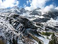
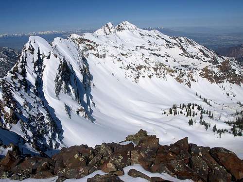 Cottonwood Ridge from Monte Cristo - by seanpeckham
Broads Fork / Triple Traverse
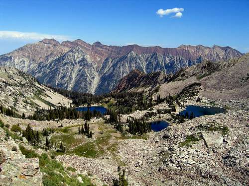
The Triple Traverse is named after the three main peaks located above Broads Fork. They are Broads Fork Twin Peaks, Sunrise Peak, and Dromedary Peak. A fun day involves traversing all three of them. Broads Fork is one of the best hikes on Cottonwood Ridge. There is a nicely maintained trail that goes to the meadow located below these mountains. The terrain above features a large boulder and talus cirque. Snow doesn't melt from this area until summer and avalanches are a common sight during winter. The highest mountain on the ridge is Broads Fork Twin Peaks. It can be climbed by the standard route up Broads Fork from the saddle between Twin Peaks and Sunrise or the Robinson Variation. In the summer, the easiest routes involve 3rd class scrambling. Sometimes a climb of Storm Mountain and the ridge connected it to Twin Peaks is done as part of the Triple Traverse.
If you are climbing Tanners Gulch then the traverse is done in the opposite direction. Tanners Gulch is one of the best spring snow climbs in the Wasatch. This route has a small time frame for safe conditions usually in late spring from the end of April to early June depending on conditions. The major issue is avalanches so try to go after the snow has consolidated.
The route climbs up the prominent snow-filled gully located between Dromedary and Sunrise Peak. From Tanners Saddle follow the ridge to the summit of Dromedary Peak which is the lowest peak of the traverse. From here you will get a view of the rest of the route. Sunrise Peak towers above with its distinct snow dome shape. The route follows its east ridge to the top. The downclimb of Jepsen's Folly from Sunrise Peak is considered to be the crux of the route. This leads to the saddle between Sunrise and Twin Peaks. Now you can just follow the standard route up the ridge to the summit of East Twin Peak. A short walk leads to the summit of West Twin Peak. The most preferred descent is down Broads Fork.
Broads Fork Twin Peaks
Broads Fork Twin Peaks
Broads Fork Twin Peaks - (11,330 feet)
This is the highest mountain on Cottonwood Ridge. It stands out in all directions above Salt Lake City. East Twin Peak is higher than West Twin Peak by only two feet but most people climb both of them anyway. Some people think that this is the highest mountain in Salt Lake County but American Fork Twin Peaks to the southeast is higher by over a hundred feet. All of the routes involve considerable elevation gain to reach the summit. Routes from the east side of the mountain include Ferguson Canyon, Deaf Smith Canyon, and Hounds Tooth Ridge. Stairs Gulch is a rugged off-trail route on the north side of the mountain. The standard approach to Twin Peaks is from Broads Fork or the Robinson Variation.

Sunrise Peak

Sunrise Peak
Sunrise Peak - (11,275 feet)
Sunrise Peak is the least climbed peak on the Triple Traverse. It is the triangle-shaped peak located in between Twin Peaks and Dromedary Peak. The scrambling is a little more difficult to negotiate. The normal route from the Twin Peaks saddle goes up the west ridge and a couple of chimneys. An unnamed subpeak labeled 11,085 sits on its west ridge. The east ridge is the easiest route. It starts from the saddle between Dromedary Peak and Sunrise Peak. The north face has a large cliff that hasn't seen much climbing activity. It is sometimes referred to as O'Sullivan Peak.

Dromedary Peak

Dromedary Peak
Dromedary Peak - (11,107 feet)
Dromedary Peak is the peak that first comes into view when hiking up the Broads Fork trail. It is the lowest of the three peaks. The standard route is to climb up from the saddle between Dromedary Peak and Sunrise Peak. The route goes up a boulder field and gully full of rock and scree. The view into Little Cottonwood Canyon is spectacular. You'll be able to look down into Tanner Gulch. Dromedary Peak is also approached less often from Lake Blanche. The peak received its name because it is thought to resemble the hump on the back of a camel.

Storm Mountain

Storm Mountain
Storm Mountain - (9,524 feet)
Storm Mountain is located to the west of Twin Peaks along Cottonwood Ridge. It isn't climbed as much because it isn't as high in elevation as the peaks to the east. It often blends in with the surrounding mountains except when viewed from certain angles. From the north, it is more visible. The most common way to climb Storm Mountain is by a short and steep route from Ferguson Canyon. The northeast face has been known to have some mixed climbing in certain conditions. You can climb Broads Fork Twin Peaks by traversing the ridgeline from Storm Mountain.
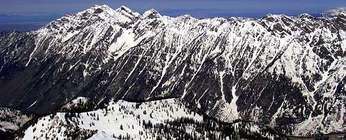
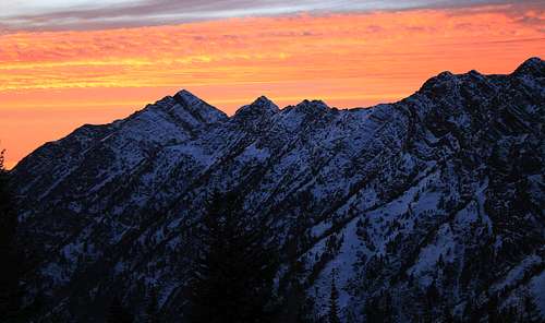 Cottonwood Ridge Sunset - by TyeDyeTwins
Cottonwood Ridge (West)
This part of the ridge is located between Dromedary Peak and Cardiff Pass. To traverse across the entire Cottonwood Ridge in one day would be quite a feat. So this section of the ridge is probably enough for most people. It is usually combined with the Triple Traverse. The traverse is more commonly done by going in a west to east direction. This means that the approach to Broads Fork is done earlier in the day. The traverse can also be done in the opposite direction starting in Alta which begins at a higher elevation. It's all a matter of preference. Bring plenty of food and water for this long hike.
Dromedary Peak can be climbed from Broads Fork or Lake Blanche. Mount Superior and Monte Cristo are located on the east side of the ridge. There are several other peaks and points along the ridge but they are not named. Notable unnamed peaks include Peak 10,910 which is a half-mile east of Dromedary Peak. The next major point located to the east is Peak 11,033. This is the highpoint of the long ridge that extends south from Sundial Peak. There is a small point located farther east that you hike over. Another prominent unnamed peak is the one located west of Monte Cristo. It is photographed often by people who climb the mountain. The last half mile along the ridge to Monte Cristo is steep and narrow. Follow the east ridge of Mount Superior and descend from Cardiff Pass.
The ridgeline is narrow for most of the way and a few parts are knife-edged with a lot of exposure looking down into Little Cottonwood Canyon and the basin southeast of Lake Blanche. The scrambling isn't difficult but the rock is loose in many places. The ridge has mostly 3rd class and 4th class scrambling. Most people consider the crux to be located west of Monte Cristo. You should be able to find good handholds in the rock. The ridge is a lot longer than it looks and sometimes scrambling along it can be incredibly slow. There are a few places to bail if the weather gets bad. Almost all of them are down the basin to the north on either side of Sundial Peak. The route finding is pretty straight forward but there are a few side ridges that connect with the main ridge.

Cottonwood Ridge

Cottonwood Ridge
Cottonwood Ridge Peaks
The ridge located east of Dromedary Peak and west of Monte Cristo is the most rugged part of Cottonwood Ridge. There are many other peaks and points along the ridge but they are not named. Notable unnamed peaks include Peak 10,910 a half-mile east of Dromedary Peak. The next major point located to the east is Peak 11,033. This is a highpoint on the ridge that extends south from Sundial Peak. There is a small point located farther east that you hike over. Another unnamed point is located west of Monte Cristo. The last half mile to Monte Cristo has fun scrambling on a narrow ridgeline.

Monte Cristo
Mount Superior
Mount Superior and Monte Cristo - (11,132 feet)
These peaks are the two prominent mountains to the west of Cardiff Pass. They are located close to each other so most people climb them both. Mount Superior is the lower of the two and has many routes to its summit. The south ridge is a fun rock scramble and a very nice winter climb. The jagged ridgeline to the north of Mount Superior is known as Cardiac Ridge. These two peaks are popular because of a short and direct approach from Cardiff Pass. The normal route for both of these peaks is the east ridge. There are nice views down into Little Cottonwood Canyon.

Sundial Peak
Sundial Peak
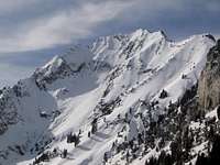
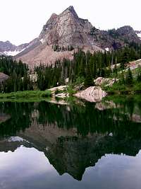
Sundial Peak - (10,320 feet)
This is the majestic mountain that towers over Lake Blanche. It is really just a highpoint at the end of a side ridge that connects with Cottonwood Ridge. Sundial Peak is one of the most photographed mountains in the Wasatch. This is because of its location directly above the Lake Blanche trail which is very popular on summer weekends. A few rock climbing routes go up its north face. A route for scramblers is on the southwest side of the mountain. It goes around the lake and into the higher basin on the west side of the Sundial Peak. Much of the ridgeline is narrow in a few places. The actual highpoint is farther south of the point that is seen directly above the lake.

Kessler Peak

Kessler Peak
Kessler Peak - (10,403 feet)
Kessler Peak is part of the long ridge that stretches north from Mount Superior. This ridgeline separates Cardiff Fork from Mineral Fork. The peak stands high above the Cardiff Fork trailhead in Big Cottonwood Canyon. The North Route is the shortest and most direct route up the mountain. It is a short and steep hike. The longer route from the Carbonate Pass ridge can be made into a loop hike with the north route. The summit provides good views of Cardiac Ridge, Cottonwood Ridge and the surrounding peaks. It has to be a cool mountain because SP member Scott named his son after it. It was originally named and spelled as Kesler, after an early timber developer and explorer of the area.
 Cottonwood Ridge seen near White Pine Lake - by ZeeJay
Cottonwood Ridge (East)
This section of the ridge is located between Cardiff Pass and Twin Lakes Pass. Some of the peaks that can be accessed from here include Flagstaff Mountain, Reed and Benson, Davenport Hill, and Honeycomb Cliffs. The nearby ski resorts allow quick access to this area. In winter, many skiers and snowshoers will be in this area, especially near Silver Fork and Days Fork. In summer, fewer people hike this part of Cottonwood Ridge but you should start seeing hikers once you get to Twin Lakes Pass. A trail can actually be followed for much of the way along the ridge.
Flagstaff Mountain can be reached from the trail up Cardiff Pass. There are two ways to climb the mountain. The route from Flagstaff Mine is the most direct route and follows a steep slope to the summit. This also bypasses the more rugged lower peak to the west. The other route starts from Cardiff Pass and goes up cliff bands that are frequented by mountain goats. Reed and Benson is a long ridge located north of Flagstaff Mountain. It is seldom climbed except during winter by skiers because there are a lot of couloirs on the face. It runs north to south and has steep cliffs on its west side that overlook Mill D South Fork.
The ridge continues as it goes toward a peak that is east of Flagstaff Mountain. The trail along the ridge descends a little and then follows the ridge except to avoid trees along the way. There will be great views of the peaks above Alta across the valley. The trail travels to the head of Days Fork and then goes to Davenport Hill. This overlooks Silver Fork to the north. The route follows the south side of the ridge as it heads toward the Honeycomb Cliffs. You can climb the mountain directly up the face. It is more easily climbed from Twin Lake Pass by following a trail up the south ridge. The last option is to follow the trail to Prince of Wales Mine and then climb up the north ridge to the summit of Honeycomb Cliffs. The best descent is down Grizzly Gulch.

Flagstaff Mountain

Flagstaff Mountain
Flagstaff Mountain - (10,530 feet)
Flagstaff Mountain is the first peak to the east of Cardiff Pass. The trail starts near the Alta service garage. The large limestone cliffband near the bottom is known as the Hellgate Cliffs. This is an easy peak to climb because of the short approach. The Cardiff Pass trail branches off at a junction with a mine. This is the route to the south slopes. It basically climbs straight up from the mine on grassy terrain. It can be climbed directly from Cardiff Pass from the west ridge but requires some scrambling and route-finding through the cliffbands. You can continue on the ridge toward Honeycomb Cliffs. Flagstaff Peak can also be climbed from Days Fork in Big Cottonwood Canyon.

Honeycomb Cliffs

Honeycomb Cliffs
Honeycomb Cliffs - (10,480 feet)
Honeycomb Cliffs sounds like a good place to go rock climbing. Unfortunately, the rock is loose and not very stable for that. It is a good hike up to the top though. There are two summits on this mountain. They are about the same elevation. The cliffs that the mountain is named after face toward Brighton. Several steep couloirs make good ski runs during winter. Honeycomb Cliffs is approached from Twin Lakes Pass by a trail up the south ridge. You can get there from either Alta or Brighton. The north ridge near Prince of Wales mine can be used as an approach route.
 Cottonwood Ridge seen from Wildcat Ridge - by Matthew Van Horn
Brighton Ridge
This ridge traverse is located above Brighton Ski Resort at the top of Big Cottonwood Canyon. These mountains are over 10,000 feet in elevation but are easier to climb than the higher peaks to the west. This ridge can be broken into smaller hikes because there are so many trails in the area. This ridge is for people who love peakbagging several mountains in one day. The good thing is that you don't need a car shuttle if you do this hike as a loop. Another version of the hike is called the Alta Ridge Run. This starts from Albion Basin to Point Supreme and then goes to Catherine Pass. Then the route follows the ridge over Mount Wolverine and Mount Tuscarora to Twin Lakes Pass and descends Grizzly Gulch down to Alta.
The Brighton Ridge Run starts by going up the trail toward Snake Creek Pass. At the pass is a great view of Mount Timpanogos and other mountains in the Southern Wasatch. You also have a choice of whether to add Clayton Peak to your hike. A trail can be followed all the way to its summit. From the pass, continue west along the standard Brighton Ridge Run. The first peak you’ll get to is Preston Peak. Descend down a little and then traverse over toward the next peak known as Pioneer Ridge. There are several lakes that can be seen including Dog Lake, Lake Mary, and Lake Martha. Hike up to the next peak which is named Pioneer Peak. Lake Catherine is located in a pretty cirque on the northwest side of the mountain. Continue along the ridge and you'll arrive at Sunset Peak. This is a popular destination so you are likely to see people here or at the saddle.
From Sunset Peak, hike down the trail toward Catherine Pass. There is a junction at the pass and you’ll want to take the smaller trail that goes north toward Mount Tuscarora. This is the smaller peak that is southeast of Mount Wolverine. Follow the ridge over boulders and rocks to the summit. Mount Wolverine is the highest mountain above Brighton. It has a great view because of its location at the top of both Big and Little Cottonwood Canyons. From here you have a choice of which direction to go. One is to follow the ridge to the northeast down to Mount Millicent. This will take you to Twin Lakes Reservoir and back to Brighton. A longer route goes over Wolverine Cirque and Patsey Marley. This goes to Twin Lakes Pass where you can follow the trail back down to the trailhead.

Mount Tuscarora

Mount Wolverine
Mount Wolverine and Mount Tuscarora - (10,795 feet)
These two peaks are right above the upper end of Little Cottonwood Canyon. They are located close to each other and are usually climbed together. Tuscarora is the first mountain you will get to if you climb up from Catherine Pass. There is a trail along the ridge. Mount Wolverine is the highest mountain in the area around Brighton. It has a nice alpine cirque on its northeast side that offers good skiing and early season snow climbs. These peaks can also be approached from Twin Lakes Pass.

Patsy Marley

Patsy Marley
Patsy Marley - (10,525 feet)
Patsy Marley is located near Mount Wolverine and Mount Millicent on Cottonwood Ridge. It sits just outside the boundary of Alta Ski Resort. The mountain is on the northeast edge of the Wolverine Cirque. There are great views of Big and Little Cottonwood Canyons and Brighton Ski Resort and Twin Lakes Reservoir. Patsy Marley is commonly accessed by Grizzly Gulch. You will see the evidence left from the mining era in this canyon. The mountain can be seen spelled as Patsy or Patsey Marley.

Mount Millicent

Mount Millicent
Mount Millicent - (10,452 feet)
Mount Millicent is located on a side ridge on Cottonwood Ridge. It is on the east side of Mount Wolverine and Mount Tuscarora. It can be approached from Brighton near Twin Lakes Reservoir by climbing directly up the east ridge of the mountain. This mostly involves a lot of boulder hopping. Another approach is either from Twin Lakes Pass or Catherine Pass. This is part of the Brighton Ridge Run which usually involves climbing up Mount Wolverine and Mount Tuscarora and then descending down toward Mount Millicent. The summit consists of a large pile of boulders.

Mount Evergreen

Mount Evergreen
Mount Evergreen - (9,840 feet)
Mount Evergreen is located above Brighton at the end of Big Cottonwood Canyon. It is a small summit that blends in well with its surroundings. It is a portion of the ridge extension leading east from Honeycomb Cliffs, and overlooks Twin Lakes Dam. The mountain received its name from Engleman Spruces which can be seen on its slopes. The summit has great views into Wolverine Cirque to the south, the east face of Honeycomb Cliffs, and Twin Lakes. The summit has two main routes, one from the service road leading to Twin Lakes, and another from Silver Lake via Mill F Fork.

Sunset Peak

Sunset Peak
Sunset Peak - (10,648 feet)
Sunset Peak is a popular peak located south of Catherine Pass. From the pass, the trail goes along the right side of a minor peak on the ridge. This peak is on the triple divide between Big Cottonwood, Little Cottonwood, and American Fork Canyons. It is a nice peak to climb because there is a trail all the way to the top. It can be climbed from Brighton or Alta along the Brighton Ridge Run. Good views from the top include Devils Castle and American Fork Twin Peaks. The trail along the ridge is a little steep but easy to follow. A climb up Sunset Peak can be combined with Pioneer Peak.

Pioneer Peak
Pioneer Peak
Pioneer Peak - (10,450 feet)
Pioneer Peak is located east of Sunset Peak on the same ridgeline. It is an easy peak to climb because there is a climbers trail most of the way to the top. It can be climbed from Brighton or Alta along the Brighton Ridge Run. It is closer to Brighton so that is the preferred route. Good views from the top include Mount Wolverine and Tuscarora and all the mountains on the eastern end of Cottonwood Ridge. Pioneer Peak is a small mountain that has great views especially of all the lakes in the area. It is located above Catherine Lake. The trail along the ridge is faded but not hard to follow. A climb up Pioneer Peak can be combined with Sunset Peak as a nice day hike.

Preston Peak

Preston Peak
Preston Peak - (10,315 feet)
Preston Peak is one of the many peaks along Cottonwood Ridge. It is usually climbed as part of the Brighton Ridge Run and can be combined with other peaks in the area. The mountain overlooks Brighton Ski Resort. Preston Peak is actually within Brighton Ski Area boundaries. During the ski season, Preston Peak is a short walk from the top of the Snake Creek Chairlift. During summer there is a small trail along the ridge. Preston Peak is located between Clayton Peak to the northeast, and Pioneer ridge which is connected to Pioneer Peak to the west. Maps of the Brighton area have Preston Peak labeled as 10,315 feet but the mountain is unnamed on the topo maps.

(Mount Majestic) Clayton Peak
(Mount Majestic) Clayton Peak
Mount Majestic (Clayton Peak) - (10,721 feet)
Clayton Peak is the last major mountain on the east end of Cottonwood Ridge. It stands to the southeast of Brighton Ski Resort. There are two routes from the parking lot. The most scenic route follows a trail toward Dog Lake. It takes the left fork twice at both intersections and starts ascending toward Snake Creek Pass. The other route follows a dirt service road where it meets up with the regular trail higher up. On a clear day you should get a great view from Snake Creek Pass. From the pass, follow the service road for 1/4 mile until you get to the west ridge of Clayton Peak and then the summit. Lackawaxen Lake is directly below and American Fork Canyon is to the south.
 Cottonwood Ridge from Mount Olympus - by TyeDyeTwins
Climbing Areas

Dromedary Peak
Wasatch Alpine Climbs
The Wasatch Mountains have a lot of alpine routes to choose from. Many of these climbs are classic routes that shouldn't be missed. This is a good page to look at if you want to climb something more challenging than the regular route up every mountain. Difficulty and quality ratings are stated on the page. They range from rock scrambles to snow and ice climbs. Winter ascents up a lot of the higher peaks have been done by some of the Utah SPers. Broads Fork Twin Peaks, Monte Cristo, and Mount Superior are a few of them. Check out some of their winter climbing pictures.

Storm Mountain

Little Cottonwood Canyon

The Hounds Tooth
This is one of the most popular places to rock climb around Salt Lake City. Big Cottonwood Canyon has good quality quartzite routes that have both sport and trad climbing. Popular areas include Dogwood Crag, The Slips, and Storm Mountain. Limestone climbing can be found higher in the canyon at the Hellgate Cliffs area. There are numerous routes in these areas from beginner to expert. Both Cottonwood Canyons are covered in detail on Pellucid Wombat's pages.
Little Cottonwood Canyon
Little Cottonwood Canyon has multi-pitch climbs on granite featuring difficult slabs and cracks. Popular areas include Crescent Crack Buttress, the Gate Buttress, and Lisa Falls. Many difficult routes with little protection were climbed in the 1960's and 1970's. The Thumb is the largest buttress in the canyon and some of its routes are eight pitches long. Overall, the north side of the canyon has easier access than the south side but multi-pitch routes can be found on either side.
The Hounds Tooth
This is the prominent buttress that is located on the ridge between the North Fork of Deaf Smith Canyon and Ferguson Canyon. This place isn't climbed much and you will probably be alone if you go there. The rock isn't as good of quality as Ferguson or Little Cottonwood Canyon. The approach is long and hard to get to. The West Ridge route is three pitches long and rated 5.6 on poor rock and bad protection. The standard descent of Hounds Tooth is down the east face.
Ferguson Canyon
This is the next canyon south of Big Cottonwood Canyon. It is located on the west side of Storm Mountain. This narrow canyon has many granite crags and buttresses with good climbing routes. Almost everything here is one pitch long. The routes are steep and a lot more challenging than they look. Heart Wall and Guano Wall are the first crags you will pass by. The Watchtower is the most popular area. It has the highest amount of routes that are mainly in the 5.10 - 5.11 range with a couple of moderates thrown in. Higher up in the canyon is the Tower of Babel, The Cathedral, Goldenfingers Wall, and several others.
 Cottonwood Ridge seen from Alpine Ridge - by Phenom
Recommended Hikes
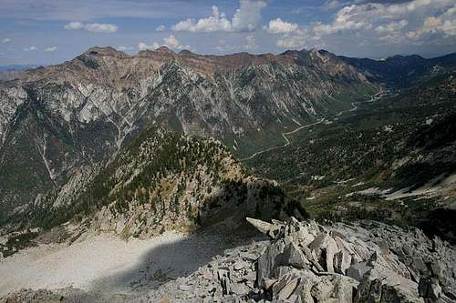
There are a lot of great hikes in the Wasatch Mountains so it is hard to choose a favorite one. I have listed a few that are part of the Cottonwood Ridge. The Big Cottonwood Canyon Road is about 15 miles long and ends at Brighton. There are many easy family hikes in this area. The Big Cottonwood Canyon side of the ridge has more hiking trails compared to the Little Cottonwood Canyon side. Little Cottonwood Canyon is surrounded with steep buttresses and cliffs. The road is a little over 11 miles long and ends at Albion Basin campground near Alta. At the mouth of the canyon is the site where granite blocks were quarried in order to build the Salt Lake Temple. You can sometimes spot mountain goats on the rocky slopes above. Most destinations in these canyons go to high mountain lakes and several peaks have trails that lead to the top.
Sunrise Peak
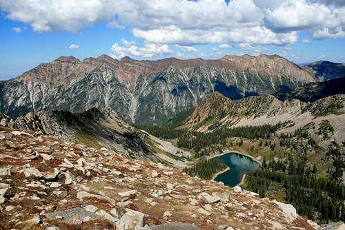
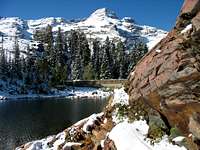
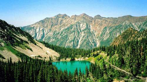
Lake Blanche
Lake Blanche
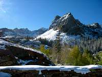
This is one of the most popular hikes in the area. It follows the Big Cottonwood stream for a quarter-mile and then the trail goes south into the Mill B South Fork drainage. The trail crosses a bridge onto the east side of the canyon. It stays near the stream for most of the way. It then starts climbing a series of switchbacks up to the ridge that holds Lake Blanche. The trail goes near several glacial carved boulders that have a red color. The first thing you'll notice is Sundial Peak which stands right above the lake. The trail also continues to Lake Florence and Lake Lillian.
Broads Fork
The Broads Fork trail begins near the southwest end of the S-Curve trailhead parking area. It starts by going around the bend and then turning back east. It passes next to Broads Fork Wall which has a few 5.10 - 5.11 routes. The trail goes through a shaded forest to a bridge crossing over a stream. After that, the trail starts climbing more steeply. It leads to a nice alpine meadow below three mountains: Broads Fork Twin Peaks, Sunrise Peak, and Dromedary Peak. The view from the meadow is beautiful and usually where many people stop. There is an even higher meadow if you continue up the talus.
Cardiff Fork
Broads Fork

Honeycomb Cliffs
Cardiff Fork is a long canyon that goes all the way to Cardiff Pass. It has a lot of mining history and many mines and equipment can be seen in this canyon. People can drive up farther into the canyon to a closer parking lot or park next to Big Cottonwood Canyon road. Hike past a place with summer homes. Kessler Peak is the large mountain on the western side of the canyon. The trail goes near the turnoff to Donut Falls. This is where the crowds will be going. Upper Cardiff Fork doesn't see very many hikers. Cardiff Mine is one of the largest mines in the canyon. There are also some nice places to camp in this area. After the mine, the trail climbs steeply up to Cardiff Pass on the top of the ridge.
Brighton Area
There are numerous trails that go to lakes in this area. Silver Lake is accessible to anyone and is a short stroll from the parking lot. The trail to Lake Solitude starts by hiking past Silver Lake up to a trail junction. The trail heads north around the side of a mountain. Lake Solitude is set in a steep mountain bowl and is quite shallow. The Solitude Tunnel is located right above the lake. It was used during the mining era as an entrance to a larger group of mines. Twin Lakes Reservoir can also be combined with this hike for a nice loop. The trail continues above Lake Solitude on a series of switchbacks above Twin Lakes. It was actually two separate lakes that became one large lake after the dam was built on the east.
The Brighton Lakes Trail up toward Catherine Pass has some of the more well-known lakes in the area. It starts at the very end of the Brighton parking lot. A short hike will lead to Dog Lake. From the junction with Dog Lake is a turnoff to Lake Mary. It is a large lake that also has a dam. It was built in 1916 and created a reservoir for water supply. Lake Martha can be seen farther along the trail in the same area. The next lake on the trail is Lake Catherine below Catherine Pass. Pioneer Peak is the mountain above Catherine Lake.
 Cottonwood Ridge seen from Reynolds Peak - by TyeDyeTwins
Brighton and Solitude

Mount Wolverine, Tuscarora, and Millicent
Brighton was named after a family that emigrated from Scotland to Salt Lake City. They homesteaded an 80-acre plot at Brighton in 1871. The family consisted of William Stuart Brighton, his wife, Catherine, and their children, Dan and Will. One of the lakes above Brighton was named after Catherine who enjoyed fishing. She was a great cook and soon travelers discovered that Brighton was a great place to get a meal. She always had a supply of mutton, beef, and fresh trout that she caught herself, as well as butter, buttermilk, and biscuits.
The Brighton’s soon opened a large store and later built and operated the Brighton Hotel. It was a small hotel with seven bedrooms that were used by some of the most prominent people who lived in Salt Lake City. The summer after the completion of the Brighton Hotel, Catherine died of a sudden heart attack on July 19, 1894.
William Stuart Brighton carried on with the hotel for the remainder of the season. Brighton had been a popular summer destination when Salt Lake City residents came to get out of the city heat but they usually didn’t stay for the snowy winters. In the late 1800s, Dan and Will Brighton made crude skis so they could move around on the snow. About 40 years later, in the 1920s, the Wasatch Mountain Club began skiing at Brighton because it had a large amount of snow.
But there were no lifts in those days. Instead, groups would travel to Park City, climb up over the ridge tops just as the early travelers had done, and ski down into Brighton where they would spend a few days skiing, eating, drinking, dancing, and playing bridge. The shortest route was a one day trip that went through Brighton. Otherwise, it took about three days to go from Park City down the canyon to Salt Lake City to then up another canyon to Alta.

Mount Millicent
Some of the routes from Park City to Brighton became so popular that the Wasatch Mountain Club marked them with signposts displaying the club’s insignia. In the early years, lifts were all privately owned. In 1936, the club built the first rope tow at Brighton. The Alpine Ski Club built a J-bar, but it was a complicated contraption that didn’t work very well. In 1938, K. Smith, an avid skier with the Wasatch Mountain Club, built a 1,440 foot long T-bar lift that was very successful.
Smith then traveled to Sun Valley in Idaho to learn about the newly invented chair lifts. This made skiing much more accessible. Several organizations began to promote skiing in the Wasatch Mountains. Ski resort activity didn't take off until the 1940's. Resorts in Salt Lake City, Ogden, and Park City soon opened. Downhill, slalom, and combined ski championships were held at these resorts. The Wasatch Mountains became a mecca for ski racing.
Zane Doyle was a meat cutter at Hill Air Force Base. He bought K. Smith’s idle lift and went into the ski business. Over several years he continued to install lifts above Brighton. In the winter of 1947-48, the 4,000 foot long, 1,100 foot high Millicent chair lift was built. At the time it was one of the best constructed in the United States. Then in 1955, Doyle and his father-in-law, Willard Jensen, formed a partnership to operate Brighton and the first double chair lift in the Intermountain region, the Majestic double chair lift. In 1963,
Doyle and Jensen operated all of the different lifts, equipment, and services under their ownership. Brighton continued to grow and become a favorite resort along the Wasatch Front. In 1987, Boyne USA, a family-owned corporation established in 1947 by Everett Kircher, purchased the resort. Everett's son John continues to guide the resort today. The Doyle family continues to operate Brighton.

Mt. Wolverine Cirque
Silver miners gave the name Solitude to the geographic area now dominated by Solitude Mountain Resort. The peak of mining activity was during the 1870s and 1880s. The first production of ore was in Honeycomb and Silver Fork Canyons. At that time, the mining district was called the Mountain Lake District because of Silver Lake and Twin Lakes, which is now a reservoir. The first mine was known as Evening Star. By 1875, there were hundreds of mines located at or near Solitude with interesting names like Argenta, Davenport, Antelope, Teresa, Wondering Boy, Prince of Wales, Highland Chief, Woodlawn, and Copperking.
Robert M. Barrett made his fortune as a Moab uranium miner during the early 1950s. He moved to Salt Lake City and took up skiing. While pursuing his passion at Alta, he was denied restroom access. The ski area used sewage tanks and was responsible for transporting waste down the canyon. Restrooms were reserved for guests so he declared he would open his own ski area. Barrett bought every piece of land available in the canyon adjacent to Alta and started construction in 1956. Solitude opened in the fall of 1957 with two chair lifts providing access to the area now skied on the front of the mountain.
Solitude Mountain Resort is located 12 miles up Big Cottonwood Canyon. The area that surrounds the mountain features 1,200 acres of terrain with challenging powder bowls and tree-lined glades with a drop of 2,000 feet. New ski lifts have enabled beginner and intermediate skiers to get up onto the mountain easier than ever before. Solitude is a favorite of Salt Lake City locals due to its abundance of powder and variety of terrain. In more recent years Solitude has expanded to include a villiage for out of town skiers and several lodges. It is open in the summer for hiking and mountain biking.
 Cottonwood Ridge seen from Alpine Ridge - by Ed F
Skiing History

Mount Tuscarora
The Wasatch Mountain Club, still alive today, was formed in 1912. Club members began leading regular ski treks into the Wasatch Mountains. In 1915, the Norwegian Young Folks Society formed and began organizing ski jumping tournaments on the hills above Salt Lake City. During the early 1900's several organizations began to promote skiing in the Wasatch Mountains. Ski resort activity didn't take off until the 1940's. Resorts in Salt Lake City, Ogden, and Park City soon opened. Downhill, slalom, and combined ski championships were held at these resorts. The Wasatch Mountains became a mecca for ski racing. Backcountry skiing has become popular in many areas.
Two resorts are located in Big Cottonwood Canyon. They are Brighton and Solitude. Utah winter sports became even more well known when it was chosen to host the Salt Lake City 2002 Olympic Winter Games. Utah began construction of an Olympic caliber training and competition facilities in an effort to show its commitment to Olympic sports. The Utah Olympic Park was opened in 1993 with world-class jumping, bobsled, and luge facilities. New cross-country skiing facilities at Soldier Hollow and ice facilities in Salt Lake City were also constructed. Utah is famous for its deep powder and quality skiing and was given the slogan "Greatest snow on Earth."
Brighton Ski Resort
Brighton is Utah's oldest ski and snowboard resort and was established in 1936. It began when members of the Alpine Ski Club which is now known as the Wasatch Mountain Club designed and built a ‘skier tow’ out of 1/2 inch wire rope and an old elevator drum. Brighton became the first serviced ski area in the state of Utah, among only a few in the country. It is located at the end of Big Cottonwood Canyon. It has a base elevation of 8,750 feet and summit elevation of 10,500 feet. Brighton receives over 500 inches of snow each season. It is a great resort for powder skiing and snowboarding. It has 66 runs spread over two mountains. The longest is over three miles long and offers plenty of backcountry terrain as well. Brighton also meticulously grooms many runs each night and offers more night skiing than any of the other ski areas. Brighton is located on public land and all of the resort's land is actually part of the Wasatch-Cache National Forest. This means that the whole resort is open to the public year-round with nice hiking trails in the summer.
Solitude Mountain Resort
Solitude is located 12 miles up Big Cottonwood Canyon below Brighton. In the early 1900s, silver miners gave the name Solitude to the geographic area that is now located at Solitude Mountain Resort. The ski area opened in the fall of 1957 with two chair lifts providing access to most of the area now skied on the front of the mountain. Solitude has over 1,200 acres of wide-open bowls, gladed runs, and steep chutes for skiers and boarders of all ages and skill levels. In 1982, Solitude built the Summit lift and opened Honeycomb Canyon to lift-served backcountry skiing. In 1989, they installed Utah's first high-speed detachable quad chair lift. In the early 1990's they began construction of Solitude Villiage. This included six different places for overnight accommodations.
 Cottonwood Ridge seen from North Thunder Mountain - by marauders
Mining History

Prince of Wales Mine
In the mid-1800's, Big and Little Cottonwood Canyons were explored shortly after the arrival of the Mormon pioneers in the Salt Lake Valley. This is where they found most of their timber to supply in the construction of their homes. Mills for processing timber were constructed near the mouths of each canyon and along streams. When the timber supply ran low, they found it necessary to construct mills further up into the canyons. Unfortunately, this unregulated logging together with overgrazing by livestock left many of Utah's mountain slopes denuded. Then by 1900 most of the timber had run out and lumber began to arrive by railroad.
Soon valuable minerals were found along the Wasatch Front that included gold, silver, and lead. Until the turn of the century, more than half of Utah's mineral production was silver. By 1925, Utah mines accounted for 32 percent of the nation's silver. This marked the transition from a period of logging, to a period of prospecting and mining. Many wagon roads were carved out of side canyons to reach mine sites. They were called hills back then and had some familiar names like Peruvian Hill, Davenport Hill, and Snowslide Hill, which is now called Hellgate. Today, the Wasatch is filled with remnants of old mines that can be spotted from trails winding up the mountainsides.
In Big Cottonwood Canyon, the oldest trail in the area is the Argenta trail to Kessler Peak. It started as a logging flume route in 1854. Mineral Fork has a mining road that leads to an overlook above Wasatch Mine. There are several switchbacks above that lead across talus fields to Regulator Johnson Mine. Cardiff Fork is one of the best places to see old relics of the mining era. The main road goes near several mine dumps, weathered machinery, and collapsed buildings on the way to Cardiff Mine. There is a branch in the road that leads to Montreal Hill Mine on the east slopes of Kessler Peak. Days Fork is another good canyon to explore. A boiler in really good condition, a steam engine, and old mine tailings can be found in an alpine cirque near Days Fork Mine and the Eclipse Mine in Upper Days Fork.
Little Cottonwood Canyon has many places left from the history of the mining era. The Cardiff pass trail up the south slopes of Flagstaff Peak goes past several mine dumps. Grizzly Gulch is an old logging road that starts from Alta. One of its well-known mines is the Prince of Wales shaft on the north ridge of Honeycomb Cliffs. It was installed in 1872 and the old steam boiler can be seen in the photo above. Brighton and Alta have many logging roads that are now hiking trails. Above Alta, Peruvian Gulch was a place of major mining activity. The discovery of Emma Mine in Gad Valley above Snowbird went down in history as one of the largest producers of silver ore in the Wasatch Mountains. It produced more than $3.8 million in silver.
 Cottonwood Ridge - by marauders
Salt Lake City
Cottonwood Ridge

Cottonwood Ridge seen from Monte Cristo
From the earliest times, Utah was occupied by nomadic tribes. These included the ancient Anasazi Indians, who were the ancestors of the modern Pueblo people. "Anasazi" is a Navajo word meaning "The Ancient Ones." The Anasazi lived in cliff dwellings. Navajo also roamed this region, as did the Ute Tribe, from which the state of Utah takes its name. Other native Americans who lived in the Great Basin desert included the Paiute and Shoshone.
In 1846, the Mormons left Nauvoo, Illinois because of religious persecution and went searching for a place where they could practice their religion freely. They were members of the Church of Jesus Christ of Latter-day Saints. They traveled across Iowa and then went to Winter Quarters, Nebraska. On April 5, 1847, an advance company led by Brigham Young set off from Winter Quarters on their trek across the United States, approximately 1,040 miles to a new home. They traveled on what is now known as the Mormon Trail. This trail actually paralleled the Oregon trail much of the way. Their purpose was to establish a utopia where they could practice their religion freely.
Salt Lake City was founded in 1847, on July the 24th, by the Mormons. When they arrived their religious prophet Brigham Young reportedly stated, "This is the place." At first, it was called the State of Deseret referring to the honey bee in the Book of Mormon. Then they named it the Great Salt Lake City after the salty inland lake that dominated the desert in the west. In 1868, the word "Great" was later dropped from the name. In 1848, more emigrants came to the valley. But a late frost, drought, and a plague of crickets nearly destroyed the harvest. Flocks of seagulls consumed the crickets and enough of the crop was saved to enable the settlers to survive the winter of 1848-49. In gratitude, the seagull, aka California gull, was later designated Utah's state bird.
Only four days after arriving in the Salt Lake Valley, Brigham Young designated the site for the Salt Lake Temple, the main temple for the Church of Jesus Christ of Latter-day Saints. It was constructed on Temple Square, in the center of the city. The temple took 40 years to build and complete and was dedicated on April 6, 1893. The city was built on a grid system based on the four streets bordering Temple Square. Other important sites were the Mormon Tabernacle, the Utah State Capitol Building, and the Salt Lake City and County Building.
Today, Salt Lake City is Utah's largest city and serves as the industrial, financial, and commercial center of Utah. It has a strong economy and a successful business industry. Salt Lake City has experienced many changes since being settled. It is now the most diverse city in Utah. People from all walks of life have moved here for work and outdoor recreation. The Central Wasatch Mountains are located on the eastern side of the Salt Lake City Valley. The outdoor possibilities are endless because one person could spend their whole life hiking and climbing in the state of Utah and still not see everything.
 Cottonwood Ridge from West American Fork Twin Peak - by TyeDyeTwins
Salt Lake City Weather
Dromedary Peak

Mount Superior and Cottonwood Ridge
Salt Lake City has a varied weather climate. It has warm, dry, and sunny summers and a cold winter climate, with snowy weather. It is located in a large valley separated by the Wasatch Mountains to the east and the Oquirrh Mountains to the west. The metro area below the mountains is known commonly as the Wasatch Front. The Wasatch Faultline runs along the eastern benches of the city along the foothills. The valley floor is the lake bed of the ancient Lake Bonneville.
The season of spring in Salt Lake City is usually nice, although the weather and climate can be variable, with sudden showers occurring. During spring, temperatures warm up drastically and days are marked by the highest humidity and some of the wildest daily temperature swings of the year. The first summer-like weather usually comes in mid-to-late May. The last major snowfall of the winter season usually occurs in early or mid-April. Snow has been recorded as late as June in some years.
The hottest months of the year in Salt Lake City are July and August, when daytime temperatures can reach around 90 °F, followed by lower temperatures at night. Summer thunderstorms can occur in the mountains, with wet weather and occasional downpours. The low humidity and the altitude combine to produce a large daily range in temperatures, and rather cool nights in summer. The warmest month is July, with an average temperature of 77.0 °F. Salt Lake City's record high temperature was 107 °F, first set on July 26, 1960 and again on July 13, 2002.
The season of Autumn weather and climate begins in September through November, when unsettled weather can be experienced. The wet weather doesn't last long and it is usually a pleasant season with warm, sunny days and cool nights. During Fall, temperatures drop drastically, with a 50 °F maximum average temperature drop being experienced within three months. The first winter-like weather is usually experienced in early-to-mid October. Salt Lake City's average yearly temperature is about 52 °F, and the freeze-free period lasts an average of 167 days, from April 30 to October 15.
Winter in Salt Lake City runs from November through to early March and the coldest months are December and January, when daytime temperatures drop to 37 °F. Night temperatures are much colder and snowy weather occurs from December onwards, with heavy snowfalls in the mountains, but much less in the city. In winter, temperatures are moderated by the Great Salt Lake to the northwest of the city and the Rocky Mountains to the north and east of the state, which serve as barriers to the frigid arctic air. Salt Lake City temperatures seldom fall below 0 °F for any length of time. January is the coldest month, with an average temperature of about 29 °F. Salt Lake City's record low temperature was -30 °F, set on February 9, 1933.
 Red Pine Lake and the Cottonwood Ridge - by TyeDyeTwins
Mountain Conditions

Monte Cristo and Superior

Afternoon thundershowers
Summer is the normal hiking season for these mountains. This is usually from July through mid-September but experienced climbers can climb year-round. Summer temperatures can range from near 90 degrees in the daytime to 30 degrees at night. Occasional summer thundershowers can be expected.
In winter, temperatures are 30-40 degrees but can be much colder in the higher elevations. Be prepared with full winter gear if you plan on climbing any mountains.
Here is the local weather forecast for Salt Lake City and the NWS website
Here is the weather forecast for Brighton and Alta.
Red Tape
Mount Superior - by TyeDyeTwins
These mountains are located in Wasatch-Cache National Forest
There are no permits or passes required.
Group size of 10 or less, no shortcutting trail switchbacks, and no disposing of garbage.
No dogs are allowed in Big and Little Cottonwood Canyons.
Contact information can be found here
USDA Forest Service
Wasatch-Cache National Forest
8236 Federal Building
125 S. State Street
Salt Lake City, UT 84138
Phone: (801) 236-3400
Public Lands Information Center
For all your recreation questions
on the Wasatch-Cache National Forest
Phone: (801) 466-6411
Hours: Tuesday - Saturday
10:30am - 7:00pm
Salt Lake Ranger District
6944 South 3000 East
Cottonwood Heights, UT 84121
(801) 733-2660
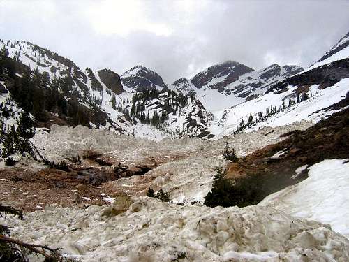 Avalanche debris in Broads Fork - by Joe Bullough
Camping
Big Cottonwood Canyon
Twin Peaks
Besides having three campgrounds, there are also a number of picnic areas. The Dogwood Picnic Area is the first one in the canyon. The Dogwood crag is located nearby and many rock climbers can be seen climbing up its many routes. Ledgemere is the next picnic site and 1.4 miles up the canyon. A number of picnic tables and grills are next to the river. The Penetentiary crag is located just up the steep hill. The Birches picnic area is located 1.7 miles from the sign. This is another area that is next to the river. Storm Mountain Island is the most developed picnic area in the Big Cottonwood Canyon. It has picnic areas, a playground, and fields. There is some really good rock climbing walls located here. Moss Ledges is the highest of the picnic areas and located 4.9 miles past the sign.
Spruces is the lowest of the campgrounds. It sits at an altitude of 7100 feet and 9.4 miles from the mouth of the canyon. It can get a little chilly even in the summertime. It's a big campground with over 90 individual sites and 9 group sites. The sites vary from being very close together to large secluded areas.
The creek wanders throughout the campground. Nearby hiking trails lead off to Donut Falls in Cardiff Fork. Redman campground is located 12.7 miles from the mouth of the canyon. It is located at an altitude of 8100 feet. There are a little over 30 sites available. The reservable sites in both of these campgrounds are usually taken well in advance. You have to be there early to ensure a "first come first served" site for the weekend. The area is popular with the locals.
Each individual site is $18.00 per vehicle, additional vehicles are $5.00.
Campground reservations can be made at Jordan Pines and Spruces and Redman.
Little Cottonwood Canyon

Dromedary Peak
Both of the campgrounds in Little Cottonwood Canyon can only be visited in the summer. Tanner’s Flat is located at 7200 feet. This campground is the lower of the two and can be accessible earlier in the season than Albion Basin. This campground is located in the forest below the road.. There are 36 sites available here which provide your typical campground accommodations. Albion Basin is a wonderful campground to visit in the summer. While it is still summer down in the valley you can see the flowers of blooming at Albion Basin. Devils Castle has a commanding presence over the area. There are 24 different sites and you have to get up early to get one. This campground is located on the Alta ski area. Get there by continuing up the dirt road with switchbacks.
Each individual site is $18.00 per vehicle, additional vehicles are $5.00.
Campground reservations can be made at Tanners Flat and Albion Basin.
Backcountry Camping Regulations:
Camp 1/2 mile from any road, 200 feet from any water source, and 200 feet from any trail.
Camping is allowed for a period of 3 days at an individual site. Practice leave no trace techniques.
No open fires are allowed in the (Lake Blanche) Mill B South Fork drainage within the Twin Peaks Wilderness.
 Cottonwood Ridge seen from the south - by TyeDyeTwins
Peak List
The Cottonwood Ridge has several great peaks to climb. It is the ridge that divides Big and Little Cottonwood Canyons in the Central Wasatch Mountains. I made a list below of the mountains located in this area. Most of them have pages on Summitpost. The route ratings are based on normal summer conditions and are more strenuous or difficult during winter or other times of the year.
Wasatch 11,000 foot Peaks List
This is a list of the 11,000 foot Peaks in the Wasatch by SP member Ammon Hatch in the Central and Southern Wasatch Areas.
| COTTONWOOD RIDGE PEAKS | |||
| Mountain | Elevation | Standard Route | SP Page |
|---|---|---|---|
| 11,000 foot Peaks | |||
| Broads Fork Twin Peaks | 11,330 | Class 3 | Page |
| Sunrise Peak | 11,275 | Class 3 | Page |
| Monte Cristo | 11,132 | Class 2-3 | Page |
| Dromedary Peak | 11,107 | Class 3 | Page |
| Mount Superior | 11,040 | Class 2-3 | Page |
| 10,000 foot Peaks | |||
| Mount Wolverine | 10,795 | Class 2 | Page |
| Mount Majestic (Clayton Peak) | 10,721 | Class 1-2 | Page |
| Mount Tuscarora | 10,660 | Class 2 | Page |
| Sunset Peak | 10,648 | Class 1 | Page |
| Flagstaff Mountain | 10,530 | Class 2 | Page |
| "Patsy Marley" | 10,525 | Class 2 | Page |
| Honeycomb Cliffs | 10,480 | Class 1-2 | Page |
| Mount Millicent | 10,452 | Class 1-2 | Page |
| Pioneer Peak | 10,450 | Class 2 | Page |
| "Mount Venture" (Peak 10,420) | 10,420 | Class 1-2 | Page |
| Kessler Peak | 10,403 | Class 1-2 | Page |
| Sundial Peak | 10,320 | Class 3 | Page |
| "Preston Peak" | 10,315 | Class 2 | Page |
| "Cardiff Peak" | 10,277 | Class 2 | Page |
| 9,000 foot Peaks | |||
| Mount Evergreen | 9,840 | Class 2 | Page |
| Storm Mountain | 9,524 | Class 2-3 | Page |
Books and Maps
1) Utah Mountaineering Guide
By Michael R. Kelsey. Descriptions are brief but this is the best book available for an overall guide to many of the major mountains in Utah. There is a sketch map and photo of each peak. He also describes winter routes up many of the mountains.
2) Hiking the Wasatch
By John Veranth. This is the book to get for hiking and climbing in the Wasatch Mountains. It describes hikes from the foothills to many of the highest mountains above Salt Lake City. The book focuses on the areas of Millcreek Canyon, Big Cottonwood Canyon, and Little Cottonwood Canyon.
3) Wasatch Eleveners Climbing Guide
By Randy Winters aka Summitpost member rmjwinters. This book is about climbing all of the 11,000 foot peaks in the Wasatch Mountains.
4) The Chuting Gallery (Backcountry Skiing)
By Andrew McLean. Steep backcountry skiing guide to the Wasatch Mountains. Also helpful to climbers interested in steep snow routes.
5) Hiking The Wasatch (Wasatch Mountain Club)
This is the official map of the WMC. It shows all of the canyons from Millcreek Canyon to Lone Peak with great detail. It is durable and waterproof.
External Links
Utah Avalanche Center
Avalanche conditions, advisories, lists, and accidents for the state of Utah. Updated every morning during winter.
Mick's Mountain Page
Mick's website has trip reports and photos for mountains in every area in the Wasatch Mountains.
Marauders Mountain Album
The Mauraders website has trip reports and photos for the Central and Southern Wasatch Mountains and other places as well.
Lane Pollock's Website
Lane's website has photos for the Central and Southern Wasatch Mountains, Southern Utah, and mountains in many other states and places.