
|
|
Area/Range |
|---|---|
|
|
47.56556°N / 121.17833°W |
|
|
Hiking, Mountaineering, Trad Climbing, Sport Climbing, Bouldering, Mixed, Scrambling |
|
|
Spring, Summer, Fall, Winter |
|
|
9415 ft / 2870 m |
|
|
Overview
The Alpine Lakes Wilderness is a wilderness area located in the central Cascade Mountains of Washington. Basically situated in the central Cascades between US-Highway 2/ Stevens Pass (on the northern end) and I-90/ Snoqualmie Pass (on the southern end), but not including the Teanaway region, the Alpine Lakes Wilderness is administered by both the Mount Baker-Snoqualmie National Forest and Wenatchee National Forest.
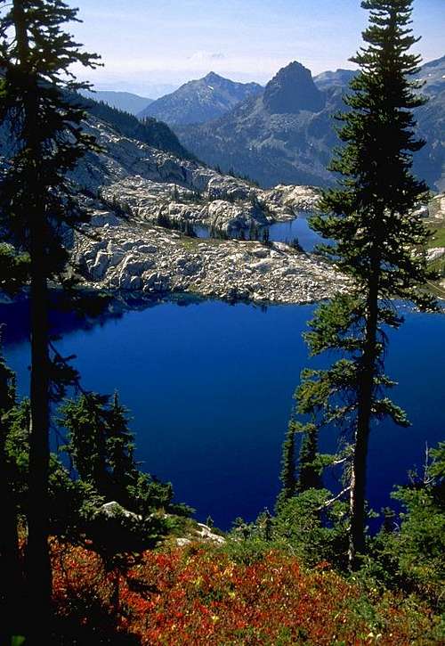
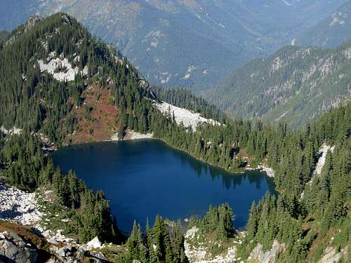 Spark Plug Lake
The Alpine Lakes Wilderness got its name from the 700+ mountain lakes found amongst the majestic rocky peaks and densely forested hillsides of the central Cascades. The official Alpine Lakes Wilderness Area was created by Congress in 1976 via the Alpine Lakes Wilderness Act as an effort to protect the region in its natural form. The Alpine Lakes Wilderness is approximately 394,000 acres. There are currently 47 official trailheads and 615 miles of backcountry trails within the wilderness area. On March 26, 2009, U.S. Representative Dave Reichert (WA-08) and U.S. Senator Patty Murray (WA) jointly announced that legislation would be reintroduced to expand the western side of the Alpine Lakes Wilderness by over 22,000 acres, as well as grant the Middle Fork Snoqualmie River and Pratt River each "National Wild and Scenic River" status. The proposed legislation is still pending in Congress.
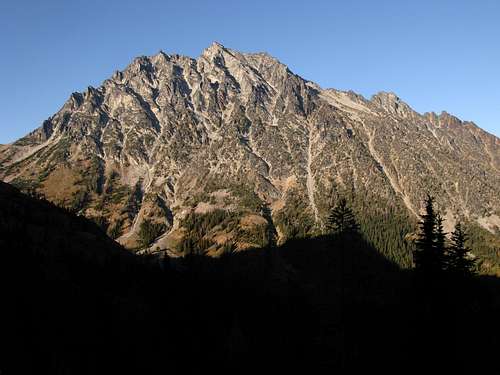
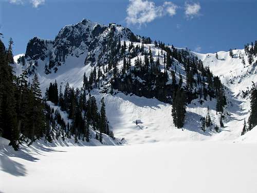 Cascade Mountain
The region has diverse plant life. In the western portions of the area, as much as 180 inches of precipitation might occur in a given year. This provides a favorable environment for Douglas fir, western hemlock, western red cedar, mountain berries, stream meadows, and underbrush. Some of the largest-diameter Douglas fir and western red cedar trees in Washington are found in the Alpine Lakes Wilderness, as a result of the high amount of annual precipitation on the west side of the central Cascades. Conversely, in the eastern portions of the area, as little as 10 inches of precipitation might occur in a given year, providing a favorable environment for ponderosa pine, whitebark pine, Engelmann spruce, alpine larch, and grasslands.
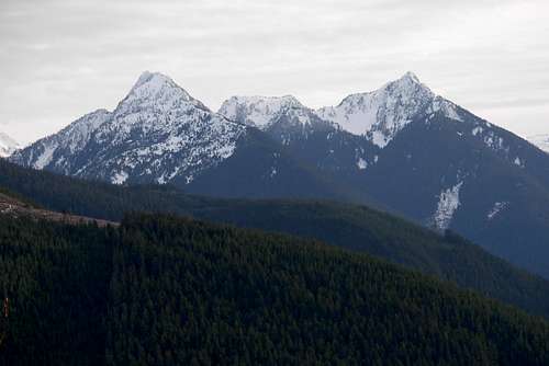 Bald Eagle Peak and Silver Eagle Peak
The Alpine Lakes Wilderness has diverse wildlife, as well. Large mammals such as black bear, elk, white-tailed deer, mule deer, cougar, and coyote can be found throughout the region. Small mammals such as bobcat, beaver, otter, badger, wolverine, mink, and weasel are also found in sporadic populations. Grizzly bears and wolves are also found in the region, but with still very small populations. Birds commonly seen throughout the area include ruffed grouse, white-tailed ptarmigan, Stellar's jay, ravens, chickadees, hawks, eagles, and woodpeckers. The region is also home to multiple amphibian species of frogs and salamanders, as well as multiple reptile species of lizards and garter snakes. Various fish species of salmon and trout, including native cutthroat trout, inhabit alkes, rivers, and streams within the area.
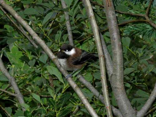 Chestnut-Backed Chickadee
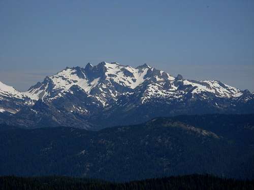
The highest point of the Alpine Lakes Wilderness is Mount Stuart, which at 9415' elevation is the second-highest non-volcanic peak (and seventh-highest peak, overall) in Washington.
 Mount Stuart, The Highest Peak In The Alpine Lakes Wilderness
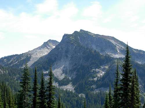
The Alpine Lakes Wilderness also contains Washington's only "two-fer" county highpoint, Mount Daniel, which at 7960'+ elevation is the highest point of both King County and Kittitas County.
 Mount Daniel, Washington's Only "Two-Fer" County Highpoint
Getting There
The Alpine Lakes Wilderness, by virtue of being such a large area, can be accessed from multiple locations in the Central Cascades.
 Mac Peak
For the northern portions of the area, various trails and peaks can be accessed via Highway 2. Reference Green Trails Maps #175 and/or #176.
For the western portions of the area, various trails and peaks can be accessed via the Middle Fork of the Snoqualmie River (north of North Bend, WA). Reference Green Trails Maps #174 and/or #206.
For the southern portions of the area, various trails and peaks can be accessed via I-90 and Highway 903. Reference Green Trails Maps #206, #207, and/or #208.
For the eastern portions of the area, various trails and peaks can be accessed via Highways 2, 97, and 970. Reference Green Trails Maps #177, #209, and/or #209S.
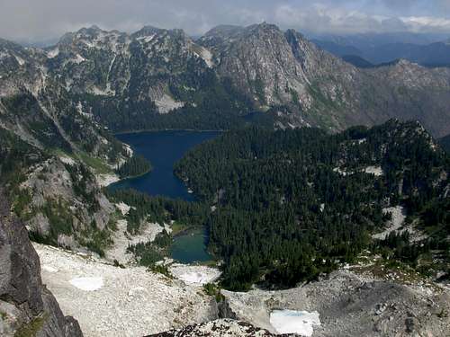
 Robin Lakes
Red Tape
ALL visitors to the Alpine Lakes Wilderness are required to have a Wilderness Permit from May 15 to October 31. Wilderness permits are free and can be obtained at trailheads and ranger stations.*
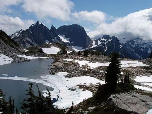 Tank Lakes Basin
If parking a vehicle in the region, most, if not all, of the trailheads within the Alpine Lakes Wilderness require a Northwest Forest Pass. A single-day Northwest Forest Pass costs $5, while an annual Northwest Forest Pass costs $30. Northwest Forest Passes can be purchased from ranger stations and at REI stores (if not also other outdoor recreation stores) within Washington State.
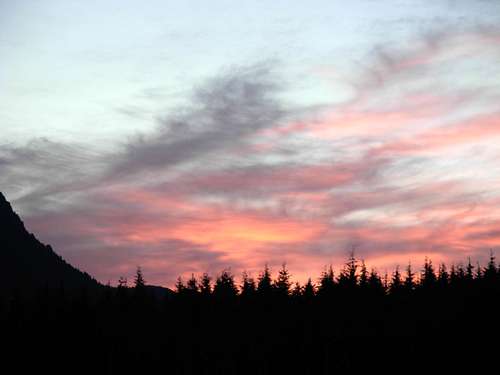 Sunrise Near Bare Mountain
*The Enchantments area of the Alpine Lakes Wilderness has special rules and restrictions. Overnight Wilderness Permits are required in The Enchantments from June 15-October 15, and an application must be submitted for each new trip. Permits cost money and have limited availability. For more information visit the official Forest Service website for special permit information.
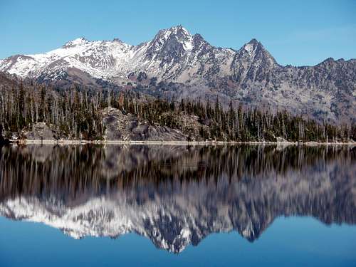
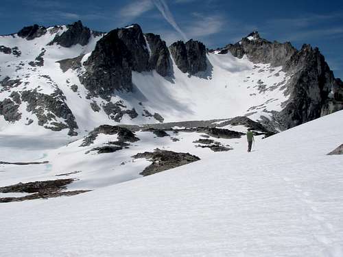 The Enchantments Range
Camping
Although backcountry camping and campfires are permitted within the Alpine Lakes Wilderness, some locations have specific rules and regulations.
Camping is allowed ONLY AT DESIGNATED CAMPSITES when within 1/2-mile of the following locations:
From North Bend/ I-90: Gem Lake, Gravel Lake, Island Lake, Lower Tuscohatchie Lake, Mason Lake, Melakwa Lake, Olallie Lake, Pratt Lake, Rainbow Lake, Snow Lake, Talapus Lake, and Williams Lake.
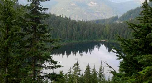 Olallie Lake
From Skykomish/ Highway 2: Big Heart Lake, Copper Lake, Lake Dorothy, Little Heart Lake, Malachite Lake, Surprise Lake, and Trout Lake.
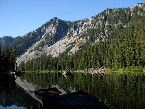 Surprise Lake Below Spark Plug Mountain
From Cle-Elum/ Highway 903: Ridge Lake.
From Wenatchee River/ Highways 2 & 97: Caroline Lake, Chain Lakes, Colchuck Lake, Doelle Lakes, Headlight Basin, Ingalls Lake, Lake Mary, Little Caroline Lake, Nada Lake, Snow Lakes, and Upper Lake Florence.
 Cashmere Mountain Reflecting On Colchuck Lake
Campfires also have special rules and restrictions:
No campfires are permitted above 4000' elevation in the Mount Baker-Snoqualmie National Forest. No campfires are permitted above 5000' elevation in the Wenatchee National Forest.
No campfires are permitted within 1/2-mile of the following locations:
From North Bend/ I-90: Lower Tuscohatchie Lake, Olallie Lake, Pratt Lake, and Talapus Lake.
From Skykomish/ Highway 2: Lake Dorothy and Trout Lake.
From Cle-Elum/ Highways 903 & 970: Deep Lake, Glacier Lake, Lake Ivanhoe, Rachel Lake, Rebecca Lake, Shovel Lake, Spectacle Lake, and Upper Park Lake.
From Wenatchee River/ Highways 2 & 97: Eightmile Lake, Hope Lake, Josephine Lake, Leland Lake, Little Eightmile Lake, Mig Lake, Nada Lake, Swimming Deer Lake, Square Lake, Trout Lake, Lake Wolverine, Lake Susan Jane, and the junction of the French Creek & Icicle Creek Trails.
 Square Lake And Lake Wolverine Below Thunder Mountain And Thor Peak
External Links
A map of the Alpine Lakes Wilderness has been created by the "Alpine Lakes Protection Society" (ALPS). This map is available for purchase at several local recreational stores, as well as online at this link.
There are also several books specifically written for the region. These include:
"Backpacking Washington's Alpine Lakes Wilderness: The Longer Trails" by Jeff Smoot. The book is available at several local recreational stores, as well as here.
"Hiking Washington's Alpine Lakes Wilderness: Day Hikes and Easy Overnights" by Jeff Smoot. The book is available at several local recreational stores, as well as here.
Additional information regarding rules, regulations, and contact information provided by vtrail.com.
General Alpine Lakes Wilderness information provided by wilderness.net.
The Cle Elum Ranger District has a great map showing much of the ESE side of Alpine Lakes Wilderness.
Wikipedia has a webpage dedicated to the officially-named lakes (and their respective associated peaks) within the Alpine Lakes Wilderness.