"Where the clouds can go, men can go; but they must be hardy men." -A. Maurer
Last year my brother Michael and Eastking went up Colchuck Peak in Late March which for over a year I been wanting to do. Last week Redwic invited me to join with Gimpilator for a Grand Slam in the Enchantments. Redwic let me stay over at his house which we sorted gear, planned out our routes, and printed off maps.
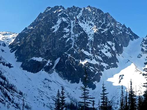
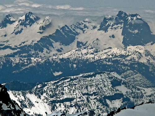
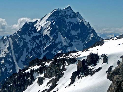
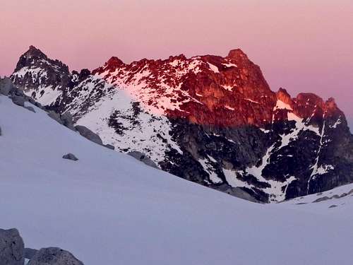
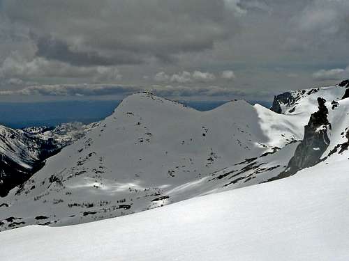
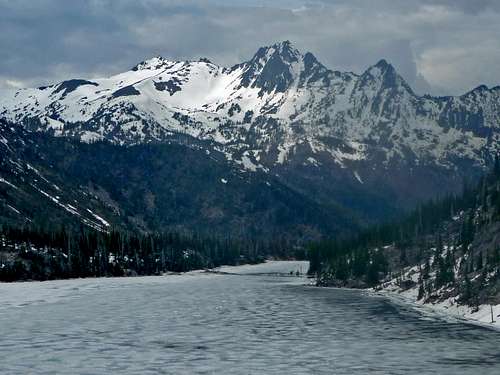
Dragontail Peak from Colchuck Lake
We woke up at 2 a.m. for a nice alpine start to head out to the Stuart Lake Trailhead. By the time we got to the trailhead we were all excited by this point. When getting out of the car it was so nice to feel the fresh mountain air again. For the past several weeks I had been stuck at home with tons of homework which I graduated June 9, 2011. The weather was absolutely perfect, we could not have picked a better time to head to the Enchantments. The weekend before people said it was too snowy, and then next weekend permit season was going to start up.
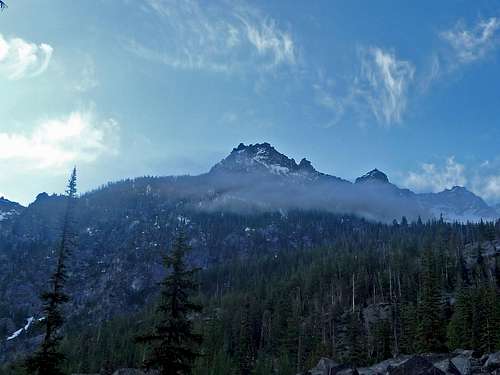
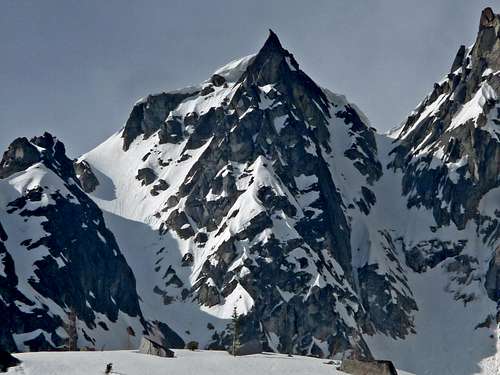
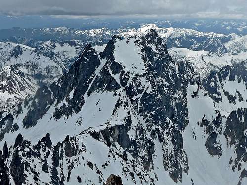
The Edge of Enchantment Peak
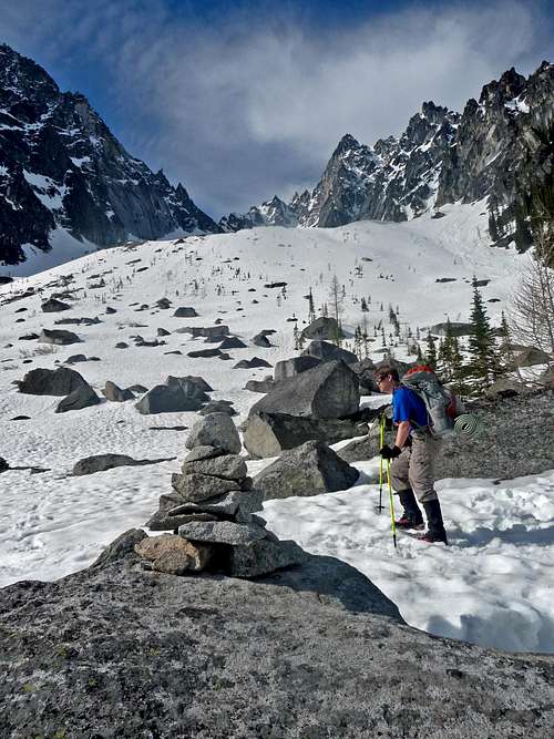
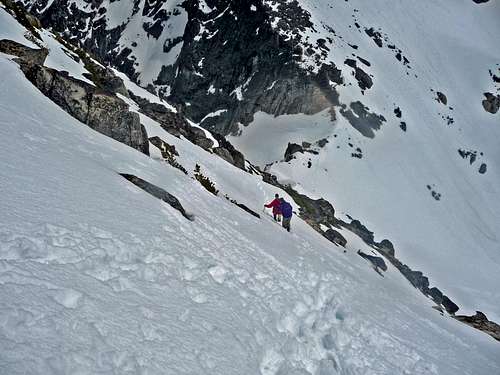
Going for Colchuck
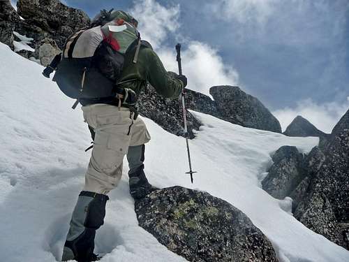
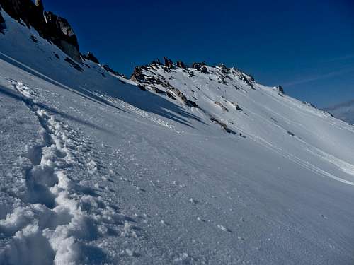
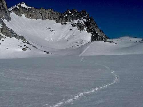
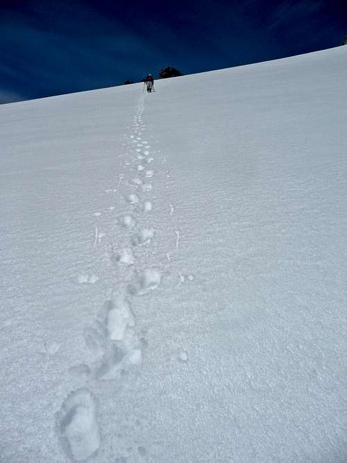
At around 5:30 a.m. we started hiking up the trail to Colchuck Lake which was nice and easy even with a heavy pack. Later up the trail we encountered snow which was mostly solid, views of Dragontail and Colchuck Peak came into view.
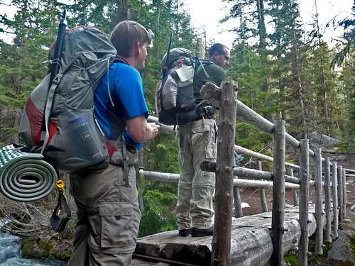
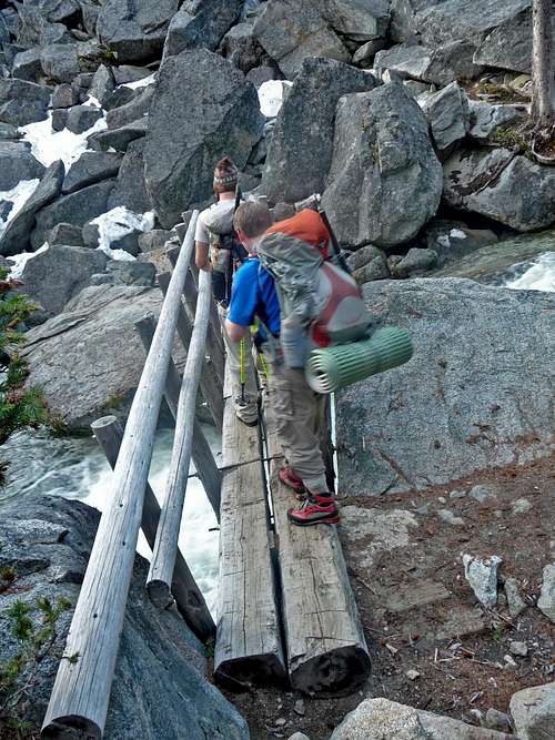
The first Bridge Crossing
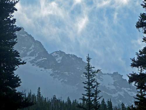
Colchuck Peak through the Trees
The Second Bridge Crossing
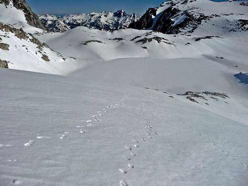
At the lake we enjoyed a nice break which I decided was time to enjoy some cream soda. From here we walked around the lake and started the ascent up the Colchuck Glacier. From here on out we gained elevation quite rapidly in fashionable time, to the South we could see Mount Cashmere, Mount Canon, and Aasgard Pass. As we were climbing we chatted with some guides from New York who stayed with us until we reached the Colchuck Col.
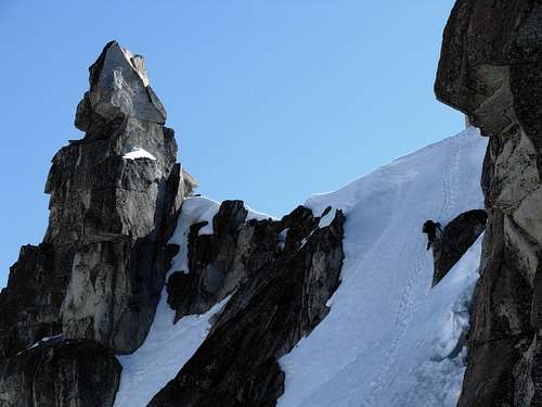
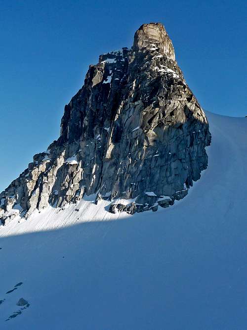
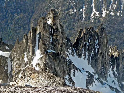
Sharp Edge on Colchuck Peak
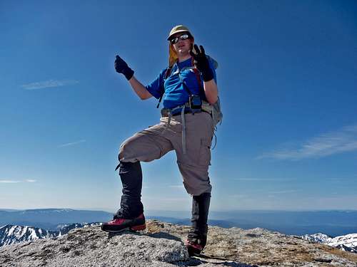
Gimpilator Excited for the Climb
Climbers with Cashmere in the Background
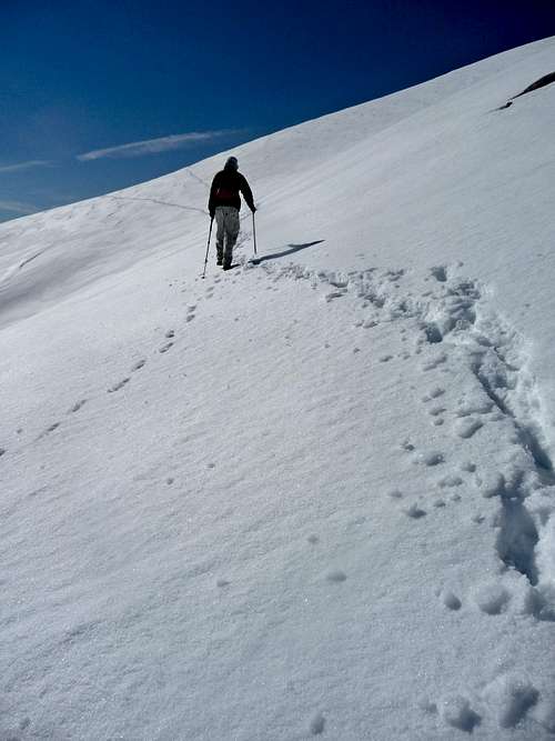
Redwic Heading Up
Halfway up the Colchuck Glacier
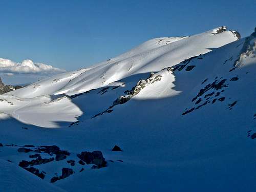
The Views to the South of the Col
At the Col we ditched our packs for the summit, by the now the heat of the day was softening up the snow making for a few posthole steps. On the summit of Colchuck we could see clouds moving in which Gimpilator figured we would be in a white out soon, fortunately that never happened.
Redwic near the Summit
Endless Mountains
Looking West
Argonaut Peak's North Face
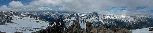
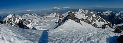
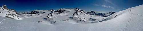
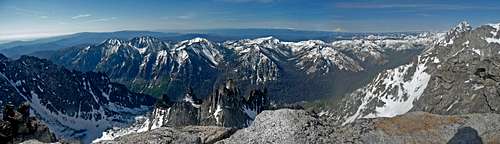
Colchuck Peak Summit Panorama
Mount Stuart Panorama
Descending back to the Col
Dragontail from the Col
Dragontail's Ridge
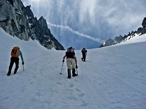
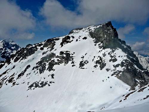
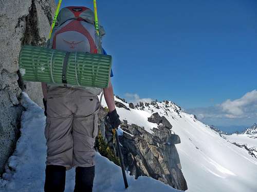
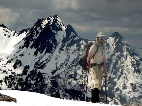
Heading over to Dragontail
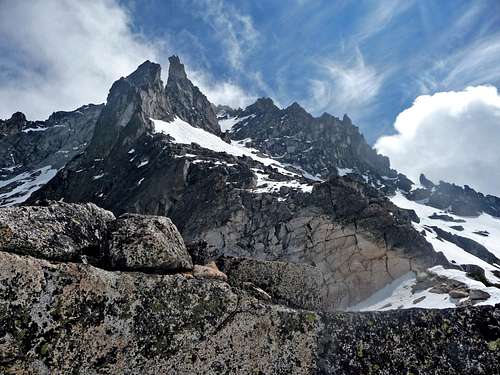
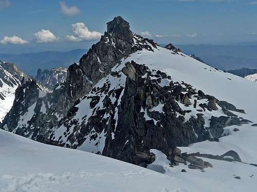
We quickly descended Colchuck back to the Col to pick up our packs and went on over to Dragontail. We misunderstood some info we got online and made attempts to avoid the gulley by cutting right to the ridge. This turned out to be a mistake, after topping out of the ridge all we could see were cliffs and a rappel ring which obviously this was not the way. I carefully explored a bit more and ended up having to down climb some class 3, we gave up and went back to the gulley.
The Ridge Above
Gimpilator checking out the Ridge
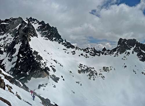
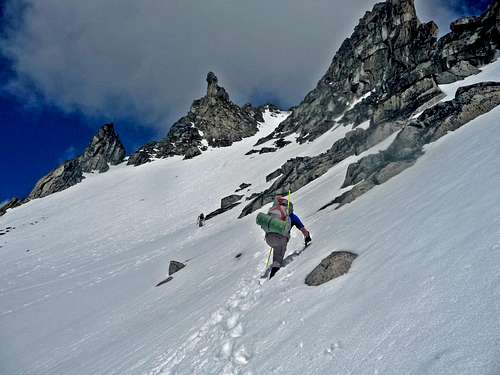
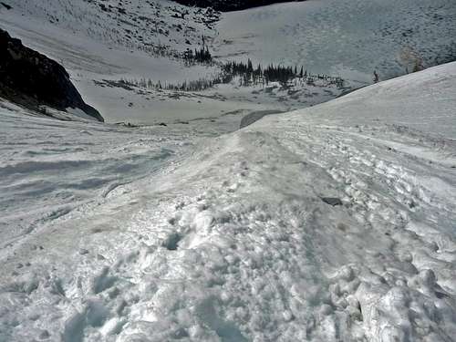
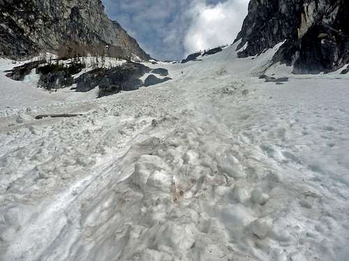
The gulley was around 45 degrees or so, but by now the snow was soft enough to feel comfortable heading up, which it was glissade worthy. Pretty soon we reached the top at Pandora's Box which we started to wonder where exactly we should go next.
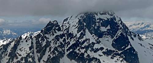
Colchuck Peak's East Face
Redwic heading up Dragontail
Nearing the top of the Gully
Mount Stuart Clearing Up
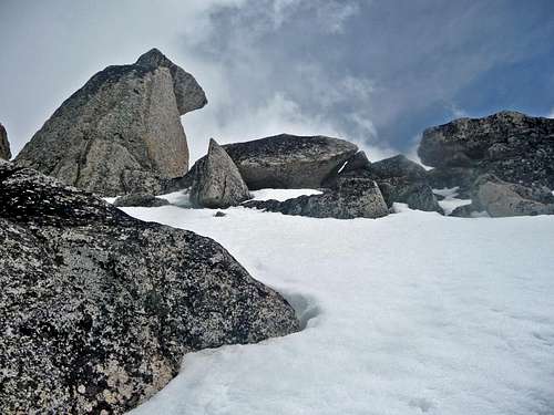
The Crux of the Trip
Redwic on the Edge
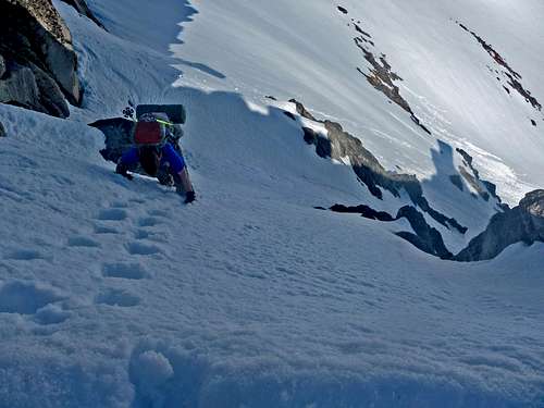
After Gimpilator went around the edge of Pandora's Box he spotted a steep snow slope leading to the Dragontail snow field. "This is it!" Gimpilator announced, looking over the edge it looked steep, I could see small cliffs and rocks sticking out which did not make me feel good about the slope. At the time I did not even see the cliffs that were below until after we were past the crux. Gimpilator was the first to go down and kick steps which I'm thankful he did this for us. He stayed perfectly quiet which we figured was him feeling fine but he later said he needed full focus. When Redwic went through he seemed worried at first but then seemed less nervous when almost near the bottom of the crux.
Redwic Heading Down the Crux
Redwic seen from Below
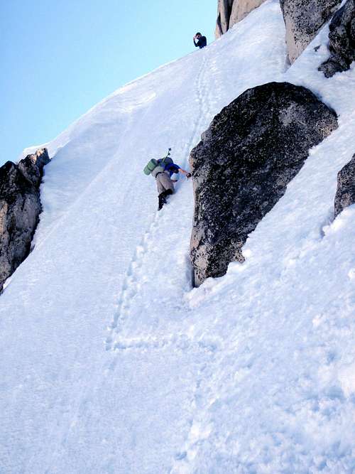
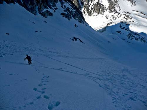
Then it was my turn, I was a bit nervous heading onto the down climb slope but was trying to remain calm. After a few steps down I instantly realized the seriousness of the slope below and the dangers of the cliffs. I now was putting as much effort as possible to kick steps in further, and began to feel vertigo. I don't mind heights, but when my life is on the line, I become quite scared. "Relax" I whispered to myself as I went over the crux of the crux (the middle was the steepest part). As I went down my middle and index finger began to go numb as well as my toes which when stepping in I could not feel exactly how far in my foot was in. On top of this I was carrying a over night pack and began to have cramps, this reminded me an awful deal of how Sahale was (although not as bad). I became more worried when I saw how easy my ice axe plopped out of the snow, which I knew that my axe was no longer my life line, my footing now was everything. Redwic every now and then would yell out encouragements which I tried smiling while knowing that I had to get off the slope soon. On my next step I saw part of the step break, this did not make me feel any better. If I had known how the slope would have been perhaps I would have not even attempted going down, but as far as we knew at the time this was the only way to Dragontail from Colchuck. After taking more careful steps I was out of the crux which I felt much better, it was among the top 5 scariest things I have ever done. In mountaineering you always got to be in control, when I'm not, that's when I start to panic. If I was either roped up or had an ice tool I would have felt much safer descending. From here it was a nice easy traverse onto the Dragontail snowfield.
Me Descending the Crux
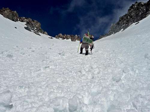
The Easy Pathway to Dragontail Peak
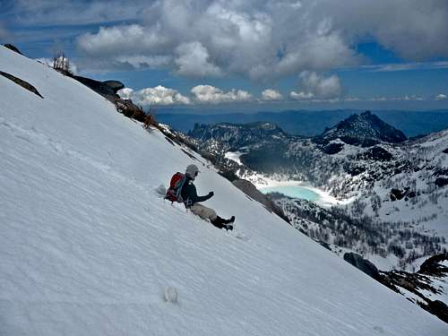
From Dragontail to Camp
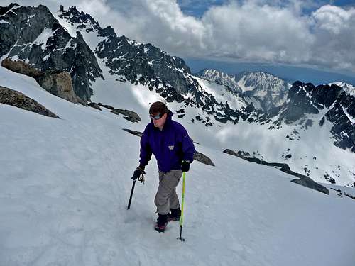
From here it was smooth sailing, the summit of Dragontail from here was relatively easy. At the summit it was a bit cliffy which I quickly touched the summit and went back a few feet to eat (I did not feel comfortable unlike Gimpilator being on the top rock on the summit for a while). Soon we started our descent which I got a nice glissade down to a mini pass. From here we went left down to Aasgard Pass, the snow was punchy making progress slow.
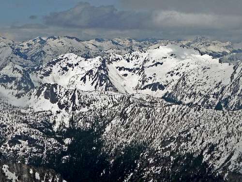
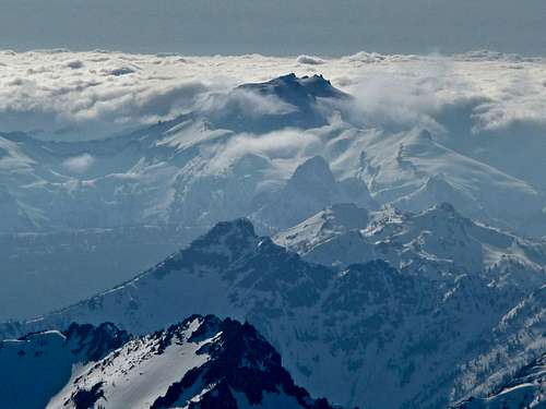
Mount Daniel above the Clouds
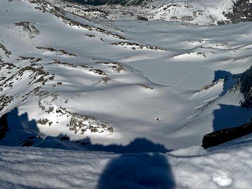
Enchantment Basin Below
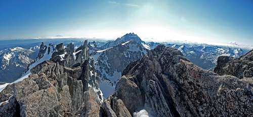
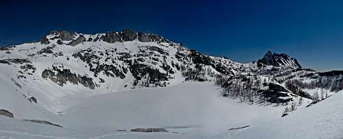
Dragontail Peak Panorama
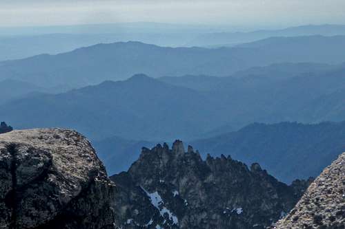
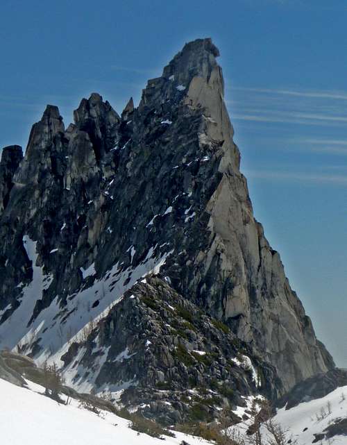
The Jagged Ridges of Dragontail Peak
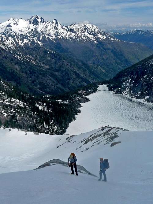
Heading Down to the Basin
Little Annapurna
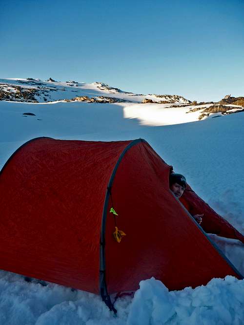
By the time we reached the bottom I could see my knees were all cut up from the ice crystals from falling in many snow holes. We were all pleased to be in the Enchantment basin which is where we put our camp at. After setting up camp I decided to be the cook which in a sense was nice because I got to enjoy the sunset and evening colors over the mountains around us.
Sunset on McClellan Peak
Our Campsite
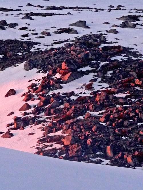
Sunset on the Rocks
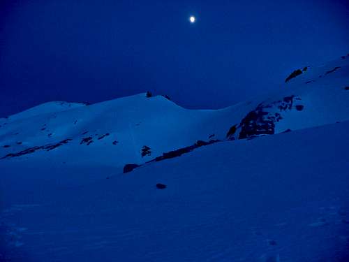
Evening in the Enchantment Basin
In the morning it was a bright sunny day, when grabbing my boots from outside they were too frozen for me to get my feet into (they loose flexibility). Redwic had to put my boots out in the sun to help thaw them out. In the mean time we boiled more water and I enjoyed some top ramen in the tent. Pretty soon my boots were flexible enough for me to squeeze them on, and pretty soon we were on the move.
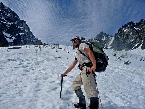
Next Stop Little Annapurna!
Dragontail Peak with Isolation Lake
We started out crossing Isolation Lake, I was a little worried with the idea of crossing a lake which had pools of water on the West side of the lake, but we did see foot prints of people who crossed it in mid day, we were crossing it in early morning. Once across we started heading up the slope of Little Annapurna, which turns out to be the easiest of the peaks we climbed during the trip.
Aasgard Pass
Witches Tower
Gimpilator heading up Little Annapurna
Looking Down on Enchantment Basin
On top of Little Annapurna we looked over to figure out our exact route up Enchantment Peak, and of course had our selves a mini celebration.
Blue Ridges from Little Annapurna
Redwic on Little Annapurna
Little Annapurna's Spires
Little Annapurna Panorama
Redwic Glissading Down Little Annapurna
Our Final Destination: Enchantment Peak
This peak was perhaps the most out of the way, but was certainly a fun one. We descended down the North East Side of Little Annapurna to Inspiration Lake and onto Prusik Pass with a slightly different variation. Along the way we got a very nice place to refill our water and refresh ourselves. From here we then ascended on up to Enchantment Peak which at first we went for one of the false summits by mistake.
Enchantment Peak Panorama
Prusik Peak
Gimpilator leading the Way
The Real Summit of Enchantment Peak
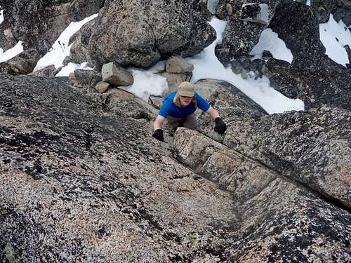
We then back tracked and went for the East summit which we believe to be the real one. The ending had a bit of class 3 section which Gimpilator calls it "The Ladder" because there were nice foot holds although not for the fearful of heights. We were all very pleased to get this summit, but as we looked over we could see incoming clouds which there was potential rain coming in.
Gimpilator near the Summit
Redwic at the bottom of the Climb
Little Annapurna with Clouds
The Return Trip
Gimpilator glissading Down
The way down was a nice big glissade to the lake, and then we had to go up hill once again to get to base camp. We decided to cross around the lake now that it was late in day. At base camp we relaxed for a little while and then packed everything for the return trip down Aasgard Pass. My feet were finally dry from changing my socks but sure enough not 100 feet from camp I fall in 2 snow holes and end up getting my feet wet again. At Aasgard Pass there was a nice glissade to the lower part of the pass, on the way down there was a hidden rock which hurt a bit, but fortunately nothing serious.
Gimpilator with Cashmere Peak
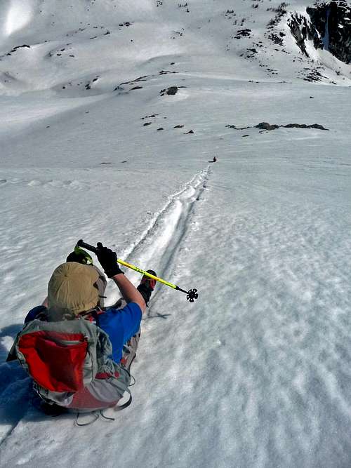
The Glissade Down Aasgard Pass
Looking up the Glissade
After looking over the edge I was almost drooling at how nice the glissade ahead looked, I down climbed 200 feet where it was harder snow, but once it got soft, man I was flying down the mountain! 1,000 feet later I decide to wait up for the team, and then go down another 1,000 feet in high speed. At the lake we then get back on trail. From here I had some good conversations with Redwic and Gimpilator and it was a nice mellow walk down to the trailhead.
Cashmere with Colchuck Lake
Thanks guys for taking me, this was a great experience and beautiful place. I would recommend this to any peak bagger who wants both big peaks and adventure!
Trip Statistics from Redwic's Trip Report:
Total Hours: 38
Total Hours Hiking: 25
Total Distance Covered: ~20-25 Miles
Total Cumulative Elevation Gain: ~10,500' Total Bulger Top 100 Peaks: Four
Thanks Redwic, you did great on this trip. It was a big accomplishment for all of us! As for trying to prove we all had a good time, I wrote at the end of the trip report that I had a great time, you would know if you had a great time, and Gimpilator's video made it pretty clear that he had a good time. So I think that is proof enough to me that we all had a great time! ;-)
Awesome pics. Crux of the crux, hehe and it sounds like you got rappelled by the 'repel ring' on Dragontail. Something just sounds funny: "Glissade down Aasguard Pass". Very eponymous for some bumpy glissades I've taken in the Sierra.
We did not have any rope at the crux. The crux was sketchy, but there was a spot in it that certainly deserves the label "The Crux of the Crux". Kinda like how one might say "The Best of the Best".
After just looking at the photos I really want to see the Cascades. You have some great pictures of some famous peaks I have always heard about. Showing you guys in different parts of the route going up or down really makes the viewer feel like he is there. A great report and some inspiring photos.
Thanks Mike, I'm glad to hear that. The Cascades are certainly a worthy visit, if you ever do come to these parts, be sure to visit the North Cascades National Park. As for the pics of people, I decided to take a new approach to my photography, in the past I would rarely photograph people, but my brother would complain to me about that. So I figured adding people to the photo would make it seem more personal. Plus the person in the photo I'm sure is pleased.
"In mountaineering you always got to be in control, when your not, that's when I start to panic." I've spent a lot of time going up and down steep slopes, up when I was brave, down when I wasn't, all the while fighting panic. Sometimes I made the summit, sometimes I didn't. Love the glissading pics!
It's a true fact. The more I live through exposure, the more I realize how vulnerable I am, and in a sense the next time I go I'm even more frightened. Most people it is the opposite, but for me I think its good sense kicking in. I've lived through some dangerous mountaineering in my time, and try to avoid it when ever possible. So sometimes it's hard to balance just right between perils and adventure. Because I do have to say I'm very adventurous at the same time!
Children refers to the set of objects that logically fall under a given object. For example, the
Aconcagua mountain page is a child of the 'Aconcagua Group' and the 'Seven Summits.' The
Aconcagua mountain itself has many routes, photos, and trip reports as children.
Parents refers to a larger category under which an object falls. For example, theAconcagua mountain page has the 'Aconcagua Group' and the 'Seven Summits' asparents and is a parent itself to many routes, photos, and Trip Reports.


Comments
Post a Comment