
-
 24030 Hits
-
 88.09% Score
-
 26 Votes
|
|
Area/Range |
|---|---|
|
|
47.47510°N / 120.90222°W |
|
|
Hiking, Mountaineering, Ice Climbing, Mixed, Scrambling, Skiing |
|
|
Summer, Fall |
|
|
9415 ft / 2870 m |
|
|
Overview
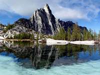
Prusik Peak Reflection
A lot could be said about this range in terms of quality, beauty, and alpine joy. But I'll let the pictures do the talking, the links do the explaining, and the paragraphs give you an idea of what this place has to offer. If you live in this state, are able bodied, and have the means for traveling, then you have no excuse to not visit this place! They don't call the central Stuart Range The Enchantment for nothing. Each peak in the range has a different adventure awaiting for you to come out and explore. While in late summer crowds serge through this alpine arena, you can certainly find places where you won't see another person. This is some of Washington's best mountains.
 Dragontail Peak Reflection | 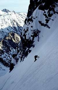 Climbing the Ice Cliff Glacier Route |  Dragontail Peak though the Fog | 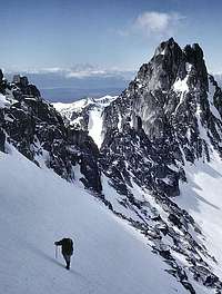 Heading up a Snow Slope above the Col |  Witches Tower from Enchantment Basin |
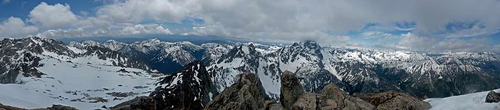
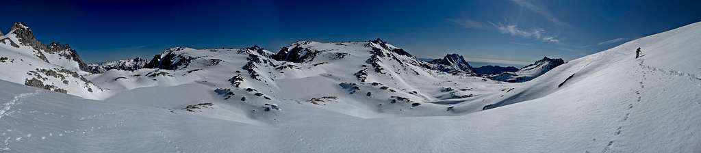
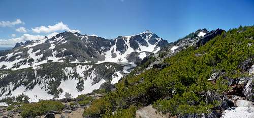
Western Stuart Range Panorama
Enchantment Basin Panorama
Getting There
Stuart Lake Trailhead: From Seattle head onto highway 520 across Lake Washington. In 6.7 miles head onto I-405 North towards Everett. In about 8 miles take exit 23 onto highway 522 towards Monroe. In Monroe head east on Highway 2 towards Stevens Pass. Roughly 85 miles later you arrive in Leavenworth which is right in front of the Stuart range. Take a right onto Icicle Creek road. In 8.5 miles turn left onto NF 7600. In 3.6 miles you arrive at the Stuart Lake Trailhead.Snow Creek Trailhead:
Ingalls Creek Trailhead: Coming Soon...
Esmeralda Basin Trailhead:
Boundaries
Major Summits
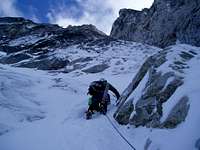
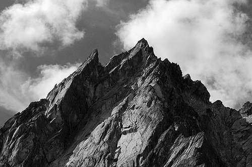
Mount Stuart (9,415 feet) is the highest peak in the range. It has many exciting routes on it for different alpine styles. It can be scrambled via the Cascadian Couloir (3rd Class), it can be an ice climb via the Ice Cliff Glacier (Grade II-III), or rock climbed up the West Ridge (5.4). There many other routes which include the Sherpa Glacier (glacier climb), the North Ridge (5.9), and the Stuart Glacier Couloir (AI2, Low 5th). This mountain can be seen from many mountains through out the Washington Cascades.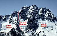 Ice Cliff Glacier |  Sherpa Glacier Route |  West Ridge | 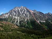 Cascadian Couloir |
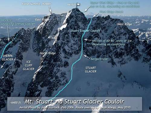
Stuart Glacier Couloir Route Overlay

Mt. Stuart's W Ridge and SW flanks from Ingalls Lake
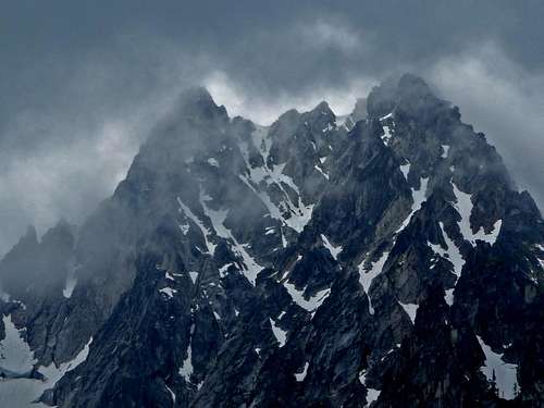
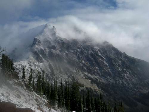
Dragontail (8,840 feet) hangs over Colchuck Lake with it's massive steep face which is breath taking on a clear day. Most folks hike up it's East Ridge while the more technical mountaineers go up the Triple Couloirs (AI/WI 3, 5.7) or the Backbone Ridge With Fin Direct (5.9). There is also the Northeast Buttress (5.8), the Serpentine Ridge (5.8), West Route (Steep Snow and Scrambling), and the Dragontail Annapurna Snow Col route (class 2-3).
 Climbing the Triple Couloirs | 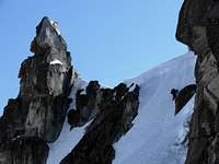 On the West Route | 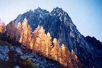 North Face with Fall Colors |  Top of the East Ridge |
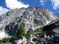 Serpentine Ridge |  NE Buttress |  Annapurna/Dragontail Col |  Backbone Ridge Direct |
Dragontail Peak from the trail up Aasgard Pass
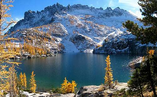
Colchuck Peak (8,705 feet) is located between Dragontail and Argonaut Peak. It's impressive North Face has a multitude of technical climbing routes. Most folks go up the Colchuck Glacier (snow hike) which is an excellent day trip. The harder routes include Northeast Buttress (5.8), North Buttress (Class 4-5), North Buttress Couloir (Grade II), and the Northeast Buttress Couloir (AI 2-3, 5.4). I know... lots of North Face routes. Every route up Colchuck Peak is a fun one. Plus one can glissade down the Colchuck Glacier.
 Colchuck Glacier Route |  Northeast Buttress Couloir |  North Buttress | 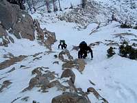 North Buttress Couloir |
Dark Misty Colchuck Peak
Cannon Mountain (8,638 feet) is on the northern side of the Stuart Range. This mountain has two main routes up it which are non technical. The Northeast Ridge is class 3, while the Prusik Pass Route is a simple walk up. The Northeast Ridge has a lot of fallen over trees at the beginning making for an interesting approach while later on having some fun scrambling. The Prusik Pass route is technically easier, but is much more distance over all. Both routes can be done in a day, but don't expect to have a lot of energy afterwards.
 Scrambling up the NW Ridge | 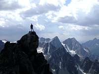 On the Summit |  Lower Part of the NW Ridge |  Alpenglow at Aasgard Pass |
Cannon Mountain from the Northwest Ridge
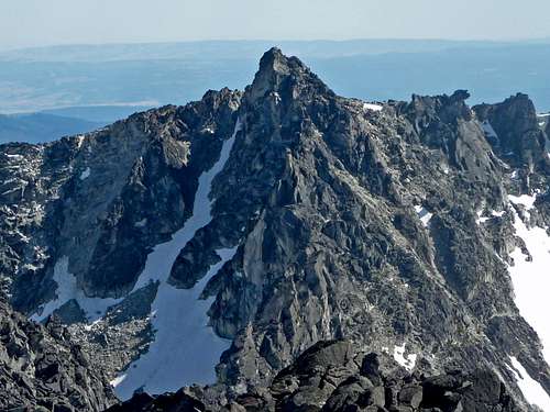
Sherpa Peak (8,605 feet) from a distance almost looks like a high point on Mount Stuart. But it has over 400 feet of prominence hence qualifying as it's own peak. All routes up this peak are technical requiring a rope and protection. The main three routes are the West Ridge (5.4), North Ridge (5.8), and the Northeast Couloir (5.0).
 Climbing the North Ridge | 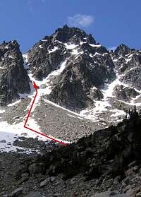 N.E. Couloir Route |  Upper West Ridge | 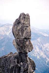 Balanced Rock near Summit |  Half way up N.E. Couloir |
Sherpa Peak North Ridge Route Diagram
Enchantment Peak (8,520 feet) is right in the center of the Stuart Range. The main route up this peak goes up from Colchuck Lake to Aasgard Pass. From the pass over though the Enchantments Basin and up to Prusik Pass. At the pass the route heads west up Enchantment Peaks ridge to the summit block. The summit block is class 3+.
Enchantment Peak's North Face
Witches Tower (8,520 feet)
Argonaut Peak (8,453 feet)
Little Annapurna (8,440 feet)
McClellan Peak (8,364 feet)
Leprechaun Lake's larches with McClellan Peak
Prusik Peak (8,000 feet)
South Wedge Mountain (6,885 feet)
Red Tape
Coming Soon...Camping
Coming Soon...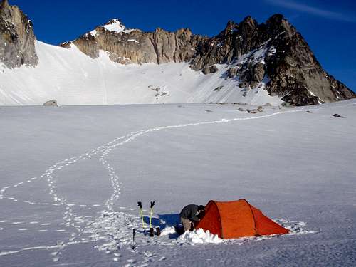
Camping near Dragontail
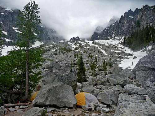
Camping near Colchuck Lake
Fall Photographs
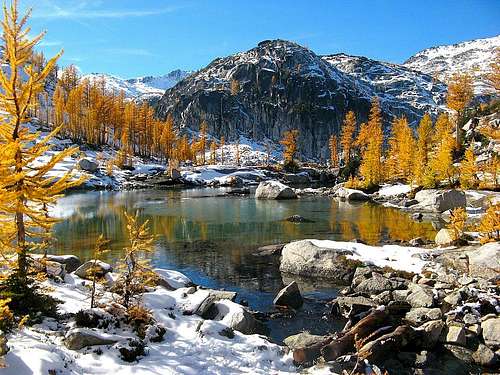
Sprite Lake Larches taken During October
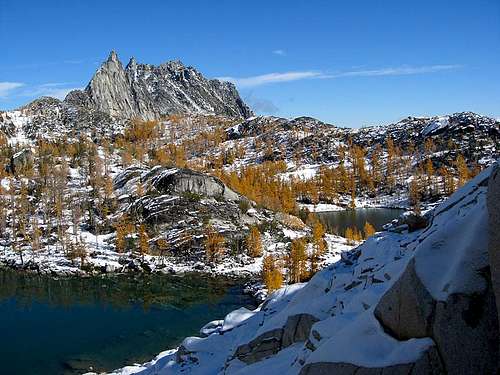
Larchtime in the Enchantments
 Prusik Pass View |  Prusik Peak Reflection | 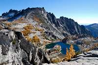 McClellan Peak | 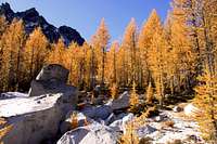 Golden Larches |
Topographic Maps
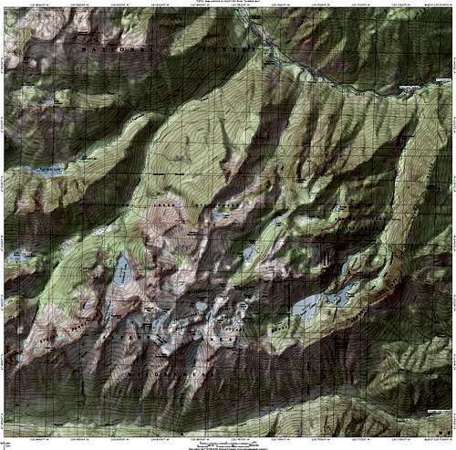
Enchantment Map
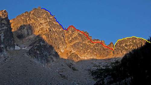
 Stuart Glacier Couloir |  McClellan Peak South Map |  McClellan Peak North Map |  Old Map from back then |
Mountain Conditions
For current weather information on Stuart Range check in with the Noaa Forecast.For Avalanche Conditions, check in with the Northwest Avalanche Center. (Limited based on the season)
Road conditions can be seen on the Forest Service site. Just scroll down to where it says "Icicle Road 7600" which is where it should say the conditions. Personally I'd give them a call if I didn't have a backup plan because you never know when the site doesn't get updated.
Mount Stuart getting Pounded by Wind
When to Climb
Coming Soon...Wildlife and Flowers
 Purple Flower |  Lady Bugs on Summit |  Goat with McClellan |  Flowers on Cannon |
 Goats Enjoying the Grass |  Cashmere with Flowers |  Flowers from Enchantments | 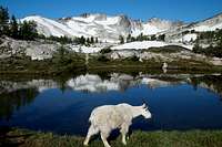 Goat with Dragontail |
 I am Beelzebub... |  Mama Goat and kids | 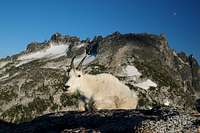 Funny face, McClellan Behind |  White-tailed Ptarmigan |
 Paintbrush Flowers |  Marmot on Colchuck |  Yellow Flower |  Lupine Flowers |
External Links
- Stuart Range Traverse on September 10-11, 2011: This trip report contains information on doing a traverse on the entire Western side of the Stuart Range
Alpine Spot Light
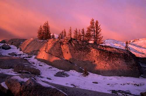
Alpenglow in the Enchantments
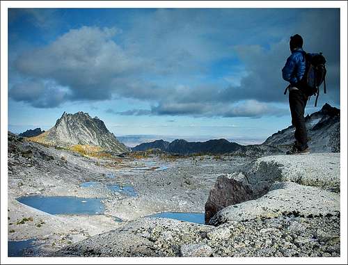
Overlooking the Upper Enchantment basin