
-
 8491 Hits
-
 81.84% Score
-
 14 Votes
|
|
Mountain/Rock |
|---|---|
|
|
28.07940°N / 17.1585°W |
|
|
Hiking, Scrambling |
|
|
Spring, Summer, Fall, Winter |
|
|
2792 ft / 851 m |
|
|
Overview
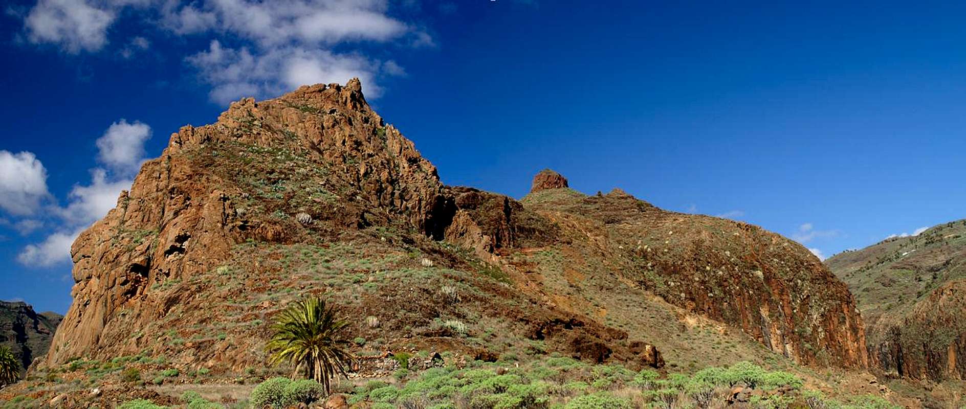
 Pico Gomero and Roque del Sombrero Pico Gomero and Roque del Sombrero |
Barranco Juan de Vera is one of the wildest canyons you can imagine, so wild that its floor is off limits to anyone but the hardiest scrambler. However, both encompassing walls can be hiked and in a long day you can complete a tough round trip, roughly gaining 1200m of elevation on the way. The Barranco is a typical product of La Gomera's geological history, formed by volcanism and erosion. Over the millenia much of the soft lava has been washed away so that now only the hardest rock structures remain. These are made up from beautiful red basalt and form multiple towers, fortresses anramparts along the sides of the canyon.
The highest point is Pico Gomero, a twin peaked rock of 851m height which towers above Barranco Juan de Vera on its northern side. From Pico Gomero a line of rocks, Roque de Mago, Roque el Sombrero and Roque Garcia leads to the south coast, steadily losing elevation. These rocks are made up from formidable basalt, wonderfully structured into red columns and absolutely solid. Some of the rocks have been climbed but climbing is not common here.
 Rock Hand Rock Hand |  Basalt face Basalt face |  Roque del Sombrero Roque del Sombrero |  Barranco Juan de Vera Barranco Juan de Vera |
On the western side a similar ridgeline of rocks draws towards the sea: Roque de Berruga, Risco de la Fortaleza, Alto de Tacalcuse and Seima follow each other from north to south. Along both ridgelines there are remnants of former agricultural activity - a finca here, a sheep or goat corral there. Today, however, all buildings are left in ruins. Tourism is by far the easier means of earning a living on the Canarias.
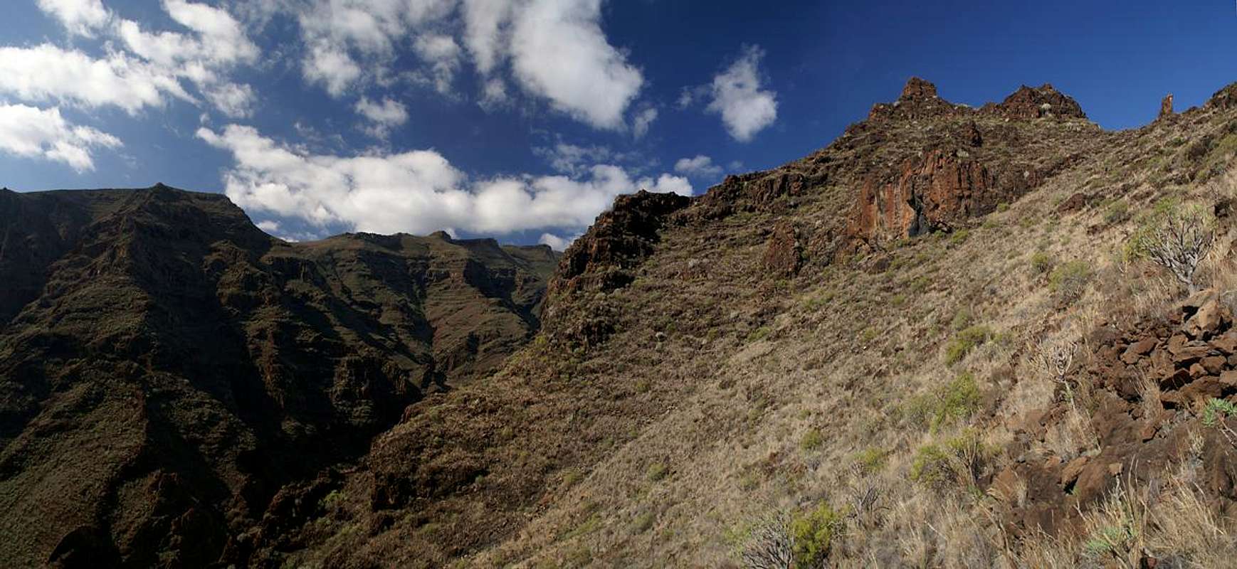
Barranco Juan de Vera is at its wildest when seen from its floor. Here the multitude of basalt towers which alternate with lava walls form a veritable labyrinth. Near its mouth the barranco is rather wide but the walls close in further inwards and it is here that you experience the wildest aspects. Venturing into the heart of the barranco is a great experience but you have to take care not to lose orientation. Climbing out of the canyon is only possible in two or three locations along marked trails. Everywhere else the rock is far too brittle to carry a grown man's weight.
 Rock Hand Rock Hand |  Pico Gomero Pico Gomero |  Roque del Sombrero Roque del Sombrero |  Tortoise Shell Catwalk Tortoise Shell Catwalk |
At the mouth of the Barranco there is a holiday settlement - El Cabrito. It is privately owned and off limits to hikers. The whole settlement is fenced off and you are not allowed to enter it by any means.
Getting There
  |
In contrast to the large Canarian Islands, La Gomera and El Hierro don't have international airports. Reaching the islands therefore means switching to a local carrier at Tenerife (or any of the other Canarian islands) or use a ferry. Since weather is known to be unstable at the La Gomeran airport near Playa de Santiago, most travel offices will offer the ferry option.
Usually you will be able to book a flight to Tenerife South together with a bus transfer to the harbour at Los Christianos and the ferry to San Sebastian de La Gomera (bus transfer to your hotel on La Gomera is also included).If you want to travel on your own you can use ferries from either La Palma or Los Christianos and Santa Cruz on Tenerife.
The trailhead for any activity in Barranco Juan de Vera is at Degollada de Peraza, right on TF-713, the Carretera del Centro. There is a restaurant there and ample parking space. The closest route into the barranco is on its western side, a short hike along the road to Playa de Santiago which you leave at the first hairpin curve. A more scenic route is on the western side of the barranco, right underneath Roque de Magro, Roque el Sombrero and Roque Garcia. You have to hike quite a way eastwards along (besides) the Carretera before a path turns off towards Roque de Magro at Casas de Magro.
|


Red Tape
 |
The whole canyon, together with its neighbour Barranco de la Guancha has been declared natural monument (Monumento Natural del Barranco del Cabrito). The only exception is the holiday settlement at the mouth, at Pllaya del Cabrito. The usual restrictions apply.
The settlement at the mouth of te Barranco is privately owned and it is not allowed to enter it. There is a path leading by it right along the beach but everything else is fenced off.
Accommodation
 Roque del Magro
Of course you can find a lot of hotels, fincas and casas on the island which you can book from any travel office. There are no close towns or villages with the exception of the private holiday settlement El Cabbrito. Playa de Santiago and San Sebastian are equally far off. In both towns you will be able to find lodging
Weather Conditions
 Tenerife seen from the mouth of Barranco Juan de Vera
There are few sites on the web, which deal with the weather for La Gomera. The island just is not very popular with the tourist crowd. The ones you can find are for San Sebastian, which is located half an island away to the east of the rocks. Temperatures at the coast are some 15 degrees lower than in the Laurisilva. With fog and high winds this difference can increase a lot.
The following table gives a rough general overview over the weather on La Gomera, at sea level.
| Month | Jan | Feb | Mar | Apr | May | Jun | Jul | Aug | Sep | Oct | Nov | Dec |
| Avg. day temp.[°C / °F] | 20 / 68 | 20 / 68 | 21 / 70 | 22 / 72 | 23 / 73 | 25 / 77 | 27 / 81 | 29 / 84 | 27 / 81 | 25 / 77 | 23 / 73 | 21 / 70 |
| Avg. night temp.[°C / °F] | 15 / 59 | 15 / 59 | 15 / 59 | 16 / 61 | 16 / 61 | 18 / 64 | 20 / 68 | 22 / 72 | 21 / 70 | 20 / 68 | 17 / 63 | 17 / 63 |
| Water temp.[°C / °F] | 19 / 66 | 19 / 66 | 19 / 66 | 19 / 66 | 20 / 68 | 21 / 70 | 22 / 72 | 23 / 73 | 23 / 73 | 22 / 72 | 22 / 72 | 21 / 70 |
| Rainy days | 11 | 8 | 6 | 5 | 2 | 1 | 0 | 1 | 2 | 6 | 8 | 8 |
The Canarian Islands (as well as Madeira) are located in the trade wind zone. You almost always encounter northeastern winds which carry a lot of humid air. Being forced to climb to higher altitudes this moisture condenses into clouds. This in return means that most of the time the northeastern part of the islands is covered in clouds from altitudes of 1000m through 1500m.
The mountainous region in the centre of the island is of the same alltitude and thus stops the clouds. While the northern parts of the islands can be foggy and rainy the southern parts most often are sunny and hot. On La Gomera the centre of the island collects almost all moisture in a big cloud forest, the laurisilva. It is the largest consecutive cloud forest on any of the Canarian islands and has been declared world heritage site.
Maps & Books
Out of the multitude of maps and books I have been using the following. However, so far I have not found a good hiking map of the island. The one posted here is ok but shows only a fraction of the marked hiking trails.- Maps
- La Gomera
Kompass Map WK231
Kompass Verlag
ISBN: 978-3-85491-015-2
Books
- La Gomera
Klaus Wolfsperger / Annette Miehle-Wolfsperger
Rother Verlag
ISBN 3-7633-4007-6 (German)
ISBN 3-7633-4823-9 (English)