
|
|
Mountain/Rock |
|---|---|
|
|
28.19671°N / 17.28735°W |
|
|
Hiking |
|
|
Spring, Fall, Winter |
|
|
2569 ft / 783 m |
|
|
Overview
La Gomera was formed by volcanic activity over millions of years and in the north part of the island much of the exposed rock and debris in this area is coarse grained Gabbro. Erosion has exposed the rock and reduced it to gravel, especially on exposed ridges.
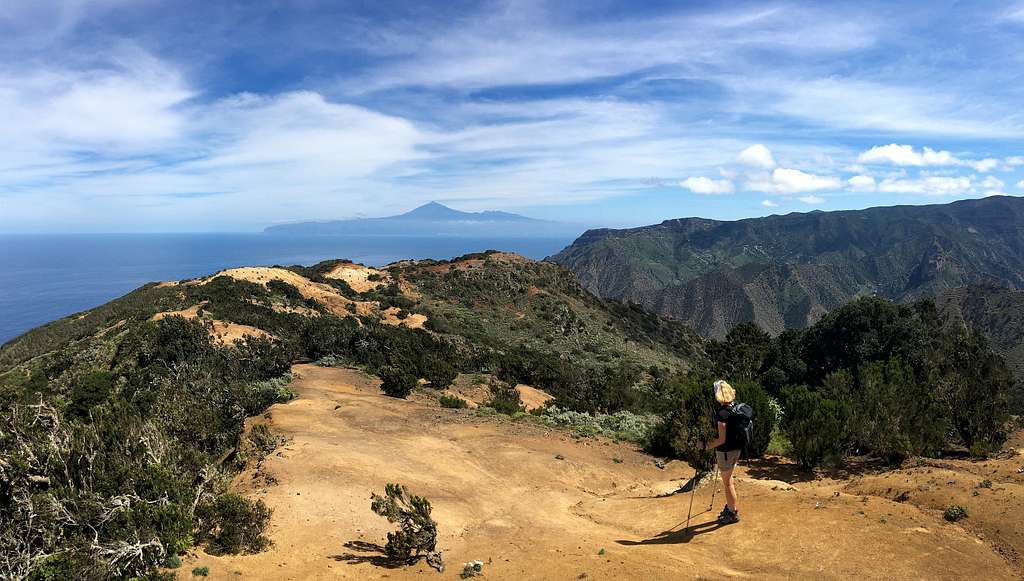
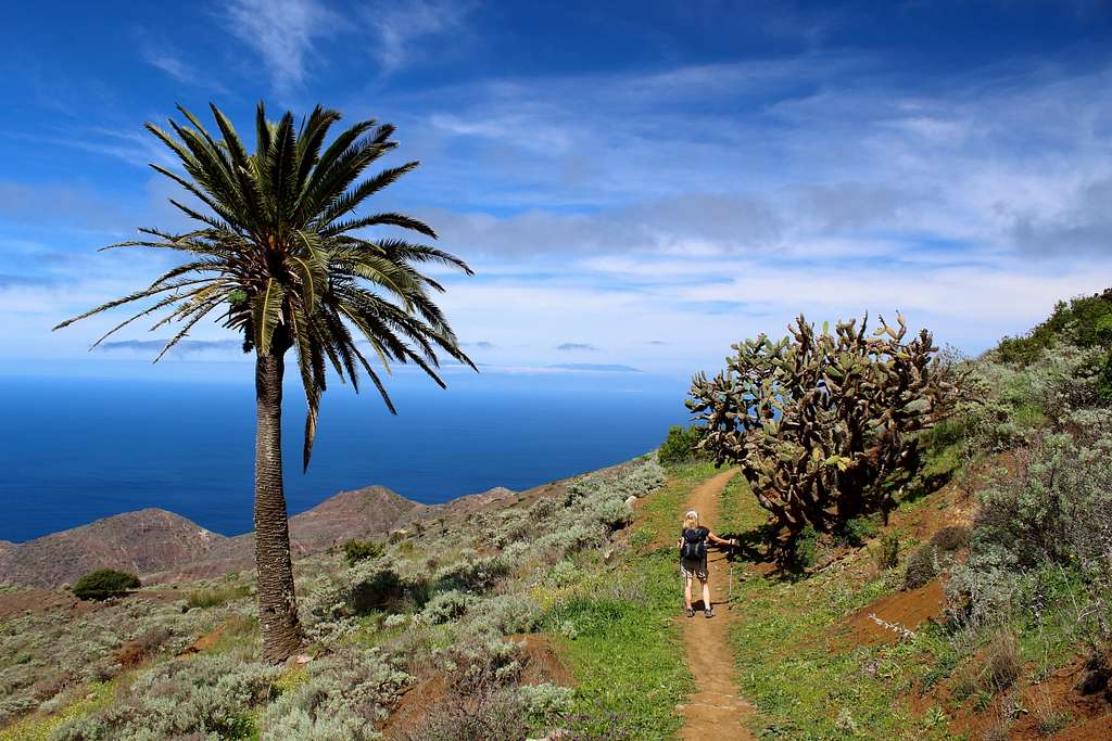
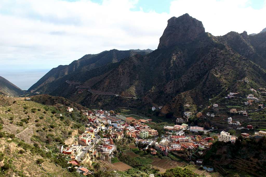
The Cumbre de Chijere is neither a mountain or rocky outcrop but I think it is worthy of its own page as an outstanding feature. From the central high ground of La Gomera, near the hamlet of Epina, a ridge extends north and swings eastwards forming a 700m high barrier between the town of Vallehermoso and the wild north coast of the island. This is the Cumbre de Chijere.
The rocky tops on the ridge above Epina are made of loose, broken rock and are covered with the hardy laurel growth which dominates the high ground on the island. These tops are difficult and unpleasant to reach and with no official paths leading to them, they have little as an attraction.
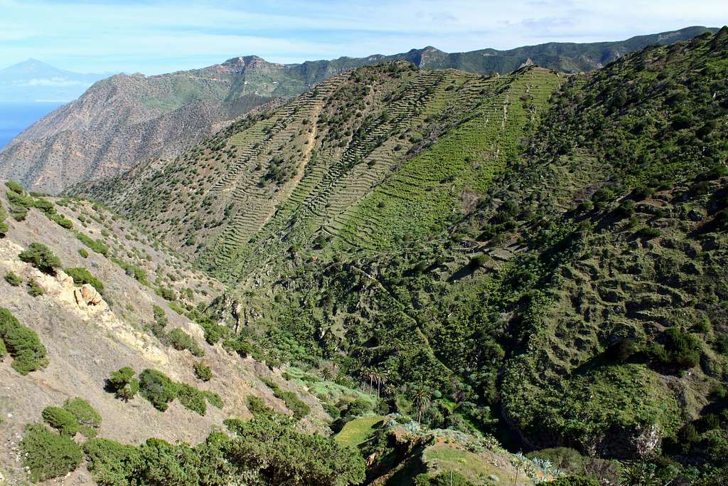
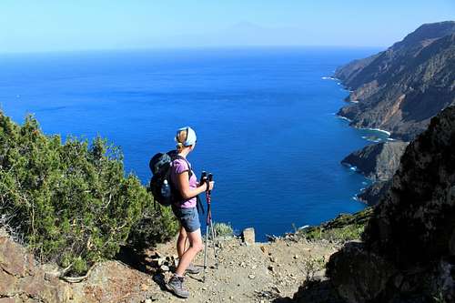
Beneath where the last of these tops lie, Teselinde (876m), the ridge becomes a broad, dusty and open hillside with excellent views of the rocky north coast and the island of La Palma. As it swings east, Mt Teide and Tenerife dominate the view ahead with the hot, enclosed Vallehermoso valley beneath.
All in all, this is one of the most beautiful parts of the island and has some excellent, if strenuous walking to enjoy.
Human intervention
From the hamlet of Epina, a road descends northwards towards Arguamul on the coast. Part way along this road, a smaller road traces a route along the foot of the ridge, north eastwards to the Ermita de Santa Clara. From there, a road (often a dusty track) continues to follow the ridge. Nowadays, this is mostly used by walkers and mountain bikers although I have seen motorbikes and once, a car! (If you have a hire care, it might be an idea to check your insurance before attempting to drive this route!) I imagine it would be a nightmare in wet weather.
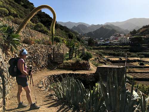
The original purpose of this road was to connect the hamlet of Chijere, which overlooks the north coast, with the rest of the island. Chijere is now deserted and falling into ruin but is worth a visit just for the views of the north coast from the ridge on a hilltop behind the houses.
Two Ermitas (Chapels) are built alongside the road, both in spectacular positions.
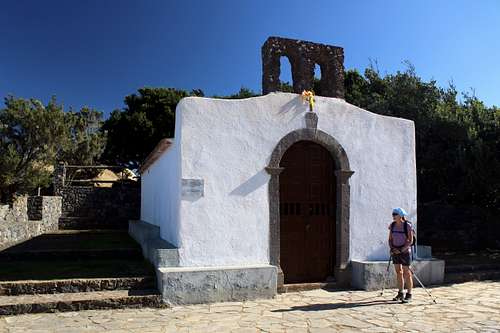
Ermita de Santa Clara
According to the legend, the image of Santa Clara was found on Santa Catalina beach near Hermigua by some fishermen from Arguamul. They decided to build a chapel in Chijeré, which survived for many years. However, direct exposure to the prevailing winds in this area caused the building to suffer permanently. So, they decided to build a new chapel on the present site beneath the rocky top of Teselinde, a more sheltered area in the mountains. Santa Clara is a highly revered saint among the residents of Vallehermoso and, it is said that she intercedes to bring good weather for the peasants' harvests.
The current hermitage dates from 1888, according to an inscription on the wall, but historical texts from the end of the 17th century mention another earlier chapel.
Ermita Nuestra Senora de Coromoto (AKA Ermita Virgen de Guadelupe)
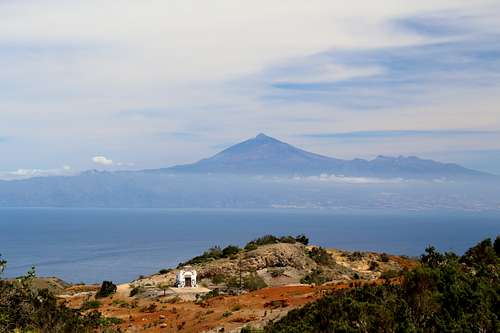
This is an Ermita situated near the deserted hamlet of Chijere, dedicated to the patron saint of La Gomera and has fantastic views across towards Tenerife.
Routes
Ermita de Santa Clara via Montana Blanca (Purple route)
Start in the main square and head up Calle Mayor, the street to the right of the cafés. Look for signs for the GR132 on your left and follow these through houses and onto a track on a ridge above town. This path is easy to follow and will take you upwards towards a distant communications aerial, this is the first goal.
The route runs parallel to the GM 1 road, below and on the left of the ridge with grand views back towards Vallehermoso and the slopes leading up towards Garajonay.
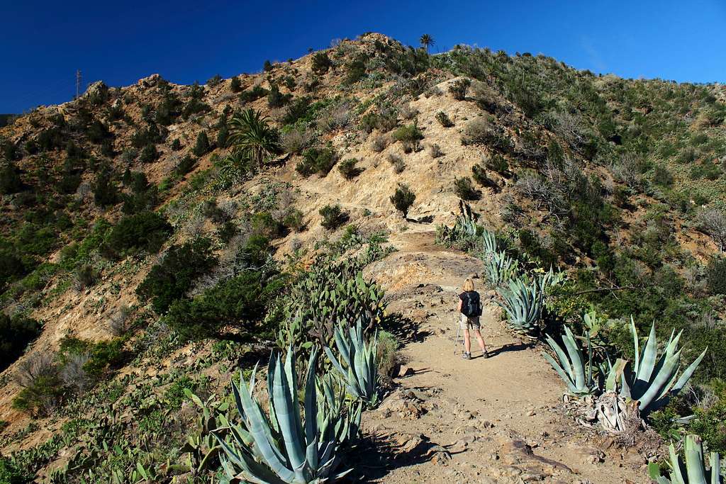
The ridge is dusty and rough underfoot, it wends its way through scrub woodland and the occasional Agave and Euphorbia.
After about 2 hours, the tarmac road up to the communications aerial on Montana Blanca should appear. Follow this to the right and up to the gates of the enclosed buildings. The path continues off the road on the left of the walls and soon drops into the wooded slopes. Follow this through the trees along and just below the ridge line until it drops onto a more open hillside. Enjoy fantastic views of the land between the hamlets of Epina and Tazo, an area given over to the production of Palm oil and very beautiful. On a clear day, there will be views of La Palma with it’s tops usually above a layer of clouds.
As the path heads to the northeast, it becomes more of a track and joins a rough road for the ascent to the Ermita de Santa Clara.
Follow the dirt track to the right of the Ermita, this continues along in the same direction before the contour of the ridge forces it into a sharp right turn around a hillside. A short time later, the track makes a sharp left turn around the hill. Before it turns left again, a footpath sign indicates the descent to Vallehermoso in 4.8km.
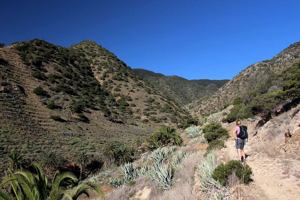
This path starts off at a reasonable angle but soon descends steeply over rough, broken ground into the Barranco de los Guanches. As you descend, it’s possible to see the path in front of you heading across the mountainside. On the map, another path is shown to join this but I didn’t see it.
Keep descending steeply until a small farm is reached at the bottom of the valley. Cross the river and continue on the path seen earlier, this contours across the hillside for a considerable distance.
Keep going to the crest of the ridge, round this and descend again on a rough path.
Eventually, the houses of San Pedro are reached just outside Vallehermoso. Descend to the first tarmac road and turn right. Stay on this road rather than descend to the main GM 1 as this will rise up to meet you in about 15 – 20 mins.
Once Vallehermoso is reached the road ahead will return you to the start point. If you need to catch a bus, you will pass the main bus depot before this.
Route time 4-6 hours.
Ermita de Santa Clara and Montana de Alcala (Blue route)
Start in the main square and head up Calle Mayor, the street to the right of the cafés. Turn left up a steep path to meet the main road to Valle Gran Rey, turn left here. At the next bend, take the narrow street that goes to the cemetery.
Turn right before the cemetery and follow the path across the Barranco del Clavo and past some farmhouses.
The path now contours around to follow the course of the Barranco de la Era Neuva upwards. Continue for an hour past the odd farmhouse and many Palm trees.
As the Palm trees become less numerous, there are more of the Laurel and Eucalyptus trees to see. The trail reaches the crest of the ridge and rewards you with views back towards Vallehermoso. Traverse on beneath Teselinde to reach the Ermita de Santa Clara.
From the seaward side of the Ermita, follow the path through the trees with stunning views of the north coast and the seascape across to La Palma. This path continues on or just below the ridge line and the view towards Tenerife and Mt Teide dominate the way ahead.
The path joins the main track at an area of sandy, eroded rock and soon the Ermita Nuestra Senora de Coromoto comes into view.
At this point, it’s possible to take a detour to the deserted village of Chijere for the views of the north coast.
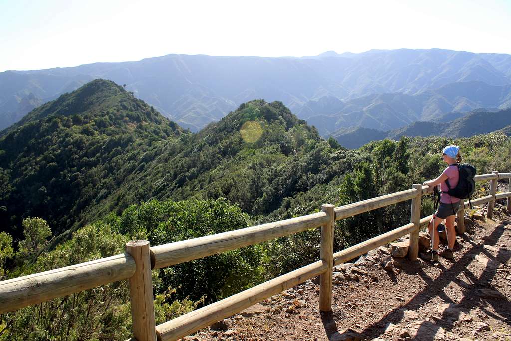
Return to the main track and continue along to the end of the ridge and the “Buenavista” from Montana de Alcala. The Roque de los Organos on the north coast, Tenerife and Mt Teide and the Vallehermoso valley are also visible from here.
Turn around and retrace your steps for 2 mins, then turn left on the marked path to descend to the Playa Vallehermoso. This is an easy to follow but steep and rough path with great views out to sea.
Once the road is reached, there is a sting in the tail. This being a 3.5 km ascent (about 200m height gain) to return to the town.
Follow the main road all the way or for a more pleasant alternative, walk up the road for 1km and turn left into the Calle Lomo Barro by the bus stop.
Follow this until it runs out, then follow the signs back into the town ahead.
The route will take you past the bus depot and into the main square.
Route time 4-6 hours
Of course, it is possible to mix parts of each route to make up your own versions!
There is a footpath from the hamlet of Arguamul to Ermita de Santa Clara which could be interesting but I have not explored this myself.
Getting There
If you are not staying in Vallehermoso there are a few possibilities to get there by bus, these two are the most useful routes.
Line 2 – San Sebastian – Hermigua – Agulo – Vallehermoso
Line 8 – Valle Gran Rey - Vallehermoso
Check the local timetable as they sometimes change and make sure you get back in time for the bus out!
If you have a car, there are three possibilities.
From San Sebastian – Take the GM 2 main road across the top of the island before turning onto the GM 1 to Vallehermoso, this is well sign posted. It’s also possible to drive via Hermigua and Agulo along the north coast extension of the GM 1.
From Valle Gran Rey – Take the GM 1 northwards, again well sign posted.
When to Climb
Winter, Spring and Autumn (Fall) are the best times to walk on La Gomera. Summer is possible too but it can become very hot. Protection from the sun is essential, especially on any exposed ridges or sea cliffs.
Maps and Books
La Gomera and El Hierro Tour and Trail map (1:35,000) – Discovery Walking guides
Gomera: wandelkaarten (1:35 000) - Freytag-Berndt und Artaria KG
La Gomera – Rother Walking guide
La Gomera and Southern Tenerife – Sunflower guides
External Links
References
gomeraverde.com
https://depositsmag.com/2019/01/16/la-gomera-a-short-geological-guide/