
|
|
Mountain/Rock |
|---|---|
|
|
48.18600°N / 121.9267°W |
|
|
Snohomish |
|
|
3040 ft / 927 m |
|
|
Overview
Note: This page was updated with improved directions on 4-26-13.
Note (added 11-6-13): New logging between Olo Pass and Blue Mountain summit has made the road maze even more confusing. Please plan to use a GPS in this area if you are directionally challenged.
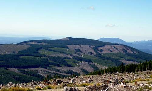
Blue Mountain from Olo Mountain
Blue Mountain (not to be confused with Blue Mountain near Spada Lake) is a forested foothill located seven miles N/NE of Granite Falls. It is the shortest of three ugly brothers (Olo, Wheeler, Blue) situated on private timber lands between Granite Falls and Oso. In the past, this mountain really had nothing going for it. Recently, however, it received a haircut (along with its big brother, Olo) from Longview Fibre, giving it fairly decent views from the summit area. So who would want to hike/bike up Blue Mountain? Most likely someone who has been housebound all winter, and needs to get out for a conditioner before the "real" mountains melt out. I was originally going to combine this mountain with the Olo Mountain page, but I figured any mountain with over 1000' of prominence deserved its own page. The roads on Blue Mountain have been changed around a bit recently, rendering USGS and Green Trails maps useless past Olo Pass. Even the Google Earth satellite shots are outdated, so I've decided to add some GPS coordinates to help would-be summiters of Blue Mountain find their way.
Update (6-2-15): Unfortunately, it appears that Weyerhaeuser is now managing this land, and a permit is now required.
Blue Mountain is accessed via a private timber road maintained by Longview Fibre. See the sign photo below for a list of the rules. I really don't think the loggers mind if you bike on this road during the week (it's never been a problem in the past). Just stay out of the active logging areas, and yield to all trucks.
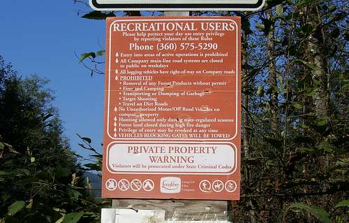
Sign on access road for Olo Mountain, Blue Mountain, and Wheeler Mountain
Directions: Follow the Mountain Loop Highway east from Granite Falls for 4.4 miles. Look for a gated gravel road on the left side of the highway, just before a large sign that says "Masonic Family Park"(N48 06.950 W121 54.586 Elev. 600'). If the gate is open, do not drive in - this gate may be locked closed at any time.
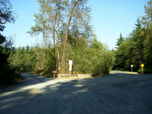
Parking area for Olo Mountain, Blue Mountain, and Wheeler Mountain
Note: This area has many logging roads going in all directions. It is assumed that you have a USGS or Green Trails map of the area, and know how to use it (at least until you get to Olo Pass).
Follow Road 100 north for 0.5 miles until the road forks (immediately after crossing Canyon Creek). Take the right fork (Road 200), and follow it for 4.3 miles to a large four-way intersection at Olo Pass (N48 09.560 W121 53.290 Elev. 1987'). Now things get a little more confusing. Longview has rerouted the roads to the west of Olo Pass, so maps of the area are no longer accurate. Turn left onto Road 240, and follow it to the first major intersection at N48 10.538 W121 53.897 (Elev. 2270'). Make a left turn, and continue to N48 10.560 W121 54.121 (Elev. 2350'). Stay right, and continue to N48 10.606 W121 54.532 (Elev. 2500'). Continue straight ahead to a three way intersection at N48 10.550 W121 54.927 (Elev. 2600'). Take the right fork, and follow it just over one mile to the summit clearcut. For those who just have to stand on the official summit, it is in the woods, about 100' from the summit clearcut.
Note: There is a dirt road leading towards the northwest on the summit ridge. Do not follow this road, as it will quickly put you into the Jim Creek Naval Radio Station property.
The views from Blue Mountain are not quite as good as Olo's, but I think the views of Puget Sound may be a little better. By moving around the clearcut a bit, the views to the north and the east can be expanded.
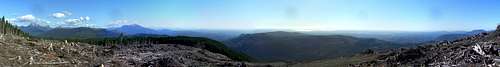
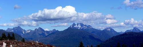
Blue Mountain summit pano
Update (3-26-16): New logging near Blue Mountain's summit has improved the views to the north considerably.

Blue Mountain northwest pano
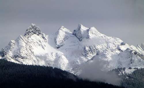
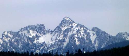
Three Fingers from Blue Mountain 11-6-13
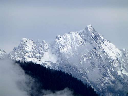
Whitehorse from Blue Mountain 11-6-13
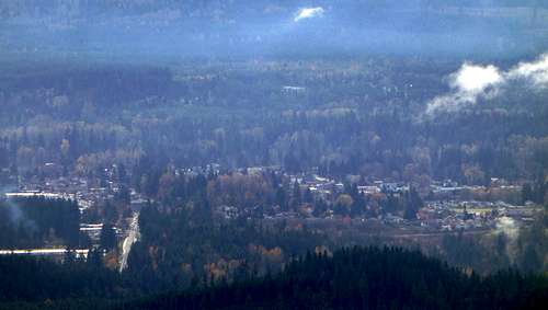
The sprawling metropolis of Granite Falls as seen from Blue Mountain. The beginning of the Mountain Loop Highway can be seen running vertically on the left side of the photo.
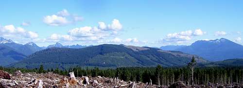
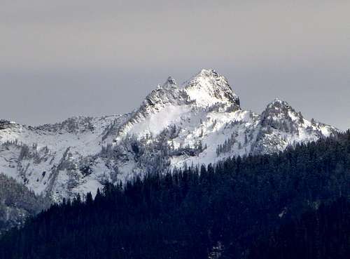
Olo Mountain from Blue Mountain
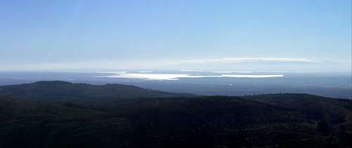
Puget Sound from Blue Mountain
Getting There
Follow the Mountain Loop Highway east from Granite Falls for 4.4 miles, and find the large gravel "parking area" on the left side of the highway. Please do not block the road or gate.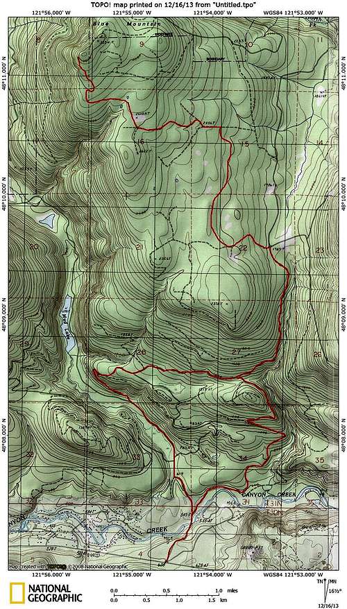
Blue Mountain route map. The first mile past Olo Pass, and the last mile to the summit are approximated. During active logging operations, consider taking the 'west route' after crossing Canyon Creek, to minimize time on the mainline.