
|
|
Area/Range |
|---|---|
|
|
39.24140°N / 109.8038°W |
|
|
Hiking, Toprope, Bouldering, Scrambling, Canyoneering |
|
|
Spring, Summer, Fall, Winter |
|
|
6600 ft / 2012 m |
|
|
Introduction
The Book Cliffs are an enormous area that spans two states: Utah and Colorado. And with the exception of a few privately held parcels of land, almost 96% of the 2.4 million acres that encompasses the Book Cliffs falls under the jurisdiction of the BLM (Bureau of Reclemation).
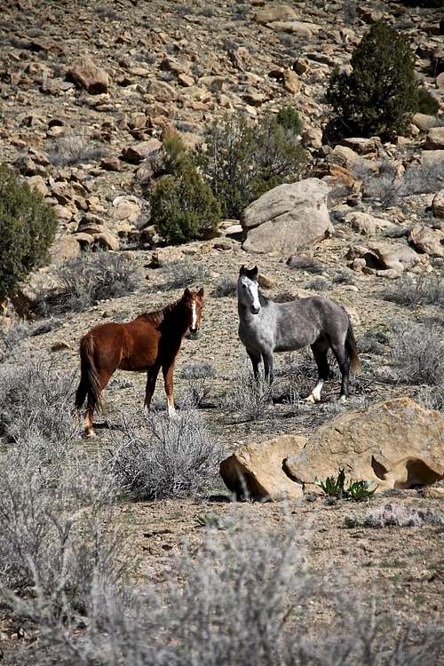
Geographically speaking, this area is roughly 240 miles long laterally (latitude). It's generally accepted this area begins in the west on the Wasatch Plateau near the town of Price and comes to a gradual conclusion out east in the arid canyons just north of Grand Junction, Co. This small area is known as the, 'Little Book Cliffs' and includes the Western Slope's famous peak, Mt. Garfield. There are also wild horses in this area. Some people might even extend that eastern boundary a bit further to include De Beque Canyon, but that's neither here or there.
The northern boundary is generally accepted to be state highway 191/40 running from Duschene to Vernal to Dinosaur, Colorado. This makes for a great drive for those more geologically-inclined as this stretch of pavement spears the Uinta Formation/Mancos Shale and the Mesa Verde Group.
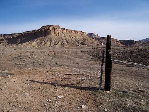
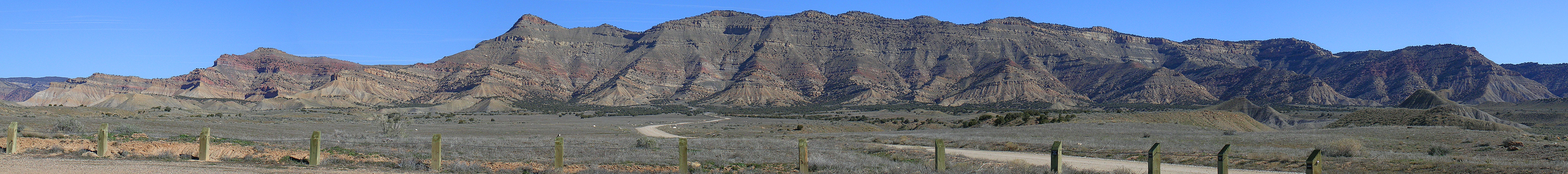
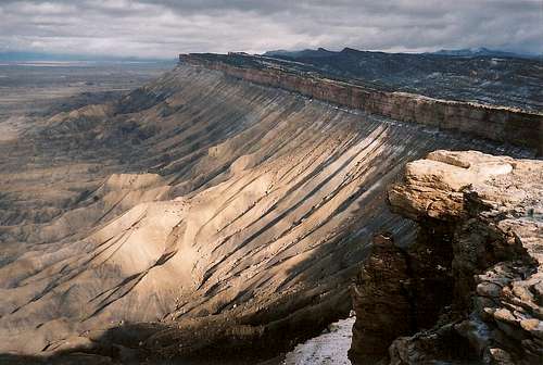
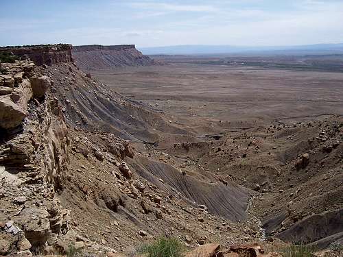
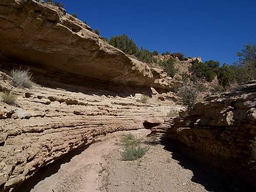
Without doubt, the southern border is marked by I-70. And it's from this vantage that the area gets its name. Looking north, the MASSIVE 1,000' escarpment (rising almost 2,000' at its peak helght) looks like horizontally-stacked tomes; especially with the lighter colored capped bluffs of cretaceous era sandstone. This escarpment by the way, is the longest continous escarpment in the world.
The one feature most notably absent in the Book Cliffs are roads. This is a barren land. Most of the roads are of oil and gas creation or on a minor front, from sheparding of livestock. In saying that, trails are also notably absent. These lands require the adventurer to be comfortable with cross-country treking, navigation and bushwhacking. Self reliance is tatamount here. For peak baggers, this area can be a nightmare and a serious challenge. But the lack of easy access is what makes this place so attractive. There's still canyons, washes, mesas and peaks that haven't been explored or seen human feet.
A question I pose is, does every canyon, peak, mesa, butte, mountain need its own page here on SP? Of course not, that's silly and ridiculous. And it's something that I believe has been addressed before here on Summitpost. But I will try to create as many feasable in-roads into this area as I can that seem necessary. This page will be a work in progress, so please bear with me.
Wilderness, as the philosopher Holmes Rolston once described it, is, “Raw, spontaneous nature.” The high deserts and sage-dotted steppe of Utah and Colorado is just that. These dry canyons are wild and rugged and seperated by long finger plateaus. It would make a great place to film a western! But one of the tragedies of the Book Cliffs, with the exception of a few sites, all of the petroglyphs and pictographs are largely unprotected; to say nothing of the sites that await to be discovered and documented. Since no permanent roads dissect this area, it is truely primitive. I honestly think that there are still sites and maybe even some dwellings that haven't been discovered yet. Because of the remoteness and utter lack of infrastructure, this is why I think most people opt for the Moab area and the National Parks.
Think about that. Only 90 minutes south, one has the town of Moab, the River Valley, Arches, Canyonlands etc. and Poison Spider Mesa to choose from for recreational activities. I've always wondered why the state of Utah has never developed the lands north of I-70. My personal opinion on that, is since the ancient Fremont people disappeared due to a combination of over-population and consumption of precious few resources, the land was made even that more barren and hasn't been able to bounce back. Taken together with the inheirant dryness and isolation, the state deems the area to be unworthy of its' recources (money) for development. But again, this is just my speculation.
So that kind of begs the question. With the infrastructure, development and grand vistas to the south, why distain that area for basically a "no-man's land?"
In so saying, within the open wilds of eastern Utah and far western Colorado, exists a dry and lonely country. It is scarred by dusty canyons and uplifted finger plateaus that hold dominion over vistas reminiscent of ‘banditos’ and Spaghetti Westerns. These badlands, part of the Colorado Plateau are framed by the Uinta Highlands to the north and Interstate-70 to the south. This predominantly roadless area derives its name from a singular rock stratum that runs the entire course of all 240+ miles of this range. This area is known as The Book Cliffs.
This open labyrinth of canyons, mesas and washes does not carry wilderness designation nor is National Forest entitlement bestowed upon it.
With the exception of a few small privately held parcels, 96% of the almost 2.4 million acres that encompasses the Book Cliffs falls under the jurisdiction of the BLM (Bureau of Land Management). With the exception of a few sites, all of the known areas that harbor petroglyphs and pictographs are not in any ‘protected status’; to say nothing of the sites that await to be cataloged and documented. Since virtually no (permenant) roads traverse this area nor are there reliable resources/facilities, the Book Cliffs are what most people would come to expect of a true primitive area. Finding a trail in this Tamarisk-soaked backcountry can be quite an arduous trial and error search and indeed, most time is spent
bushwhacking through scrub-sage, pine and cactus to get anywhere. The canyons are remote and virgin. The plateaus, mesas and mountains do not receive human traffic and the washes are ghost roads.
As said, the Book Cliffs are roughly 240 miles long running west to east. They begin on the Wasatch Plateau (known for mining) in the west near the town of Price and come to a gradual conclusion in the canyons just north of Grand Junction in an area known as, The "Little Book Cliffs”. Some people might even extend that eastern boundary a bit further to include De Beque Canyon.
The Roan Cliffs and Hwy 191/40 abut the northern boundary. This open road starts at the town of Duchesne and courses eastward through the Uinta Formation/Mancos Shale and the Mesaverde Group on its way to the town of Vernal and ultimately, the Colorado/Utah state line. I-70 marks the southern boundary. Most of the ~2.4 million acres are part of a main 2,000-v-ft. escarpment and depending on who you talk to, may or may not also include the Tavaputs Plateau to the north. The 1,000-v-ft. cliff face as seen from interstate-70 (to the north) is actually the longest continuous escarpment in the world.
From Vernal (in the north), a few occasional dirt roads wind south into the Tavaputs Plateau, which rises gradually from desert scrub in the Uintah Basin to aspen forests of the higher elevations. Roughly sixty miles later to the south, the plateau ends abruptly at the Roan Cliffs and Book Cliffs. This plateau, usually known only as the Book Cliffs, is a confusing patchwork of federal, state, tribal and private lands. In spite of the political subdivisions, it is a largely unbroken landscape, representing some of the most remote country in the lower 48. Nine years ago, five experienced staffers from the federal Bureau of Land Management and the Utah Division of Wildlife Resources gathered around a campfire on one of those remote acres. Here, they formed & hatched a plan to conserve the unique wilderness and wildlife in the Book Cliffs.
The areas only settlers of any notable habitation were the Fremont People (named for the Fremont River in Capitol Reef National Park) but they disappeared around 1,250AD. No exact reason is known save for educated theories assuming the guise of over-consumption of natural resources, drought and over-population.
When taken as a whole, that is Utah’s northeastern country, the main question to ask yourself would be,
Front Escarpment- Eastern Utah by Cameo
To start, The Book Cliffs, specifically the Nine Mile Canyon area in the north contains one of the largest concentrations of petroglyphs to be found in the entire Western United States. Doubtless, more sites exist in undocumented canyons waiting to be discovered (the fires that uncovered numerous habituations in the Mesa Verde National Park area 3-4 years ago come quickly to mind). But due to the unforgiving terrain, discovery is a slow process.
A second reason to visit is for the isolation and solace felt here. Not even the overlooks at Dead Horse Point or The Needles area can hold a candle to The Book Cliffs (Ok, maybe the Needles area can). One can rest assured that any outing here either by foot or pack animal will be met with a pure, rugged backcountry nostalgia that is completely absent from places like the Canyonlands or Arches. The Book Cliffs are essentially an unspoiled yesteryear of what the desert high plains once was. Trailheads are non-existent and GPS knowledge while in this area is extremely beneficial.
third reason to visit the Book Cliffs is for the naked geology on display. Unlike the sheer walls, buttresses and pinnacles to the south, splendid and grand to be sure, most of the geologic strata here is accessible. There are 3-4 predominant layers within The Book Cliffs with additional layers in lower lying areas and many more subsequent layers embedded in the chief formations and the terrain is much gentler in terms of topical relief.
Elk, Antelope, Black Bear and Sage and Blue Grouse call this area home. Golden Eagles, Peregrine Falcons and a couple other raptors have also been noted. This area is also known to support occasional populations of Black Footed Ferrets.
Vegetation is sparse and limited to certain plants for a couple of reasons. The soil has a relatively high concentration of selenium in it due to the outlying matrix of rock and that the erosion/evaporation process tends to accumulate dried alkali deposits in the soil. Plants will have a tendency to absorb the selenium, which will result in plant death due to toxicosis leaving behind only those (mainly range vegetation) that can maintain with elevated selenium levels. This will and can of course be transferred to cattle and free-range grazers also resulting in elevated selenium levels; a.k.a. death.
The other reason that this area is selective to certain plant growth is due again, to the morphology of the soil. There is a large concentration of clay that resides within the Mancos Shale stratum. With each passing storm, the clay swells and than contracts as it dries. This makes it difficult for any kind of root system to take hold and establish a network.
So if you can do without paved roads, cities and the modern facilities of the Moab Valley and National Parks then take a few days to explore the Book Cliffs. You’ll be rewarded by sunsets without comparison, a maelstrom of silence and of course, "raw, spontaneous nature."
Geology
Utah is a geologic playground. With the level of erosion that occurs here, exposing millennia of earth tones and colors, strata of different rock and fossils, what's not to love? At the risk of repeating myself from the prior section, aside the Book Cliffs, Utah also offers other areas to play in and marvel at such as: Hovenweep National Monument, Zion, Dinosaur, three different (and unique) area's of the Canyonlands, Timpanogoas Cave, Cedar Breaks, The Great Basin and neighboring Great Salt Lake to name but a few. I personally find it amazing that for an area that has a relatively low amount of biodiversity and geologic diversity that there is so much variation.
Utah can be divided into three overlapping areas. In the west is the Salt Flats and Great Basin. Running straight down the center of Utah is the Wasatch highcountry. To the east and south are the mesas, canyons, plateaus and washes of "Canyon Country." Protected areas like Escalante/Grand Staircase and Bear's Ears are found here.
Utah lies on the western fringe of the behemoth North American Plate. This plate stretches from the California coast east to Greenland and as far south as the Caribbean. Even though Utah lacks the volcanism of the "Ring of Fire" and the typical mountain-building processes, most of the geologic events that occur here include: compression, folding & uplifting, tension cracking and of course, the ever present, erosion. The book, "Roadside Geology of Utah" by Helka Chronicis EXEMPLARY at explaining the geologic history. It is highly recommended. In fact, Helka has a whole series of books detailing the geologic history of the west broken down by state.
The Book Cliffs are part of an area known as the, Colorado Plateau. It is named not for the state, but for the river that partially runs through it. The plateau straddles Utah, Colorado, New Mexico and Arizona (basically the four corners) and is known as 'high desert.' It occupies as area of about 130,000 square miles. It is oil and gas rich and is a hotbed for drilling. This 'Red Rock Country' is known for its' rich display of cliffs, hoodoos, domes and mesas.
"The canyons and finger mesas of the Bookcliffs are the result of fracturing and folding , uplifting and subduction.
Then throw on top of that, the constant weathering from erosion. This area is trying to be erased by the
elements but the occasional cracking and rockfall ensures the canyons stay steep."
H. Chronic
One of the biggest points of interest in this area is the mining of, oil, natural gas, shale, radon and uranium. In fact, it is thought that there is approximately 1.6 trillion barrels of oil reserveswithin the Colorado Plateau. However, the estimate is that 97% of this is locked away in a matrix of shale in a form called, kerogen, a waxy substance. The process of extracting this is highly energy intensive. I imagine oil companies' interest in this will probably ebb and flow with the market prices.
Bureau of Land Management site
Consequently, drilling is a bit of a hot-button topic currently within The Book Cliffs. Largely considered as an area of untapped wealth, it is being hotly contested by environmental groups as energy companies pressure BLM authorities to grant drilling and excavating permits. This is actually quite an interesting topic all onto itself as a prime example of politics, consumption (of natural resources) and conservation that is common to the western states, something that I liken as a sister dilemma to the logging exploits of the 70’s and 80’s in the Pacific Northwest. For instance, in June 2013, the Utah State Board of Education approved a five year drilling lease to Anadarko on 96,000 acres; made largely without comment or input from the general public. The running worry is that this area has canyons located closer to civilization, like Price that people use to recreate frequently. With drilling and fracturing occuring, people are worried it will run off the wildlife or worse, posion and kill the wildlife and permanently alter the landscape.This isn't the right platform to discuss political topics such as drilling, but if you're interested, check out the following links or the Mining section below.
Without delving too much off-topic, all I’ll add about the Colorado Plateau is the following, taken directly from Roadside Geology.
tectonics pattern is hard to say.
As described above, the plateau consists of many individual segments-smaller
The faults and monoclines broadly speaking, trend north-south.
have rotated clockwise to other parts of the continent, a rotation
that may be linked to the northward movement of the Pacific Plate
and the drag that movement exerts on the North American Plate.
But why the Plateau region retains its integrity, like a raft in a stormy
sea of mountain building, has not been satisfactory explained.”
The sedimentary rock found in the Book Cliffs and the Wasatch Plateau in the west range in age from mid-Cretaceous age to early Eocene (100+ million to 53.2 million yrs). The stratum that is evidenced within the Bookcliffs (in ascending order) is the Dakota Sandstone, Mancos Shale, The Mesaverde group (further subdivided into the Castlegate and Price River Sandstone) and ultimately, the North Horn Formation. As one travels from the west to the east (towards Colorado), these layers amalgamate and dissipate; thickness ranges dramatically, especially within Mancos Shale. Even in the Mesaverde Group, Geologists have identified an additional four-seven strata of varying constitutions but still very much, sedimentary. The usual suspects of this geologic composure are Sandstone, Siltstone, Shale and Coal.
With even a little geologic knowledge, based solely on the evidence of the coal, one could correctly assume a marine origin-lake beds, shoreline and past vegetation, peat bogs/marches. Considering paleogeologic patterns, this is indeed true of the large interior sea (Mid-Cretaceous Sea) that at one time existed within the center of North America; commonly referred to as the Western Interior Seaway. This large body of water would have had its western shoreline abut to the Bookcliffs along present day Interstate-70. The Roan Cliffs located further north would have held tidal lagoons.
The cliffs erode from the side rather than from the top. What this does is expunge the softer material leaving the harder to eventually fall into smaller slabs. This process has caused the Bookcliffs to erode northward away from I-70. Sediment is shifted and carried away down the washes during storms. White deposits of salt and alkali are left behind as the evaporation process tenaciously removes all trace of moisture.
Erosion within the Book Cliffs, since the terrain is so malleable and pliant would normally be quite rapid if it were not for the complete lack of water. So instead, a placid landscape ensues. Steep slopes when encountered are typically the effect of overgrazing from Ranchers. This prematurely speeds up the erosion process by removing the ground vegetation. I find it amazing that this kind of ‘terra firma’ exists only ~34 miles north of the sheer walls, pinnacles and buttresses of the Canyonlands.
The Unusual Occupation at the Bookcliffs (1.19.2015)
Further Reading- Salt Lake Tribune (7.30.2018)
Utah open the Book Cliffs up for drilling (9.8.2013)
Oil drilling in the Bookcliffs (9.19.2019)
The Fremont People
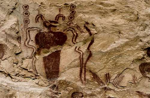
Petroglyphs -Bob Sihler
The Fremont Peoples are an archaic Native American culture long extinct. There are pointers/flags sprinkled throughout Native American archeology that distinctly point whether a piece of pottery, weaving or dwelling is Fremont. However, due to that we know so little about them, (comparitively speaking), and that exceptions do exist within the Fremont culture itself, the whole 'Fremont' label does ebb and flow depending on who one is talking to. And again, this is in comparison since there were other tribes living in the vicinity as well that are separate but with similar lineages and modes of habitation.
Collectively speaking, the Fremont people were Puebloans. A label that also includes the tribes: Anasazi (think Mesa Verde in SW Colorado), Hopi, Paiute and Zuni. The Puebloan label is an umbrella term in that, it jus means different cultures that share material, agricultural and even religious practices. Also, these tribes tended to be located geographically around the desert southwest of America.
In regards to labeling/classifying cultures, the Paiute and Hopi tend to reject this 'Fremont' moniker. The Paiute refer to their ancestors as "Wee Noots," people who lived the old ways. And the Hopi usually call their ancestors, "Hisatsinom," people of long ago. Regardless of how current generations refer to their ancedtors, these 'old people' were skilled builders & masons and knew how to live in an arid and often unforgiving landscape.
It is believed during the 3rd and 4th centuries, drought and over-consumption of natural resources drove the progenitors of the Fremont out of the Great Basin where they would eventually resettle present day Utah and Colorado. Traces have been found in the Uinta Highlands and Capital Reef National Park. There is even a lesser hald belief that instead of migrating from the Great Basin, the Fremont was a sect that splintered off from the Mogollon (mountain) peoples in Northern Arizona and New Mexcio. There are similarities in terms of diet, housing and pottery. So this theroy does have some cred.
The Fremont culture/people thrived from 600-1280AD in what is now the areas of Utah, Nevada and Colorado. The name comes from the Fremont River Valley in Utah where many of the originally discovered sites are located. The Fremont, as opposed to other sects of Puebloans who lived in large cliff dwellings, prefered to live in pit-style houses, natural rock shelters and wickiups (brush & log huts). This enabled them to be more mobile and adaptive, moving freely with the seasons or environment. It is believed that a historically documented drought during the 13th century forced the Fremont peoples to disperse and leave their ancestral lands. Most lineages would completely disappear. A few moved further into Colorado into the Little Book Cliffs region and others moved south into what is now the San Luis Valley where they would eventually become integrated by the conquering Spanish and Mexicans. By roughly 1415, the Fremont culture had more or less become extinct. It's only through their pottery, weavings and pictographs/petroglyphs that we know this lineage of ancient Puebloans exisited at all.
Regardless of where the Fremont originated from (actually, some think they're a splinter sect from the ancient Mogollon in Northern Arizona/New Mexico), or whether this label refers more specifically to a distinct lineage, lineages or a collection of phoenetically similar customs & languages is up for debate. In my opinion, it's probably a little of everything that is ultimately dictated by geography and environment. Over hundreds of years, through trial and error, some customs and practices are found to work better than others depending on the environment. But I digress.
Of the trappings that set the Fremont peoples apart from others, a major one is housing. The pithouse isn't a new or unique construct found only within the Fremont or Mogollon peoples. This housing style is found in other cultures world-wide and is typically used to store supplies, food or to provide temporary shelter as this style lends itself well to protection from wild temperature and weather extremes. Because their contemporaries built large and sometimes complex rock/cliff dwellings (Chaco Canyon, Mesa Verde), housing is an easy way to distinguish. Because the Fremont tended to be more nomadic, large complexes wouldn't have worked anyway. Given the temperature swings in the desert, pit-style houses worked better since they provided stability. The only downfall, they erode easily making upkeep a constant process and that, they're hard to find. However, you can still see examples of this kind of construction at several locations:
- At Capital Reef National Park. Follow the Hickman Bridge Trail. After ~3 miles, a couple will be specified and signed as such.
- Also, given time, visit the Fremont Indian State Park, which is 24 miles southwest of Richfield and 15 miles east of I-15. Here, a village named five-finger was discovered in 1983 as I-70 was being constructed through Clear Creek Canyon.
- In the town of Vernal north of the Book Cliffs, there is the Uinta County Heritage Museum. This is a surprisingly well-organized and impressive museum and consequently the largest in the States for Fremont relics and beta. Admission is free (donations). #435.789.7399
"Uinta County Heritage Museum features displays by the pioneers, Native Americans Indians, miners
soldiers, lawmen and outlaws who helped shape the history of the Uinta Basin."
- Also just outside of the town of Vernal about 6.4 miles northwest is the McConkie Ranch. There are several examples of Fremont art and pictographs.
Petroglyphs: Images carved into rock.
Pictographs: Images painted onto rock.
Pictographs: Images painted onto rock.
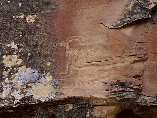
Pictographs and petroglyphs are one of the more prevelent signs of Fremont. The style is distinct and generally referred to as, "Classic Vernal Style." Figures were often painted with large broad shoulders and trapezoidal or square heads. Heads were often adorned with jewlery and shields are often present alongside.
Food was another linking factor. Diets were typically rich in corn, maize, squash and beans. The camas root or yucca (which also doubled as a medicinal tool due to its anti-inflammatory and digestion properties) and bitterbrush were also eaten. During the later summer months, chokecherries, wolf berries and buck berries were enjoyed. A typical Fremont individuals diet consisted of 25%-30% vegetation.
Keeping in line with what we know from anthropology, the Fremont people were initially hunter-gatherer. This lifestyle lends itself well to nomadic cultures which, given the known environment, was probably for the best since resources were scarce. At some point during the later part of ther 9th century, the farming methods that were utilized started to figure more prominantly into daily life as the people gradually moved into a more semi-sedentary lifestlye. And again, since the desert could be inhospitable at best sometimes, the fremont preferred areas where there was water; places like Desolation Canyon, Nine Mile Canyon and of course their namesake, Fremont River Canyon.
Flora & Fauna
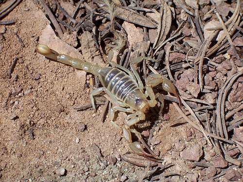
Desert Scorpion
In this empty Northeastern pocket of Utah, common animals that are frequently sighted are Mule Deer, Antelope, Elk, armies of squirrels and rabbits and to a lesser degree, Bighorn Sheep. Those that are less sighted and harder to glimpse include bear, Mountain Lion, Blue and Sage Grouse, Peregrine Falcons and Bald Eagles. At last estimate there was about 375 species of vertebrates residing in the Book Cliffs and surrounding areas.
In November of 2007, a plan was initiated by the Utah Wildlife Board with the cooperation of the Division of Wildlife Resources (DWR), The Bureau of Land Management (BLM), private ranchers, The Nature Conservancy and the Rocky Mountain Elk Foundation to reintroduce about 45 bison into archaic native habitat within the Uinta Basin and Book Cliffs. The initiation schedule of January 2008 had been pushed back and delayed due to abnormally heavy snowfall and a revised, more comprehensive plan for disease testing (Brucellosis) since the area of release is sensitive. As of late August, early September, 13 bison were successfully released into the Book Cliffs region (one was gored to death during transport). There are another 30 animals ready to be released later in September, possibly early October 2008 to create a sustainable population pending the efficiency of tagging and disease testing. The animals were rounded up with the help of the Ute Indian Tribe.
Trees, bushes and plants are the clothing and adornments of the earth. Within places like the Book Cliffs, the topography resembles a 'down-and-out whisky soaked beggar.' The Forest Service has good reason to preach, “Tread lightly”. Existence is tough for vegetation and unfortunately, there has been a noted rate of non-native plant species moving into the Book Cliffs area. Native tree’s and plants such as the White Rive Penstemon, Pinon & Juniper trees, Indian Ricegrass, Big Basin Sagebrush and Buckwheat are now competing for valuable resources of water and nutrients from invading noxious plants.
Typically, what happens in a case of introduction of a non-native plant species, is the new plant IE: (Russian Olive) will spread uncontrolled due to a lack of insect control specific to the invader, mineral or nutrient concentrations in the soil that benefit the invader due to intrinsic reasons specific to morphology and (or) a lack of animal species that negatively effects the newcomer.
The Salt Cedar is a good example of a species that is hard to kill. This tree thrives in low-lying areas and around concentrations of water or moisture. It readily absorbs water, has an entangled and dense root system and is highly hermetic against elevated levels of minerals (alkalines, salts, selenium) that would otherwise retard growth in normal indigenous flora.
The Russian Knapweed and Russian Olive are also hardy plants with little benefit (nutritional) to indigenous wildlife. The Yellow Starthistle, African Rue and the Black Henbane are also examples.
Another extenuating factor of non-native flora deals with the process of interspersion.
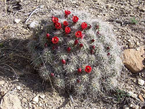
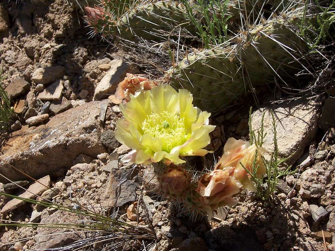
Claret Cup Cactus
What this means is that in a regularly functioning ecosystem, the total diversity of life is a direct function and result of the species that occupy specific niches and places within that ecosystem. So when a change is introduced in the form of invading animal or plant species, pollutants or meteorological stresses, basically any outside xenomorphic condition, the ecosystem must learn to change to adapt this new stress/variable or components within the system will fail, falling victim to competition.
To better illustrate this, take for example the over-grazing of cattle. In arid lands, of which this is a current dilemma within the Book Cliffs, this practice can and does lead directly to higher erosion rates. This means the topsoil is now open to increased winds and rain, which eventually will be carried off. Plants trying to carve a spot to grow will have a harder time digging down for purchase. This in turn limits plant growth and directly affects the native wildlife that eats certain plants for sustenance. It however, doesn’t stop there. With fewer floras on the ground, mineral concentrations are allowed to escalate because to a certain degree, all plant life incorporate and absorb a certain amount of toxins/chemicals and minerals as a normal/routine part of growth.
These naturally existing minerals can reach prohibitive levels that keep new plant growth minimal or outright stop it. Elevated selenium in the soil in certain parts of these areas is a current problem with its roots in cattle over-grazing.
The Russian Olive is an example of a species that can adapt to these changes in organic soil chemistry and exploit it. This tree offers little to no value to the wildlife in terms of nutritional benefit except as a safe haven from predators. While offering a moments solace from being hunted, at the same time it drives the same animals further and farther in search of food. This is an example of interspersion being reduced. This is certainly not a monopolized problem by any one area. You could also look at the mongoose/snake dilemma, Gypsy Moth problem, Giant (Cane) Toad in Florida and on a larger but hidden scale, white man and Native American Buffalo.
In every scenario, the cause and effect is essentially the same. However, in areas like the desert/high plains, where the bio-diversity is low to begin with, the effect becomes that much more pronounced and visible.
 |
 |
 |
 |
 |
Utah Division of Wildlife Resources
1596 W. North Temple Salt Lake City, UT 84116#807.596.8660
Ouray National Wildlife Refuge
This 12,469acre refuge was established in 1961 and is currently owned and supervised by the U.S. Fish and Wildlife Service. There is an information kiosk and pamphlets are available to the prospective wildlife and riparian inhabitants. Information for a self-guided car-tour is also available. Most of the terrain that encompasses the refuge is situated around 10-12 miles of the Green River so bird watching is excellent. Bald Eagles frequent the area in early winter.Open sunrise to sunset year round.
Ouray National Wildlife Refuge
19001 E. Wildlife Refuge Road
Randlett, Utah 84063
#435.545.2522
Mailing Address
HC69 Box 232
Randlett, Utah 84063
Mining is an integral part of the history of the United States. It’s almost necessary to touch on the subject since this industry has its fingers within the Book Cliffs.
Mining
 |
The Western United States has seen its share of mines, oil rigs, pollution, fracking and deaths. Fortunes have been made and lost overnight, equipment left forgotten under the hard sun and whole towns have withered away. This has touched almost every state but in particular, California, Nevada and Colorado have reaped the consequences.
In Utah, most of what is mined or has been mined includes: Coal, Gilsonite, Oil, Gold, Natural Gas, Copper, Radium, Uranium and Potash etc.
Since the Book Cliffs are part of the 6,970,000 acres that also includes the larger Uinta Basin, mining might seem a bit trifle compared to a scale this large and primitive. And I suppose in some respects it is. However, factor in tangents like the water table, endangered species and natural resources and the question of whether or not it is trifle becomes a lot more muddied and hard to answer.
Naturally enough, ranchers are going to have a different opinion from Farmers who will likewise have different opinions from Environmentalists or government agencies and even hunters. Then we have outdoor recreationalists who will have different opinions from all the aforementioned. Mining is in some aspects, a necessary problem. It is an industry that, like or not, has always been tied to local economies and public outcry.
The BLM holds a large percentage of the Book Cliffs under its jurisdiction. Within this dominion, as of 2003, there were 323,510 acres that held 400 active leases by no less than 294 separate energy companies. This obviously puts the BLM in an awkward position because on one hand, the BLM has the relatively easy revenue income that these mining leases create and the responsibility of proper land management on the other. Piece by piece, the BLM has either auctioned off or leased tracts within the Book Cliffs and parts of the Uinta Highlands. They’re currently considering allowing as many as 423 new natural gas wells on almost an additional 83,000 acres.
It’s somewhat downtrodden to hear facts and numbers like this but when comparing this to what’s currently happening to the local economy in Garfield County, Colorado from the recent gas and oil boom, it’s hard to make a stand against drilling/mining when people futures can be bettered by it.
Citing numbers from another 2003 study impact statement conducted by a small collection of private holdings, said interests would require 14-40 new wells per year being serviced by 127 miles of new roads. This is a place (Book Cliffs) that is not typically, “user-friendly”. There are already 64 wells and 139 miles of road in place. In an area that is already officially labeled as “Wilderness Quality” by the BLM, this is a prime example of the dual nature of ethics and economy. I’m not going to draw conclusions or make known my own opinions on this other than put forth the old question of whether or not the means will justify the ends.
Currently, mining in the Book Cliffs has been largely regulated to Oil and Natural Gas. It’s been speculated that this area contains somewhere in the neighbourhood of 1.2-2.4 million barrels of both. With predictions like this, there will undoubtedly be more drilling. For anyone who’s ventured into this ‘no-man’s land’, the terrain is harsh, bone-dry and difficult to navigate. For anyone who’s crossed the San Rafael Swell in Central Utah without the aid of I-70, know this is not an easy undertaking. So again, in some respects, having a few more roads to access the ‘ghost areas’ of the Book Cliffs is nice. Otherwise, it would take an extra few days to reach these backcountry areas. It’s a bittersweet dilemma with no resolution that is going to make either side smile.
Coal
Settlers began arriving in Utah in 1847. Most of these people were Mormons looking for an escape from religious persecution. For roughly three years from 1852-1855, coal production in Utah was ramped up and viewed as necessary and important to iron making since it was an easy energy source and in great abundance. From the 1860’s to the late 1880’s, the two major railroads: The Denver/Rio Grande and Union Pacific monopolized most of the coalfields seeing the importance of easy energy and money.Towns like Springville, Thompson Springs, Sunnyside and Crescent Junction grew overnight as railroad towns directly related to the production of coal. The field plateaued in 1920 during WWI and saw another rise during WWII. Since then, things have stabilized and gradually fallen due to the discovery of oil and natural gas. The coal industry saw another spike during the 1980’s followed by another financial plateau during the 1990’s when things again, started a gradual slide as the Wasatch Plateau and the Book Cliffs regions came to maturity.
As insane as it sounds, maps of underground coalmines didn’t start to materialize until the late 1870’s and it wasn’t until the 1940’s, that maps became required for all existing and new mines.
Utah has roughly 4% of its land underlain by coalfields and currently produces 2.4% of the nation’s coal, much of this being in the Book Cliffs and Uinta area. Of this, only .024% lies on the ground or within four feet of the surface. 25.2% lies underneath at depths greater than four feet. This ranks Utah as the #13 highest in coal production behind states like Montana and Colorado. The chief difference between standard coal and oil shale is that coal contains a larger percentage (sometimes significantly) of organic matter.
|
|
 |
Oil Shale
Something that the Book Cliffs have an abundance of...is Oil Shale. Fact, recent estimates of Oil Shale puts the abundance into the billions of barrels. However, the catch is in the processing of it. Processing oil shale into a useable hydrocarbon is not entirely energy-effective and still expensive.In short, oil shale is a fine-grained sedimentary rock that typically contains varying amounts of kerogen. From the processing of kerogen, liquid hydrocarbons can be extracted and ultimately used as fuel.
A 2008 estimate set the total world resources of oil shale at 689 gigatons — roughly equivalent to a yield of 4.8 trillion barrels (760 billion cubic metres) of shale oil, with the largest reserves in the United States, which is thought to have 3.7 trillion barrels (590 billion cubic metres), though only a part of this is recoverable.
The chief difference between coal and oil shale is that coal has a larger percentage of organic matter and oil shale has a larger percentage of minerals and at that, a highly flux composition depending on where its found. For this reason, it’s difficult to assign a chemical formula to oil shale or to even geologically define it. The types of minerals present aren’t uniform nor are the ratio compositions standard. Even the mining location has a large factor in what goes into the matrix such as the amount of organic matter present and the types and quality of kerogen trapped in the matrix of rock. The general accepted classification is that oil shale is typically labeled as terrestrial, lacustrine (lake-bottom deposited) or marine (ocean).
 |
||
So if world deposits are what they are and countries are sitting on what’s potentially hundreds of millions of barrels of unrefined oil, why are prices so high to process it?
There are two main methods of processing.
The first is underground processing & mining. This is being seen as the most efficient way of processing and there are multiple methods being used to bring the price of extraction down. From what I have read, all the possibilities utilizing this method are complicated and relatively still under development. There are many patents still pending and the chemical process isn’t easy to follow or understand.
The second method, which I’ll touch on is above ground processing. In a chemical process called, pyrolysis, the kerogen in the shale is converted into a synthetic crude oil and shale gas. This is frequently done by heating the shale in the absence of oxygen to a temperature at which the kerogen is disassociated into a gas, condensable oil and a solid residue. The temperature at which this happens is between 842°F (450°C) and 935°F (501°C).
According to a survey conducted by the RAND CORPORATION, the cost of producing a barrel of oil in the United States by using a ‘standard’ extraction process will range between $70-$95. This estimate is wide in margin and hard to point with accuracy because of unknowns such as kerogen quality, matrix composition and extraction efficacy. With oil prices always in flux, the practicality of pursuing this course remains questionable.
However, if past prices dictate future prices, this eventually will become a viable option.
The Western United States (Colorado, Utah, Wyoming) contains an underground lake bed spanning almost 17,000 sq/miles. Shell Oil is aggressively pursuing this industry and area for development. Estimates put this area to contain at least 800 billion barrels of recoverable oil. This is roughly triple the reserves of Saudi Arabia.
A recent 2007 DOE study contends that the Colorado Plateau can sustain 2 million barrels a day by 2020 and upwards of 3 million by 2040 with the possibility of 5 million barrels a day with multiple company’s mining/processing. At this level, western oil shale fields would rival the largest oilfields in Saudi Arabia and (or) the Middle East.
Uranium
Uranium, the "wonder mineral" had slowly become a giant in the 1950’s compared to the slow obsession from earlier days. The quest for uranium and accompanying natural minerals has historical roots in Southern Utah and Colorado. The industry in the late 1950’s and 1960’s actually depended upon prior experience in the fields of prospecting, mining, and processing. The earliest users of uranium ore in Utah were Native Americans who used it for paints (hard to believe!). Initial Utah uranium mining began in the 1870’s and 1880’s on a small scale. Processed ore was shipped to France and Germany in the mid-1880’s for use in the forming of salts and oxides as colorants for ceramics and dyes, in the manufacture of glass and pottery, and as aids in photography and steel plating. By 1898 radium had been successfully isolated from uranium and carnotite had been found and identified. Eventually, radium became known as the "wonder drug" and usurped most of the importance away from uranium.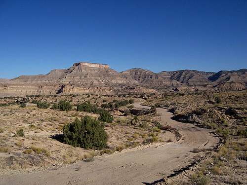 |
||
Market demands grew for vanadium and radium, which are both found in uranium. By 1906 nearly 200 tons of uranium were mined annually in Colorado and Utah. World War I sharpened the demand as vanadium was found to be an efficient steel-hardening agent and radium as an illumination agent for watch faces, compasses, gunsights, and airplane dials.
Nearly all the known deposits were located in the United States and the market demand stayed fairly strong.
War and mineral prices affected and altered Utah's uranium industry. Production slowed during the 1921-23 depression. Of more permanent significance were the rich ore finds of radium in the Belgian Congo in 1923 and of vanadium in Peru. Because of the strength of these mining fields, these countries came to dominate the market. Between 1923 and 1940 the production of uranium in Utah and the West proved negligible and slowed to a trickle. On a global scale, Utah took a backseat to Colorado in terms of uranium exploration. Think of the Colorado town, Uravan (URA- uranium, VAN-vanadium). Though compared to elsewhere at a time when the US was practically the only source of these radioactive materials, the numbers were financially huge.
However, during the Cold War from the 1950’s and 1960’s, uranium again reigned as a wonder metal. Charles (Charlie) Steen reigned as the most well known of the uranium bonanza kings. His home in Moab exemplified this newfound wealth; but Steen's fortunes were also tied to the mining industry and ultimately affected by the economic downturns of the industry.
Gilsonite
Another lesser known but equally important mineral in Utah's mining history is Gilsonite. This substance is lightweight, glossy black, bituminous and of asphaltite quality. This was the primary hydrocarbon mined in Utah. Its raw form is very brittle and can be smashed and ground quite easily and has the appearance of obsidian. It has been mined commercially only in northeastern Utah, where it occurs south of Vernal and Roosevelt in parallel vertical veins that cut across the Uinta Basin. It is believed to be a solid residue of petroleum, and was initially named uintaite in 1885 by W.P. Blako. The mineral was later named in honor of Samuel H. Gilson, a businessman from Salt Lake City who brought it into prominence for commercial uses such as in paints and varnishes and in other building products.Gilsonite has been produced since the 1880’s and in 1886, Gilson, Burt Seaboldt, and others filed claims. Seaboldt, the most inquisitive of the trio, experimented with the substance and observed that it was resistant to acids and moisture. He succeeded in having his mining claims removed from the Uintah Reservation. In 1888 the Gilsonite Manufacturing Company was organized and formed in Salt Lake City. Reportedly, at that time some 3,000 tons of Gilsonite were shipped to Price and sold for $80.00 a ton. In 1889 the company sold out to the Gilson Asphaltum Company of Missouri and by 1900, the Gilson Asphaltum Company of New Jersey had acquired the property.
 |
||
Wagon freighting costs in 1900 were reported to be from $10.00 to $15.00 per ton to carry the ore to the railhead with rail costs at $10.00 per ton to Chicago or St. Louis. In 1911, the railway was extended to Watson, then four miles southwest to the Gilsonite mine at Rainbow. A wagon road called the Uintah Toll Road was eventually built to carry freight and passengers over the sixty miles between Vernal, Fort Duchesne, and Dragon.
Mining the vertical fissures of Gilsonite was difficult, as the veins were often quite narrow, most of the time only a few feet across.
Pick and shovel were the most useful mining tools. Ore would then be hoisted from the shafts. In the early days, veins were worked on a rising slope to permit the ore to roll back down the slope. When a sufficient amount had been loosened, the mineral would be loaded by hand into a burlap bag holding about 200 pounds. This method limited the depth of these operations to about 100 feet.
Uintah and Duchesne counties produced the principal Gilsonite mines--Dragon, Rainbow, Watson, Little Emma, Bonanza, and Little Bonanza were among them. In Duchesne County, the Parriette Mine (closed in 1900 because of an explosion) was located near Parriette Bench. In 1935 the main operation had been moved to Bonanza and ore was trucked to Craig, Colorado. This resulted in the eventual abandonment of the Uintah Railway.
What is Gilsonite? -Ziegler Chemical & Mineral Corporation
Book Cliffs-Uinta Basin -Who owns the West?
Quadrangles along the Book Cliffs
This is a general list of the state of Utah.It is broken down into typical, square quadrangles that the USGS and BLM uses to navigate, point and plot and map existing land.
It is also a useful resource for 'peakbaggers' to keep track of what points, peaks and mountains have been climbed or scrambled.
It may be an over-the-top way for purists to take the whole 'peak bagging thing' to the extreme but there is no doubt that it does provide an avenue for people to see parts of their state that they would ordinarily ignore. Plus, it's an easy way to size down an absolutely huge area into smaller, more manageable segments.
Utah- Quadrangles List
Search Utah's peaks and points
What is a USGS Quadrangle?
In Defense of the Wild Places
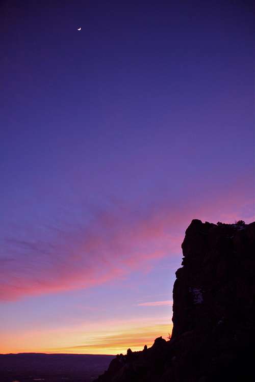
Utah Sunset -Liba Kopakova

Resources for Additional Information
Utah Road Atlas

Google Maps
View Larger Map
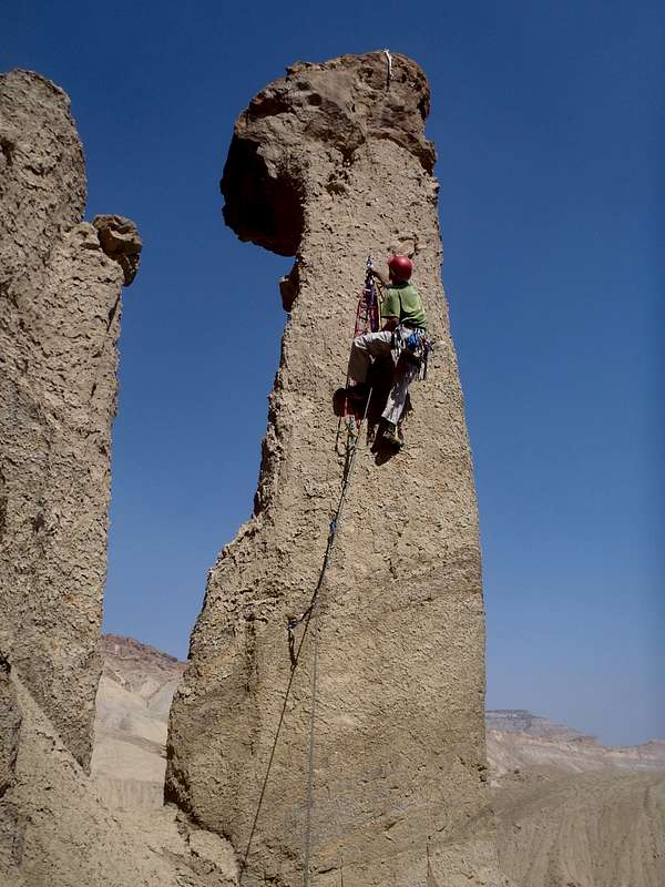
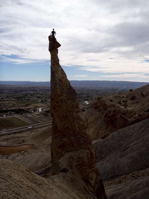
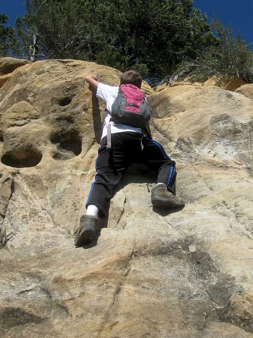
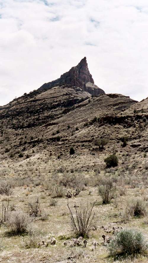
Climbing Pictures
 |
 |
 |
|---|---|---|
| SP Member- Brian Crim | Bug-Eyed Monster | Sword of Damocles-FA Paul Ross |
|
|
|
| Scott's son, Kessler | Peak 6,100' | Choss Master 5.11a |
Dean - Feb 1, 2009 6:22 am - Voted 10/10
Bison updateYou mentioned that Bison were being re-introduced to the Book Cliffs. Here's the latest info on that effort link number one Link number two Link number three You can delete this post any time you wish. You have put forth an awesome amount of effort on this page, thank you.
Kiefer - Feb 4, 2009 9:54 pm - Hasn't voted
Re: Bison updateDelete? Never! The links are spectacular and only add to the page and information for everyone. Thanks for taking the time, Dean to add the hyperlinks!
Scott - Oct 17, 2014 1:23 pm - Voted 10/10
UraniumAs far as I know, I don't think that there is any uranium or has been any uranium mining in the Book Cliffs. The uranium in the region is usually in the Moss Back Member/Shinarump Conglomerate which is far older than the strata in the Book Cliffs.
Kiefer - Oct 19, 2014 7:59 am - Hasn't voted
Re: UraniumCool. Thanks for the beta, Scott. After some years of neglect, I'm rehashing the page with current information. I'll add this when I get to the Geology section.
Matt Lemke - Oct 28, 2014 8:47 pm - Voted 10/10
Re: UraniumI agree with Scott, there has not actually been any uranium mining done in this area however the Mancos Shale does contain small amounts of Uranium inclusive minerals originating from the carbon rich, reduced environment that was the shallow sea floor 50-65 million years ago. Where the uranium actually came from is highly debated but small amounts of it exist...although nowhere near enough to be mined like the Uranium deposits found in the Chinle Formation. One thing to correct though Scott, the Shinarump member is a white, quartz rich sandstone sitting directly below the Chinle Formation, which is where the Uranium rich deposits were mined. The Shinarump isn't found everywhere and doesn't really host much uranium.
Scott - Dec 8, 2019 8:10 am - Voted 10/10
Re: UraniumMissed this early, but the Shinarump and Mossback members are related and part of the Chinle. Most uranium mines are in the Morrison and then the Shinarump/Moss Back members of the Chinle. The uranium in the Chinle is mostly from the Shinarump/Moss Back members.
Scott - Dec 8, 2019 8:18 am - Voted 10/10
PictographsThe areas only settlers of any notable habitation were the Fremont People (named for the Fremont River in Capitol Reef National Park) but they disappeared around 1,250AD. This may interest you. The Barrier Canyon sytle Pictographs in places like Sego Canyon and Thompson Canyon (and in other places in the Book Cliffs) are much older than the Fremont Culture. See here (though the article erroniously refers to the pictographs and petroglyphs): Sego Canyon The Sego Canyon pictographs themselves are known to range from 3000-8000 years old, which is much older than the Fremont Cultrue. There are also Fremont Culture petroglyphs there, some of which have been chipped over the older pictographs. There are also Ute petroglyphs at the site. The Utes also lived in and used the Book Cliffs. The top of much of the Book Cliffs and the east side of Desolation Canyon is still part of the Ute reservation. Some still like in the area of the Book Cliffs, such around Florence Creek.