
|
|
Mountain/Rock |
|---|---|
|
|
33.96610°N / 117.28542°W |
|
|
Riverside |
|
|
Hiking |
|
|
3047 ft / 929 m |
|
|
Location
Box Springs Mountains look over eastern Riverside, California, and western Moreno Valley, California, roughly forming the border between the two Inland Empire cities.
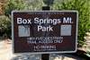
Box Springs Mountain Park encompasses 1,155 acres and is located 5 miles east of Riverside off Highway 60 and Pigeon Pass Road near the city of Moreno Valley. The park consists of equestrian & hiking trails. Located in the mountain range between the city of Grand Terrace and Moreno Valley.
Peaking at 3,047 feet, this brown mountain is among the most prominent features of the central Riverside County landscape. Many of the local Radio stations, have there antennas on it, because it's the highest point between San Bernardino and Riverside.
In winter after a good rain and cold weather you can have some fantastic views from the top. You can admire the snowy peaks of the San Gabriel and San Bernardino Mountains, or you can see as far as Corona, the Santa Ana Mountains and Lake Mathews.
Access
I have attached a large image where I highlighted the trails on the mountain.
Fire Break Road - In Moreno Valley, from the hwy 60 exit on Pigeon Pass and keep going till the pavement ends(Pigeon Pass road will turn right but you need to continue straight ahead), than continue on the gravel Box Springs Road till you get to the Box Springs Mountain Park parking lot. This is as far as you can drive.
FEE AREA: $4 per vehicle and $1 per pet. Last time I checked (11/06/2008) there is an iron pole where you need to drop in the payment, but there is no envelope or pen.
From here you can walk or bike to the top very easily on the gravel road.
With a very slow walk and a little siesta on the top it can be done in about 4 hours.
 |
 |
 |
 |
 |
 |

Trails
Trails
The "M" trail:
On Piggeon Pass Rd in Moreno Valley, park at the Westbluff Park.
NO FEE if you park here!
It is located on the right hand side of the road between the sporting fields of Canyon Springs High School. When you come out of the parking lot, go right and shortly (before the stop light) on the left hand side of Pigeon Pass road there will be some dirt roads. Start heading towards the mountain (East)for about 0.4 miles. On the left side of the dirt road that is heading East there is a trail that heads South towards the direction of highway 60. As you start heading up on the trail you will start zig-zag-ing and in about 0.6 miles you will arrive to a fork in the trail. You can take either one of the trails, they will run into each other later again. I would say the one on the right is the shortest. When you meet up with the other trail again, just keep going upwords.
Right before the top you will pass under the big "M" sign. You can follow the trail up till the top, or if you want you can start walking up on the letter itself. If you go climb up on the letter, watch out, cause there is a lot of broken glass.
The total length of the trail is about 2.2 miles. Elevation gain about: 1347 ft
Two Trees Trail
Getting to the parking lot: From Hwy 60/ I-215 take exit to Blaine St and go East 1.7 mi. Left at Belvedere Dr go 364 ft. Slight right to stay on Belvedere Dr 0.1 mi. Turn right at Two Trees Rd go 0.2 mi. There is place to park at the end of Two Trees Street, but the sign says that you should park at Blaine Street.
There is NO FEE here.
From here to the top is a total of 4 miles and elevation gain of about 1700 ft.
Skyline Trail I
From the Box Springs Mountain Park Parking Lot it is a 2.7 mile loop. If you are doing a right handed loop, after about 0.3 miles there is a side trail on the left hand side, that goes to the top of the peak that this loop runs around.
After 1.6 miles the trail will intersect with Skyline Trail II Loop.
Skyline Trail II
coming soon
Sugarloaf Mountain
You can park (free) at the intersection of Spruce Street and Valencia Hill Dr. There is a trail that starts right there and it is about 0.6 miles to the top of the mountain. It can be done in less than a half hour.
Camping
There is NO overnight camping allowed on the mountain.
Maps


Blair - Nov 7, 2008 1:54 am - Voted 10/10
Nice start, keep it upRevised- I love these little hills, they provided me with alot of good times when I was young and they still have many cool areas that surprise me still! Thanks for adding this page, and the two trees trail as a route, and please give a little more information on this area.
Bob Burd - Jan 19, 2012 7:32 pm - Hasn't voted
No feesThere were no fees required at Box Springs Mtn park when I visited in the summer of 2011.
surgent - May 23, 2012 10:53 pm - Voted 8/10
Summit elevationThe HP is 3,080 feet, marked "Box Springs Lookout" on the map, topped by a monumentally ugly tower with spray paint, etc. It's the 2nd-to-last tower before the road ends near the "M". When you're on it and sighting back, it is clear it is higher than the nearby ridgepoints.