
-
 1027 Hits
-
 71.62% Score
-
 2 Votes
|
|
Mountain/Rock |
|---|---|
|
|
38.85478°N / 111.90457°W |
|
|
Sevier |
|
|
Hiking |
|
|
Spring, Summer, Fall, Winter |
|
|
6551 ft / 1997 m |
|
|
Overview
One of several prominent foothills in the east side of Sevier Valley composed of compacted gypsum, salts, and capped by broken basalt. The scattered juniper and lots of grass make it great habitat for snakes.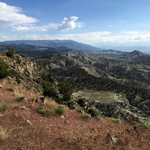
Summit View Bullsnake Peak
Getting There
Take UT-24 southwest out of Sigurd, Utah. Drive 2.4 miles and take a left onto Sage Flat Road. Drive a mile to the waste disposal facility but take a left at the gate onto the dirt road. Continue on for another 2 miles and take a left onto a smaller dirt road that crosses Sage Flat. Continue on this for 0.4 miles and park at the bottom of the hillside where the road begins to travel upward. There is construction on a new road in the area but it is slow-going and would best be traveled by foot.Route
Follow the dirt road currently under construction on the northeast flank. At the end of the road, ascend the steep slope to the west with basalt boulders with care. The slope flattens and the false summit is attained. From here, meander along the rolling ridgeline to the southwest and ascend the slope to the summit.Round-trip Distance: 1.84 miles
Elevation Gain: 707 feet