
-
 11234 Hits
-
 85.87% Score
-
 21 Votes
|
|
Mountain/Rock |
|---|---|
|
|
38.19365°N / 78.7948°W |
|
|
Mountaineering |
|
|
Spring, Fall, Winter |
|
|
2068 ft / 630 m |
|
|
Overview
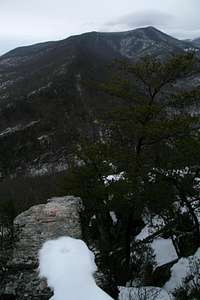
Seen from the Shenandoah Valley, Buzzard Rock, a low peak on the western edge of Shenandoah National Park's South District, does not quicken the pulse. It appears as a low ridge dwarfed by Trayfoot Mountain and Rocks Mountain, and unless you are looking for it, you probably won't even notice it due to the height and size of its neighbors (each is more than 1000' higher and is much more massive).
From the north, the peak appears sharper, and perhaps its profile is somehow what earns it its name. It is more likely, though, that the name alludes to vultures perching on the peak's outcrops. In an area like the Blue Ridge where most terrain is tree-covered, vultures can flock to the relatively few exposed outcrops, creating an ominous setting.
But Buzzard Rock, not to be confused with Buzzard Rocks near the Rose River on the east side of the park, will appeal to wilderness seekers because there is no trail up it (translation: solitude) and because of the interesting outcrops, and nice views, up top. Those views take in the Shenandoah Valley, the ridges of the Appalachians to the west, and nearby ridges and peaks. The climb is a short one, too, and can easily be done in just a few hours.
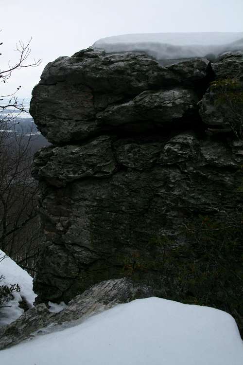
Among the rock outcrops, there are a few cliffs high enough to interest really desperate rock climbers, but for the most part, the outcrops just welcome scrambling and bouldering.

Getting There
The shortest approach is from the west, outside the park.
Just south of Grottoes along U.S. 340, turn left at a sigh indicating access to SR 661. Follow 661 about 5 miles until the end of state maintenance and park; this is between two homes, so do not block the homeowners' driveways or park on their property. The road, now rocky, narrow, and steep, continues another 0.1 mi to the park boundary. If the road is not gated, you could drive it with high clearance and 4wd, but it probably isn't worth the hassle.
Another approach is from Skyline Drive, inside Shenandoah National Park. Park at Blackrock Gap, between MP 87 and 88, and hike down the Paine Run Trail.
Route Information
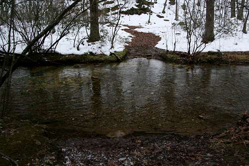
From the small parking area, hike a short distance on the old road downhill to Paine Run. When you reach the park boundary, the road crosses the run onto private property marked as such both by signs and on maps. A trail continues into the park; this is Paine Run Trail.
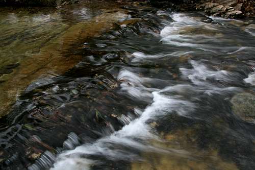
Cross the stream, which may be wide but will not be more than knee-deep most of the time, taking care to avoid crossing onto private property. Now begin the steep uphill climb to the summit of Buzzard Rock, where you will find several interesting exposed outcrops and where you may also find a fire ring.
The climb is less than a mile, and the elevation gain is about 600'.
Do this route late fall through early spring, for it may become a tangled, painful mess at other times (and poison may be rampant). You may also wish to avoid this peak during hunting season; although hunting is not allowed in the park, the peak's location on the border of the park may put you in range of the careless or the mistaken.
Climbing the peak from Skyline Drive is a longer, more strenuous affair. The shortest way is to head down Paine Run Trail for 3.7 mi to the park boundary and the ford described above, losing 900' of elevation en route. Thus, an approach from Skyline Drive doesn't make a lot of sense unless one were to include it along a backpacking loop involving Trayfoot Mountain.
Red Tape
Respect landowners' property in order to keep access open.
It now costs $15 to enter the park via Skyline Drive; this fee is collected at entrance stations. The South District of Shenandoah National Park is completely closed during dark while hunting season is underway; this is to deter poachers.
Camping
None at the trailhead outside the park. There is probably nothing legally preventing you from sleeping in your car there, but you are right next to two homes, and that could create a situation anywhere from awkward to hostile.
In the park, the closest campground is Loft Mountain, MP 79. This is a full-service campground with showers and a store nearby.