
-
 47613 Hits
-
 88.61% Score
-
 27 Votes
|
|
Mountain/Rock |
|---|---|
|
|
38.73690°N / 104.8806°W |
|
|
9565 ft / 2915 m |
|
|
Special Note
In April of 2012, I adopted this page from mmoerk. mmoerk was critical in building the foundation of Colorado Springs area peaks on SummitPost, contributing many of the region's keystone peaks (such as this mountain). Thank you, mmoerk, for your pioneering hard work showcasing the beautiful summits in our metro area.
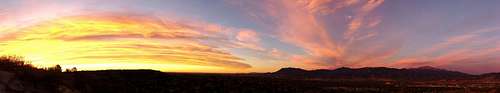
Cheyenne Mountain (center-right) meets the plains in a Colorado Springs sunrise | mattpayne11
Overview
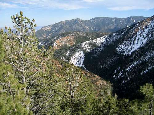
Cheyenne Mountain from North Cheyenne Canyon
Dominating the skyline of southern Colorado Springs, Cheyenne Mountain is easily the 2nd most recognizable mountain in the area. The mountain's sheer mass, coupled with its array of television and radio antennas, make it a ubiquitous backdrop to the Springs. Even on the darkest of nights, the red blinking lights of the radio towers let you know where Cheyenne Mountain is.
This mountain has everything. In addition to the antenna farm, the mountain also hosts the Will Rogers Shrine of the Sun, the only mountain zoo in the United States, and of course, NORAD. There was once a restaurant high on the mountain, boasting spectacular views of the surrounding mountains and the city. But in spite of all of Cheyenne Mountain's character, it is a mountain that is seldom-climbed. This is most likely due to a lack of information about the mountain.
Spending some time on Cheyenne Mountain is truly a treat. If you have spent time in the mountains near Colorado Springs, you will really appreciate the unique perspective Cheyenne Mountain affords. The view of the surrounding mountains is awesome.
Please note that there is not a defined trail to the summit. A summit attempt requires confident navigation skills, good maps, a compass, and preferably a GPS. While there has been talk about the Cheyenne Mountain State Park eventually building a trail to the top of this peak from the east, it has yet to become a reality.
 |
 |
 |
 |
Getting There
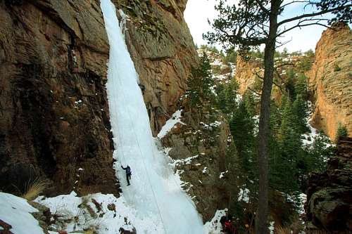
Ice climbing near Cheyenne Mountain | pyerger
NEW SCHOOL
The summit of Cheyenne Mountain is now officially available the Dix Trail from the Cheyenne Mountain State Park. Find details here: https://springsmag.com/hike-dixon-trail-to-top-cheyenne-mountain/
OLD SCHOOL
There are two primary old school routes up this mountain that both avoid private property and provide trailhead parking:
Rock Creek Trailhead: Elevation 6,300 feet
Directions courtesy of EdF
• Going South on Nevada Avenue (Rt. 115), pass the south end of Colorado Springs and head toward Fort Carson.
• Pass Ft. Carson Gate 2, and then set your odometer at Fort Carson Gate 1.
• Pass Gate 1 and drive 4.9 miles south on Rt.
• 115 and turn onto a dirt road. Park before a gated closure shortly up the road. Don't block the gate.
MacNiel-Swisher
• Exit 138 west from Highway I-25 on Lake Avenue/Circle Drive. Soon you will be looking at the front of the Broadmoor Hotel.
• Follow signs to the Cheyenne Mountain Zoo, leading you to the right around the hotel until you get to the Old Stage Road.
• Take Old Stage Road (FDR 368) into the mountains/uphill for 5.7 miles to a sign for the Broadmoor Stables (at the crest of a gentle hill).
• Parking is available for several vehicles in a pull-out to the right of the road.
Red Tape
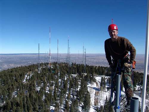
Antenna Farm on Cheyenne Mountain | RckyMtneer | Note: This SPer was on an official work assignment. Do not approach or attempt to climb the radio towers - to do so would be trespassing.
It is a common misperception that the summit of Cheyenne Mountain is on private property. In fact, the summit is in the Pike National Forest, and as such, is public land. Much of the mountain is privately owned, including NORAD, the antenna farm, the Zoo, the Shrine, and The Horns, site of the now-destroyed restaurant. The private property is generally on the north and east sides of the mountain, while the south and west sides are in the National Forest. There is plenty to explore on this public part of the mountain, including the summit itself.
Much of Cheyenne Mountain is in Pike National Forest. All routes described herein travel only on public land in the National Forest, unless explicitly stated. It is legal to hike anywhere in the National Forest; permits and fees are not required.
It is your responsibility to know where public property ends and private property begins. I recommend the Pikes Peak Atlas for this, as it explicitly has Pike National Forest shaded green. Other options are the "Colorado Springs Pikes Peak 75k Trail & Recreation Map" (www.skyterrain.com), or the USGS map, but these are somewhat less explicit about property boundaries.
Here are some specific notes of interest, but it should not be considered an exhaustive list.
- NORAD is located on the east side of the mountain. You really, really don't want to trespass here.
- There is a road to the antenna farm; however, this road is gated, locked, and is off limits to the public. Don't try it.
- Most of the area along Old Stage Road, on the northern part of the road, is private property. It may be possible to access the mountain from this side without trespassing. Then again, it may not be.
- There is an abandoned road, above the Shrine, that leads to the Horns and the old restaurant site. This road is also on private property and is off limits.
- Access from the east is now available via Cheyenne Mountain State Park. You can view a PDF Map here.
Weather & Seasons
 |
Cheyenne Mountain is, generally, an all-year mountain. • Nice powder (for snowshoeing or step-kicking) can be found on the slopes of Cheyenne Mountain in the winter months. • Summer months bring heavy vehicle traffic to Old Stage Road/Gold Camp Road and summer temperatures can be quite high here, despite the altitude. • Spring access to the summit would depend on the year’s snowpack; a heavy snowpack would mean deep drifts of soft, late-season snow lodged in the trees. • Fall may well be a great season to attempt Cheyenne, and the golden aspen glowing on the lower reaches of the mountain would be sure to delight. |
 |
Contact the Pikes Peak Ranger District for current conditions.
Pikes Peak Ranger District
(719) 636-1602
Click here for a live webcam of Cheyenne Mountain.
Camping
Rustic car camping and backcountry camping can be throughout the surrounding Pike National Forest. Be forewarned that the proximity of this area to the urban I-25 corridor means that crowding can be an issue, especially in the summer, and that unsavory characters are known to frequent this area. Be prepared for heavy ATV use, large crowds, drunkenness and casual firearms usage.
While the Old Stage/Gold Camp area provides for all of the rustic camping you could hope for, I honestly suggest not spending the night in the area for the sake of peace and quiet, and even for your safety. Old Stage Road/Gold Camp Road serves as a conduit for the urban masses to explore Pike National Forest. While this sounds like a good idea, the reality is messy (garbage, spent shells, beer bottles, auto parts and busted clay pigeons) and sometimes grim. I am ashamed to even print this, but this area (Old Stage / Gold Camp Road) has the reputation as the “body dump” of Colorado Springs.
Do yourself a favor and stay in town, visiting Cheyenne Mountain as a day excursion.
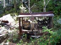 Abandoned pump | mmoerk Abandoned pump | mmoerk |
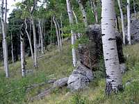 Aspen meadow | tojensen Aspen meadow | tojensen |
 Almagre & Pikes | Sarah Simon Almagre & Pikes | Sarah Simon |
Hotels, Cabins & B&Bs
Old Colorado City
Nearby Old Colorado City has an assortment of lodging options, old and new, for all budgets. Restaurants, bakeries and shops are within strolling distance from many lodging facilities.
Manitou Springs
Manitou Springs lies at the foot of Ute Pass. This colorful, eclectic town offers a wide range of lodging options including old-style motor cottages and cabins, retro family-run motels, charming B&Bs and modern chain hotels. Shopping and dining are within walking distance of most Manitou lodging. Visit the a href=http://www.manitousprings.org/Default.aspx >Manitou Springs Visitors Website for more information on lodging in the area.
Backcountry Camping
On the mountain, there are plenty of opportunities for backpacking sites. Most notably at the 8700' high point where the MacNeil Trail becomes faint, or at numerous places along the long summit ridge. However, there is no reliable water source just about anywhere on the mountain.
External Links
- CNN Cold War -- Cheyenne Mountain
- Cheyenne Mountain Zoo
- Will Rogers Shrine of the Sun
- Cheyenne Mountain Adventures
Some history of the mountain, and other information. - Cheyenne Mountain State Park
This new State Park is at the base of Cheyenne Mountain. - Cheyenne Mountain - Wikipedia
Interesting information on NORAD at Cheyenne Mountain.
big_g - Dec 6, 2008 12:36 pm - Hasn't voted
broken linksThe Live Webcam is permanently offline and the Interactive map link is broken too.