
|
|
Route |
|---|---|
|
|
37.16133°N / 113.01928°W |
|
|
Hiking |
|
|
Spring, Fall, Winter |
|
|
A long day |
|
|
Hike |
|
|
Overview
 |
Chinle Trail is located in the southwestern parts of the Zion National Park. Unlike the “classic” Zion trails that go through canyons and highlands, Chinle Trail introduces you to some of the desert lowlands of the park. The trail starts at a spot to the east of the town of Rockville and ends in Coalpits Wash 7.7 miles away. Along the way, the trail will take you across beautiful plateaus and a number of small canyons carved by seasonal streams. You will also get great views of the local jagged/slick rock mountains such as The West Temple, Mt. Kinesava, and The Sundial. The vegetation ranges from thorny desert shrubs to a forest of Juniper Trees. A portion of the trail traverses a plateau where the petrified remains of ancient trees can be seen scattered around the trail.
Getting There
Note: Older sources talk about a dirt road to the east of the town of Rockville. This road has now been paved and is known as Anasazi Road. New homes have also been constructed around the road.
From the southern entrance of Zion National Park (In Springdale, UT), drive 3.5 miles west on Route 9 and turn north onto Anazazi Road (just to the east of the town of Rockville). Drive the steep road a very short distance and then turn right onto a dirt road where you will find a parking area and a sign for Chinle Trail. The Trailhead is located outside the park boundary.
Route Description
All distances are per my GPS.
Trailhead Coordinates: 37 Deg 09.680 Min North
……………………………….......113 Deg 01.157 Min West
Round Trip Distance: 15.4 Miles
Please note that the trailhead is outside the boundaries of Zion National Park.
Find the trail on the north side of the parking area. As you hike up the side of the hill, you will have great views of the Virgin River Valley (where Route 9 runs) and the jagged Eagle Crags to the south/southeast.
 Eagle Crags Eagle Crags |
 Virgin River Valley Virgin River Valley |
The trail crosses Anasazi Road, goes around some of the local homes, and then gets into a dry wash until it reaches Anasazi Road again and crosses to the north of it. You will then find yourself on a plain covered by desert shrubs.
 |
 |
 |
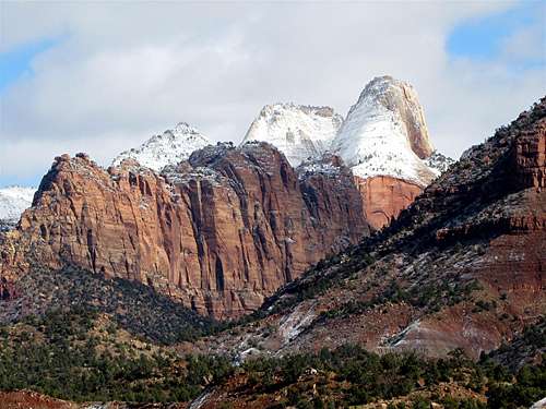
You will have great views of the southeastern faces of The West Temple 7810 ft and Mt. Kinesava 7285 ft.
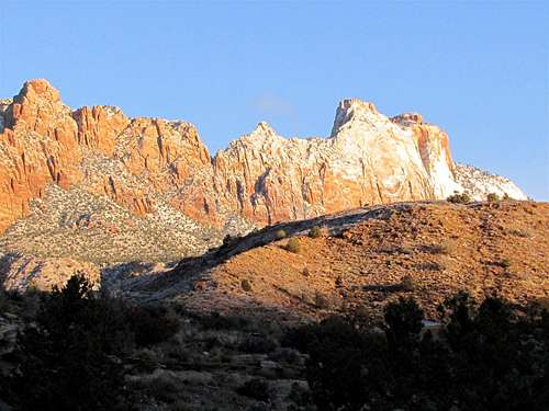 (L) Mt. Kinesava, (R) West Temple (L) Mt. Kinesava, (R) West Temple |
 (L) Mt. Kinesava, (R) West temple (L) Mt. Kinesava, (R) West temple |
The trail heads northwest over the plateau and very slowly goes up in elevation. After 1.1 miles, you will reach the park boundary. Go through the gate and make sure you close the gate behind you.
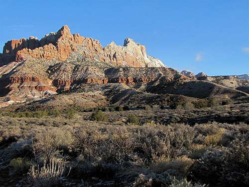
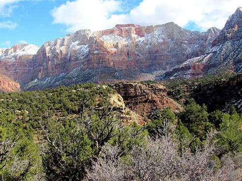
The trail continues on the plain and skirts around the southern foot of Mt. Kinesava 7285 ft.
 South face of Mt. Kinesava South face of Mt. Kinesava |
 South face of Mt. Kinesava South face of Mt. Kinesava |
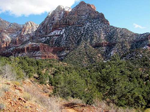
As you go higher in elevation, a forest of Juniper Trees appears over the plateau.
 Juniper Forest Juniper Forest |
After 2.6 miles, the trail reaches the eastern edge of the canyon of Huber Wash. It follows the edge for a short time while going down in elevation and eventually crosses to the west side.
 Canyon of Huber Wash Canyon of Huber Wash |
 Canyon of Huber Wash Canyon of Huber Wash |
On the west side of Huber wash, you will find yourself on the Petrified Forest Plateau where you can see ancient petrified wood all around you.
 Petrified Wood Petrified Wood |
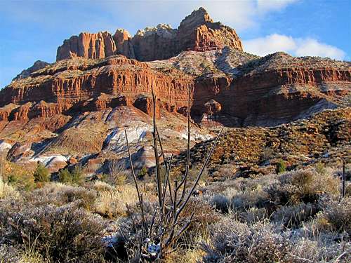
As you continue northwest on the Petrified Forest Plateau, you will slowly go up in elevation and will soon start to see the southwestern faces of the West Temple 7810 ft, Mt. Kinesava 7285 ft and The Sundial 7590 ft. The very prominent Point 6310 ft also comes to view.
 West Temple & Sundial West Temple & Sundial |
 |
 Point 6310 ft Point 6310 ft |
After 4.7 miles, you will see the sign for Camp 1 and reach the maximum elevation of 4420 ft. The trail starts to slowly go down in elevation into the canyon of Scoggins Wash.
 Descending into Scoggins Wash Descending into Scoggins Wash |
 Descending into Scoggins Wash Descending into Scoggins Wash |
You will soon cross the Scoggins Wash.
 Scoggins Wash Scoggins Wash |
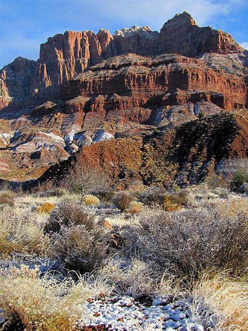
On the west side of the Canyon of Scoggins Wash, the trail heads southwest going up and down in elevation slightly. The signs for campsites #2 and #3 will also become visible. As you hike, make sure to turn back and get fantastic views of the massive slick rock mountains that rise to the east and northeast.
 The Bishopric The Bishopric |
||
 |
 |
 |
 The West Temple The West Temple |
||
 Mt. Kinesava Mt. Kinesava |
||
After Camp 3, the trail heads west and then north. You will find yourself on a plain covered by burned trees. The walls of Cougar Mountain appear to the north.
 Cougar Mountain Cougar Mountain |
 |
The trail then reaches the edge of the canyon of Coalpits Wash and slowly descends into it to end at Camp 5 (4100 ft elevation).
 Coalpits Wash Coalpits Wash |
 Coalpits Wash Coalpits Wash |
Red Tape
Check out http://www.nps.gov/zion/index.htm for all fees and regulations.
Weather and When to climb
See the forecast for Springdale, UT
Due to very hot summers, October through May is the best hiking season.