
|
|
Mountain/Rock |
|---|---|
|
|
46.14300°N / 11.56580°E |
|
|
7916 ft / 2413 m |
|
|
Overview
Cima delle Buse Todesche : "the memory paths"
This summit is located in the RAVA Group: the eastern side of Lagorai
These Lagorai's mountains have been silent watchers of all the human events of the last thousands of years... starting from the hunters (12000 years ago) near the Lagorai lake till the last barbarities and human struggles of the 1st World war.
Now the scenery is the same and these rugges summits became "memory paths" ... Cime delle Buse Todesche (Summit of Deutsch Holes) takes its name after past events and military structures that are plentyful here.
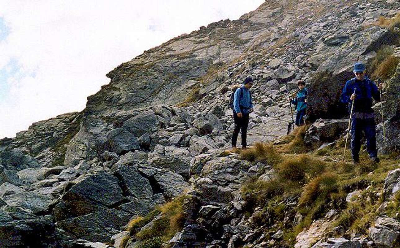
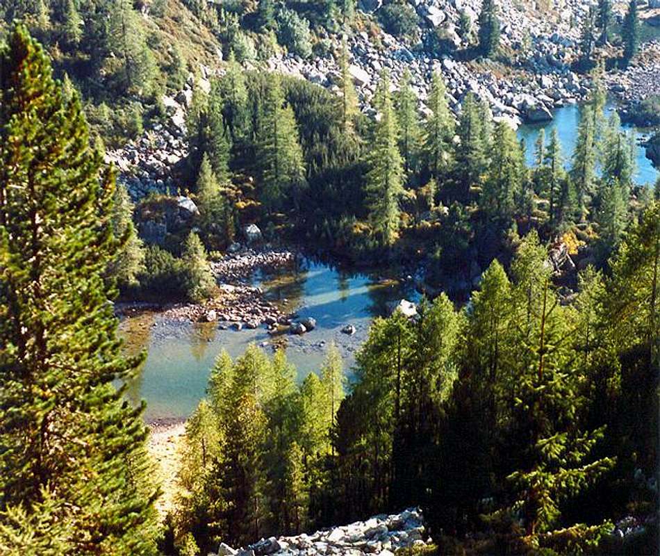
The environment is full of debris and unstable rocks, the only ways to define it are wild, hostile, but it is full of charm ... to get the summit you must go cross wonderful landscapes, with lakes that reflect blue skies and the ridges in background.
Borders
To the North the Monte Cengello (2439m) and Alpe Conseria,and Val di Fumo to the South the Cima Orsèra (2471m), the Lake of Costa Brunella, to the East the Val di Fumo and the Val Vendrame, to the West the Val d'Inferno and the small lakes in Val d'Inferno.
 |  |  |
Geology
The rocks are quartzose phyllades (a kind of Porphyr)
 |  |  |  |
Getting There
By carFrom Trento - after the highway way out, go along the SS47 of Valsugana till Villagnedo -Way out along the road toward Strigno, once in Strigno , to the left toward Spera, beyond the built-up area along a narrow road that leads to Tedon.
Cross the bridge and turn to the right following for "colonia estiva Alpina" (1334m) - car parking.
From Bassano del Grappa - follow the SS47 of Valsugana till Villagnedo (50km) and follow as above said
By train
using the Valsugana railway (both from Trento or Bassano) - stations of Borgo Valsugana, Strigno or Ospedaletto.
By bus
from Trento and Borgo Valsugana.
Nearest airports Bolzano, Venezia e Verona

Routes Overview
2 different good hiking routes to this summit :going by car toward Spera, on beyond Rifugio Crucolo and the Val Campelle till the bridge over the Rio Caserine (1334m) .Cross the bridge and turn to the right following for "colonia estiva Alpina" (1334m) - and in 400 m to the Rifugio Carlettini.
Here you must park your car and go, along the fine Val Caldenave (path 332) till Malga Caldenave (1792m) a site of pastures where you can often see some horses along the Rivo di Caserine. Now you must turn to the left, cross the Caldenave bridge and start the ascent along the Val d'Inferno (path 360). After boarding the fine small lakes surrounded by rocks and hoods the ascend goes on along the slopes leading to the Forcella delle Buse Todesche (2390m), leaving the hoods to get the rocky N slopes toward the Cima delle Buse Todesche (2413m)
Herefrom you can see some fine summits : the Monte Cengello(2439m.), the Pala del Becco (.2422m), the Cima delle Buse ( 2574m), the Cima Stellune (2605m), the Cima Lagorai ( 2574m)
Coming back is along the same path till the fork to Val d'Inferno, here you can follow the Nomadi path that, boarding the Lago di Nassere (2063m) leads you back to the Rifugio Carlettini.
start to walk along the steep path 326 that leads to the Malga Consèria, then follow for Cinque Croci pass (2018m) . Here you must turn to the right following marks to Forcella Magna, boarding the Lakes Lasteati. Once at the saddle, turning to the right along the path 373, you get straight the lake of Forcella Magna and the ten.Cecchin shelter (2305m)
The path 373 allows to walk along military mule tracks and paths, still in good conditions, and cross, from North to South from Forcella Magna to Forcella delle Buse Todesche where you find the previous route.
Coming down is along the path 360 for about half an hour, toward the val d’Inferno till the fork with the path Nomadi that, turningh slightly to the right, remounts a little then starts going the long descent passing above the lake of Nassere (2063m) and Malga Nassere (1763m). Here from you, crossing the forestal road, you must enter in the hood but, after about 100 m you have to leave the main path (leading to Rif. Carlettini), following, on the right, a not marked path that, remounting the valley, leads you near the starting point. (Consèria bridge)
 |  |  |  |  |
When To Climb
All year long, for skilled ski-mountaneers in winterMiscellaneous info
Valsugana Orientale, Altopiano di Tesino ,Passo BroconAPT Lagorai Valsugana Orientale e Tesino
Accomodations in trentino
Hiking and Trekking in Lagorai
Refuges/Alpine Huts
Società Alpinisti Trentini
Soccorso Alpino del Trentino
Meteo
MeteotrentinoMeteo Alpin
Società Meteorologica Italiana
Webcam in trentino
Map making on line
