
-
 6716 Hits
-
 86.85% Score
-
 23 Votes
|
|
Mountain/Rock |
|---|---|
|
|
46.25120°N / 11.89250°E |
|
|
9238 ft / 2816 m |
|
|
Overview
Geographical Classification : Eastern Alps > Dolomites > Pale di San Martino > Cima Manstorna
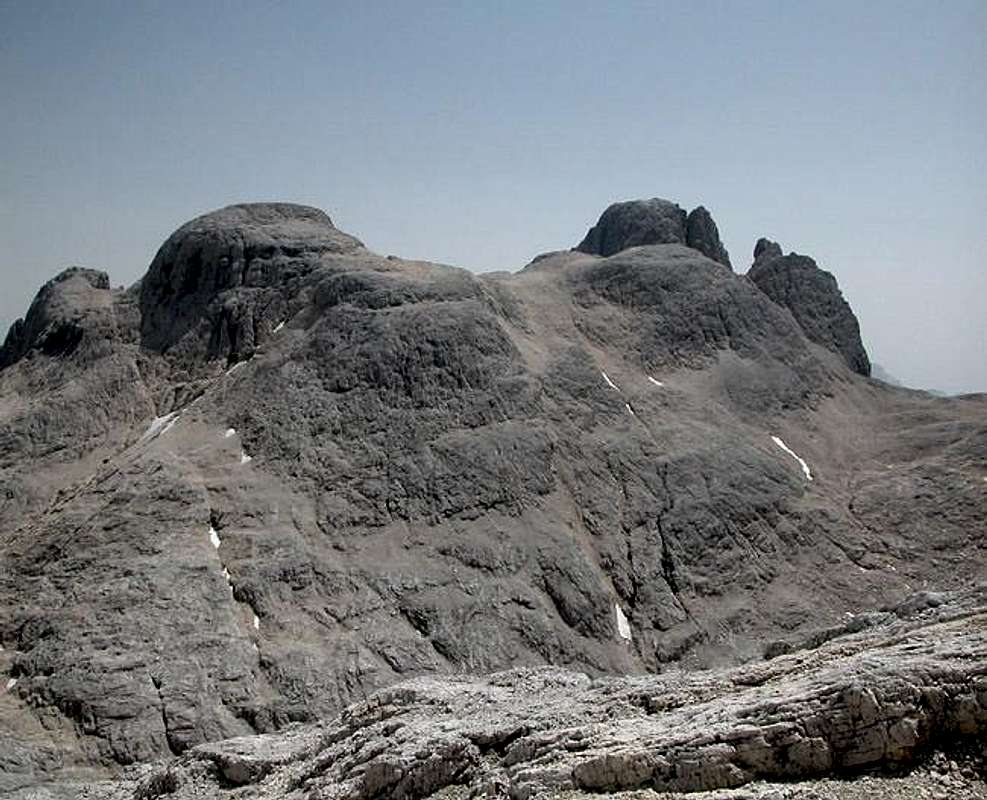
I have hesitated to put up Cima Manstorna on SP, mostly because I climbed it by accident and having "chosen" the wrong access route didn't make it quite to the summit. But Cima Manstorna is an almost perfect lookout summit (yes you can tell even if you only made it to the shoulder 100m below the summit) and it is never crowded. It is not located near to any of the trails that run across the Altipiano delle Pale di San Martino and in any case close-by Cima della Fradusta is the higher and more popular destination.
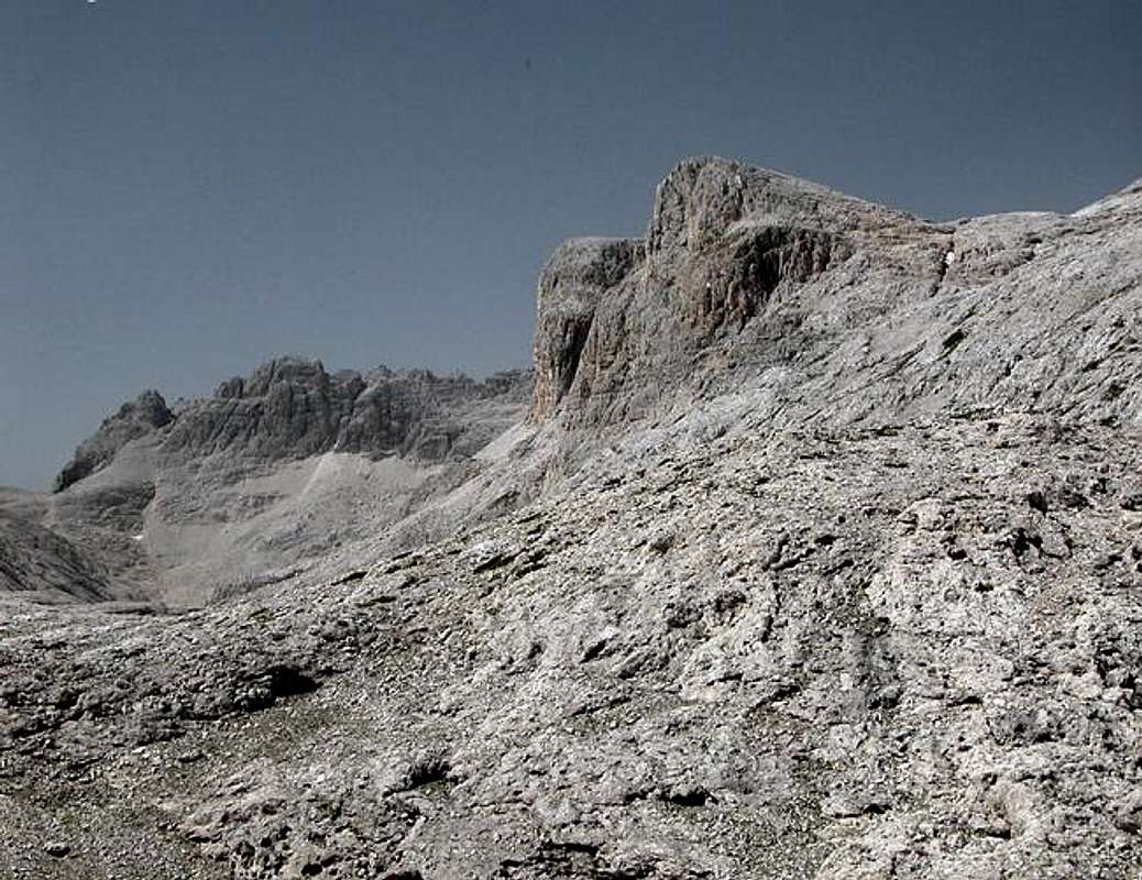
Moreover Cima Manstorna is easy to get to - if you start out from the right (that is western) side. Access routes are very long, however. The summit is rounded - like so many of the summits on the Altipiano - and the rock is of good quality. There are few scree fields and thanks to the lack of visitors the rock is not polished. I assume that in former ages Cima Manstorna was covered by a glacier - much like Cima della Fradusta - which must have been responsible for the smooth surfaces on all sides of the mountain.
Thanks to its position above Val Canali the summit is a great lookout point. The direct southern view is obstructed by the slightly higher Cima dei Lastei but in all other directions there are few limits. Thanks to our dumbness - we tried to reach Forca Alta del Ghiacciaio and mistook trail signs when we left Passo Canali we were already halfway up the north-east "ridge" before we noticed our error. We went on but only reached the shoulder east of the summit from where a steep 40m climb would have taken us to the summit. Without equipment and experience this was out of the question.
 |
 |
 |
 |
 |
Panoramic View
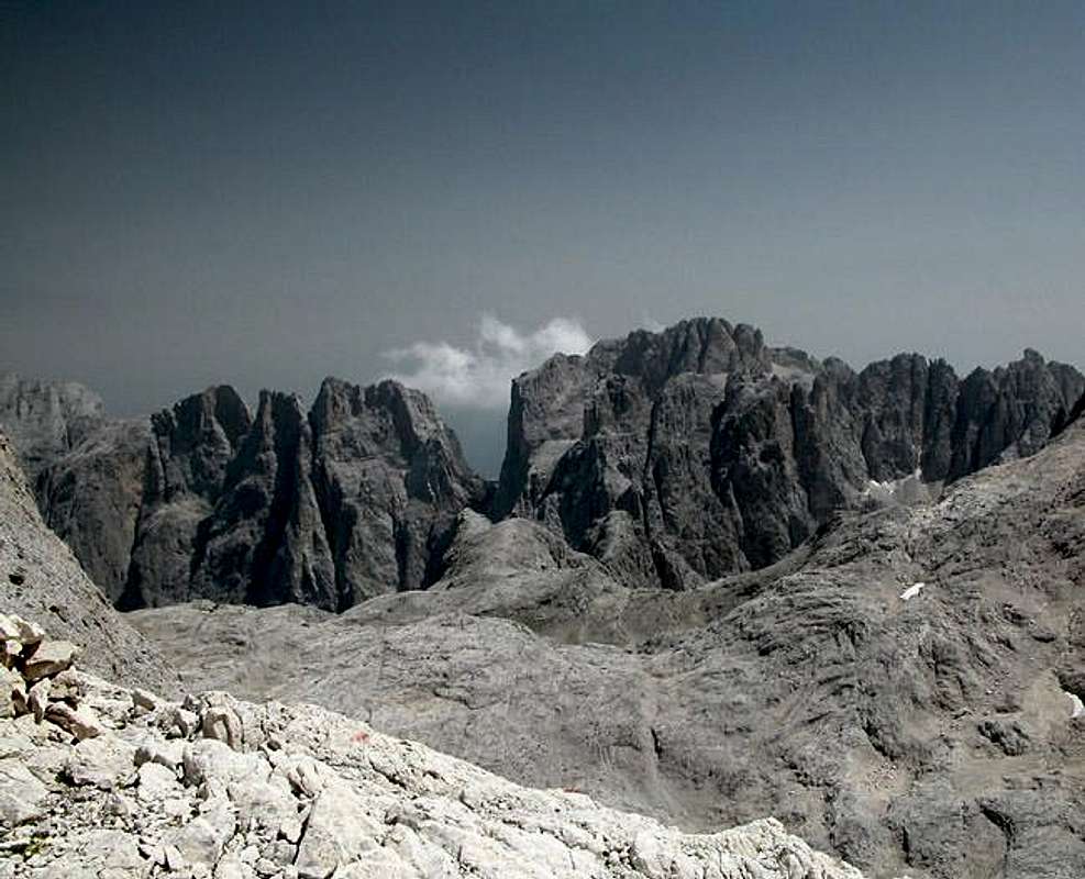
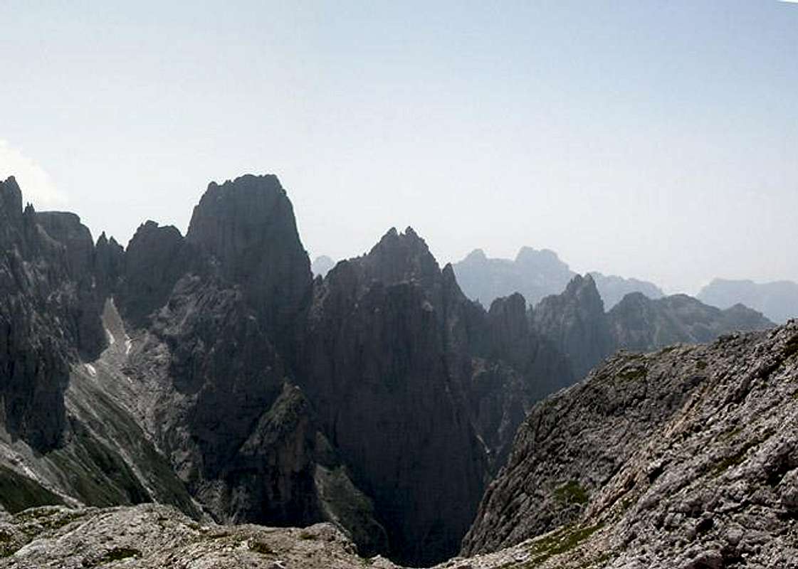
Sass de le CaureSass de le SnareCima de la BetaCroda GrandeCime del MarmorCime Vani AltiCima ManstornaCima dei Lastei
 |
 |
Getting There
Cima de la BetaCime del MarmorCima d'AlberghettoCima del CoroCroda GrandeCime Vani AltiCima Santa AnnaSass d'OrtigaPala del RifugioPala della MadonnaCima d'OltroLe RochetteC i m o n e g a G r o u p
 |
 |
There are many ways how to reach Cima Manstorna but the two most logical are either from the cable car at Cima della Rosetta ( a long hike across the Altipiano) or from Val Canali (elevation difference: 1700m!). Better stay over night at Rifugio Treviso in Val Canali, 1100m below the summit).
The following itineraries describe how to reach San Martino di Castrozza (starting point of the Rosetta cable car). Rifugio Canali can be best reached from Fiera di Primiero south of San Martino.
- Motorway A13 (Bologna-Padova) exit Padova South or Padova West;
SS47 della Valsugana (in the direction of Bassano/Trento) up to Cismon del Grappa;
SS50bis (in the direction of Feltre/Belluno) up to Arten;
SS50 to San Martino - Motorway A4 (Torino-Trieste) up to Vicenza and motorway A31(Vicenza-Valdastico) exit Dueville;
SS47 della Valsugana (in the direction of Bassano/Trento) up to Cismon del Grappa;
SS50bis (in the direction Feltre/Belluno) up to Arten;
SS50 to San Martino - Motorway A22 (Modena-Verona-Brennero) exit Trento center;
SS47 della Valsugana (in the direction Bassano/Padova) up to Cismon del Grappa;
SS50bis (in the direction of Feltre/Belluno) up to Arten;
SS50 to San Martino - Motorway A22 (Modena-Verona-Brennero) exit Egna-Ora (BZ);
SS48 (in the direction of Val di Fiemme - Val di Fassa) up to Predazzo;
SS50 to Passo Rolle and San Martino di Castrozza
 |
 |
 |
 |
 |
Red Tape
 |
 |
Cima Manstorna and the Pale di San Martino Group are located within the park boundaries of the Parco Naturale Paneveggio - Pale di San Martino.
The Natural Park consists of the area of the Pale di San Martino Group as well as the forest of Paneveggio and the porphyritic chain of Lagorai. It contains an area of 125 sqare km which in 1987 has been divided in three different levels of protection:
33% of the area have been assigned complete protected areas,
60% are restriced areas while
7% are controlled area.
For more information you can look at the Park's official website.
There are no fees or limitations for hiking and climbing, however you might have to be prepared for small parking fees within San Martino, Fiera or at Malga Canali. The cable car parking lot is free.
When To Climb
The mountain is easy to climb all year round and might make for an interesting ski tour destination. Given the fact that it is located in the shadow of nearby Cima della Fradusta it doesn't see many visitors at any time of the year. Climbing season runs from late May through late September
Accommodation
For Hotels and appartments have a look at the websites of the towns and villages of the region:
- San Martino di Castrozza - www.sanmartino.com
- Fiera di Primiero - www.dolomiti.it
If you are interested in the mountain huts and Refuges, just have a look at the Pale di San Martino Group Page. Rifugio Canali is the closest one.
Weather Conditions
For weather conditions in Trentino look at the following pages
- www.meteotrentino.it
- www.parks.it.
As for Webcams you can look at - www.dolomitisuperski.com
Maps & Books
Books:
- Hiking and Trekking
- Höhenwege in den Dolomiten
H. Dumler
Bruckmann Verlag
ISBN: 3 7654 3860 X - Dolomiten
P. Fleischmann
Kompass Verlag
ISBN: 3 8705 1409 4
- Höhenwege in den Dolomiten
- Climbing
- 3000er in den Alpen - Die Normalwege
R. Goedecke
Bruckmann Verlag
ISBN: 3-7654-3661-5 - Dolomiti. Il grande libro delle vie Normale / Dolomiten. Das große Buch der Normalwege
G. Buscaini, S. Metzeltin
Zanichelli
ISBN: 88-08-09892-3 (German Edition) - Pala Gruppe
L Visentini
Ed. Athesia
ISBN: 8 8701 4612 X (german version) - Pale di San Martino
Luca Visentini (1990),
ed. Athesia, Bolzano
(with a handmade 1:25000 map)
ISBN 88-7014-598-0 (italian version) - Dolomiti - Scoperta e Conquista
Hermann Frass (1976)
Ed. Athesia, Bolzano/ Bozen
ISBN 88-7014-025-3 (italian version)
- 3000er in den Alpen - Die Normalwege
Maps
- Pale di San Martino
Kompass Map WK 622
ISBN: 3 8549 1548 9
Scale: 1:25000 - Pale di San Martino
Kompass Map WK 76
ISBN: 3 8549 1086 X
Scale: 1:50000 - San Martino di Castrozza e le zone adiacenti
Carta delle zone turistiche d'Italia
Touring Club Italiano
Scale 1:50000 - Pale di San Martino
Tabacco Map 022
Scale: 1:25000
- Hiking and Trekking