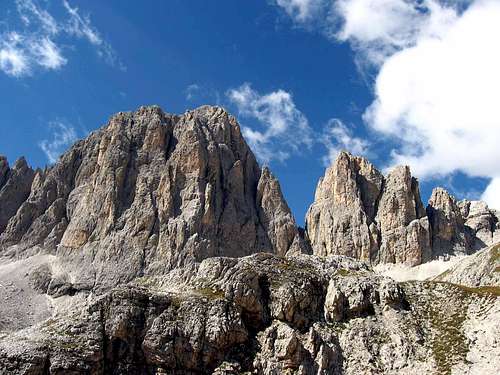
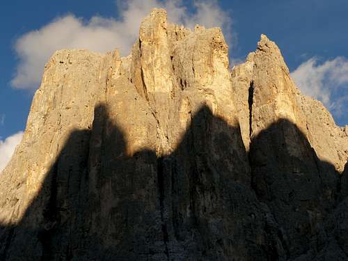
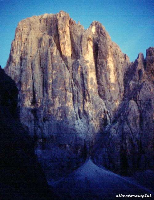
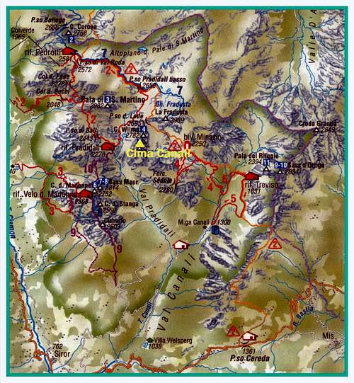
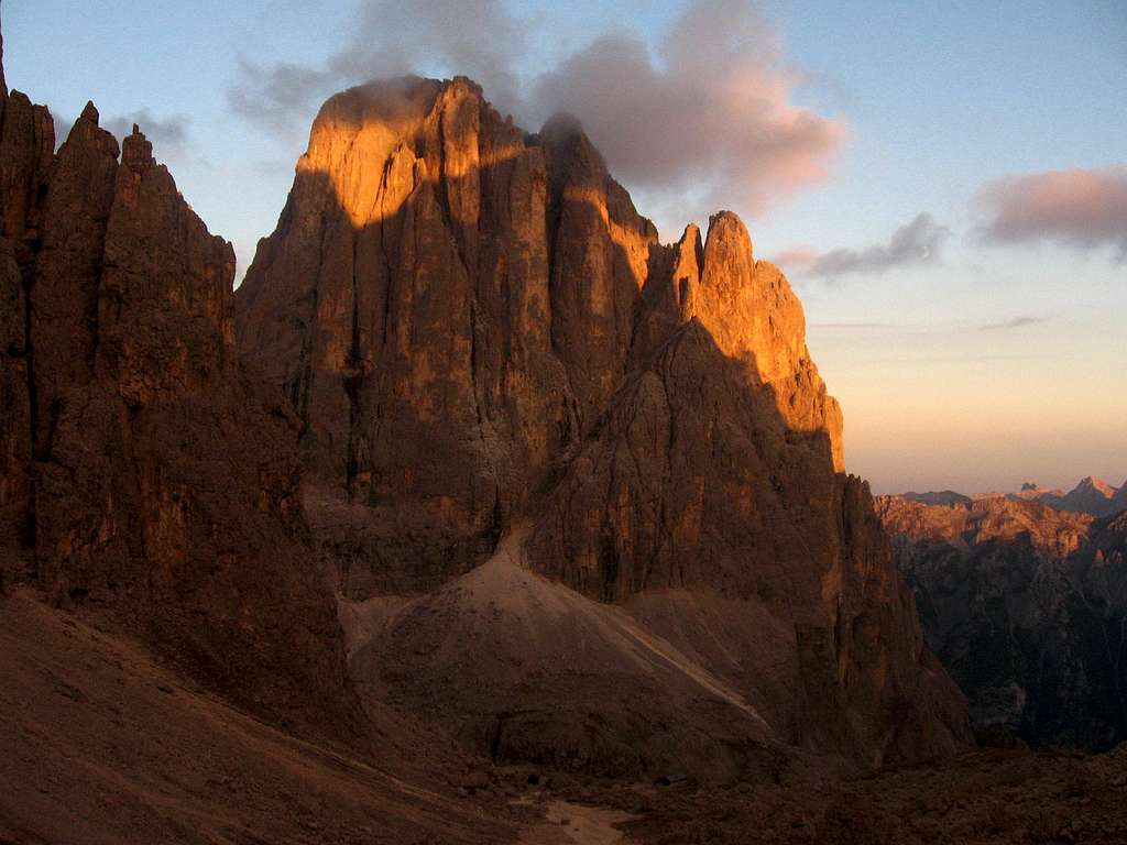
In upper Val Pradidali it rises a mountain with a singular and majestic shape, well known by climbers as it offers several challenging routes: it's Cima Canali, belonging to Pale di San Martino, Central Hub. From whatever side one looks at this peak, he will remain attracted by its beauty. In reason of the high quality dolomia and the variety of different high-level routes, as well as the armony of shape, Cima Canali is in fact one of the most attractive mountains not only of Pale di San Martino, but of the whole Dolomites. The appearance of the mountain is superb and imposing on all sides, but especially stands out the West side, the one facing the Refuge Pradidali and the most popular in reason of the beauty and the boldness of its routes, which has truly a magical look: it is a complex wall formed by a series of steep pillars and yellowish towers, fascinating irresistibly the viewer from Refuge Pradidali, especially in the red glow of the sunset.
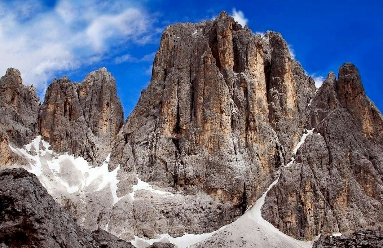
Cima Canali seen from West
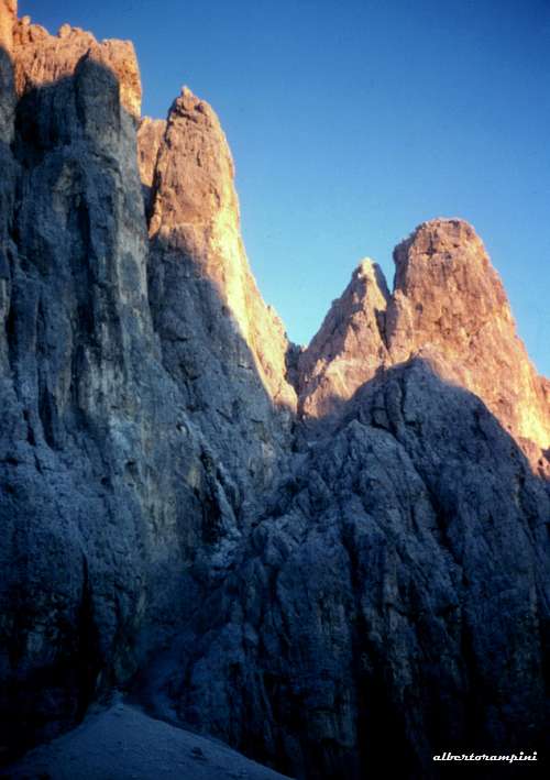
Starting from the left we see: "I Gemelli", two small and elegant pillars, very similar, separated by a deep gorge, the "Pilastro Buhl", which takes its name by mountaineer who climbed the most famous route of Cima Canali and path five routes, "Il Salame" which looks like a tower that dominates all others, and makes the mountain like a castle, "Pilastro Brunet", the sharp "Torre Gialla" and finally "La Figlia della Canali" , separate from the main body by a deep and steep slanting canyon.
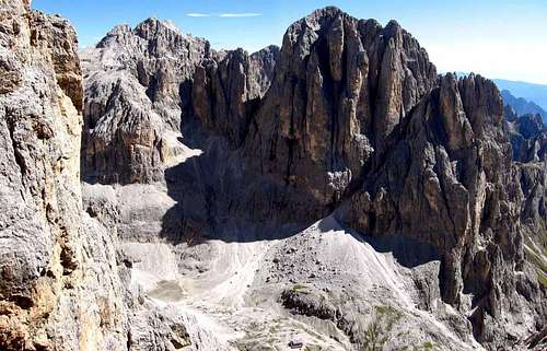
The South face of the mountain casts a complex and high triangular separate wall from the rest, Pala Canali, while the East wall is built as well by several towers and pillars like W face. It's a jagged and complex wall, wild and much less frequented than the other ones, but no less fascinating.
History
The conquest of the summit took place on 1879, August 30th, by M. Bettega and the English C.C. Tucker. Some of the greatest protagonists of mountaineering in the Sixth Grade Age linked their name to Cima Canali, like Gino Soldà, Bruno Detassis, Ettore Castiglioni, Hermann Buhl and more recently Sergio Martini and Maurizio Zanolla "Manolo". They climbed in first ascent some of the most challenging routes on Cima Canali.
B. Detassis and E. Castiglioni
Gino Soldà
Hermann Buhl
Sergio Martini
Maurizio Zanolla
Getting There
The closest town is Fiera di Primiero. Cima Canali West side can be reached starting from Fiera di Primiero along Val Canali and then along Val Pradidali, while East side can be reached along Val Canali and Vallone delle Lede. Another possible approach is from the upper Pale di San Martino tableland along the CAI path n. 709 to get to the West side, or the CAI path 711 to get the East side. It will be decribed the approach from Val Canali.
Road access
- Coming from A22 Autobrennero exit Trento and take the Valsugana road. Follow it reaching the junction to Feltre in Primolano. At the junction leave the Valsugana road and take the road to Feltre, then follow the road to Fiera di Primiero. In Fiera di Primiero take the road to Passo Cereda, shortly before this proceed towards Val Canali and reach La Ritonda parking where the road ends.
- Coming from A4 Milano-Venezia Motorway exit Padova West, reach Bassano del Grappa, take the Valsugana road to the junction towards Feltre in Primolano. In Primolano leave the Valsugana road and carry on as described in the previous chapter.
Walking approach to Rifugio Pradidali
From the parking near "La Ritonda" follow the good path 709 which enters the beautiful Val Pradidali, leading to Rifugio Pradidali (2.30 - 3 hours from the parking lot).
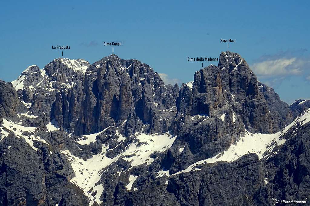
Pale di San Martino central hub annotated pano from Cima Grugola
Walls and routes
The highest and most frequented wall is the majestic West Wall, overlooking Rifugio Pradidali. Starting from the left we see: "I Gemelli", two small and elegant pillars, very similar, separated by a deep gorge, "Pilastro Buhl", which takes its name by the mountaineer who climbed the most famous route of Cima Canali and has five routes, "Il Salame" which looks like a tower that dominates all others, and makes the mountain similar to a castle, "Pilastro Brunet" massive and rounded, the sharp "Torre Gialla" and finally "La Figlia della Canali", separate from the main body by a deep and steep slanting gully.
South Face casts a complex and high triangular wall separate from the rest, Pala Canali. Even the East wall presents a series of several towers and pillars, these are numerous and do not present the solid geometry of those on the opposite side. It's a jagged and complex wall, wild and much less frequented than the other ones, but no less fascinating.
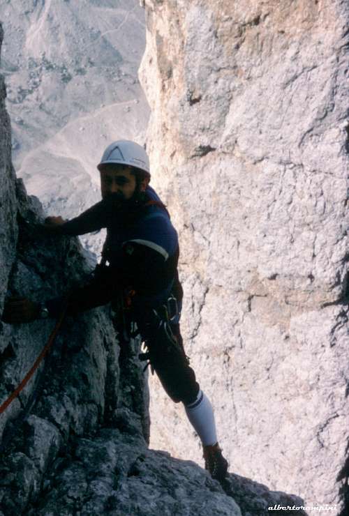
Cima Canali Normal route
Difficulty: PD, II and III (1 length) Development: 600 m Material: belays equipped Times: Approaching 15 minutes from Pradidali, 3 hours uphill, 2 hours downhill
It's an easy good route, the route climbed by the first summiters of Cima Canali, and followed to descent from the top
West wall routes from left to right
- Via Brunet-Pellican NW Ridge - Via Anglada - Via Crisalide - Via Simon Wiessner - Via Strani Incontri - Via Buhl - Via Despiau-Barokas al Salame - Via Heidi - Via Franzina-Novello - Via Trifoglio appassito - Via Mazzotti-Cappelletto - Via Brunet-Pellican - Via Cubeddu - Via Pagani
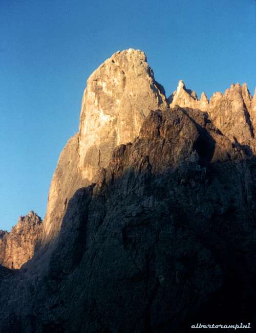
Torre Gialla
- Via Solleder - Via Soldà - Via Leviti-Sommadossi - Via Franzina-Valdo
Some Images from Cima Canali West wall
Cima Canali from West
Torre Gialla and Figlia della Canali
On Soldà, Torre Gialla
Sass Maor seen from Cima Canali
Figlia della Canali - Via Normale - Via Manolo - Via Franceschini
Pala Canali (South wall) - Via Zonta-Berti - Via Castiglioni-Detassis - Via Dipankar - Via Zonta-Zonta
East wall - Via dei Bortoli - Via Brunet-Scalet - Via Kess Terschak - Via delle Righe Nere - Via Plaichinger Hamburger - Via Zecchini-Brodie and North-South crossing of Cima Canali
Red Tape
No particular restrictions in climbing and hiking. Cima Canali is located inside a wild and preserved setting.
Situation: Pale di San Martino Central Hub, upper Val Pradidali
Open: 15 of June - 30 of September
Size: 65 pers.
Owner: C.A.I. Treviso Guardian: Duilio Boninsegna
Hut's phone 0039-0439-64180
Guardian's phone:0039-3482455732
Getting There: from La Ritonda - Can del Gal (Val Canali) 2,30-3 hours From La Ritonda (parking lot) you reach the hut in 2.5 to 3 hours following the path n. 709 running through Val Pradidali
- Bivacco Carlo Minazio on Vallone delle Lede 2250 m.
Situation: Pale di San Martino Central Hub, Vallone delle Lede
Open: always
Size: 12 pers.
Getting There: from Malga Canali (Val Canali) - 3 hours From Cant del Gal - La Ritonda take on the right the road entering Val Canali and drive as far as the road ends. Take the path n. 707, at the fork follow the path 711. On 1957, July 19 th, to the north of the Bivouac, it occurred a plane crash: an US military aircraft crashed into the south wall, and 11 airmen were killed. In memory of the fallen, near the bivouac was affixed a plaque on which are listed the names and grades of the airmen. In the area are still clearly visible the wreckage of the aircraft.
Rifugio Pradidali
Bivacco Minazio
Natural Parks
Cima del Coro is located inside Pale di San Martino group. This area, shared between the provinces of Trento and Belluno, is one of the nine mountain systems of the Dolomites acknowledged as UNESCO World Heritage Site. More info about Dolomiti Unesco World Heritage can be found here:
Parents refers to a larger category under which an object falls. For example, theAconcagua mountain page has the 'Aconcagua Group' and the 'Seven Summits' asparents and is a parent itself to many routes, photos, and Trip Reports.

 7125 Hits
 87.31% Score
 24 Votes
 Cseh Làszlò - Alpenglow on Cima Canali
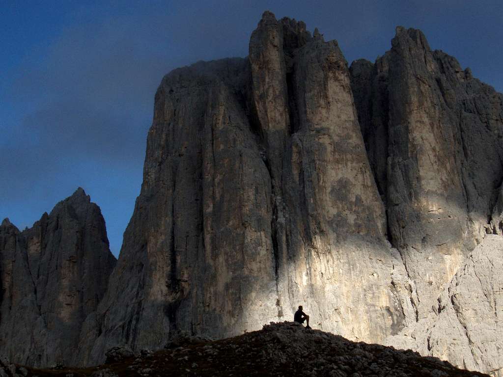 Vida Szabi - Peaceful evening