
|
|
Route |
|---|---|
|
|
36.09369°N / 115.48404°W |
|
|
Scrambling |
|
|
Spring, Fall |
|
|
Most of a day |
|
|
Strenuous |
|
|
Class 4 |
|
|
Overview
This climb is reputed to have been discovered several decades ago by Howard Booth. Estimated distance is 7.5 miles round trip and estimated elevation gain is 3,100’. Time for a fit hiker should be 6-7 hours minimum and difficulty levels are mainly class 3 with several short class 4 sections. It involves hiking across about 1 1/2 miles of the Mojave desert and bouldering past the summit for about 1 mile up Oak creek canyon before circling back about 270 degrees to climb to the summit of Mt Wilson which is one of the more outstanding vantage points in Red Rock NCA.Getting There
From Charleston Blvd and the 215 Beltway in the western part of Las Vegas, take Charleston Blvd. (Highway 159) west for about 5 miles until you reach the entrance to Red Rock Canyon NCA. You should allow about 30 minutes driving time from the strip to the entrance.There are a couple of trailheads that can be used for this climb. My preference is a pullout from Hwy 159 about 2.6 miles SW of the entrance to Red Rocks. (.6 mile past the exit from the 13 mile loop road) The other trailhead is reached by entering Red Rock NCA, driving around the 13 mile loop and taking the Oak Creek trailhead exit which is the one after Pine Creek parking area and involves driving perhaps ½ mile on a gravel road. The hiking distance is about 5 minutes longer from Hwy 159.
Route Description
Follow the trail chosen to the foot of the canyon enjoying the views of Mt Wilson on the left side of the canyon (south) and Rainbow Peak on the right side. It is about 1 ½ miles across the desert to the mouth of the canyon. If you hike from the highway, there is no need to worry about hours of operation for Red Rock so you can start or finish whenever you like without worrying about the park hours of operation. This trail used to be an old jeep trail and when you reach any junctions, head either toward the canyon or take the right fork if neither is heading toward the canyon.When you reach the canyon, watch for a trail that follows the right hand side above the wash.
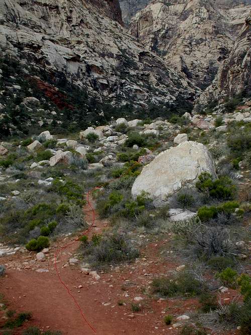 Trail junction
 End of trail
 Head into wash
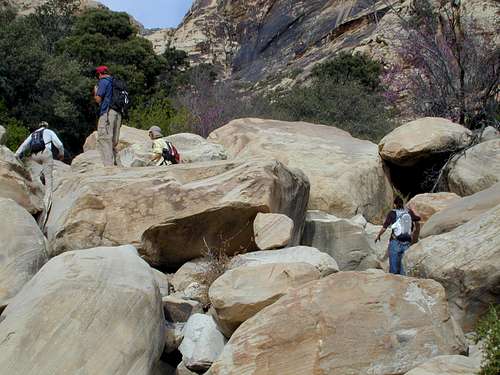 Bouldering up canyon
 Climb thru roof
 Large boulders
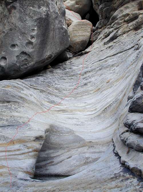 route climbs around pothole
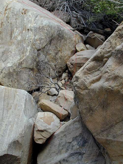 challenging
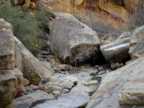 hillside sidetrip
After about an hour, you will reach a fork where the canyon splits and goes past Oak Peak on either the north or south. Take the left (south) branch and head up another previously hidden canyon on your left near this main junction. This is where you begin climbing toward the Cleaver Crack. There is usually a small waterfall coming out of this small canyon
 1st waterfall
 Amphitheatre
 Route above 1st falls
 upper falls
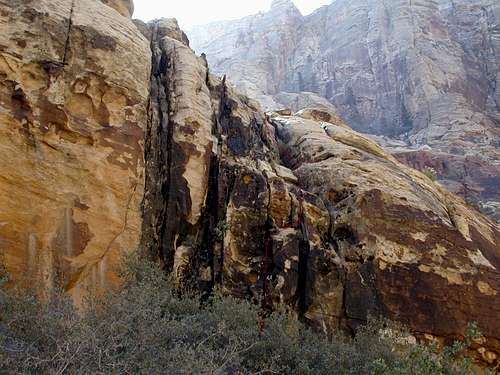
At this next level on my preferred route on the left (above the higher falls) look for a 30’ pock marked, dark stained wall (class 4)
 Route up wall
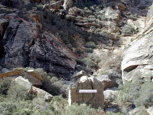 Route across brushy area
 Route into next basin
As you climb up the main crack in the center of this subsidiary canyon, there are options to head straight up the crack (5th class), head around the steepest section on the left (4th class) or head around that section on the right (3rd class).
 options to pass dark red layer
 entering slot
Near the top of this system is one boulder move that is awkward and after you get above it you will look to exit this crack system on the right
 exit slot
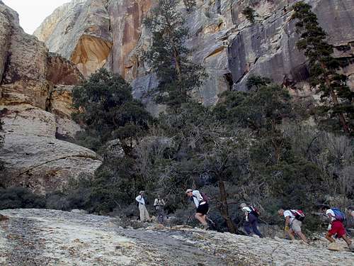 hike up slab
 follow wall up
 Cleaver crack
Near the top of the Cleaver crack, you will see an overlook on your left with great views out over the canyon to your north. Just beyond this overlook, the crack resumes for a short distance with a large ponderosa pine growing near the start in the center of the crack.
 Upper Cleaver crack
 Boulder next to face climb
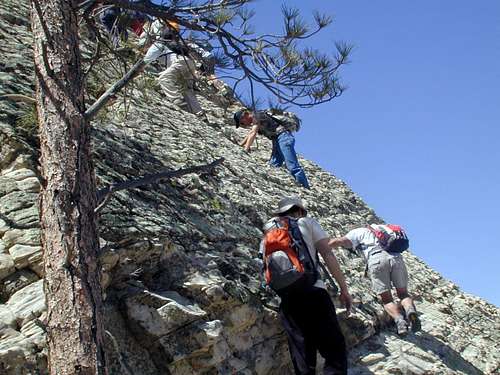 Tree marks ledge
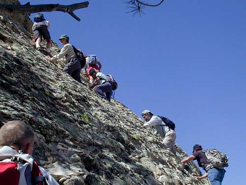 Climb face above traverse
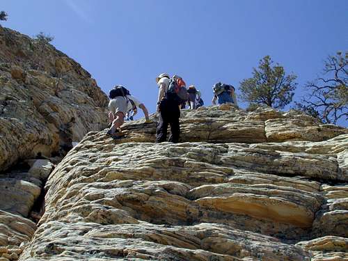 Climb face to ridge
 Upper portion of route
Work your way across the slopes toward the summit on an ascending traverse. Stop along the way and check where you have been climbing from to aid in locating the top of the wall you climbed to reach the ridge.
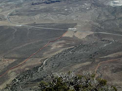 view of trailhead from summit