-
 17372 Hits
-
 78.27% Score
-
 9 Votes
|
|
Mountain/Rock |
|---|---|
|
|
48.26060°N / 120.44324°W |
|
|
Hiking, Mountaineering, Scrambling |
|
|
Spring, Summer, Fall, Winter |
|
|
8392 ft / 2558 m |
|
|
Overview
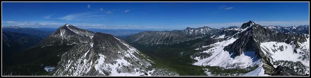
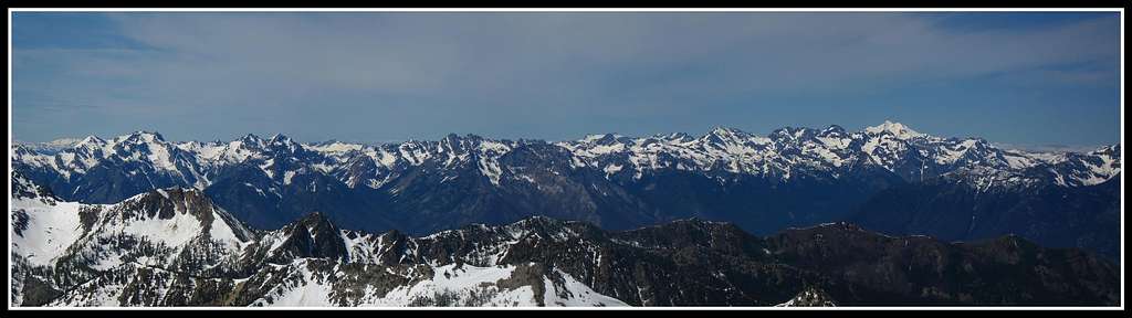
Courtney Peak is located in the Chelan Sawtooth Wilderness to the east of Lake Chelan. This summit isn't quite as tall as nearby Star and Oval Peaks but it is often regarded to have the best view in the wilderness. With an elevation of 8,392 feet is is one of the Bulgers, that is one of the highest 100 in the state and with 812 feet of prominence it stands high above the saddle connecting it with Star Peak.The cliffs of the north face of Star Peak lie to the southeast and this aspect of Star is very impressive. To the northeast you see Oval Peak which appears to loom high above you despite being only a few hundred feet higher than Courtney. To your west looking down the vertical cliffs of Courtney you see the Oval Lakes basin; a beautiful alpine setting of three lakes surrounded by larch trees. This place must be spectacular in the fall when the larches are at their peak. You can also get unobstructed views to the northwest of the big glaciated peaks of the North Cascades. Although you may be higher than most of those peaks standing on Courtney but there is much more work required to summit many of the peaks to your west. Take a moment to realize how big the Cascade rain shadow effect is while you stand atop Courtney. You can be atop Courtney Peak or any nearby peak in early July with relative ease while only 50 miles to your northwest you may need full expedition gear to climb something in the Pickett Range.
Getting There
West Fork Buttermilk Creek Trailhead
This is the standard starting point for Courtney Peak. Courtney Peak can be climbed in a long day but packing in would be a nice way to make this a relaxing climb and see the area when the light is good. From the small town of Twisp on Highway 20, head west on the Twisp River Road for about 10 miles and turn left onto West Buttermilk Creek road. At the "Y" in the road veer right onto East Buttermilk Creek Road and go 3 miles before veering right on Road 500. Follow this road almost 3 miles to the trailhead which is at 3,800 feet. A Northwest Forest Pass is required to park here.
Southeast Ridge - Class 2
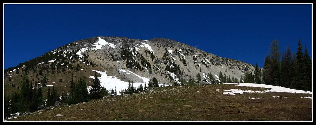
From the trailhead, hike up the nice trail as it climbs gently at first but steepens. Follow it all the way to Fish Creek Pass at 7,500 feet. There are many potential places to camp along the way as well as on the south side of the pass around Star Lake or the meadow just below. From Fish Creek Pass the route is easy to see. Take a minute to look at Star Peak from here. The cliffs above you make you feel very small. This view is very photogenic and is the best in early fall. Larch trees can be seen as far as the eye can pick up detail. Start heading northwest up the obvious ridge. From the pass it is about 1000 feet vertical on easy class 2 terrain. We even noticed a good game trail or climbers path most of the way. Near the top the terrain gets a little more rocky and approaches class 2+ but still very doable.
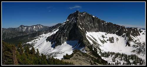 The cliffs of Star Peak from near Fish Creek pass The cliffs of Star Peak from near Fish Creek pass | 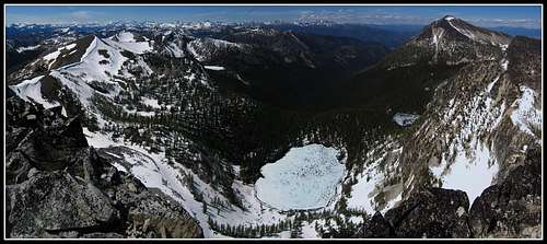 Oval Lakes Basin from Courtney Peak Oval Lakes Basin from Courtney Peak |
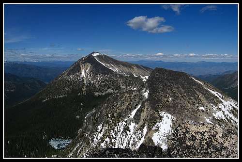 Oval Peak and east Oval Lake
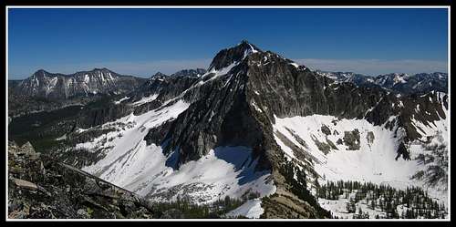 The cliffs of Star Peak from the summit of Courtney Peak
Map
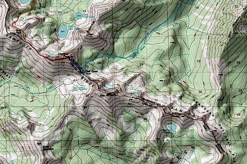 LIGHT BLUE: West Fork Buttermilk Creek Approach - DARK BLUE: Southeast Ridge route - Class 2 - ORANGE: Oval Lakes Approach - RED: West Ridge route - Class 2
Summit Views