
-
 10944 Hits
-
 71.06% Score
-
 1 Votes
|
|
Mountain/Rock |
|---|---|
|
|
36.31852°N / 118.74641°W |
|
|
Tulare |
|
|
Mixed |
|
|
8654 ft / 2638 m |
|
|
Overview
A fine, yet to date unlisted, example of a relatively low elevation Sierra peak that presents a few different options for ascent, all of them challenging, Dennison Mountain rises imposingly to the North of Springville, CA, and is well visible from the Central Valley from several directions with 1066 feet of prominence. Views from the summit capture much of Sequoia National Park to the North, including Homer's Nose, The Kaweahs, Mineral King, and much of the Great Western Divide. To the East, the mountain's closest neighbor Moses is quite prominent, as well as North Maggie, Sheep Mountain, Jordan Peak, and others.
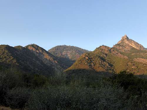 View of Dennison from above Blue Ridge Road. The W Ridge approach begins at left (summit is roughly center; the interesting formation to the right is known as Dennison Peak).
All of the approaches I know of require a fairly long day, and about 5000' of elevation gain. Distances range from around 10 to 16 or so miles round trip. The most common approach seems to be via Snowslide Canyon from the North via South Fork Campground (Class 3). There is another documented route starting on Forest Service Rd 19s09 at Jenny Creek East of the Summit (Possibly Class 2). Finally, the mountain may be climbed from the West via Blue Ridge Rd (Class 3).
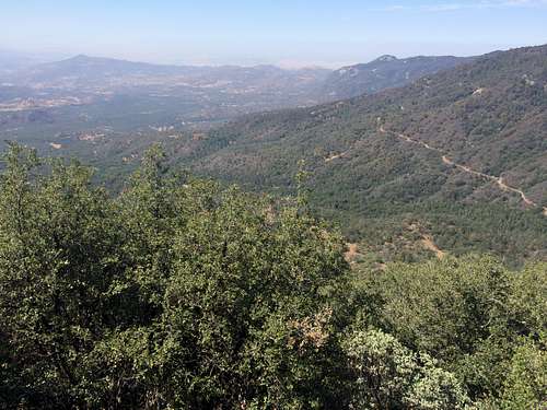 Looking down at Blue Ridge Rd from the West Ridge
Each of the routes above requires some careful route finding, and even with the best navigation, bushwhacking seems to be a matter of course. Any approach from the East, South, or West will see dense manzanita, oak, and conifer populations along the ridges, slopes, and in the canyons. Granite slabs are frequently obscured by leaf litter, and careful steps will slow down progress in some spots. Poison oak is abundant from any direction, especially below 5000-6000'. Ceanothus guards the summit from around 8200' on up from the West.
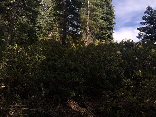 A 4' wall of Ceanothus between climber and summit.
Climbing Dennison can be very challenging, and as such, rewarding (depending on your personality). I would recommend bringing more than 3 liters of water, good sun protection, and some barriers for arms and legs to limit exposure to poison oak and thorns during the inevitable bushwhacking that will ensue. There are no trails to speak of (there is some mileage on trail from South Fork during the Northern approach, but it simply leads to the route which begins at Snowslide Canyon), so any approach should be treated as a cross-country affair. As such, give yourself lots of extra time, and carry extra everything.
The rock formation located at 7218', South of the summit of Dennison Mountain, warrants its own page, which I will get to after getting more information and exploring the peak.
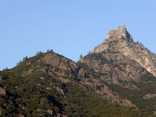 7218' Dennison Peak
Getting There
South Fork Campground is reached from the South Fork road, which begins in Three Rivers. The Other approaches all originate from Balch Park Rd, North of Springville. Blue Ridge Rd is a left turn about 10 miles from Springville, with multiple entry points along the road, beginning about 4 miles up. Forest Service Rd 19s09 is a right turn, about 1 mile up Blue Ridge Rd. Jenny Creek is about 2 miles up this road.
Red Tape
FS Rd 19s09 is not accessible to most vehicles. High clearance only, otherwise walk the 2 miles in.
 Approaching Jenny Creek on FS Rd 19s09
When to Climb
Any time; winter ascents would require a great deal of care, as well as ice axe and crampons. Summer climbs can be brutally hot, particularly when starting from the South or the West.
Camping
Camping opportunities exist at South Fork CG. There are numerous places along FS Rd 19s09. Trekking the peak is desirable in some ways, as it lessens the time constraints presented by a day hike. Carrying the extra weight should be manageable in most circumstances.
External Links
Bob Burd's trip report:
http://www.snwburd.com/bob/trip_reports/dennison_n1_1.html
Peakbagger Page for Dennison Mountain:
http://www.peakbagger.com/peak.aspx?pid=2852