

-
 49818 Hits
-
 90.48% Score
-
 32 Votes
|
|
Area/Range |
|---|---|
|
|
36.12750°N / 118.20778°W |
|
|
Hiking, Mountaineering, Trad Climbing, Sport Climbing, Toprope, Bouldering, Skiing |
|
|
Spring, Summer, Fall, Winter |
|
|
Overview
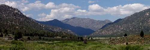
For purposes of this page, the Southern Sierra is defined as the geographical region south of Sequoia & Kings Canyon National Parks and the Cottonwood Lakes area, all the way down to the Tehachapi Mountains. It is bounded on the west by the Central Valley, on the east by the Indian Wells Valley, and on the south by the Antelope valley.
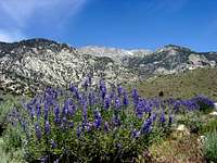
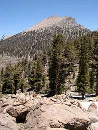
The peaks of the Southern Sierra are generally lower and less alpine than the peaks to the north. Indeed, only Olancha Peak, the highpoint of this region, extends much above treeline. The gentler terrain has made this area more amenable to human use. Ranching, in particular, has been an important economic activity. The Southern Sierra is fairly accessible by road. In addition to the many paved roads, there are a large number of dirt roads, some of which are open for public use.
The Southern Sierra provides a wide range of outdoor recreational opportunities, from water sports on the Kern River and Lake Isabella, to rock climbing in the Domelands Wilderness and the Needles, from summer hiking and meadow loafing to winter cross country skiing, the Southern Sierra is a world-class recreational area that is available year-round without the more severe conditions found farther north.
 |
Getting There
In contrast with the High Sierra, the Southern Sierra is served by an extensive network of roads, including several trans-sierra routes. With the exception of Highways 190, 155, 178, and 58 and the Caliente-Bodfish Road, most roads are seasonal and are gated somewhere along their length during snow season. Most Southern Sierra roads are unpaved, though (unless they have been damaged) they are usually easily navigated with a 2wd passenger car. There are a great many more roads than described below. However, they will get you at least close to where you're headed. "Getting There" sections for individual peaks and routes should fill in whatever additional details are needed.
Highway 190
Highway 190 provides access to the Tule River and Great Western Divide east of Porterville. It is open to the Ponderosa area year-round. It connects with the Western Divide Highway (Mountain Road 107) which heads south to connect with the Parker Pass Road (Mountain Road 50). The Parker Pass Road travels east-west and connects California Hot Springs with Johnsondale near Mountain Road 99 and it is open June-Nov. Both Mountain 107 and Mountain 50 are open late May through early November, weather permitting.
Highway 155
Highway 155 connects the City of Delano in the Central Valley with Lake Isabella. Like Hwy 178, it is paved and open year round. Highway 155 is an alternate route into the Lake Isabella area and points east. It also provides access to a number of other access roads and trailheads.
Highway 178
Highway 178 provides east-west passage from Bakersfield in the Central Valley to the vicinity of Ridgecrest in the Mojave Desert. This paved highway is open year round except for occasional brief closures due to severe weather. It passes through the town of Lake Isabella as well as a handful of other small hamlets.
Highway 58
Highway 58 crosses the Tehachapi Mountains and connects Highway 99 in Bakersfield to Highway 14 near Mojave. It provides access to a number of access roads and trailheads for the Tehachapi, Greenhorn, and Piute Mountains.
Caliente-Bodfish Road
The Caliente-Bodfish Road travels north-south through the Greenhorn and Piute Mountains and connects Lake Isabella to Highway 58.
Chimney Peak Back Country Byway
The Chimney Peak Back Country Byway is a designation applied by the BLM to segments of several dirt roads that combined make a long, scenic loop through the Chimney Peak Recreation Area.
Mountain Road 99
Mountain Road 99 begins as Sierra Way in Kernville and goes north along the Kern River to the junction of the Sherman Pass Road.
Ninemile Canyon/Blackrock/Sherman Pass
The Ninemile Canyon Road leaves Hwy 395 near Pearsonville and travels west up to the Chimney Peak area then Kennedy Meadows. Here it connects with the Blackrock/Sherman Pass Road which continues west over Sherman Pass (9,200 feet in elevation) and then down to the Kern River to connect with Mountain Road 99.
Link to Sequoia National Forest Maps based on USGS 7.5" Quads
Buy a Sequoia National Forest Map
Camping
On most National Forest and BLM lands you can disperse camp, which means camping outside of a developed campground. In some areas you cannot, so it is best to call or stop in the ranger station to tell them your plans. Also, if you have a campfire or charcoal barbeque, you will need a campfire permit (see red tape section).
Here are some of the campgrounds in the area of the Southern Sierra Nevada:
BLM Campgrounds
Walker Pass Trailhead CG
This is a small campground located just west of Walker Pass on the south side of Hwy 178. There are eleven walk-in campsites, and two more that accommodate vehicles. There is water from April through October, pit toilets, fire grates, and horse corrals. No reservations, fees, or shade.
Chimney Creek CG
Chimney Creek Campground lies in a wooded canyon at about 5,700' elevation. Located off Canebrake Road about halfway between Hwy 178 and Ninemile Canyon Road, and a quarter-mile from the PCT, this is a good staging area for the many peakbagging possibilities in the area. There are 36 sites with picnic tables, pit toilets, and fire pits with grills. No fees or reservations. Gathering down wood for fires is allowed, though you are encouraged to bring your own. There are water hydrants here and there, but if they are functioning, they should not be used. Naturally occurring Uranium contaminates the local groundwater.
Long Valley CG
Long Valley Campground provides access to the Domelands Wilderness and the South Fork of the Kern River. It is located at an elevation of 5,200' just east of the Domelands Wilderness boundary. There are 13 sites. There is no drinkable water. From Hwy 178 take Canebrake Road north about 15 miles to a "Y" intersection (well marked, and the only one around). This is the Long Valley Loop Road. Turn left at the interesection and follow the road for about 10 miles to the campground. From the north, you can take Canebrake road from Ninemile Canyon Road to the above-mentioned intersection, or continue on to Kennedy Meadows and pick up the other end of the Long Valley Loop Road and come in from the north. No fees or reservations.
Forest Service Campgrounds
Campgrounds on the Kern Plateau
Kennedy Meadows Campground is located just north of the Ninemile Road. It is a popular jumping-off place for PCT'ers. It is near the South Fork Kern River and at an elevation of 5,800'. Troy Meadow and Fish Creek Campgrounds are located along the Blackrock/Sherman Pass Road. They are at 7,800' in elevation and are popular campgrounds for OHV enthusiasts. Horse Meadow Campground is located on the Cherry Hill Road which connects with the Sherman Pass Road just west of the pass. It is at 7,600' in elevation. A fee is required at all four of these campgrounds.
Campgrounds on the upper part of the Kern River
There are many campgrounds along the upper portion of the North Fork Kern River north of Kernville on M-99. These include: Headquarters, Camp 3, Hospital Flat, Goldledge, Fairview, and Limestone. For more information and to make reservations at these campgrounds please visit this website www.ReserveUSA.com
Campgrounds around Lake Isabella
Campgrounds near Lake Isabella include: Live Oak North Campground, Main Dam Campground, Live Oak South Campground, Pioneer Point Campground, Paradise Cove Campground, Hungry Gulch Campground, Camp 9 Campground, Boulder Gulch Campground, and Tillie Creek Campground & Group Area. For more information and to make reservations at these campgrounds please visit this website www.ReserveUSA.com
Campgrounds on the lower part of the Kern River
These campgrounds are in the lower portion of the Kern River Canyon west of Lake Isabella: Hobo and Sandy Flat. For more information and to make reservations at these campgrounds please visit this website www.ReserveUSA.com
Campgrounds along the Great Western Divide
Quaking Aspen and Redwood Meadow Campgrounds are along Mountain Road 107. Both are near sequoia groves and accommodate vehicles up to 24' in length. Both require a fee and you can make reservations through www.ReserveUSA.com. Upper Peppermint Campground is a primitive campground that does not charge a fee and does not have potable water, but there are pit toilets, picnic tables, and fire rings. It is along Mountain Road 107 between Quaking Aspen and Redwood Meadow. Lower Peppermint Campground is below Upper Peppermint and is along the Lloyd Meadow Road (Forest Road 22S82). It is $14 a night and is a first-come, first-served campground.
Campgrounds in the Greenhorn Mountains
Leavis Flat, White River, and Cedar Creek Campgrounds are all in the western foothills of the Greenhorn Mountains. Leavis Flat and White River are near the town of California Hot Springs and Cedar Creek is between Greenhorn Summit and Glennville on Hwy 155. All three campgrounds have water and a fee is required. You can make reservations for Leavis Flat and White River by visiting www.ReserveUSA.com.
Frog Meadow, Panorama, Alder Creek, and Evans Flat are four free primitive campgrounds near the summit of the Greenhorn Mountains. They do not have potable water, but there are picnic tables and fire rings and pit toilets. Frog Meadow and Panorama Campgrounds are off of Forest Road 23S16. Alder Creek and Evans Flat are off of Forest Road 23S15.
Campgrounds in the Piute Mountains
Breckenridge Campground is an elevation of 6,600' and does not have drinking water nor is there a fee. It is off of the Breckenridge Road, Forest Road 28S06.
Lodging
There are many hotels in Kernville and Lake Isabella. Visit the Kernville Chamber of Commerce and Kern River Valley Chamber of Commerce for more info.
Near Johnsondale is the Durrwood Creek Bed and Breakfast (760) 376-2719.
Near Ponderosa you can stay at the Ponderosa Lodge (559) 542-2423 or Mountain Top Bed and Breakfast.
There are Forest Service Cabins at Quaking Aspen, Poso, and Frog Meadow and a Forest Service Lookout at Oak Flat that you can rent, visit www.ReserveUSA.com for more info.
Near Camp Nelson you can stay at the Pierpoint Springs Resort (559) 542-2423.
There are numerous lodging options in the surrounding cities of Porterville, Bakersfield, Tehachapi, Mojave, and Ridgecrest.
Red Tape
The Southern Sierra are under the administrative control of the US Forest Service and Bureau of Land Management (BLM). Much of the northern portion of this region is part of the Sequoia National Forest (SQF). The area south and east of the SQF is principally the domain of the BLM. The federal government does not own all the mountainous land in the area. To avoid friction with private landholders, visitors should be aware of the boundaries of public and private land, and respect the wishes of private owners.
Sequoia National Forest
Campfire permits are required in the SQF. They are available free at any of the offices listed below, as well as at the California Department of Forestry or Bureau of Land Management office. Overnight trips into the Golden Trout Wilderness also require a permit, available free of charge at any Forest Service Office or by mail or fax.
Sequoia National Forest Offices
| Forest Supervisor's Office 1839 South Newcomb Street Porterville, CA 93257 559-784-1500 FAX 559-781-4744 TDD 559-781-6650 Western Divide Ranger District - Springville Office Hume Lake Ranger District |
Kern River Ranger District - Kernville Office 105 Whitney Road P.O. Box 9 Kernville, CA 93238 760-376-3781 TDD Available Kern River Ranger District - Lake Isabella Office |
Wilderness Areas in the Sequoia National Forest and BLM Lands
The Golden Trout Wilderness is located in both the Sequoia and Inyo National Forests and encompasses 475 square miles of pristine lakes, jagged peaks, and lush green meadows. Visitor permits (required only for the Golden Trout Wilderness) are available free from ranger stations near wilderness entry points. |
South Sierra Wilderness The South Sierra Wilderness consists of 63,000 acres of high meadowlands between forested ridges in both the Sequoia and Inyo National Forests. Elevations range from 6,100 feet near Kennedy Meadow to Olancha Peak at 12,123 feet. Trail access is available from forest roads to the east, south, and west. |

The Dome Land Wilderness covers 94,695 acres of the southeast part of the Kern Plateau. It is filled with a series of rugged domelike rock formations, including Church Dome, one of its outstanding scenic points. Because of its lower elevations, visitors especially enjoy this wilderness during the spring and fall seasons. |

The Kiavah Wilderness covers 88,290 acres in the Scodie Mountains, on lands managed by both the Sequoia National Forest and Bureau of Land Management. This wilderness includes eroded hills, canyons, and bajadas in the transition zone between the Mojave Desert and the Sierra Nevada. The Pacific Crest Trail runs the length of the Kiavah Wilderness. |
 Owens Peak Wilderness Owens Peak Wilderness
The majority of this wilderness is comprised of the rugged eastern face of the Sierra Nevada Mountains. Owens Peak, one of the high points of the southeastern Sierra Nevada, rises more than 8,400 feet. The mountainous terrain has deep, winding, open and expansive canyons, many of which contain springs with extensive riparian vegetation. This area is a transition zone between the Great Basin, Mojave Desert and Sierra Nevada ecoregions. Vegetation varies considerably with a creosote desert scrub community on the bajadas, scattered yuccas, cacti, annuals, cottonwood and oak trees in the canyons and valleys and a juniper-pinyon woodland with sagebrush and digger/grey pine on the upper elevations. Wildlife includes mule deer, golden eagle and prairie falcon. Evidence of occupation by prehistoric peoples has been found throughout the wilderness. The Pacific Crest Trail passes through the wilderness along the crest and western side. |

This wilderness surrounds Kelso Peak and associated drainages to the north, south and east. To the west, the Kelso Mountain system is contiguous with the Piute Mountain Range in the Sequoia National Forest. Vegetation varies: upper slopes of the 5,000 foot Kelso Peak are dotted with pinyon pine and juniper trees; intervening slopes are brushy with large granite rock outcroppings; and the boulder-strewn valley supports dense stands of Joshua trees. The varied habitats of the Mojave Desert, Sierra Nevada, San Joaquin Valley and Transverse Ranges ecoregions allow for a wide diversity of wildlife. The entire wilderness is included within the BLM Jawbone-Butterbredt Area of Critical Environmental Concern, an area set aside for cultural and wildlife values. |
This wilderness encompasses the rugged pristine eastern face of the Sierra Nevada Mountains. Topography ranges from valley, canyons and alluvial fans to steep hills that lead into granite peaks and ridgetops reaching elevations of more that 7,800 feet. Vegetation is extremely diversified with creosote bush, desert shrubs and Joshua trees on the lower slopes and cacti and scattered pinyon-juniper woodlands on the upper slopes. Several of the canyons are complemented by springs with their riparian habitats of cottonwoods, willows and grasses. The Sacatar Trail, an old wagon road and one of the few evidences of man in this area, provides backcountry access into this wilderness. Wildlife within the area includes mule deer, golden eagle, prairie falcon, quail and dove. |

The Chimney Peak Wilderness encompasses rocky mountainous terrain dominated by pinyon pine with areas of sagebrush. There are also some springs and streams with their associated riparian habitat species. The Pacific Crest Trail passes through a portion of this wilderness on its way to the Domelands. |
Bureau of Land Management
South and east of Sequoia National Forest, much of the wildland is owned by the Bureau of Land Management (BLM). The BLM has several designated wilderness areas under its administrative control: Owens Peak, Chimney Peak, Sacatar Trail, Bright Star, and parts of Domeland and Kiavah. These areas are all managed out of the the BLM's California Desert District Office. Regulations in the BLM wilderness areas are all the same. Campfire permits are required. No wilderness permits are required. See this for the long-winded version of camping regulations on BLM land, or contact one of the field offices below.
| Ridgecrest Field Office 300 S. Richmond Rd. Ridgecrest, CA 93555 Phone: (760) 384-5400 Fax: (760) 384-5499 |
Bakersfield Field Office 3801 Pegasus Drive Bakersfield, CA 93308 (661) 391-6000 |
Resources
Books:
Exploring the Southern Sierra: West Side by J.C. Jenkins
Exploring the Southern Sierra: East Side by J.C. Jenkins
External Links
Sequoia National Forest
BLM - Bakersfield
BLM - Ridgecrest
Kern Valley Canyon Connection
Nature Alley
A variety of Southern Sierra Webcams showing views from:
Tobias Peak
Sherman Peak
Jordan Peak
Bald Mountain
Breckenridge
...and more!
Southwestern Sierra Panorama
  |