


-
 3240 Hits
-
 79.78% Score
-
 11 Votes
|
|
Area/Range |
|---|---|
|
|
45.69030°N / 7.78590°E |
|
|
Hiking, Mountaineering |
|
|
Spring, Summer, Fall |
|
|
Note
La montagna chiama i suoi figli, ed essi rispondono fedelmente al suo appello… Osvaldo Cardellina, Diario alpinistico, 1964-65 Page texts: @ OsvaldoCardellina "Osva", passed away on May 2, 2022. Page owners: Christian Cardellina e Osvaldo Cardellina. Any updates from September 12, 2022: Antonio Giani, page administrator, friend and climbing companion. Testi della pagina: @ OsvaldoCardellina "Osva", scomparso il 2 maggio 2022. Proprietari pagina: Christian Cardellina e Osvaldo Cardellina. Eventuali aggiornamenti dal 12 settembre 2022: Antonio Giani, amministratore della pagina, amico e compagno di salite. |
The Southern Faces of Challand's Misses Overview
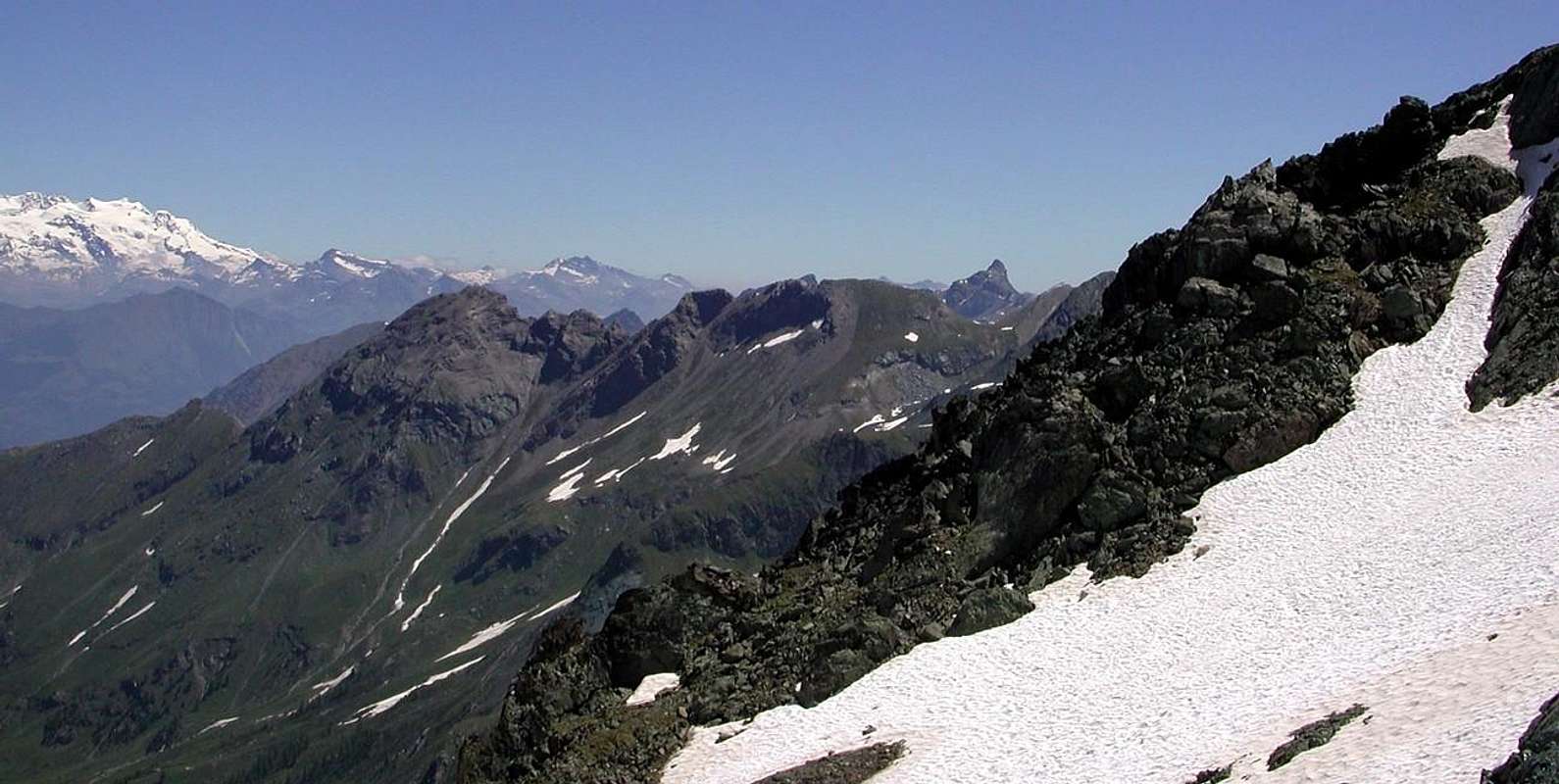
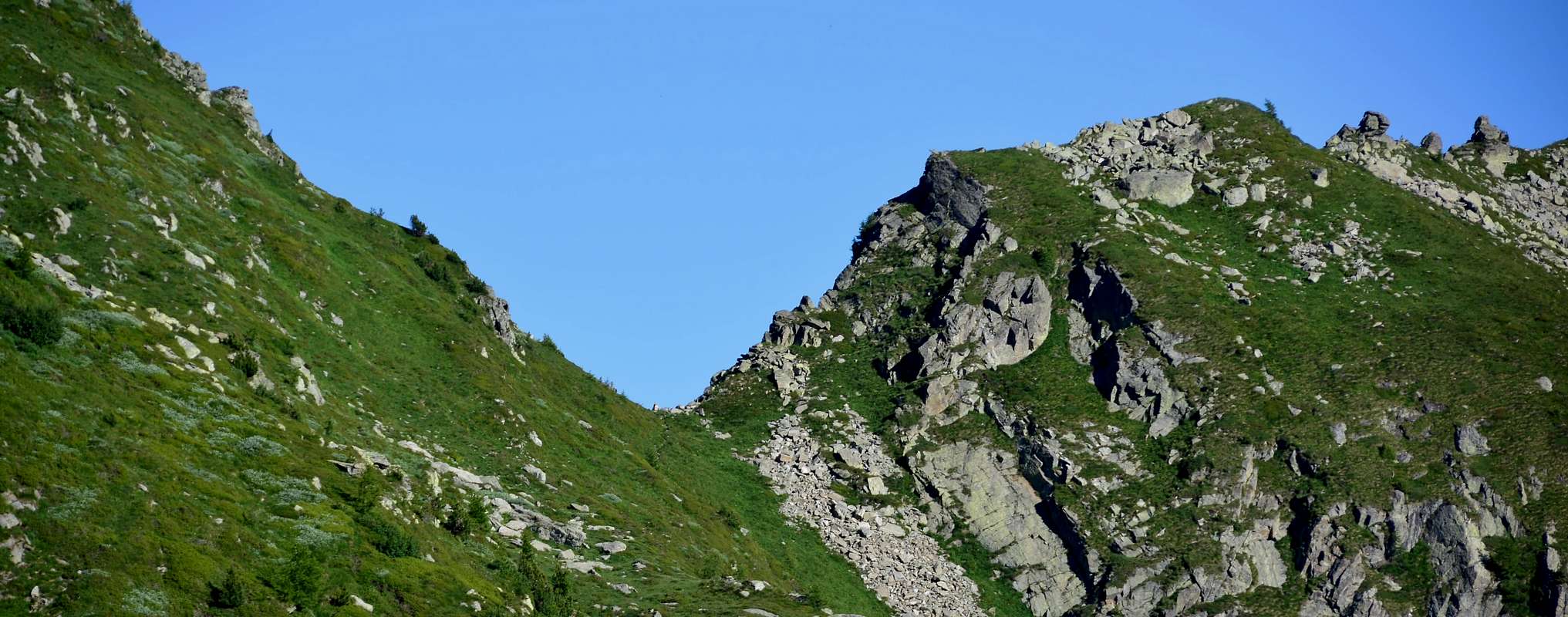
This is the last side vallon of the orographic and hydrographic left (East) in the Mid-Lower Ayas Valley; between all of these coming down perpendicular to the Torrent Ayas is certainly as the most "isolated" considering the very long approaches from the valley floor, but certainly not the least popular. Already transit to the local Populations of Celtic Salassians, was garrisoned by troops from the Austro-Russian in 1800 and in the same year, "boasts" the passage of the French Army led by Napoleon Bonaparte himself. Locked at Bard Fortress, the same opened an alternative route to go down in the Po Valley rounding the obstacle to the North and passing through the Dondeuil Hill (2.338m) with the entire Army May 20th, 1800 composed of more 2.000 armed soldiers. This pass connects the Ayas Valley to the Gressoney or Lys, linking the Communes of Challants Saint Victor (821m) and Issime (953m), both located at the foot of the "Dames de Challand". On the first incumbent of the Vallon Dondeuil symbolized by Becca Torché (3.016m), while the latter is dominated by the deep Vallon of Valbona, also said Scheity in the local language Walser, is dominated by the beautiful pyramid of Becca's Vlou (3.032m). The Vallon of Dondeuil does not offer great hiking and climbing but definitely beautiful, in the sides at the bottom, beautiful walks; the same does not hold the lakes and to find the same you have to cross the hill to reach those who are known as the Little Lakes at the Eastern foot of the Bec des Allemands also Corno del Lago (2.747m) and North of Mont Crabun. This is the last meeting, there being no further walloons of the Great Basin overlooking the stretch between the Municipalities of Verrès, Arnad and Pont St. Martin, Eastern exit of the Aosta Valley.
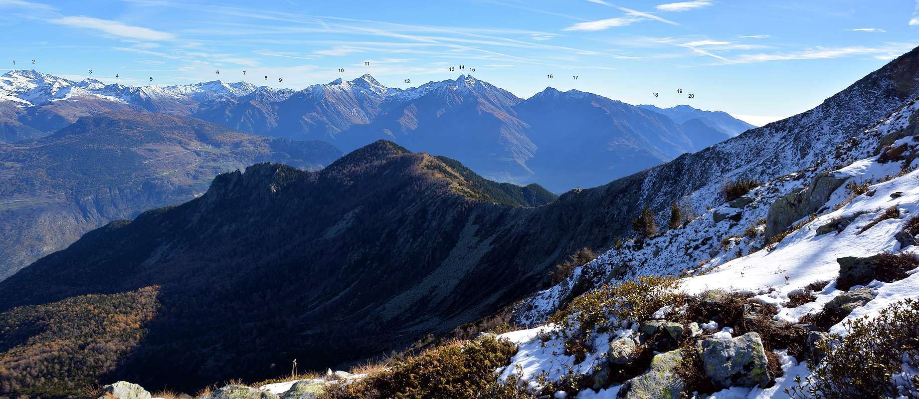 |
Questo é l'ultimo vallone della sponda orografica ed idrografica sinistra (Orientale) nella Media-Bassa Valle di Ayas; tra tutti questi che scendono perpendicolarmente verso il Torrent Ayas risulta sicuramente come il più "isolato" considerando gli avvicinamenti dal fondovalle, ma non certamente il meno frequentato. Già transito per le locali Popolazioni Celtiche dei Salassi, fu presidiato dalle truppe Austro-Russo nel 1800 e nel medesimo anno "vanta" il passaggio dell'Armata Francese con a capo lo stesso Napoleone Bonaparte. Bloccata alla Fortezza di Bard, la stessa s'aprì una via alternativa per scendere nella Pianura Padana doppiando l'ostacolo a Settentrione e transitando dal Colle Dondeuil (2.338 m) con l'intera Armata il 20 di Maggio 1800 con oltre 2000 soldati armati. Questo colle unisce la Valle di Ayas a quella di Gressoney o del Lys, mettendo in comunicazione i Comuni di Challant Saint Victor (821 m) e d'Issime (953 m), entrambi collocati ai piedi delle "Dames de Challand". Sopra il primo incombe il Vallone del Dondeuil simbolicamente rappresentato dalla Becca Torché (3.016 m), mentre il secondo é sovrastato dal Vallone di Valbona, detto inoltre di Scheity nella locale lingua Walser, ed é dominato dalla bella piramide della Becca di Vlou (3.032 m). Il Vallone del Dondeuil non offre grandi arrampicate ma sicuramente belle escursioni e, nelle parti più in basso, belle passeggiate; lo stesso non possiede dei laghi e per trovare gli stessi devesi attraversare il colle raggiungendo quelli che son conosciuti come i Piccoli Laghi alle pendici Orientali del Bec des Allemands e Settentrionali del Mont Crabun. Quest'ultimo costituisce il vertice, non essendoci ulteriori valloni, di quel grande bacino che domina il tratto tra i Comuni di Verrès, Arnad e Pont St. Martin, all'uscita Orientale della Val d'Aosta.
******* ![]()
Getting There
BY CAR:
- From TORINO, MILANO, etc: Motorway A5. Exit at IVREA or Quincinetto (PIEDMONT) From IVREA Town: in West (Southern side) to Pont Saint Martin, Verrès Municipalities in East from Aosta Town. From Courmayeur Resort: in East-southeast to Aosta, Nus, Chatillon, Saint Vincent, Verrès Municipalities.
- From Verrès to Val d'Ayas Valley From Verrès (549m), with Regional Road, to Challant Saint Victor-Isollaz (658m), Challant Saint Anselme-Quincod (1.030m), Tollegnaz Village (1.041m), Archésaz Hamlet (1.146m), Brusson (1.332m) Municipalities; wanting, continuing to Northwest to Antagnod-Ayas (1.709m) Commune, below Mounts Tantané and Zerbion also in North towards Champoluc (1.570m) and Saint Jacques (1.670m) Communes at the end of Evançon or Ayas Valley and under the Western side of Monte Rosa (Rollin Hump, Breithorns, Pollux and Castor).
- From FRANCE: through the Mont Blanc Tunnel to Entrèves/Courmayeur. By Little Saint Bernard Pass, closed since November until half May to La Thuile Valley - Pré Saint Didier - Aosta - Verrès Municipalities. It is not necessary to take Motorway A5: you can drive on SS.26, in the direction of AOSTA - IVREA - TURIN.
BY PLANE:
- Aeroporto "Corrado Gex" Saint Christophe (Aosta).
 |
 |
 |
 |
 |
Summits & Passes
1) - Becca di Chavernie (2.100m). Questa piccola montagna, sopra Challand St: Anselme e Tollegnaz e il Vallon Chasten nella Valle di Nordovest, domina sul versante opposto all'inizio del Vallon del Dondeuil il paesino di Tilly (954 m, ad Ovest) e il Comune di Saint Victor Challants (821 m, nel sud-ovest). Situato sulla cresta nord-ovest, che scende aggirando Torché Becca Becca Mortens, è raro che l'ascesa in vetta sia dal Vallon Chasten da quello di Dondeuil. Partendo dal Borgo di Isollaz (669 m) una sterrata poderale per raggiungere l'Alpe Est di Valfrecha (1.053 m); da questo punto un sentiero incentrato principalmente nelle propaggini nord-orientali del Renou (1.844 m) ai piedi della Becca Mortens. Abbandonando la stessa, che è indirizzata a Sud-Est verso l'Alp Tron, si prosegue su stradina fino al torrente a monte e, infine, dirigendosi a Nord per un ripido pendio erboso per raggiungere lo spartiacque tra la Becca Chavernie e la spalla 2.538 metri a Nordovest di Becca Mortens e concludere con la facile cresta Est-Sudest (EE/F; 4h'00/4h'30 da Isollaz).
2) - Becca Mortens (2.736m). Like the previous one this mountain is also the subject of very well too rare visits by local Escursionist; the climb requires a thorough knowledge of the area and certainly is more frequented by hunters of deer that lovers of the mountain. His ascension, which is not difficult but takes place in a setting, very scenic, between large steep slopes and cliffs, requires good hiking experience. It reaches from Valfrecha (1.053m) above the Village of Tilly and upper Alps of Renou (1.844m) and Le Tron (1.920m; hemi abandoned) into a small valley with the same name , but now already at the interior of the small valley of the next Dondeuil, or depression 2.700 meters (see above) for the short Crest East-southeast (2h'00/02h'20 from Le Tron Alp; 4h'45/05h'15 from Valfrecha). All other routes are not recommended, as it takes place on steep slopes and dangerous; certainly are preferable only paths on the ridge, coming from Becca Chavernie or Torché, which are also quite scenic.
2) - Becca Mortens (2.736 m). Come la precedente anche questa montagna è oggetto di visite anche molto rare da parte di Escursionisti locali; la salita richiede una conoscenza approfondita del territorio e sicuramente è più frequentata dai cacciatori di cervi che dagli amanti della montagna. La sua ascensione, che non è difficile ma si svolge in un contesto, molto panoramico, tra grandi pendii ripidi e falesie, richiede una buona esperienza escursionistica. Raggiunge da Valfrecha (1.053 m) sopra il villaggio di Tilly e le alte Alpi di Renou (1.844 m) e Le Tron (1.920 m; semi abbandonato) in una piccola valle omonima, ma ormai già all'interno della piccola valle del successivo Dondeuil, o depressione 2.700 metri (vedi sopra) per la breve Cresta Est-Sudest (2h'00/2h'20 dall'Alpe Le Tron; 4h'45/5h'15 da Valfrecha). Tutti gli altri percorsi sono sconsigliati, in quanto si svolge su pendii ripidi e pericolosi; sicuramente sono preferibili solo sentieri di cresta, provenienti da Becca Chavernie o Torché, anch'essi piuttosto panoramici.
 |
3) - Becca Chalex also Punta Boret (2.356m). Among Becca Mortens and Torché down towards the Southwest a small buttress child that reaches its end Becca Chalex (Tip Boret to the locals), located between the Alps Tron to the North and Chalex (1.780m) to the South, or between a small secondary walloon, above the Village of Tilly, and the real Vallon of Dondeuil. It can be reached with the previous private dirt road for Valfreche and continue across Southeast with the same to Fontaney Pasture (1.423m), where it ends. The path marked as "Via Alpina" to the Hill of Dondeuil first reach the Alp of Chalex (1.780m), just before Alpe Dondeuil, while a further branch to get to the North of Chanaley (1.848m); from this, through unnumbered path to the Northwest, reaches a next pasture unnamed (or at least the name is unknown to us because certainly any) in altitude 1.922 meters at the foot of Becca. With semi-circular path, passing to the West of it, the same reaches another pasture (2.141m) similar to the opposite side, just above that of the Tron; from any of these points you can reach the small hilltop along the unmarked route (better for the short Crest West-northwest; EE/F; 02h'00/ 02h'20 from Chalex Alpage). Easy, enjoyable Trip with beautiful views over the middle Ayas Valley, the complete Dondeuil Vallon up to the Corno del Lago and on the nearby Becca Torché, of which constitutes a large and "flat" shoulder.
3) - Becca Chalex anche Punta Boret (2.356 m). Tra Becca Mortens e Torché scende verso Sudovest un piccolo contrafforte bambino che raggiunge la sua estremità Becca Chalex (Tip Boret ai locali), situata tra le Alpi Tron a Nord e Chalex (1.780 m) a Sud, o tra un piccolo vallone secondario , sopra il Villaggio di Tilly, e il vero Vallon di Dondeuil. Si raggiunge con la precedente strada sterrata privata per Valfreche e si prosegue per Sud-Est con la stessa fino all'Alpe di Fontaney (1.423 m), dove termina. Il sentiero segnato come "Via Alpina" per il Colle di Dondeuil raggiunge prima l'Alpe di Chalex (1.780 m), poco prima dell'Alpe Dondeuil, mentre un ulteriore ramo per arrivare a Nord di Chanaley (1.848 m); da questo, attraverso sentiero non numerato verso Nordovest, si giunge ad un prossimo pascolo senza nome (o almeno il nome ci è sconosciuto perché sicuramente qualsiasi) a quota 1.922 metri ai piedi della Becca. Con sentiero semicircolare, passando ad Ovest di esso, lo stesso raggiunge un altro pascolo (2.141 m) simile al versante opposto, appena sopra quello del Tron; da uno qualsiasi di questi punti si può raggiungere la piccola collina lungo il percorso non segnalato (meglio per la breve Crest Ovest-Nordovest; EE/F; 02h'00/ 02h'20 da Chalex Alpage). Escursione facile e divertente con bella vista sulla media Valle d'Ayas, l'intero Vallon Dondeuil fino al Corno del Lago e sulla vicina Becca Torché, di cui costituisce una larga e "piatta" spalla.
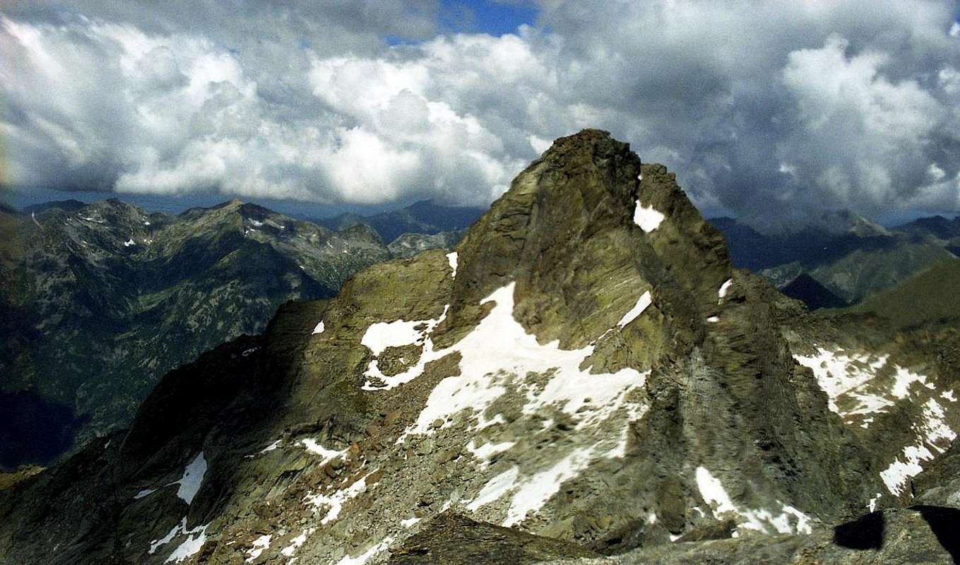
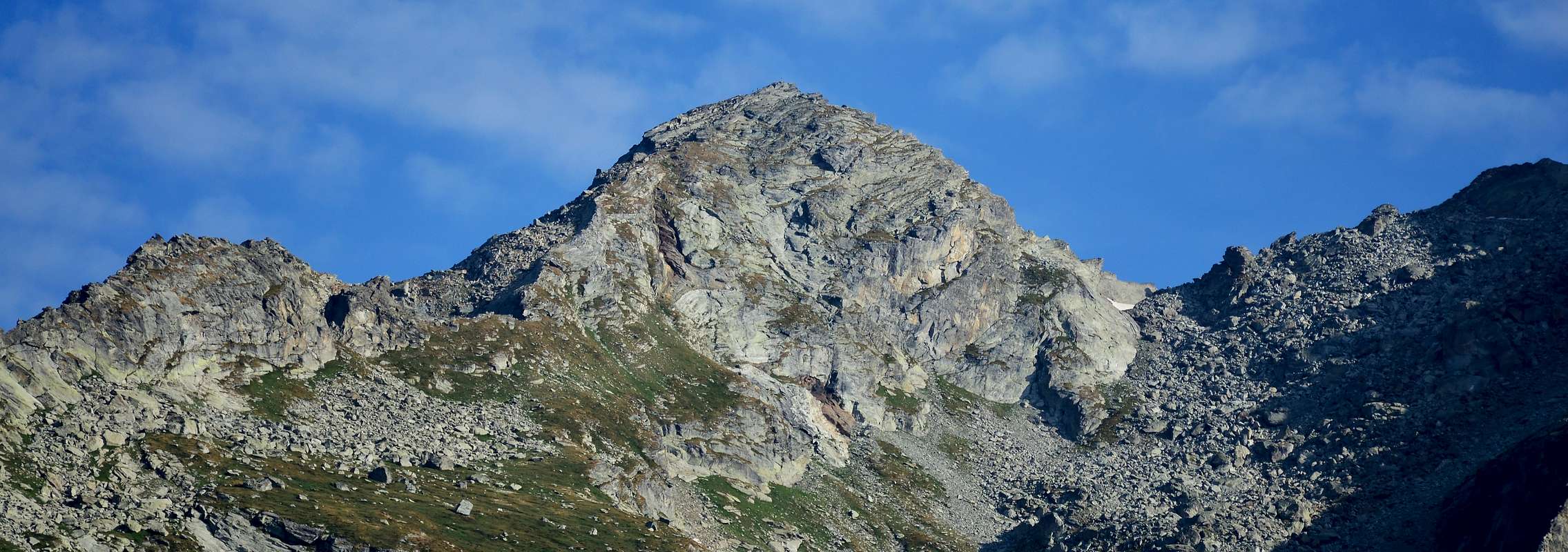
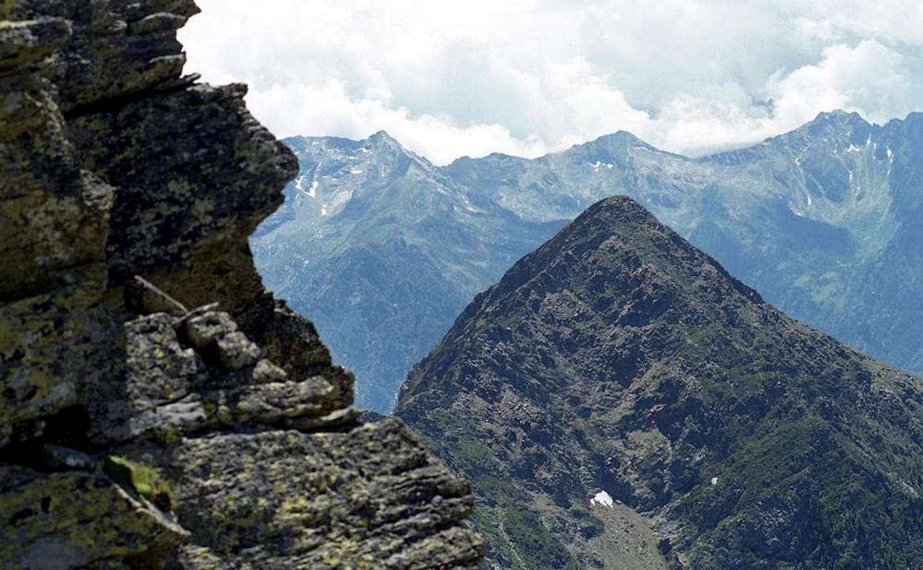
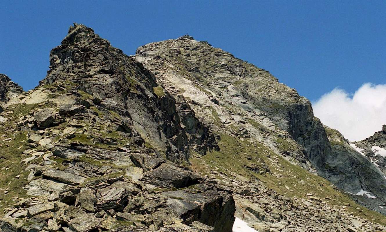
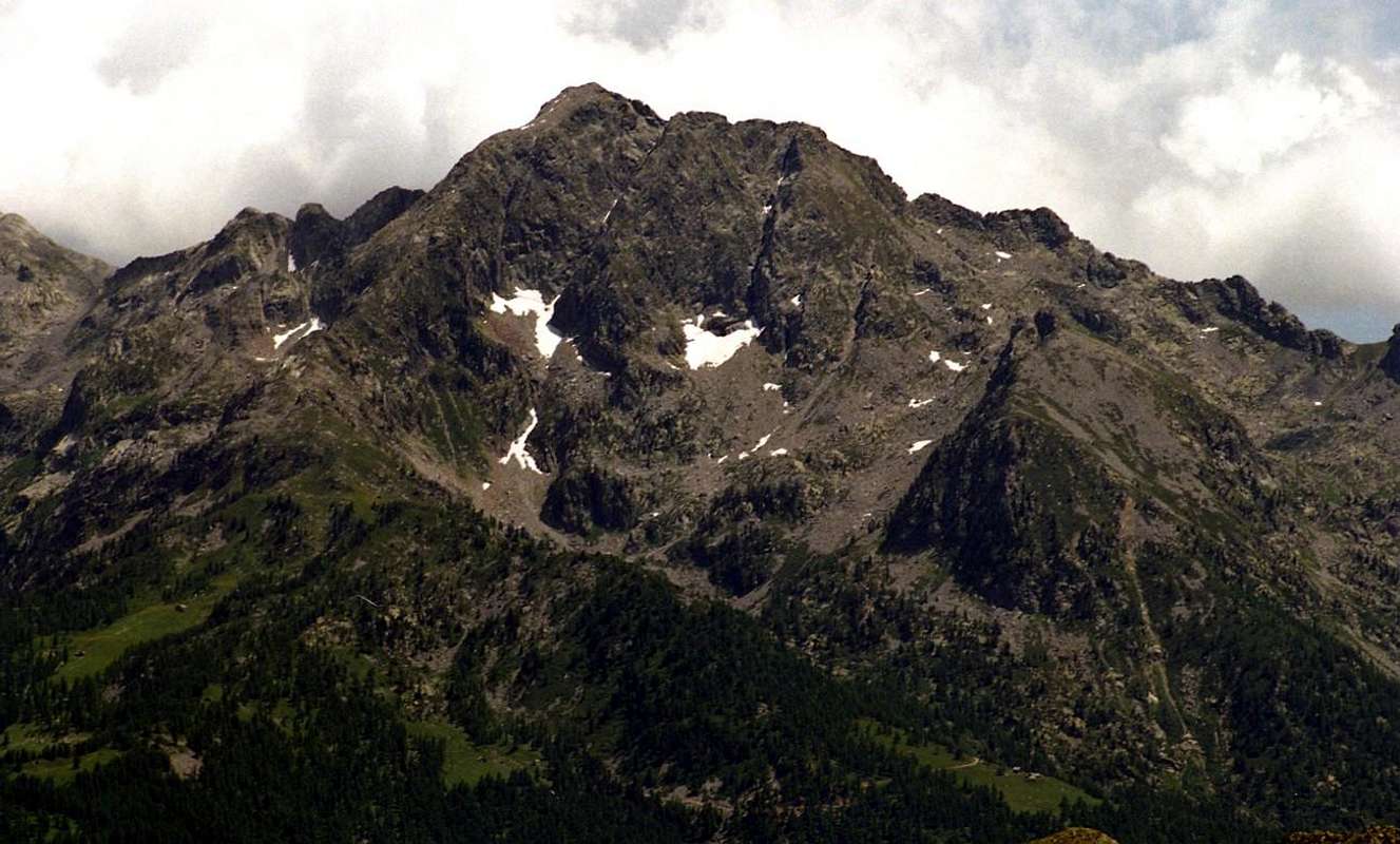
4) - Becca Torché (3.016m). This Summit is the highest of the entire valley that symbolically represents, then connecting the East with the "twin" Becca Vlou (3.032m); but while Torché "belongs" to the Valley of Dondeuil, the other is located entirely in the Gressoney Valley overlooking the Valley of Scheity and Issime. Together, they form the so-called "Ladies of Challand", thanks to the exposure that are on this side of their two magnificent North Walls, always in sight going by the Media High Ayas Valley; while the opposite slope are highlighted with less prominence. The Torché from the face Dondeuil does not offer any particular type of climbing, but it does offer a pleasant hike through its Nornal Via; the same we must highlight the ease stressing that a crossing of about fifty metres to the right and just over the hill, through a grassy ledge with caution because very exposed in the Southeast. It should also differentiate like hiking appearance changes completely departing from the Alps Dondeuil (having permission to take the private road by car), or, starting from Isollaz, with the full path of entire walloon; in this case, "resurfaces" an old way of going to the mountains with a nice "grind" that requires good hocks. In any case, it is beautiful, pleasant and scenic trip.
4) - Becca Torché (3.016 m). Questa vetta è la più alta dell'intera vallata che simbolicamente rappresenta, collegando poi l'Oriente con la “gemella” Becca Vlou (3.032 m); ma mentre Torché "appartiene" alla Valle di Dondeuil, l'altro si trova interamente nella Valle di Gressoney e domina la Valle di Scheity e Issime. Insieme, formano le cosiddette "Ladies of Challand", grazie all'esposizione che si trovano al di qua delle loro due magnifiche Mura Nord, sempre in vista passando dalla Media Alta Valle d'Ayas; mentre le pendenze opposte sono evidenziate con minor risalto. La Torché dalla parete Dondeuil non offre nessun tipo particolare di arrampicata, ma offre una piacevole escursione attraverso la sua Via Nornale; lo stesso bisogna evidenziare la facilità sottolineando che una traversata di una cinquantina di metri a destra e poco oltre il colle, attraverso una cengia erbosa con cautela perché molto esposta a Sud-Est. Si deve anche differenziare come cambia aspetto escursionistico completamente partendo dalle Alpi Dondeuil (avendo il permesso di percorrere la strada privata in auto), oppure, partendo da Isollaz, con il percorso completo dell'intero vallone; in questo caso, "riemerge" un vecchio modo di andare in montagna con un bel "grind" che richiede buoni garretti. In ogni caso è un viaggio bellissimo, piacevole e panoramico.
 |
 |
 |
 |
 |
a) - Through the easy Southern Crest or Standard Route from Dondeuil Hill. After crossing above easily follow the path that will run along the edge or below the ridge to the right (East) (EE/F; 1h'45/2h'15 from hill; 3h'45/4h'15 from Dondeuil Alpage; 7h'15/7h'45 from Isollaz Village).
b) - Through Southwestern Slope from Chalex Alpages (1.780m) (EE/A/PD-; about 2h'30/3h'00 from base; 7h'00/8h'00 Isollaz).
c) - Through Northwestern Ridge from le Tron Alp. This long ridge coming down from the Northwest to the tip Meriaoù can also be reached from the Vallon of the same Dondeuil reaching from the Alp le Tron to the saddle of 2.700 meters after Becca Mortens and proceeding fairly smoothly on wire of the same (A; from PD- to PD+; about 3h'00/3h'15 from le Tron; 7h'30/8h'30 Isollaz). Better to walk away from this with ascent through Tollegnaz Chasten Vallon, because the search for the via forward is simpler and requires less knowledge of the area being more visible.
a) - Attraverso la facile Southern Crest o Standard Route da Dondeuil Hill. Dopo aver attraversato in alto si segue agevolmente il sentiero che correrà lungo lo spigolo o sotto la cresta a destra (Est) (EE/F; 1h'45/02h'15 dal colle; 3h'45/04h'15 dall'Alpe Dondeuil; 7h'15/7h'45 da Isollaz Village).
b) - Attraverso il versante sud-occidentale da Chalex Alpages (1.780 m) (EE/A/PD-; circa 2h'30/3h'00 dalla base; 7h'00/8h'00 Isollaz).
c) - Attraverso la Cresta Nordoccidentale dall'Alpe di Tron. Questa lunga cresta che scende da Nordovest fino alla punta Meriaoù è raggiungibile anche dal Vallon dello stesso Dondeuil arrivando dall'Alp le Tron alla sella di 2700 metri dopo Becca Mortens e procedendo abbastanza agevolmente su filo della stessa (A; da PD- a PD+; circa 3h'00/3h'15 da le Tron; 7h'30/8h'30 Isollaz). Meglio allontanarsi da questo con la salita attraverso Tollegnaz Chasten Vallon, perché la ricerca della via avanti è più semplice e richiede una minore conoscenza della zona essendo più visibile.
5) - Punta del Dondeuil (2.746m). This small Summit is made up of a little triangular and pointed elevation on the South Crest of Becca Torché in its middle part; generally avoided on the right (East) going to the same. It has the shape of a large gendarme consists of numerous boulders with the additional feature of having a mini pond hidden in a cave on the Northern side. Also known as Becca Dondeuil, has been climbing twice along with the nearby Gendarme (about 2.770 meters) by Osvaldo Cardellina, lone, August 18th, 1996 and June 25th, 2000 during the ascents to the Becca Torché, respectively, with Giuseppe Lamazzi and Emilio Bertona found no cairns or signals on the two little Summit. Climb a short detour to the left of the Normal Route Becca Torché and by means of a delicate climbing on steep rocks and compact on the East and South Slopes (A/AD-; 0h'30 from the base; 1h'30/1h'45 from the Hill Dondeuil; 5h'00/7h'00 from Isollaz).
5) - Punta del Dondeuil (2.746 m). Questa piccola vetta è costituita da un piccolo prospetto triangolare e appuntito sulla Cresta Sud della Becca Torché nella sua parte mediana; generalmente evitato sulla destra (Est) andando alla stessa. Ha la forma di un grande gendarme costituito da numerosi massi con l'ulteriore caratteristica di avere un mini laghetto nascosto in una grotta sul lato Nord. Detta anche Becca Dondeuil, ha salito due volte insieme al vicino Gendarme (circa 2.770 metri) di Osvaldo Cardellina, solitario, il 18 agosto 1996 e il 25 giugno 2000 durante le ascensioni alla Becca Torché, rispettivamente, con Giuseppe Lamazzi ed Emilio Bertona non trovò né ometti né segnali sulle due vette. Salire una breve deviazione a sinistra della Via Normale Becca Torché e per mezzo di una delicata arrampicata su rocce ripide e compatte sui Versanti Est e Sud (A/AD-; 0h'30 dalla base; 1h'30/1h' 45 dal Colle Dondeuil; 5h'00/7h'00 da Isollaz).
 |
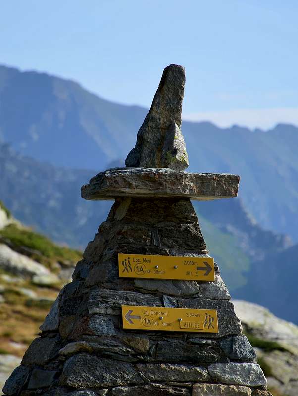
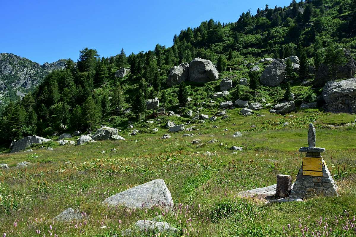
6) - Colle Dondeuil (2.338 m). Percorso molto lungo che si snoda verso Est dalle frazioni Targnod e Isollaz sopra il Comune di Challand Saint Victor seguendo il corso del Torrent Roesa (dall'antico dialetto Roizà o ghiacciaio) fino a raggiungere il colle, posto tra Becca Torché a Nord e a Sud Bec des Allemands anche Corno del Lago. Questo passo è stato frequentato "ab immemorabilis" e ha una notevole storia nel tempo (vedi Panoramica); oggi è attraversato da una corsa podistica che si è svolta per vent'anni, sta a rafforzare le due popolazioni della Valle d'Ayas e quella del Lys. Partendo dalla seconda delle due frazioni (658 m, raggiungibile per 1,2 km. da un bivio della Strada Regionale e attraversando il Torrent Evançon) si procede per una bella mulattiera fino alla località Fontaney per quasi 2 km fino a superare la Torre di Bonot (744 m), dove inizia il sentiero "Via Alpina" che raggiunge i Pascoli Ollion (1.168 m) e Fontaney (1.423 m, qui si può raggiungere anche tramite una strada sterrata poderale privata, partendo sempre da Isollaz; T/E/F; 2h'00/2h'15). Con lieve pendenza, lo stesso sale, scartando a destra (Sud), una deviazione per l'Alpe Mazù (1.310 m), attraverso le pendici meridionali della Becca Chalex e, sempre seguendo il torrente ed in raccordo con la strada sterrata privata, si arriva all'Alpage Chalex (1.780 m) e poco dopo quella di Dondeuil (1.817 m). Da qui il sentiero affronta la parte più ripida del terminal e supera l'Alpage Tramont de Dondeuil superiore dove completa la strada poderale verso la conca sottostante la collina; seguendo un lungo vallone "costellato" di splendidi rododendri, e proseguendo tra gli stessi si arriva al Col (E/F; 3h'00/3h'15 dall'Alpe di Fontaney; 5h'00/5h'30 Isollaz).
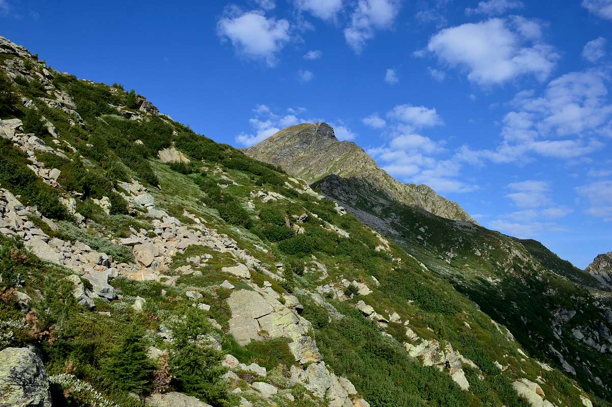
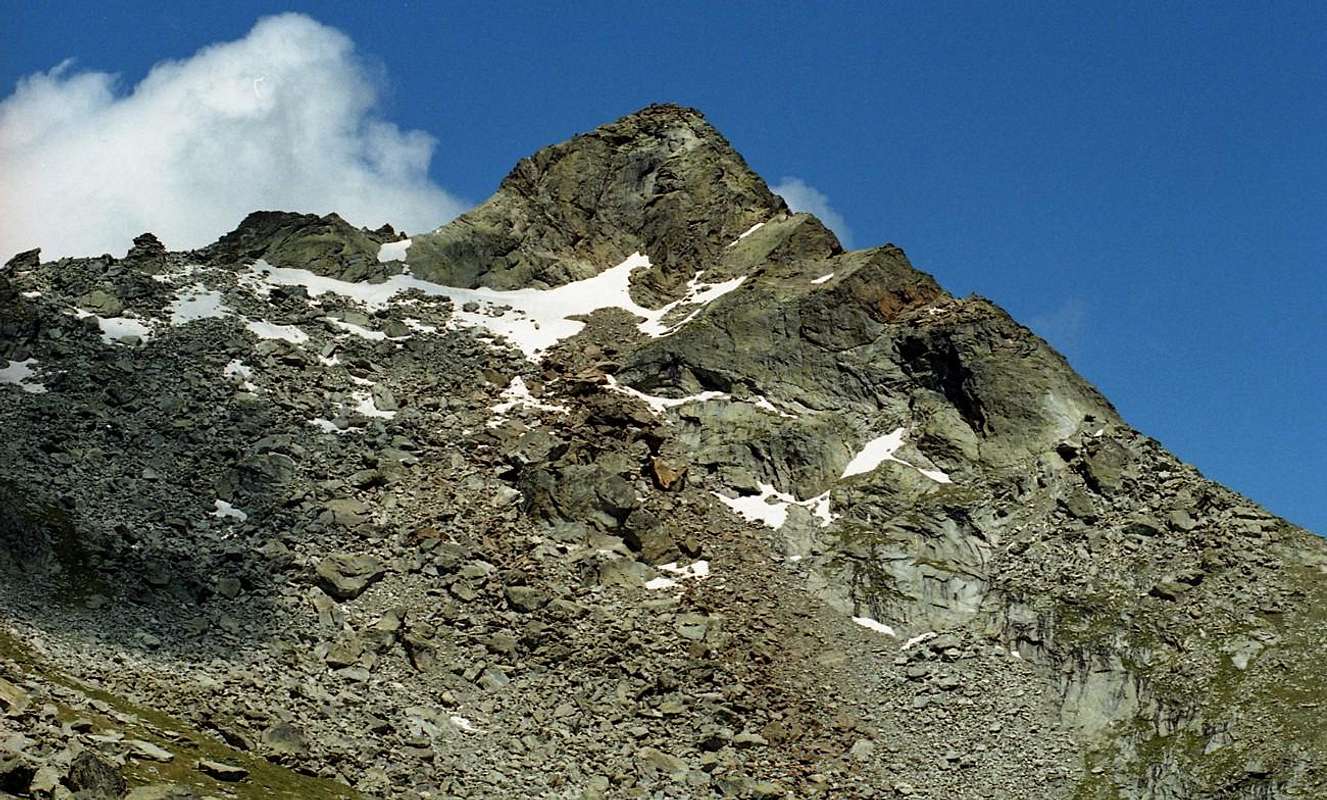
7) - Corno del Lago also Pic or Bec des Allemands (2.747m). This mountain, sited just South of the Dondeuil Hill, takes its name from the fact that immediately double its Southeast Slope there are a number of small lakes, mostly just called Little Lake (2.263m), above the deep valley of Valbona or Scheity coming up from Issime Commune (953m) in the Gressoney Valley and at the foot of Mount Crabun (2.710m). The second reason is that the same had been manned, in addition to recording the passage of the French Army of Napoleon, too troops from the Austro-Russian near the Summit in 1800. Although it is clearly visible after Becca Torché is rarely visited while they are often visited the lakes, even by fishermen, starting from the Alps Munes (2.008m; Madonna delle Nevi also Lady of the Snows), this maybe the look "grim and vicious" offering to the Vallon of the Dondeuil with its steep and abrupt Face West. It salt through the easy North-northeast Crest rising from the hill with a very small path that often becomes a small track (EE/F; 1h'15/1h'30 from Dondeuil; (E/F; 4h'00/4h'30 Isollaz). To views and panos deserves more visitations.
7) - Corno del Lago anche Pic o Bec des Allemands (2.747 m). Questa montagna, situata appena a sud del colle Dondeuil, prende il nome dal fatto che immediatamente al doppio del suo versante sud-est si trovano numerosi laghetti, per lo più chiamati semplicemente Laghetto (2.263 m), al di sopra della profonda valle di Valbona o Scheity salendo dal Comune di Issime (953 m) nella Valle di Gressoney e ai piedi del monte Crabun (2.710 m). Il secondo motivo è che le stesse erano state equipaggiate, oltre a registrare il passaggio dell'Armata francese di Napoleone, anche truppe austro-russe nei pressi della vetta nel 1800. Benché sia ben visibile dopo la Becca Torché è raramente visitata mentre sono spesso visitati i laghi, anche dai pescatori, a cominciare dalle Alpi Munes (2.008 m; Madonna delle Nevi anche Signora delle Nevi), questo forse lo sguardo "triste e vizioso" che offre al Vallone del Dondeuil con la sua parete ripida e scoscesa Ovest. Si sale per la facile Cresta Nord-Nordest che sale dal colle con un piccolissimo sentiero che spesso diventa un piccolo sentiero (EE/F; 1h'15/1h'30 da Dondeuil; (E/F; 4h'00/4h'30 Isollaz) Per panorami e panorami merita più visite. cato sulla cresta sud-ovest del Bec des Allemands e poco prima del Monte dell'Aquila (Becco d'Aquila). Da Nord si raggiunge con un sentiero non numerato, quello staccandosi dalla "Via Alpina" all'Alpe Dondeuil (1.817 m), con sentiero semicircolare per raggiungere prima l'Alpe di Sud-Est Bondini e poi un'altra senza nome (2.020 m), nei pressi di un piccolo torrente . Da quest'ultimo un sottile sentiero procede verso sud verso il passo (E/F; 1h'30/2h'00 Dondeuil Alpage). Dall'altro lato scendono due sentieri con le stesse caratteristiche, il primo dei quali a Sudovest in direzione del Villaggio Vachères (880 m circa) e del Comune di Arnad (412 m), mentre il secondo si indirizza a Sud-Est, sotto Cima Pietre Bianche (Cima White Stones), raggiungendo il Villaggio Merioù (1.211 m), sopra Corma dei Machaby (724 m). Entrambi con una lunga storia con percorso di oltre 5 ore erano sicuramente il passato più frequentato per il passaggio di armenti e greggi. Merita una visita culturale ed educativa da entrambi i lati.
 |
 |
 |
 |
 |

|
8) - Monte dell'Aquila (2.580m). This Summit is located immediately behind the Hill of Chiva on the long ridge of the Pic des Allemands or Corno del Lago first toward the Southwest and then Westward definitely down to the Top Graulà and Col Vert overlying the Municipality of Verrès, thus defining the entire Southern border of the Dondeuil Walloon. Climb with previous routes to the Col de Chiva and going into the end the short and easy Northeast Crest. (0h'30/0h'45 from Chiva Pass; 2h'15/2h'30 from Dondeuil Alpage; in total 5h'00/5h'30 from Isollaz Hamlet).
8) - Monte dell'Aquila (2.580 m). Questa Sommità si trova immediatamente alle spalle del Colle di Chiva sulla lunga cresta del Pic des Allemands o del Corno del Lago prima verso Sudovest e poi verso Ovest decisamente in discesa fino alla Cima Graulà e al Col Vert sovrastanti il Comune di Verrès, definendo così l'intero Sud confine del Vallone di Dondeuil. Salire con vie precedenti al Col de Chiva e addentrarsi in fondo alla breve e facile Cresta Nordest. (0h'30/0h'45 da Passo Chiva; 2h'15/2h'30 da Dondeuil Alpage; in totale 5h'00/5h'30 da Isollaz).
9) - Cima Granlà (1.907m). Located about two Kilometres West of Monte dell'Aquila is an off-grassy woodland, can be reached by a private dirt road, punctuated by a path that goes from the Village of Riorta in South of Isollaz Fraction, at the entrance of Dondeuil Vallon. The same, leading up to the Col Vert is divided at Alp Champorre reaching Northwards to Pianet Alp (1.162m; possibility to reach here also by a path starting from the Northeast of Verrès Castle). From this point leave the dirt farm to continue with a path, walking through the woods in the Southeast, to Alp Seura (1.547m) and continuing along the ridge, easily reaching the Summit (T/E/F; 2h'00/2h'15 from Pianet Alpage; 4h'00/4h'30 Verrès Castle).
9) - Cima Granlà (1.907 m). Situato a circa due Chilometri ad Ovest del Monte dell'Aquila è un bosco fuori erboso, raggiungibile da una strada sterrata privata, scandito da un sentiero che sale dal Borgo di Riorta a Sud della Frazione Isollaz, all'ingresso del Vallon Dondeuil. Lo stesso, salendo al Col Vert si divide all'Alp Champorre giungendo verso nord all'Alpe Pianet (1.162 m; possibilità di raggiungerlo anche per sentiero partendo da Nordest del Castello di Verrès).Da questo punto si lascia il podere sterrato per proseguire con un sentiero, nel bosco di Sud-Est, fino all'Alp Seura (1.547 m) e proseguendo lungo il crinale, raggiungendo facilmente la Sommità (T/E/F; 2h'00/2h'15 da Pianet; 4h'00/4h'30 Castello di Verrès).
10) - Col Vert (around 1.400m). This hill is the extreme point of the watershed between the Vallon of Dondeuil and the nearby Communes of Verrès and Arnad underlying this diverse field, widening towards the Northeast in the direction of Mont Crabun, overlooking the Central Valley of Dora Baltea. Now we are going to completely exit the Dondeuil Vallon and remains this last trip, starting from the Champorre Pasture (see above), it reaches the Col Vert below its ancient ironmines now abandoned, placed between it and the Prattse Pasture (1.460m). Go up the private farm dirt road to reach it starting from the Village of Riorta (around 640/50 meters), detached from the Northeast Regional Road to the Ayas Valley, taking the fork that leads to the Village of Isollaz (1h'45/2h'00 from Champorre Pasture; in total 3h'45/4h'00 from Riorta).
10) - Col Vert (circa 1.400 m). Questo colle è il punto estremo dello spartiacque tra il Vallon di Dondeuil ei vicini Comuni di Verrès e Arnad sottostante questo variegato campo, che si allarga verso Nordest in direzione del Mont Crabun, a strapiombo sulla Valle Centrale della Dora Baltea. Ora stiamo per uscire completamente dal Vallon Dondeuil e resta quest'ultima escursione che, partendo dall'Alpe di Champorre (vedi sopra), raggiunge il Col Vert sotto le sue antiche miniere di ferro ormai abbandonate, poste tra esso e l'Alpe di Prattse (1.460 m). Risalire la strada sterrata dell'azienda privata per raggiungerla partendo dal Borgo di Riorta (circa 640/50 metri), staccato dalla Strada Regionale di Nordest per la Valle d'Ayas, imboccando il bivio che porta al Borgo di Isollaz (1h'45/2h'00 dall'Alpe di Champorre; in totale 3h'45/4h'00 da Riorta).
Campings
Remember that free camping is forbidden (except for emergency reasons, over 2.500m, from darkness until dawn).
Mountain Conditions
- You can get meteo information at the official site of the Regione Valle d'Aosta:
- Valle d'Aosta Meteo
Books and Maps
BOOKS:
- "Guida delle Alpi Occidentali" di Giovanni Bobba e Luigi Vaccarone C.A.I. Sezione di Torino Volume II (parte II), 25 Maggio 1896.
- "Guida dei Monti d'Italia" Alpi Pennine (Vol. 2) di Gino Buscaini - Club Alpino Italiano/Turing Club Italiano, Luglio 1970 (In Italian).
MAPS:
- Meridiani Montagne "Monte Rosa" Carta 1:50.000 con carta di dettaglio 1:20.000.
- L'Escursionista "Val d'Ayas Val di Gressoney Monte Rosa" Carta dei sentieri (n° 8) 1:25.000.
- Comunità Montana Evançon "Carta dei sentieri" (n° 2), 1:30.000.
- Kompass "Breuil/Cervinia-Zermatt" Carta turistica 1:50.000.
- I.G.C. Istituto Geografico Centrale Torino "Cervino e Monte Rosa" 1:50.000.
Important Information
- REGIONE AUTONOMA VALLE D'AOSTA the official site.
- FONDAZIONE MONTAGNA SICURA Villa Cameron, località Villard de la Palud n° 1 Courmayeur (AO) Tel: 39 0165 897602 - Fax: 39 0165 897647.
- A.I.NE.VA. (Associazione Interregionale Neve e Valanghe).
Useful numbers
- Protezione Civile Valdostana località Aeroporto n° 7/A Saint Christophe (Ao) Tel. 0165-238222.
- Bollettino Meteo (weather info) Tel. 0165-44113.
- Unità Operativa di Soccorso Sanitario Tel. 118.
 |