

-
 12726 Hits
-
 89.77% Score
-
 30 Votes
|
|
Area/Range |
|---|---|
|
|
45.77548°N / 7.19676°E |
|
|
Hiking, Mountaineering, Scrambling, Skiing |
|
|
Spring, Summer, Fall, Winter |
|
|
10043 ft / 3061 m |
|
|
Overview
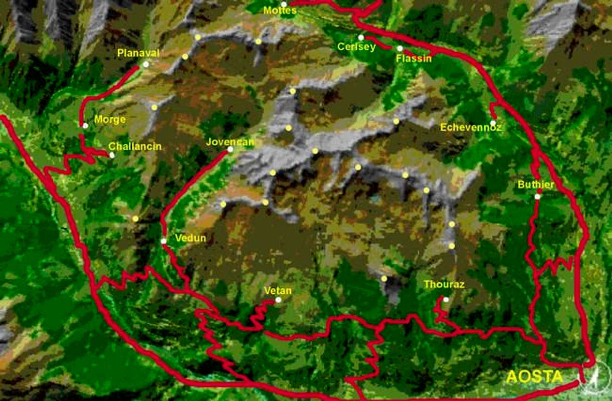
We call Fallere Group the area located at the North-West of Aosta town, including a lot of summits.
The area is delimited:
- SOUTH: Motorway Aosta-Courmayeur
- EAST: Highway Aosta-Gran San Bernardo as far as Etroubles
- NORTH: Road from Etroubles to Mottes
- North/WEST: Comba di Planaval
All the summits are easy to be climbed, and the area is a real heaven for ski mountaneering.
There are also a lot of trails, built to reach the mountain farms, that are the kingdom of the bikers or of the riders (a few horses ranches in the area).
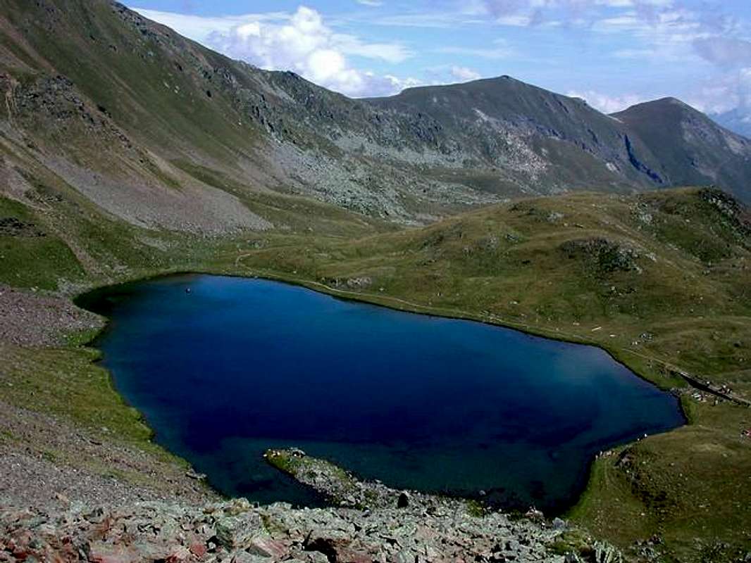
If you are too lazy to climb the summits, a lot of colorful lakes, easy to reach, offer a nice rest.
In spring and in early summer the wide grasslands are full of flowers, including a lot of edelweiss, and the surroundings are rich of nice places to visit and wide panoramas, due to the central position of the area with respect to the Aosta Valley.
 West part of the Fallere Group from south 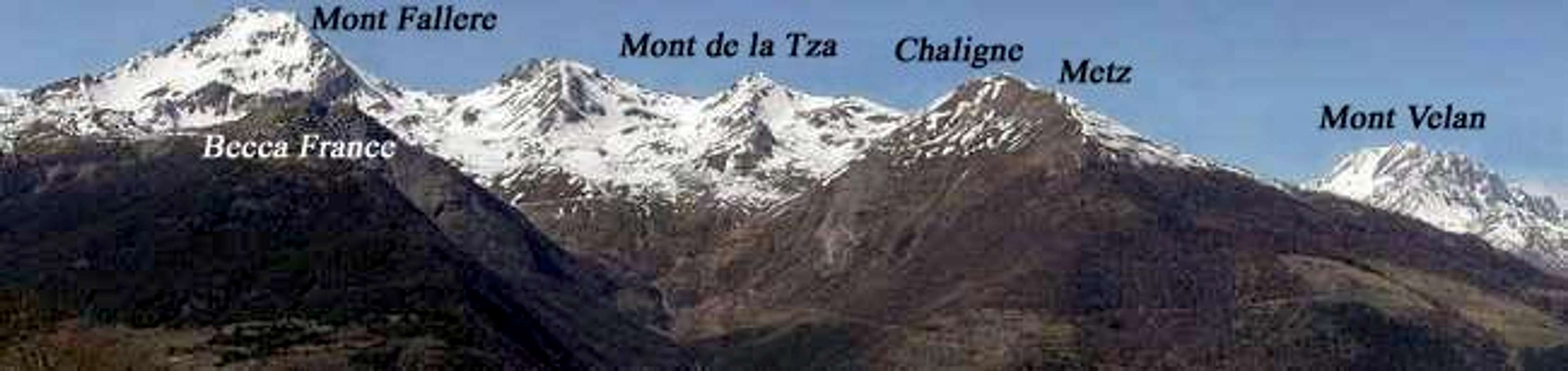 East part of the Fallere Group from south 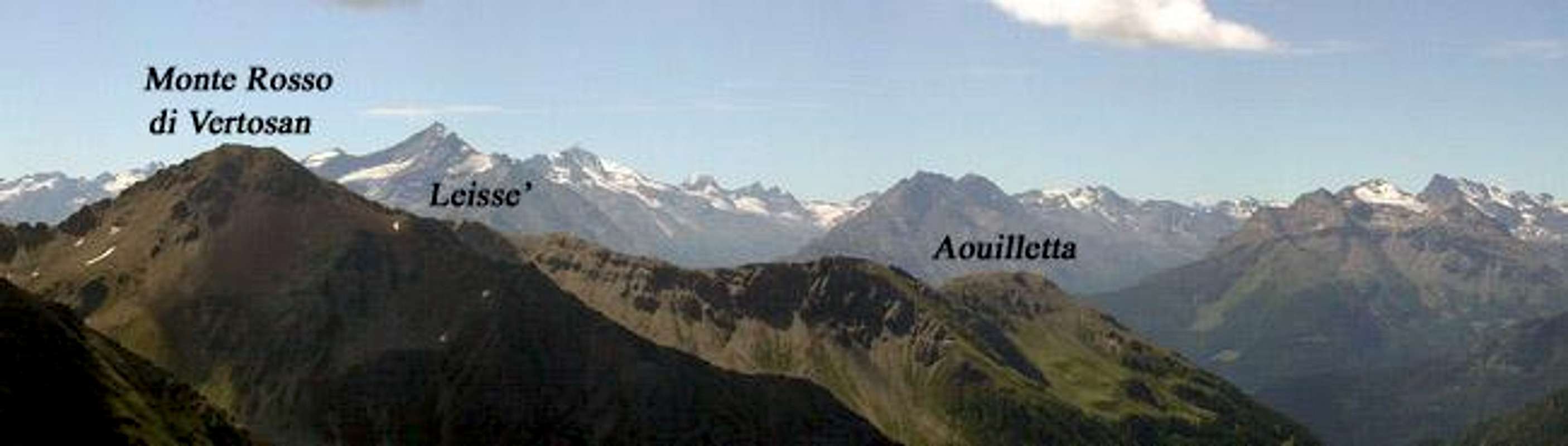 West part of the Fallere Group from north 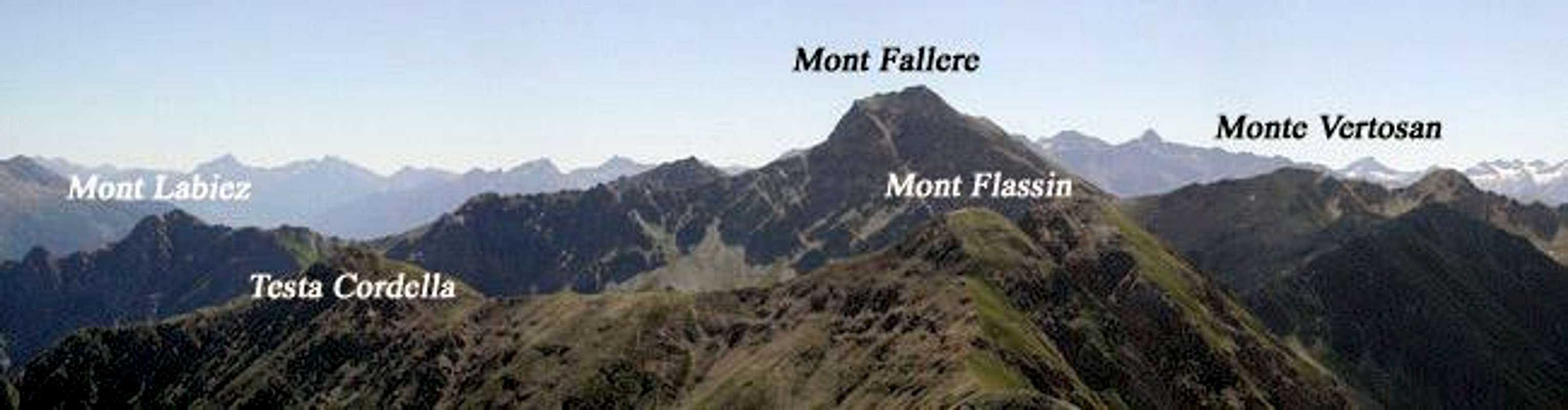 East part of the Fallere Group from north |
Getting There
The starting points are different according to the route chosen; each summit will be described in its page, with all the indications about how to reach the different points of departure.Summits of the Fallere Group
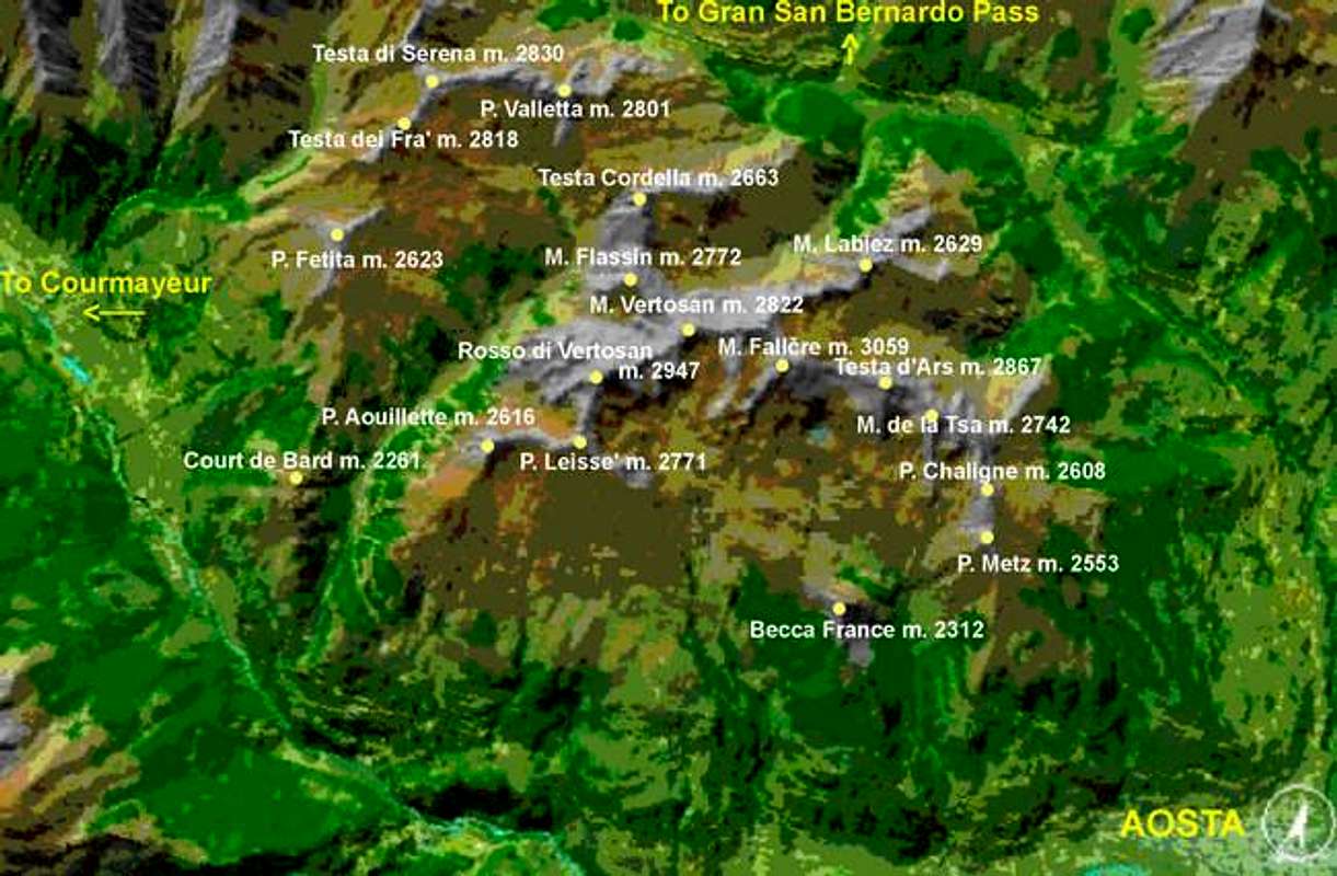
The most important summits of the area are the following ones:- AOUILLETTE 2.616m
- BECCA FRANCE 2.312m
- CHALIGNE (Croix de Chaligne) 2.608m
- COURT de BARD 2.261m
- LEISSE' (or Leysser) 2.771m
- METZ 2.553m
- MONT DE LA TSA 2.742m
- MONT FALLERE 3.061m
- MONT FLASSIN 2.772m
- MONT LABIEZ 2.629m
- MONTE ROSSO DI VERTOSAN 2.947m
- MONT VERTOSAN 2.822m
- PUNTA FETITA (or Falita) 2.623m
- TESTA CORDELLA 2.663m
- TESTA d'ARS 2.830m
- TESTA dei FRA' 2.818m
- TESTA di SERENA 2.830m
- VALLETTA 2.801m
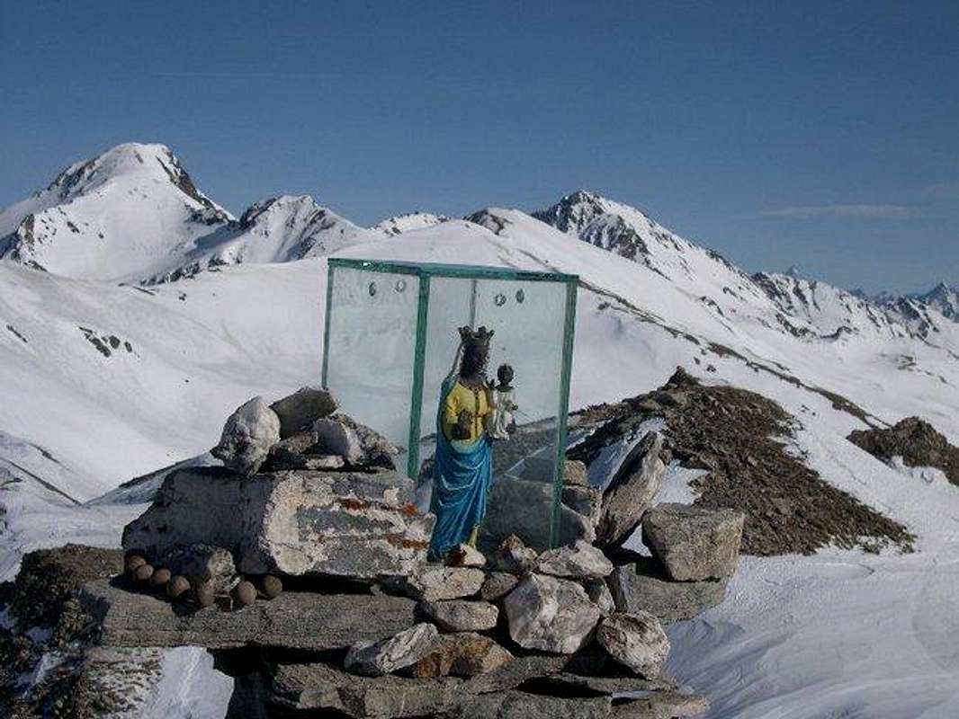
Aouillette 2.616m
- ROUTE from VETAN
- ROUTE from VENS
A small statue of the black Virgin of Oropa is placed on the summit.
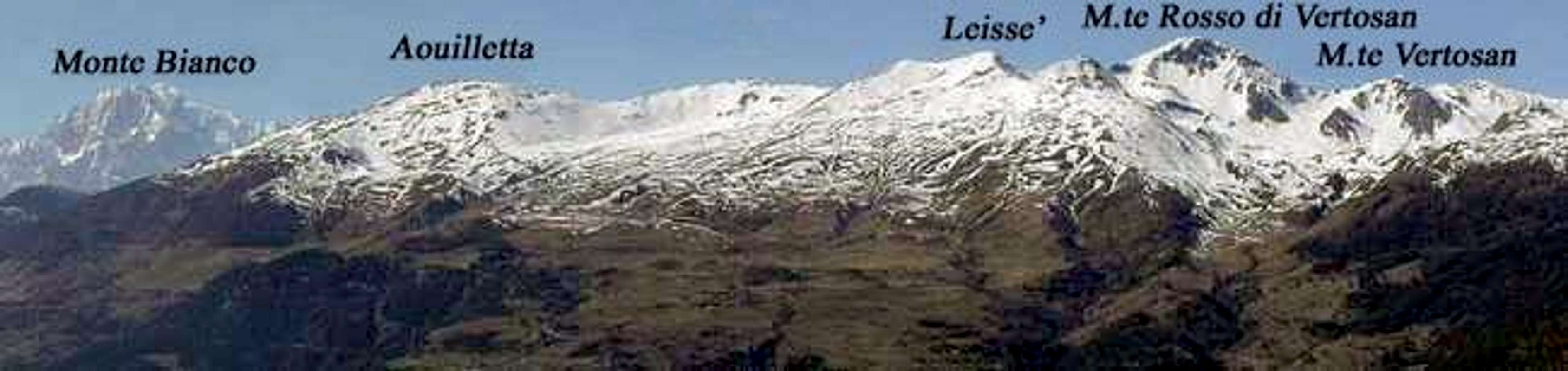
Behind, from left, Monte Rosso di Vertosan, Mont Paletta, Leisse', Mont Fallère
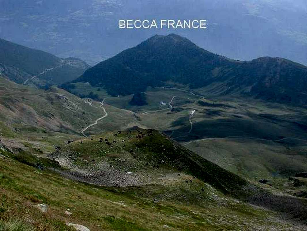
Becca France 2.312m
- ROUTE from BELLON
It is a low summit, but also a particular one; on a July morning of the year 1564, the summit of this mountain fell down and buried the old village of Thouraz and it's 600 inhabitants. A new smaller village was rebuilt in another location.
Chaligne 2.608m - Metz 2.553m
- ROUTE from THOURAZ
- ROUTE from BUTHIER
The summit of Chaligne and the summit of Metz are very close one another, and it's possible to hike both of them in the same course.
We met some chamoises around them.
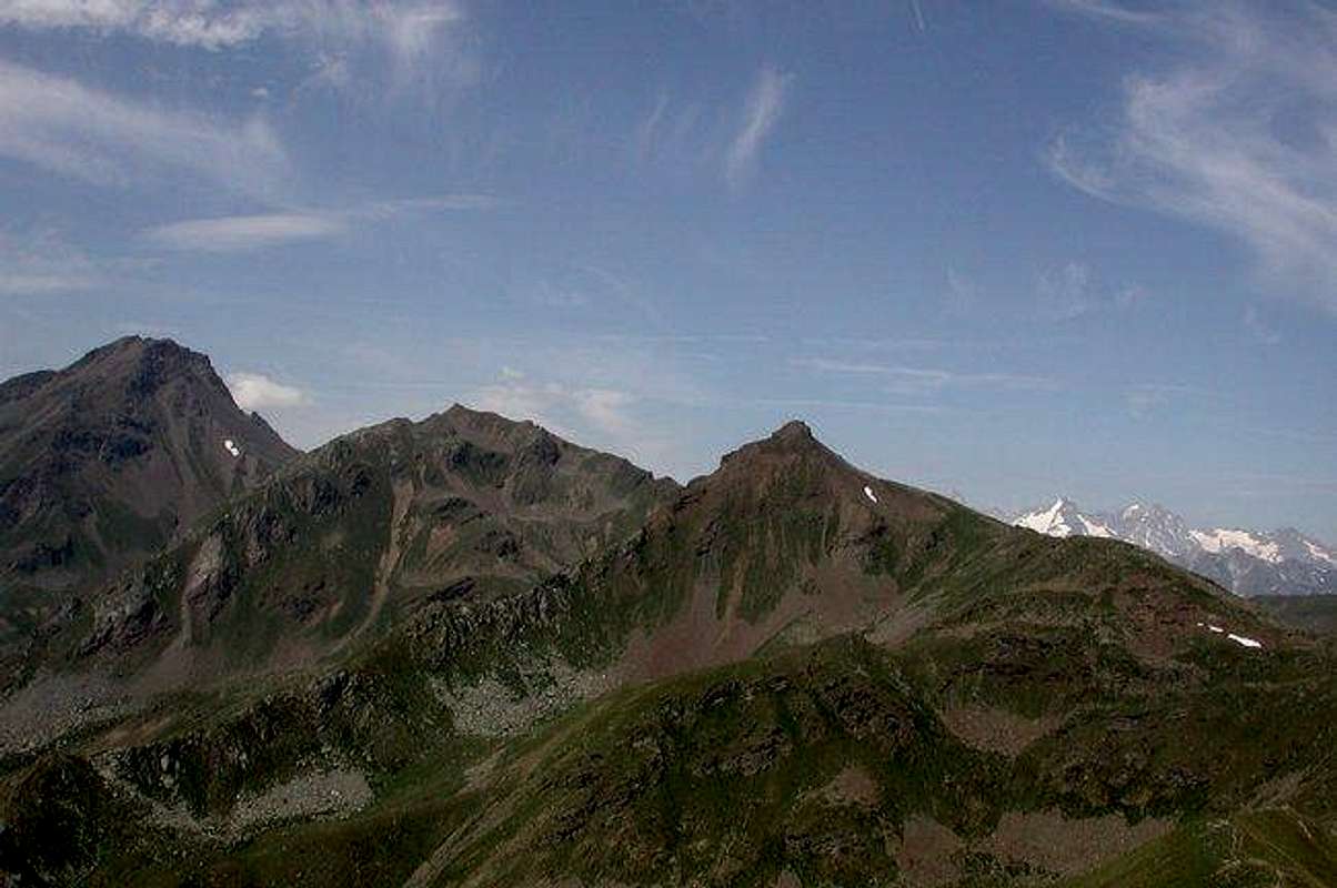
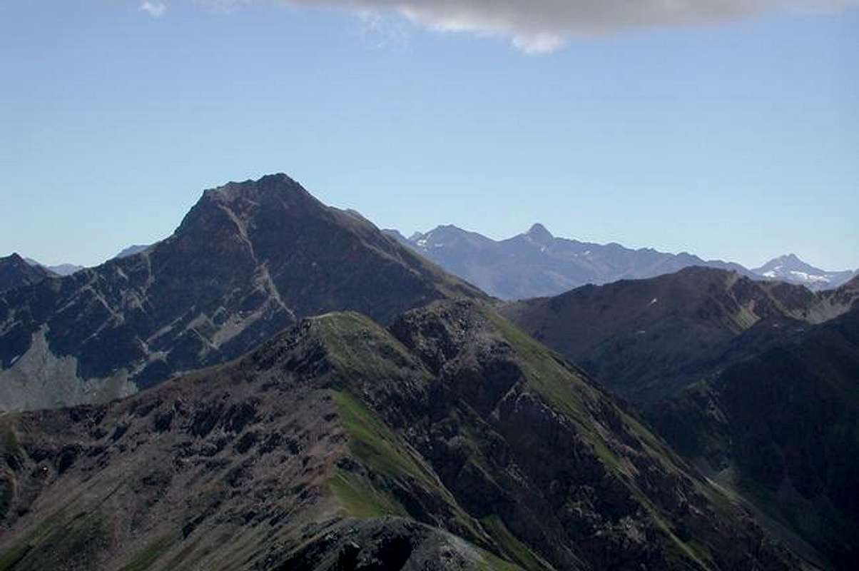
Leisse' 2.771m - Monte Rosso di Vertosan 2.947m
- ROUTE from VETAN
- ROUTE from COMBA DI VERTOSAN
Leisse' from Vetan is the classic ski mountanering route, the place where you can go when others routes are not possible because of bad snow conditions.
Monte Rosso di Vertosan is a technical route for ski mountaneering. From the top, very wide view all around.

From left, Leisse', Monte Paletta, Monte Rosso di Vertosan
Mont de la Tza 2.742m
- ROUTE from THOURAZ
Behind the Chaligne, on the ridge that faces on the Comba d'Arsy.
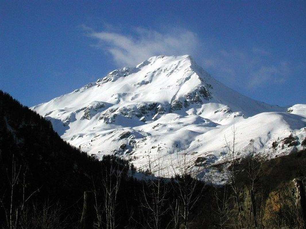
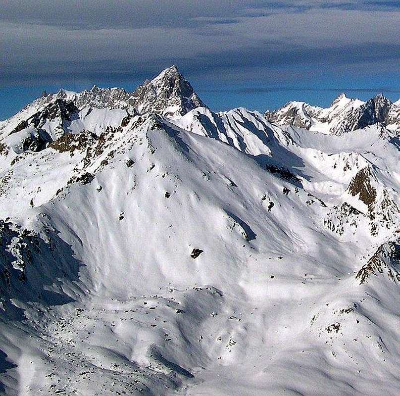
Mont Fallere 3.061m
- ROUTE from VETAN
- ROUTE from THOURAZ
- ROUTE from ECHEVENNOZ
It is the highest summit of the area, and also the one that needs more attention to be hiked; in summer, the ridge between the east and west summit can be climbed: despite it is not difficult, it is narrow and exposed.
In winter the south route is very steep, and reserved only to very expert practising. Also ask locally about the conditions of the slopes.
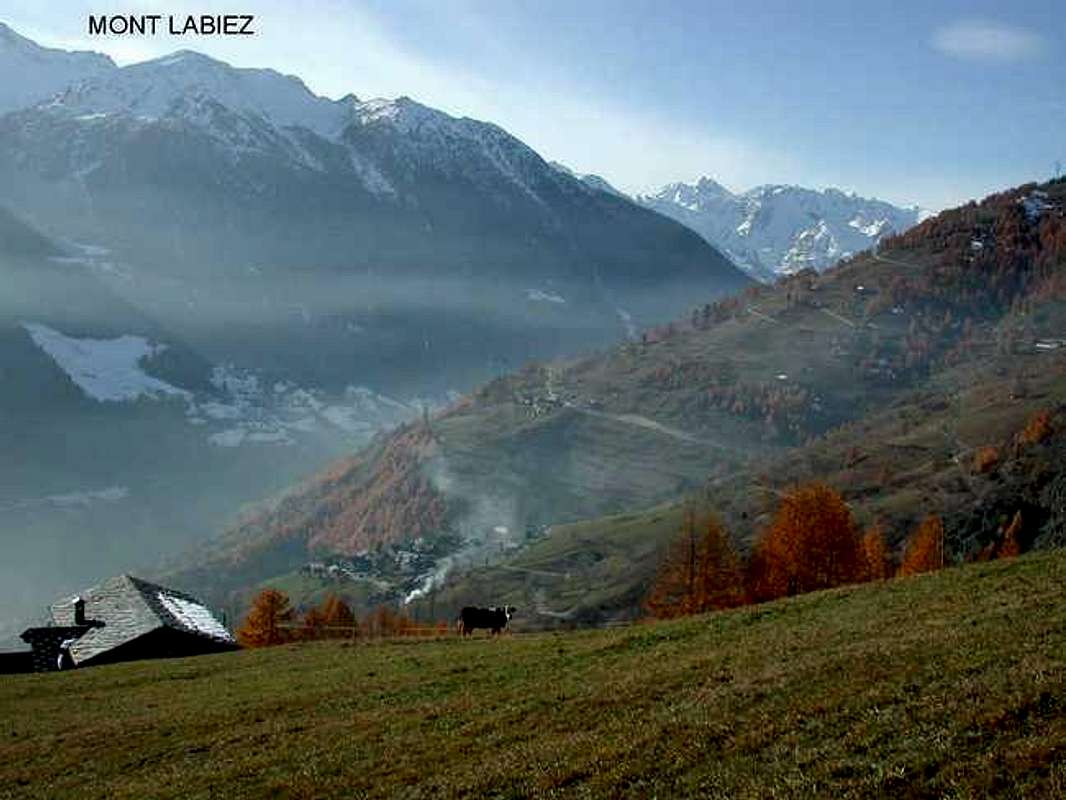
Mont Labiez 2.679m
- ROUTE from ECHEVENNOZ
It is the only one that you can hike from Echevennoz, Comba d'Arsy; this route is also followed for an alternative ski mountaneering to Mont Fallere
 |
 |
 |
 |
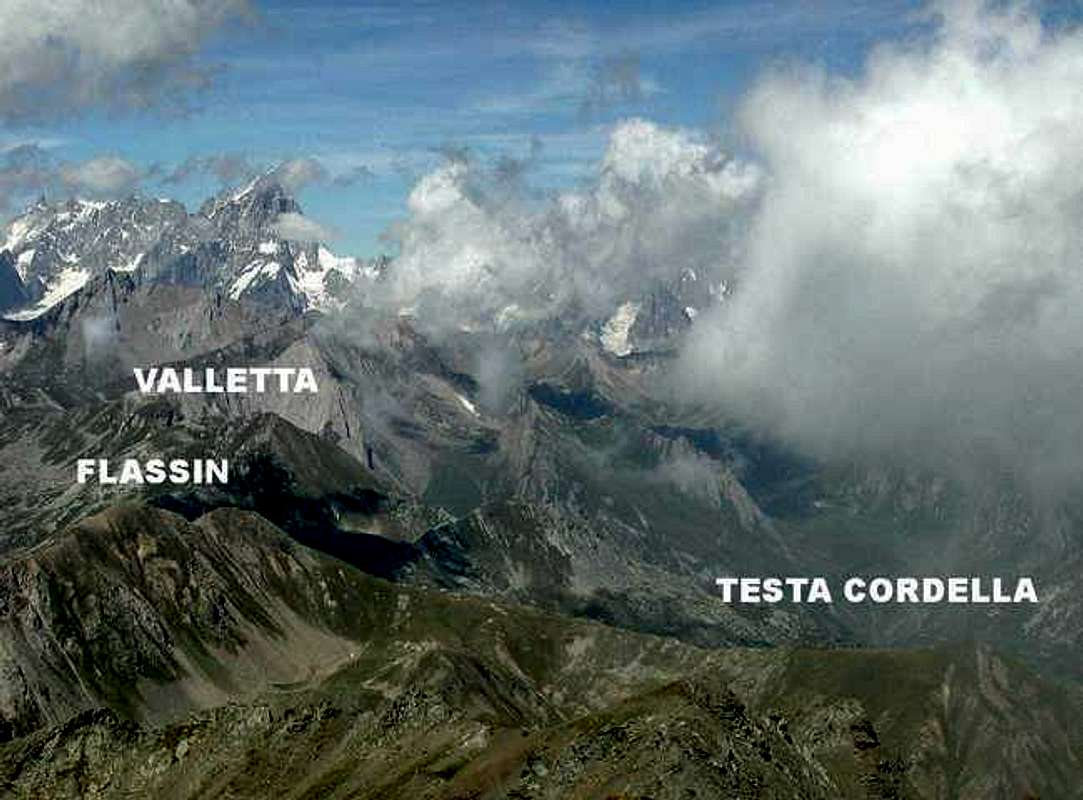
Mont Flassin 2.772m - Testa Cordella 2.663m
- ROUTE from COMBA FLASSIN
Also these two summits can be hiked together.
Mont Vertosan 2.822m
- ROUTE from VETAN
- ROUTE from COMBA DI VERTOSAN
- ROUTE from COMBA FLASSIN
It is in the middle of the group, behind Monte Rosso di Vertosan.
Left side, Mont Fallere, the lower summit right side is Mont Vertosan
Valletta 2.801m
- ROUTE COMBA CITRIN
- ROUTE COMBA DI VERTOSAN
The slopes of this top, famous since it's a classic ski mountaneering route, are very steep.
When To Climb-Camping
Hiking: from June to October, according to the weather conditions.Ski mountanering: if there is snow, of course, some of the summits are good also in October, usually till April.
Some of the beautiful flowers that you can find in spring in the area
 |
 |
 |
 |
 |
Mountain Condition
- Meteo: you can find all the needed informations at the official site of the Valle d'Aosta Region:
Valle d'Aosta Meteo
Webcam
- WEBCAM on Aosta Valley:
Webcam
Books and Maps
- "Guida delle Alpi Occidentali" di Giovanni Bobba e Luigi Vaccarone C.A.I. Sezione di Torino Volume II° (parte II) 25-05-1896.
- "Guida dei Monti d'Italia-Alpi Pennine" (Vol. I°) di Gino Buscaini-Club Alpino Italiano/Turing Club Italiano, Luglio 1971.
- "Dove si specchia il cielo - i laghi della Valle d'Aosta", di Sergio Piotti, Ed. Ferrari Luglio 1996.
- "80 itinerari di Escursionismo Alpinismo e Sci Alpinismo in Valle d'Aosta", di Osvaldo Cardellina, Ed. Musumeci, Giugno 1977 (in Italian); seconda Ed. Luglio 1981; terza Ed. Luglio 1984; (in French), prima Ed. Febbraio 1978; seconda Ed. Marzo 1980.
 |
 |
 |
 |
- Kompass "Monte Bianco Valle d'Aosta Sentieri e Rifugi" Carta turistica 1:50.000.
- Ediz. Bottega D'Arte Alpina Coumayeur "Carta Turistica della Valle d'Aosta" di Alessio Nebbia 1:100.000.
- I.G.M. Istituto Geografico Militare 1:25.000.
Tourism informations
The area is also interesting for the different castles and an interesting museum.I am going to add some pics and info on the matter.
 |
 |
 |
 |
 |
Others important informations
- REGIONE AUTONOMA VALLE D'AOSTA the official site.
- FONDAZIONE MONTAGNA SICURA Villa Cameron, località Villard de la Palud n° 1 Courmayeur (AO) Tel: 39 0165 897602 - Fax: 39 0165 897647.
- A.I.NE.VA. (Associazione Interregionale Neve e Valanghe).
Useful numbers
- Protezione Civile Valdostana località Aeroporto n° 7/A Saint Christophe (Ao) Tel. 0165-238222.
- Bollettino Meteo (weather info) Tel. 0165-44113.
- Unità Operativa di Soccorso Sanitario Tel. 118.