
-
 9551 Hits
-
 89.01% Score
-
 28 Votes
|
|
Route |
|---|---|
|
|
45.92311°N / 7.83466°E |
|
|
Mountaineering, Ice Climbing, Big Wall |
|
|
Summer |
|
|
A long day |
|
|
Alpine D |
|
|
Overview
Eastern Lyskamm NE Face via Welzenbach
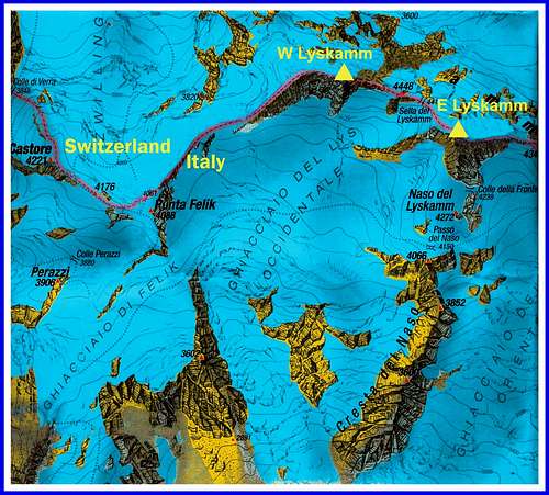
Lyskamm is a magnificent snow-capped peak belonging to the Pennine Alps, located in Monte Rosa range along the Swiss-Italian border between the Wallis and the Aosta Valley. It's a great Fourthousander almost entirely ice-covered. Lyskamm are actually two distinct peaks: Eastern Lyskamm 4527 m, the highest one, and Western Lyskamm 4481 m, joined by a superb snowy ridge (Lyskamm traverse), which is one of the most fine ridge in the Alps. Equally spectacular is the North face of the mountain, that rises on the Grenzgletscher for hundreds of meters. There are many routes on this stunning ice wall, also with extreme difficulty. On the North-East wall of Eastern Lyskamm runs one of the best classic ice-climbs of the Alps: the route Welzenbach, entirely on snow and ice, which is the route currently followed to climb E Lyskamm North-East face. It was first climbed by Willy Welzenbach and Rudolf Walter in 1925, who at the fourth repetition of the pre-existing route realized by Ludwig Normann-Neruda with the Swiss guide Christian Klucker and Josef Reinstadler in 1890 followed a new itinerary. Currently the historic route is no longer climbed in favour of Welzenbach.
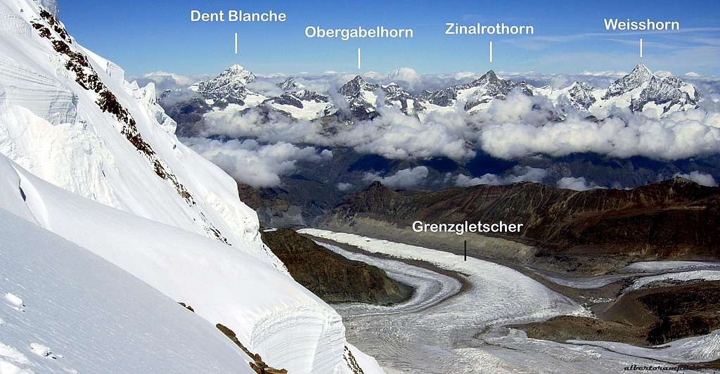
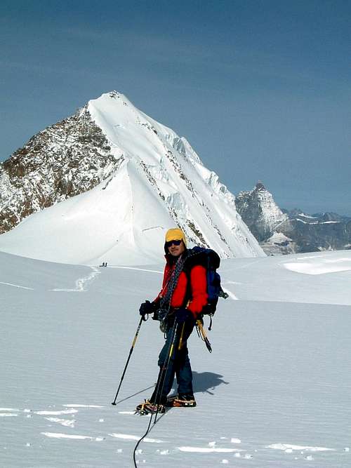
E Lyskamm summit view towards Wallis
Getting There
The route can be climbed starting both from Val Sesia (Piedmont side) and Valle di Gressoney (Aosta side).
- Access from Val Sesia (Piedmont) - From the A26 Highway exit to Romagnano Sesia and take the road SS299 to Varallo Sesia. Here continue following all the Val Sesia road to Alagna Valsesia. From Alagna Valsesia take the Cable car to Pianalunga - Passo dei Salati – Indren
- Access from the Valle di Gressoney (Aosta Valley) - From the A5 Torino – Aosta Highway, exit to Pont St. Martin and take the Valle di Gressoney, getting to Gressoney St. Jean, Gressoney La Trinité and Staffal. From Staffal take the Cable car to Alpe Gabiet – Passo dei Salati - Indren

|

|
Walking approach to Rif. Mantova m. 3498 and Capanna Gnifetti m. 3657
From Punta Indren Cable-car upper station corss the Indren Glacier to reach Rifugio Mantova or Rifugio Gnifetti. From this latter shelter gain the starting point of the Lys Glacier. Enter the glacier and follow it to North East, then to North, rising along gentle angled ice-slopes. Continue along the track, usually well-marked, reaxching the Lys Col.
Route Description
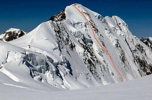
Eastern Lyskamm NE Face - Welzenbach Route
Difficulty: Alpine D, 55° max
Difference in level: 750 m.
Develope: 1000 m.
Exposure: North-East
First ascent: Willy Welzenbach and Rudolf Walter 1925, August 8th
Superb 50°-55° ice climb, the most frequented on the stunning Lyskamm North wall, running between the rocky rib that comes down from the East summit and the huge seracs that chararacterize the upper part of the wall. The route requires both a good technical background and a good training. Given the length of the climb an alpine start is absolutely advisable, moreover excellent meteo conditions and visibility are needed.
Approach - From the Rifugio Gnifetti reach the Lys Glacier (almost flat, but with several crevasses, even hidden, requiring the due care); head to the NE towards the Pyramid Vincent, then go up (some crevasses) to the North following the trail, usually present, which rises to Punta Gnifetti and Capanna Margherita. After the rocky islet of Balmenhorn, where are situated the Bivacco Giordan and the statue of Cristo delle Vette, head slightly to the right, getting to Colle del Lys m 4248. 2.30 hours from Rifugio Gnifetti. From Colle del Lys descend in the glacial basin to the north, then turn to left and go down along the Grenzgletscher at a certain distance (possible ice falls) from Eastern Lyskamm North Face reaching the altitude of about 3800 m, below the rocky rib coming down from the top. 0.30 from Colle del Lys, 3 hours from the Gnifetti shelter. If you are coming from Rifugio Mantova it's not necessary to pass from Rifugio Gnifetti: climb along the glacier Garstelet in the NE direction, passing to the right of the rocky islet of Rifugio Gnifetti, then join the previous route coming from Gnifetti where it turns to North (starting from Rifugio Mantova count 30 minutes longer).
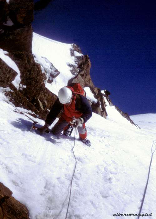
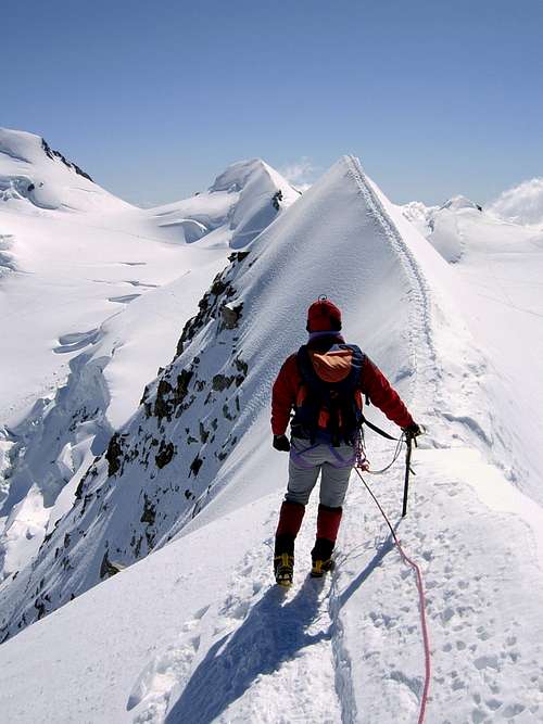
Climbing moments on Welzenbach route |
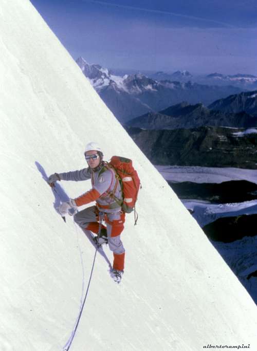
Climbing moments on Welzenbach route |
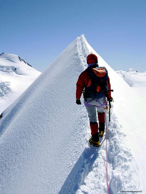
The return along the East Ridge |
Route report
Pass the bergschrund and climb directly the wide ice-slope as far as the starting point of the first rocks of the obvious rocky rib where runs the original Normann-Neruda route at the height of 4086 m. From here climb straightly with several pitches the ice-slopes to the left of the rocky rib, turning slightly to the left in the last 200 meters, getting the summit ridge a few tens of meters below the East summit. Get to the summit following the exposed ridge to the right.

|

|
Descent
The descent follows Eastern Lyskamm Normal route, running on the spectacular and airy East Ridge, ending on the wide saddle named Colle del Lys m. 4248, between Eastern Lyskamm (on the right) and Ludwigshohe (on the left). From this col the tracks joins Punta Gnifetti Normal route, along Lys Glacier, skirting Corno Nero and Piramide Vincent and getting at first to Rif. Gnifetti m. 3611, then to Rif. Mantova m. 3470. From Rif. Mantova the route crosses the Indren Glacier and leads to the upper station of Alagna - Punta Indren Cable car m. 3260. More information: Funivie Alagna Valsesia
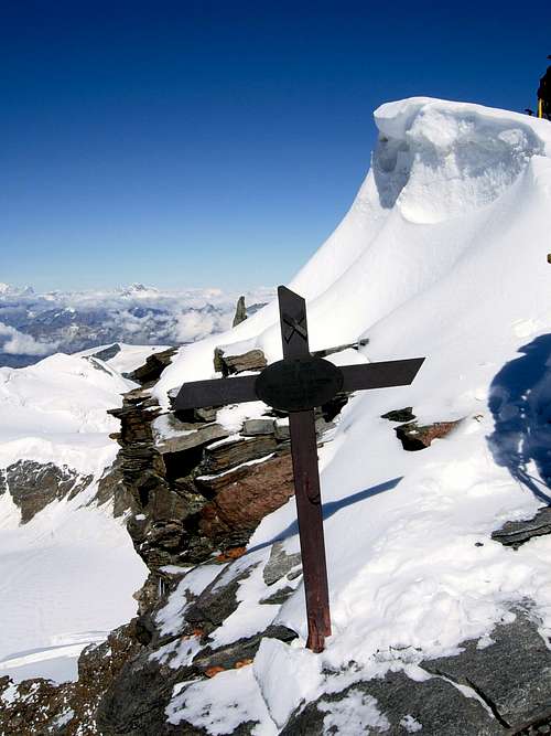
A little iron cross on Eastern Lyskamm |
Descent ridge |
E Lyskamm and Cervino from Colle del Lys |
Essential Gear
Take the conventional equipment for a climb of this kind (listed Alpine D): 50 m. rope, 2 ice axes, crampons, harness, helmet, carabiners, 2 or 3 slings, ice screws
Red Tape
There are no fees or permits needed to climb
Huts and Bivouacs
- Rifugio Città di Mantova m. 3470
- Capanna Gnifetti m. 3611
- Bivacco Giordano on Balmenhorn

|

|

|
When to climb
From June to July. The climb is to be performed early in the season.
Meteo
Meteo Valle d'Aosta
Meteo Piemonte
Guidebooks and maps
“Monte Rosa” by Gino Buscaini – Collana Guide dei Monti d'Italia C.A.I.-T.C.I.
“Tutti i 4000 – L’aria sottile dell’alta quota” – Club 4000, CAI Torino – Vivalda Editori
“4000 delle Alpi” by Richard Goedeke - Ed. Libris
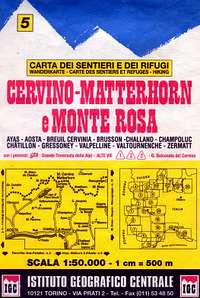
IGC sheet 108 - Cervino Matterhorn, Breuil Cervinia, Champoluc 1:25.000
IGC sheet 109 - Monte Rosa, Alagna Valsesia, Macugnaga, Gressoney 1:25.000
KOMPASS sheet 88 - Monterosa
 |
 |
 |
 |