
-
 18212 Hits
-
 85.87% Score
-
 21 Votes
|
|
Route |
|---|---|
|
|
45.92343°N / 7.83464°E |
|
|
Mountaineering, Ice Climbing |
|
|
Summer |
|
|
Most of a day |
|
|
AD, snow and ice up to 45° |
|
|
Overview
Lyskamm is a ice capped mountain belonging to the Pennine Alps, Monte Rosa Massif, and located on the Swiss-Italian watershed between the Swiss canton of Valais (North) and the Italian region of the Aosta Valley (South). Considered by someone as a single mountain, actually Lyskamm consists of two well identified peaks, the Western Lyskamm and the Eastern Lyskamm, separated by a long and sharp ridge.
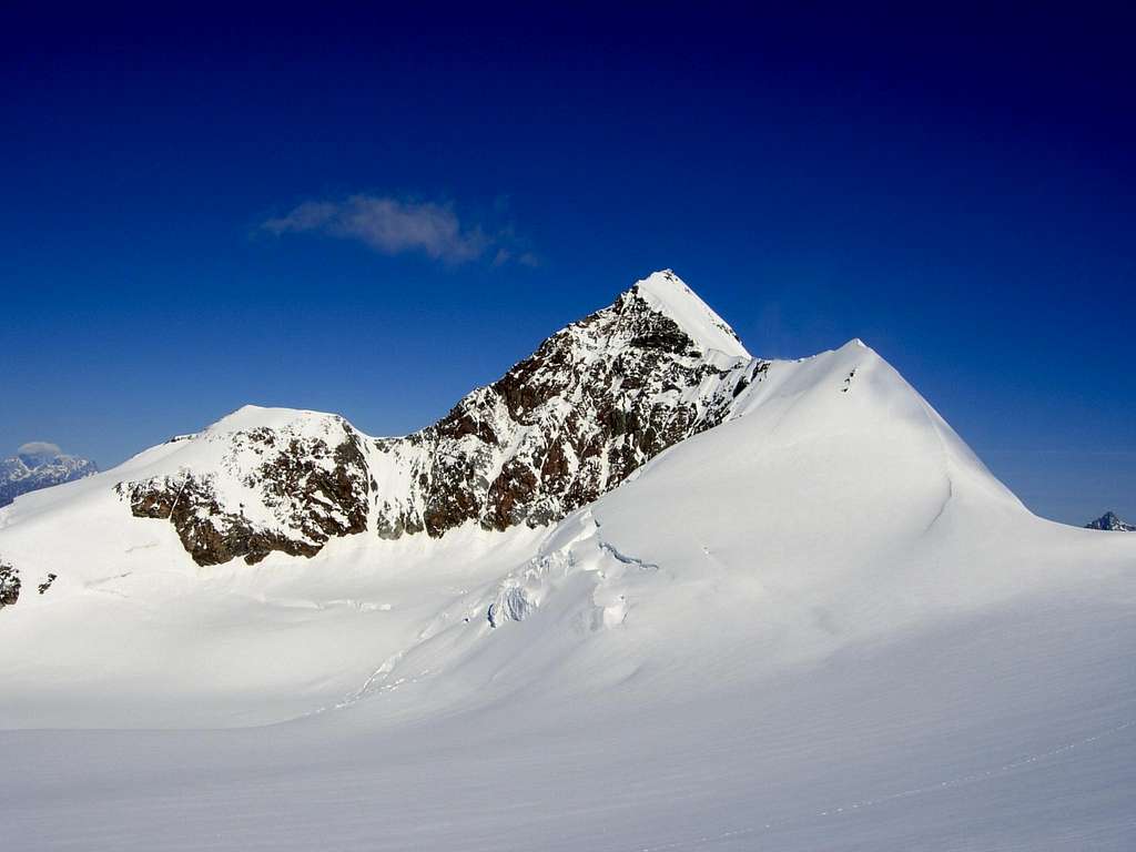
The Eastern summit 4527 m is the highest point of the ridge, which is about 1000 meters long and crowns the high and ice covered North-East face, which is about 900 meters high. The Western summit is sowmewhat lower, 4479 m, but is considered a stand-alone summit according to the UIAA-list of Alpine 4000-meter peaks. Check here the complete list of the 82 alpine Fourthousanders and the 46 minor summits: Club4000.
The Eastern Lyskamm 4527 m is the 8th highest mountain in the Alps. It was first ascended in 1861 from the Lisjoch up the East ridge by a 14-man team (seven Englishmen, one Scotsman, and six Swiss guides) led by J. F. Hardy and including William Edward Hall. The normal route starts from the Lisjoch, which can be accessed from the Gnifetti/Mantova Huts. The route follows the route taken by the first ascenders. Eastern Lyskamm is often climbed as a traverse from the Feliksjoch (West), to the Lisjoch (East) or vice versa, a true classic.
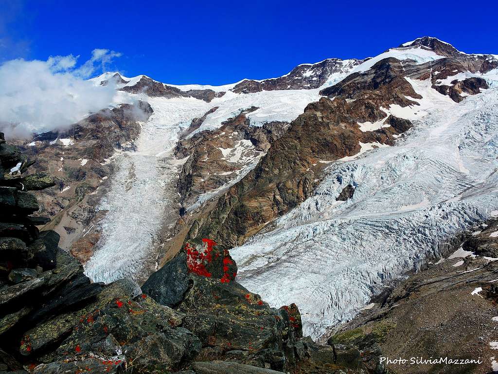
The South side is built up by a 500 m high rockflank, which is interrupted by a small hanging glacier. This rockflank stands on the Lys glacier with its two broken tongues. It goes down to the Gressoney valley.
Getting there
Two different road approachs are possible depending if coming from the Valle di Gressoney (Aosta) or from Val Sesia.
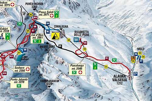
Access via Valle di Gressoney (Aosta Valley) - From the A5 Torino – Aosta Highway, exit to Pont St. Martin and take the Valle di Gressoney, getting to Gressoney St. Jean, Gressoney La Trinité and Staffal. From Staffal take the Cable car to Alpe Gabiet – Passo dei Salati - Indren
Access via Val Sesia (Piedmont) - From the A26 Highway exit to Romagnano Sesia and take the road to Varallo Sesia. Here continue following all the Val Sesia road to Alagna Valsesia. From Alagna Valsesia take the Cable car to Pianalunga - Passo dei Salati – Indren
Access to the Rif. Città di Mantova 3498 m and Rif. Gnifetti 3611 m
From Punta Indren, 3260 m (cable car from Alagna or Gressoney) get the Rif. Città di Mantova in 1 hour and Capanna Gnifetti in 1,30 h. In the lower part, it is a marked path (n. 5). The traverse of the glacier is not marked. From Punta Indren, traverse the ski-run, slowly going up on the Indrenglacier till you reach the outstanding rock band above which the Mantova-hut is situated (yellow-red signs). Climb up the rock steps (fixed ropes) to the hut. To reach the Capanna Gnifetti from the Rifugio Mantova Hut cross the glacier going up over the E-side of the glacier to the N and at the end on the rocks to the Gnifetti hut. This will take up to 30 minutes longer.
From the hut, you go up over the E-side of the Lysglacier to the N and at the end over rocks to the Gnifettihut.
Route Description
Eastern Lyskamm Normal route - UIAA Scale
Summit altitude: 4527 m
Difficulty: Alpine AD-
Vertical gain 1027 m from Rifugio Mantova, 915 m from Capanna Gnifetti
Exposure: E
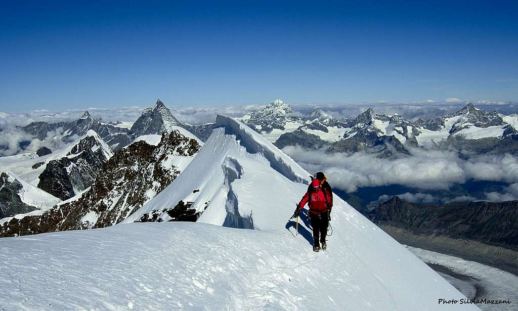
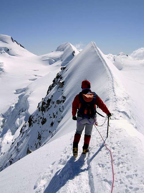
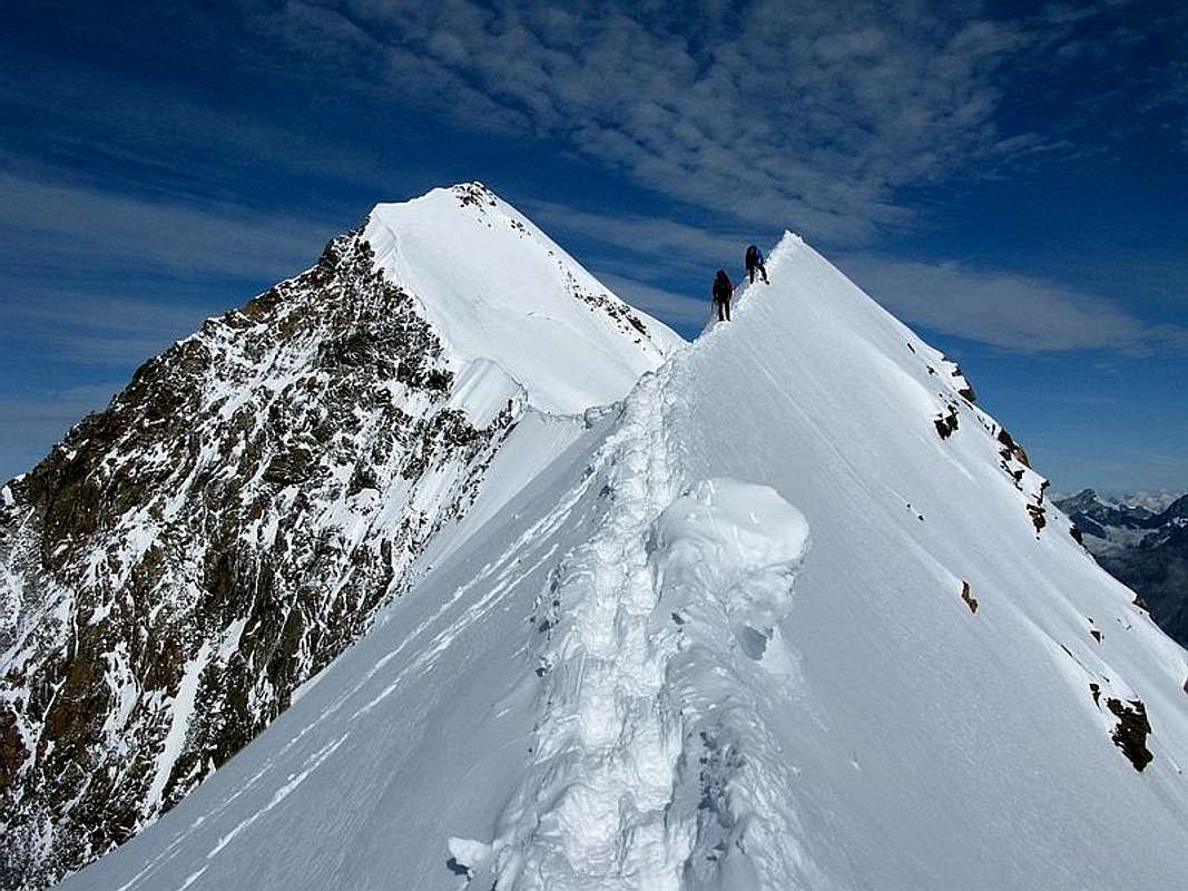
An awesome ridge, sharp, exposed and of great aesthetics.
If starting from the Refuge Mantova reach the Capanna Gnifetti. Behind the Gnifetti hut take the usually wide track that runs on the Garstelet glacier on the southern edge of the rocky spur that supports the Capanna Gnifetti. Climb up the Lys glacier on a couple of steeper slopes next to the seracs of the Northern slope of the Pyramide Vincent until you reach the Balmenhorn, on the right in the direction of the ascent, on the top of which it stands the statue of Cristo delle Vette. Coming in sight of the Colle Lys leave to the right the wide track to Punta Gnifetti and head to left reaching the saddle at the base of Lyskamm Eastern ridge. If the berschgrund (terminal crevasse) allows it, start immediately to climb along the sharp steep ridge (45°), otherwise cross diagonally upwards to reach the ridge, which is always exposed and sharp before getting the Cima della Scoperta 4335 m. From here the ridge become more gentle, but it's necessary to pay close attention to the huge frames that protrude to the South side, until you reach the last steep ridge.
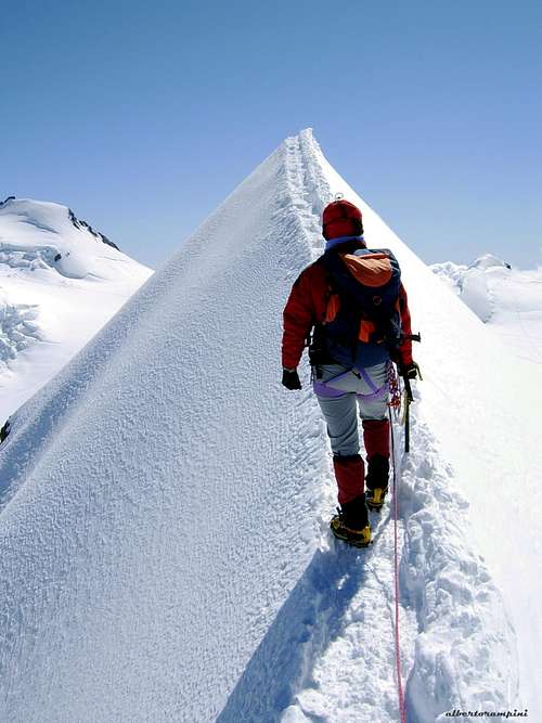
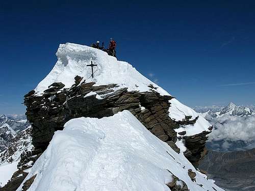
In the narrower and more airy sections it is more convenient to lean slightly towards the NE sideThis turns out to be again a steep slope (45°) quite open, where the exposure is not so great as in the first stretch, but where it's always convenient to pay attention to the frames. In the narrower and more airy sections it is more convenient to keep slightly towards the NE side. After the confluence of the South ridge (Sella ridge) from the left, some short and easy steps on the rock lead to the summit.
Descent: from the East summit (the highest) you can continue to the West summit or descend by the same route.
Essential Gear
Rope, helmet, ice pick, crampons.
Red Tape
No fees no permits required
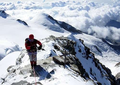
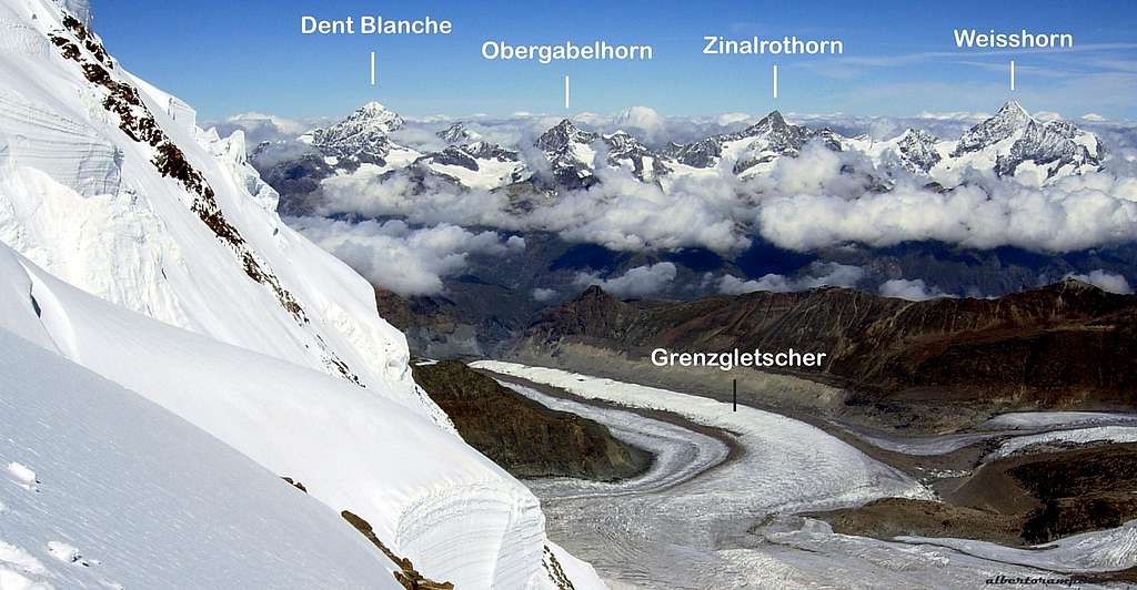
Summit views
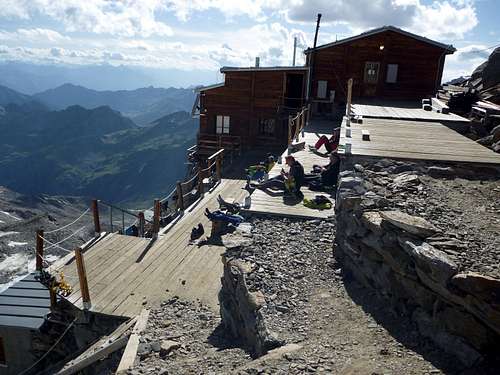
Huts
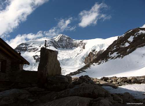
- Rifugio Città di Mantova m. 3470
Situation: Garstelet Glacier
Open: from June to September
Guardian: Guide di Gressoney
Size: 85 persons Winter shelter: 15 persons
Phone: +39-0163-78150/Mobile: +393470802910
Situation: Garstelet Glacier
Open: from February to April and from June to September
Size: 176 persons
Winter shelter: 4 persons
E-mail: info@rifugimonterosa.it
When to climb
Best period is from June to September
Meteo
Meteo Valle d'Aosta
Meteo Switzerland
Guidebooks and maps
 |
 |
 |
- Guidebooks
- "Il grande libro dei 4000" by Marco Romelli, Valentino Cividini - Idea Montagna Editore, 2015
- “Tutti i 4000” – L’aria sottile dell’alta quota” – CLUB 4000 CAI TORINO – Vivalda Editori
- “The 4000 of the Alps” by Richard Goedeke (CAAI) – All the normal routes to the 4000m. summits of the Alps
- “I Quattromila delle Alpi” by Karl Blodig and Helmut Dumler – Zanichelli Ed.
- "Monte Rosa2 Gino Buscaini - Guida dei Monti d'Italia C.A.I.-T.C.I.
External links
Lyskamm at www.4000er.de Images, routes, coordinates and more information about the highest peaks of the Alps
Lyskamm at Camptocamp - Description of all major routes on Lyskamm; Partly in English, mostly French
Official Website Zermatt (CH) and Alagna Valsesia (I)
Photos of all the Monte Rosa peaks: Monte Rosa 4000
Mountain Guides for climbing Lyskamm: Guide Alpina Alagna in Alagna, Alpincenter Zermatt in Zermatt
Weather Forecast by mountain-forecast.com