


-
 3822 Hits
-
 79.78% Score
-
 11 Votes
|
|
Area/Range |
|---|---|
|
|
45.77860°N / 7.79092°E |
|
|
Hiking, Mountaineering |
|
|
Spring, Summer, Fall, Winter |
|
|
Note
La montagna chiama i suoi figli, ed essi rispondono fedelmente al suo appello… Osvaldo Cardellina, Diario alpinistico, 1964-65 Page texts: @ OsvaldoCardellina "Osva", passed away on May 2, 2022. Page owners: Christian Cardellina e Osvaldo Cardellina. Any updates from September 12, 2022: Antonio Giani, page administrator, friend and climbing companion. Testi della pagina: @ OsvaldoCardellina "Osva", scomparso il 2 maggio 2022. Proprietari pagina: Christian Cardellina e Osvaldo Cardellina. Eventuali aggiornamenti dal 12 settembre 2022: Antonio Giani, amministratore della pagina, amico e compagno di salite. |
Total Estoul Overview
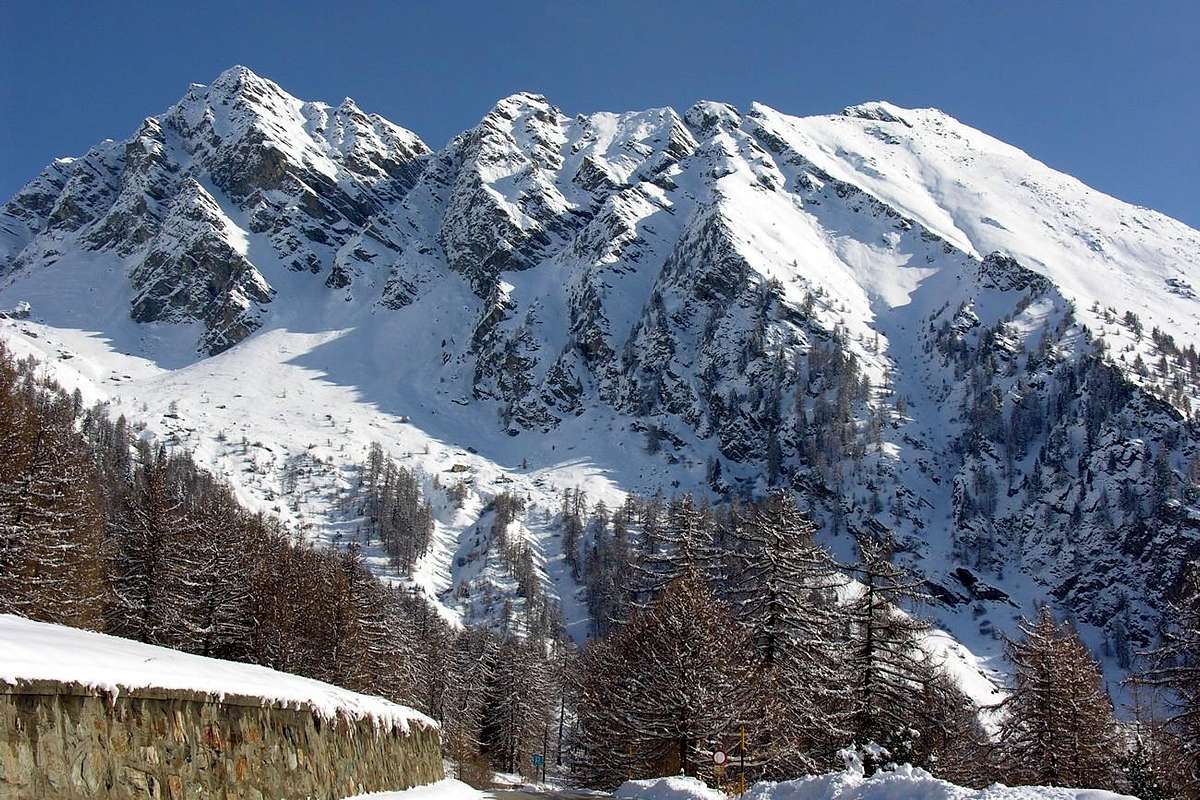
As we have said in regard to the previous page on the Sector Palasina, Estoul "Conca" (Basin) is divided into three separate and distinct areas delimited precisely by the cardinal points of the both ridges that divide. In this deal the Conca directly above the Hamlet and small Resort of Estoul that opens above the same and culminates with the two beautiful Lakes of Estoul and Chamen at the foot Tip Valnera or, in the dialect of the Ayas Valley, Valdònierhòre. From the same drop to surround this lonely dock two crests almost parallel: the first, after ascent to Mont Bieteron, softens on its Southerner slopes or Mont Palòn to finish above Lake Literan, at the entrance of the Vallon real Palasina. The second in Southeast declines towards the Bocchetta ("Little Nozzle") of Eclou, whence, but slightly more to the South-southeast, through the three distinct Summit of Mont Ciosé for the local inhabitants Mont Chose while for "Gressonards" is the Staller Horn or Horn overlooking the village with this name, and then go to "die" above the important Ranzola Hill, that communicates with the Gressoney Valley. Over the ridge dividing divides with a branch towards Mont Néry also Becca Frudière and a second, less important and facing West, act to "close" the Estoul Valley separating it from the next one of Graines/Frudiera. But the latter area will be part of the next and final work to "more Southerner", analyzing it with a 360° the entire Estoul Basin. This area, compared to that of Palasina, does not offer many opportunities and variables in search of routes being a vallon "closed and tight"; the basic itinerary is the one to the two lakes, but you can try something new going to explore some of the walls and, most importantly, crossing, not always easy, on ridges. As a last thing to point out that the quality of the rock is poor, rotten, broken and often covered with grass and therefore requires a certain amount of caution. Despite these remarks and considerations, it can be safely said that this walloon is well worth a visit, definitely helped by good private farms dirt roads in the first section make it easy to approach even in not good weather allowing even beautiful hikes, as well as Ski-Mountaineering and Climbing, with Snowshoeing or simply, with little snow, walking.
 |
 |
 |
Com'abbiam già precedentemente detto ed illustrato a riguardo della prima pagina concernente il Settore Palasina, il Bacino d'Estoul dividesi in tre separate e ben distinte aree delimitate in modo preciso sia dai punti cardinali che dalle creste spartiacque. In questo trattiamo la Conca direttamente sopra il Villaggio di Estoul che s'apre al di sopra del medesimo e culmina con i due bei Laghi di Estoul e Chamen alle pendici della Punta di Valnera o, nel dialetto della Valle di Ayas, Valdònierhòre. Dalla medesima scendono a cingere questo bacino solitario due creste pressocché parallele: la prima, dopo essere risalita con una cresta molto frastagliata al Mont Bieteron, s'addolcisce sulle sue pendici Meridionali o Mont Palon per indi terminare sopra il Lago Literan, all'ingresso del Vallone vero e proprio di Palasina; la seconda declina a Sudest verso la Bocchetta di Eclou, donde, ma più leggermente a Sud-sudest, attraversa le tre distinte Sommità del Mont Ciosé, per gli abitanti locali Mont Chose mentre per i "Gressonari" é lo Staller Horn ovvero il Corno che domina il villaggio con codesto nome, per andare poi a "morire" all'importante Colle della Ranzola, comunicante con la Valle di Gressoney. Oltre la cresta divisoria si divide con un ramo verso il Mont Néry o Becca di Frudière ed un secondo, meno importante e rivolto verso Ovest, atto a "chiudere" il vallone successivo separandolo da quello di Graines/Frudiera. Ma quest'ultima area farà parte del prossimo e conclusivo lavoro rivolto alla parte più "Meridionale" dell'area, analizzando così con un giro a 360° l'intero Bacino nel quale par "adagiato" il Comprensorio d'Estoul. Questa zona, rispetto a quella di Palasina, non offre tante opportunità e variabili nella ricerca degli itinerari essendo un vallone "chiuso e ristretto"; l'itinerario di base risulta quello verso i due laghi, ma si può cercar qualcosa di nuovo andando ad esplorarvi alcune pareti e, soprattutto, nella traversata, non sempre facile, di alcune creste. Com'ultima cosa da sottolineare la qualità della roccia che é scadente, molto rotta e spesso coperta da manto erboso richiedente una certa dose di cautela e buona prudenza. Nonostante ste considerazioni si può tranquillamente affermare che questo vallone merita una visita, sicuramente agevolata dalle buone strade poderali che nel primo tratto facilitano l'avvicinamento anche nella non buona stagione permettendo anche belle escursioni, oltre che Sci-Alpinistiche, con le Racchette da neve o a piedi.
Getting There
BY CAR:
- From TORINO, MILANO, etc: Motorway A5. Exit at IVREA or Quincinetto (PIEDMONT) From IVREA Town: in West (Southern side) to Pont Saint Martin, Verrès Municipalities in East from Aosta Town. From Courmayeur Resort: in East-southeast to Aosta, Nus, Chatillon, Saint Vincent, Verrès Municipalities. From Verrès to Val d'Ayas Valley From Verrès (549m), with Regional Road, to Challant Saint Victor (765m), Challant Saint Anselme (1.060m), Brusson (1.332m) Municipalities; wanting, continuing to Northwest to Antagnod-Ayas (1.709m) Commune, below Mounts Tantané and Zerbion also in North towards Champoluc (1.570m) and Saint Jacques(1.670m) Communes at the end of Evançon or Ayas Valley and under the Western side of Monte Rosa (Rollin Hump, Breithorns, Pollux and Castor).
- From FRANCE: through the Mont Blanc Tunnel to Entrèves/Courmayeur. By Little Saint Bernard Pass, closed since November until half May to La Thuile Valley - Pré Saint Didier - Aosta - Verrès Municipalities. It is not necessary to take Motorway A5: you can drive on SS.26, in the direction of AOSTA - IVREA - TURIN.
BY PLANE:
- Aeroporto "Corrado Gex" Saint Christophe (Aosta).
The Summits
This second sector, certainly less extensive than this of Palasina, comprises a lower number of mountains with and without name. Always starting from the Southwest to Southeast to pass, we have three important points to consider:
1) - Mont Palòn, or Shoutern shoulder of Mont Bieteron, with its base on Lake Literan;
2) - the Tip Valnera or Valdònierhòre as North Summit of this narrow isosceles triangle and
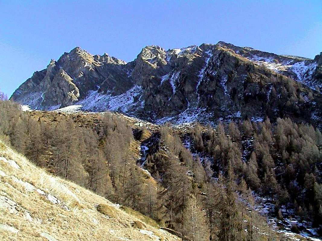
3) - right at the base of the Hill Ranzola. The first part, already seen in the area of Palasina but on its Western side, once again on the opposite, more or less the same characteristics with the difference that while in the Northwest Mont Bieteron presents a steep wall, probably still a virgin, on the Northeast exhibits the same steep and treacherous rocky slopes covered with turf. From the Valnera Summit, orographic important point, go down first to the Southeast until the "Bocchetta" of Eclou and then further to the South-southeast ridge dividing the watershed from the Ayas Valley of Gressoney that formed the three Summits of Mont Ciosé or Staller Horn, ends above the Ranzola Pass, important and popular crossing point between Brusson Gressoney Saint Jean. From the hill the the dividing ridge continues South towards Frudière Pass, Marienhorn, Mont Nery and, after Chasten Pass, Mont Voghel and two Dames de Challand (Becca of Vlou and Becca Torché). All these mountains are composed of rock is not good, route and often covered with debris or even grass; wherefore are best paths on the ridge, even if the same require the same care. From the point of view "exploratory" look at the merits of the three Western Slope Ciosé, gullies and couloirs formed by several rocky ribs alternating with debris that accompany the same parallel; but even here, in my opinion, you should not hope for great things, and, rather, the hazards (in particular falling rocks) far outweigh the satisfactions of climbing. But it is not with these intentions that you must visit this walloon. Other aspects are provided by the same and which offer good walking and hiking in a beautiful environment still intact and safeguarded; the feeling of seclusion and tranquility, along with the unusual landscapes, especially on Chain Pink, are a guarantee of a wonderful day in the mountains. The same aspect is even more enhanced during the winter season through the practice of Ski-Mountaineering or, more modestly and laboriously, the one with the Snowshoes. But even a good walk on foot to the lakes bestows rewarding gratifications, especially to those who love the places naturally reserved.
 |
 |
 |
Questo secondo settore, sicuramente meno esteso di quello di Palasina, comprende un numero inferiore di montagne con e senza nome. Partendo sempre da Sudovest per transitare a Sudest, abbiamo tre punti importanti da prendere in considerazione:
1) - il Mont Palon, o spalla Meridionale del Bieteron, con alla sua base il Lago Literan;
2) - la Punta di Valnera o Valdònierhòre come vertice Settentrionale di questo stretto triangolo isoscele e
3) - all'estremità della base destra il Colle della Ranzola. Il primo tratto, già visionato nell'Area di Palasina, ma sul suo versante Occidentale, ripropone sull'opposto, più o meno, le medesime caratteristiche con la differenza che, mentre a Nordovest il Bieteron presenta una ripida parete, probabilmente ancora vergine, su quello Nordest il medesimo espone ripidi ed infidi pendii rocciosi ricoperti da manto erboso. Dalla Punta di Valnera, importante punto orografico, scende dapprima verso Sudest fino alla Bocchetta d'Eclou e poi maggiormente a Sud-sudest una cresta divisoria la Valle di Ayas da quella di Gressoney che, formate le tre sommità del Mont Ciosé o Staller Horn, va a concludersi sopra il Colle della Ranzola, importante e frequentato valico tra Brusson e Gressoney Saint Jean. Dal colle lo spartiacque prosegue verso Sud in direzione del Passo di Frudiera, del Marienhorn, del Mont Nery e, dopo il Colle di Chasten, del Monte Voghel, delle due Dames de Challand (Vlou e Torché), mentre un ramo secondario piega più ad Ovest verso la Punta della Garda, atto a separare il Vallone d'Estoul da quello adiacente a Sud di Frudiera. Tutte queste montagne sono costituite da roccia non buona, rotta e sovente ricoperta da detrito se non addirittura erba; per la qual cosa sono da prediligersi i percorsi in cresta, anche se i medesimi richiedono identiche cautele. Dal punto di vista "esplorativo" un'occhiata la merita il Versante Occidentale dei tre Ciosè, formato da canaloni detritici alternati a diverse costole rocciose che accompagnano parallelamente i medesimi; ma anche qui, a mio avviso, non si deve sperare in grandi cose e, piuttosto, i pericoli (in particolare caduta di pietre) superano di gran lunga le soddisfazioni dell'arrampicata. Ma non é con questi intenti che devesi visitarlo. Altri son gli aspetti offerti dal medesimo e tali d'offrire buone passeggiate ed escursioni in un ambiente ancora integro e salvaguardato; la sensazione di isolamento e tranquillità, insieme ai panorami inconsueti, soprattutto sulla Catena del Rosa, risultano a garanzia d'una splendida giornata trascorsa in montagna. Lo stesso aspetto viene ancora di più esaltato durante la stagione invernale tramite la pratica dello Sci-Alpinismo oppure, più modestamente e faticosamente, quella con le Racchette da neve. Ma anche una buona passeggiata a piedi verso i laghi elargisce splendide gratificazioni. With departure from Estoul the choice is limited, but you can try something new ... but doing good attention to the rock quality. (For the approaches see "The Lakes" & "Where do we go fishing?" ... but the way is almost unique)
A Summit which you want to go?
2) - Mont Bieteron (+; 2.763m). Through the
a) - Southwest Slope of Mont Palon from Literan Lake and crossing through South-southwestern Slopes. From big shoulder down through the rocks easy but exposed a short distance; then continue by flexing just to the North-northeast and through a small track, which often gets lost between the grassy slopes, with some small rock (sometimes delicate passages of I°) to reach the Summit (EE/F+; 2h'50/3h'10 from the lake or, more in bottom, from dirt road). This side can be climbed as Ski-Mountaineering or Snowshoes. Note: you absolutely can not draw down the grassy slopes of the East-Northeast Slope to the Lakes Estoul, Chamen, because really treacherous and dangerous, even in snow absence but covered grass as "Olline", very slippery. There is to be noted that, while the uphill path is "acceptable", downhill, especially with wet grass, it is really "lazy" (personal exp.); should return to Palòn and navigate to the Northeast to the Lakes Estoul. Or through the
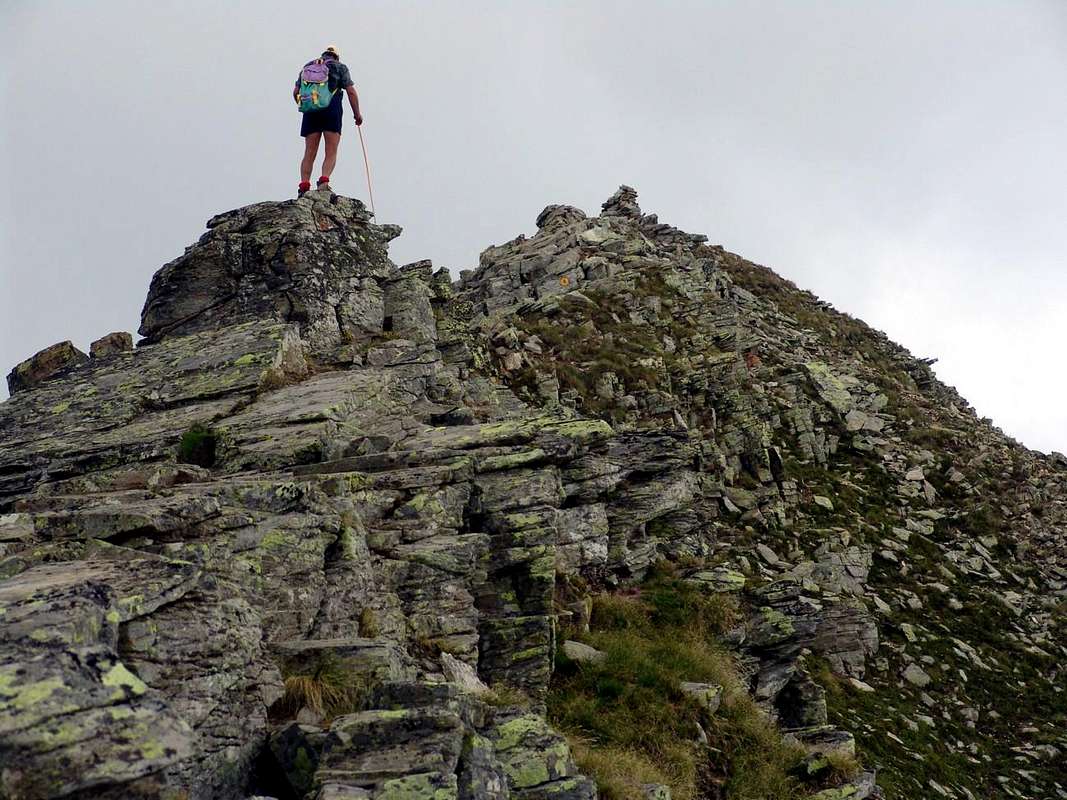
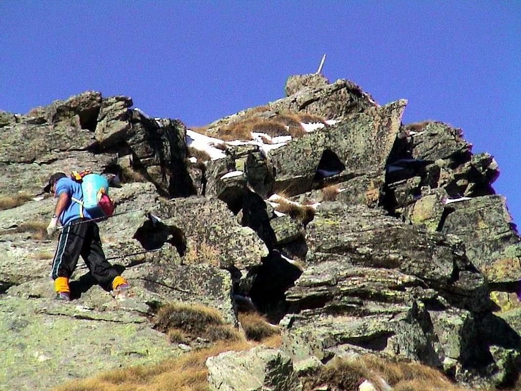
b) - indented North Crest from small saddle (2.681m); in this regard see the various remarks made about the underlying Valdònierhòre, as well as the above picture where the profile of the ridge against the sky is taken from the West side or from the Vallon Palasina.
3) - Valnera Summit or Valdònierhòre (+; 2.754/6m). Through the
a) - Southwest short Crest from little saddle 2.681 meters, reached with path and traces in Northwest from Estoul and Chamen Lochs (F/F+; 0h'50/1h'10 from the both or 3h'00/3h'15 from the parking of Resort). Also
b) - can be reached with an "acrobatic" and complete crossing in descent from Mont Bieteron (see Jags), probably traveled only once or twice, but for which there is a relationship. Surely this small hilltop, but important node topography, it is more easily accessible via this side, ie from Lakes Estoul and Chamen into homonymous vallon Probably this ascension is still waiting to be carried uphill (E/F; 1h'10/1h'20 by both lochs).
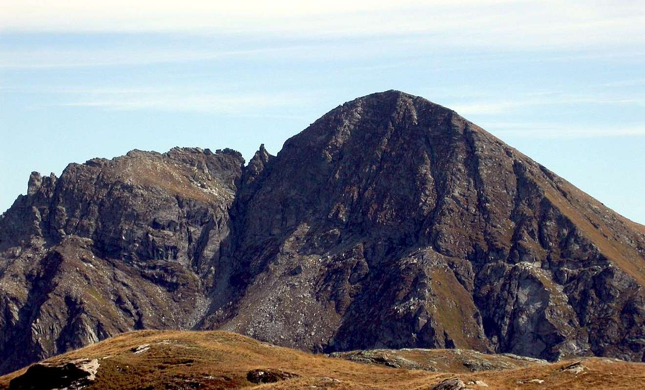
4) - Mont Ciosé or Chose or Tiosé also Staller Horn Northern Summit (2.662m). The first Summit of the semi circular following order of description (but actually the third and last starting from Ranzola) and the Northern that is, among the three, even the highest, then the true Top of Staller Horn (by Gressoney inhabitants), although that is certainly the most popular South (from information on the spot always very scarce transits). After a sharp carving 2.643 meters rises culminating in a triangular shape. The report cited (see following Summit Central) specifies the technical sequence of difficulties, it is not as clear-cut distinction in the same three summits. Following the same and relying on new maps (L'Escursionista "Val d'Ayas Val di Gressoney Monte Rosa", 1:25.000 of the year 2007) summarized thus: the collar between the Central and Northern Summit is almost faithfully follows the ridge beyond the Summit 2.680 meters (2.662 meters on the Map) and the subsequent Northern Antesummit; down to avoid a wall about 60 meters leans first on the left (West) and then right over a ledge. Then continuing in a linear manner to 10 meters through a groove facing to the right (Northeast) reaches a notch (II°/I°), after which continue over a stretch jagged reaches another great tower; it wanders right into a steep grassy slope and through a couloir and rocks in final part, you reach a second. Get off at the next carving, the smaller of the entire ridge, through a terminal wall about 10 metres vertical (III°) and with a slight slope to get to the Bocchetta Pass (2.526m; for the local inhabitants Bocchetta of Eclou). The above Map marks in succession these quotas altitude: 2.643m, 2.662m, 2.631m, 2.537m, 2.555m and 2.522 meters to the carving; we leave the task to a few young. (A; 1h'15/1h'30 from Central to Bocchetta of Eclou; 4h'00/4h'30 combined with very long traverse coming from Ranzola Hill; 8h'00/8h'30 from Estoul parking, round/trip). Crossing technically not difficult but it requires good experience and research capacity of the via. This Summit is a little secluded and, once achieved, it must necessarily go down to the "Little Nozzle" of Eclou, otherwise (see next point) to go back to the collar with the Central Summit and get off this Westward to vallon floor.
 |
 |
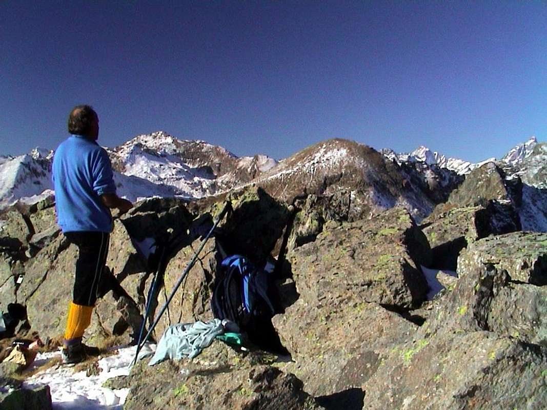 |
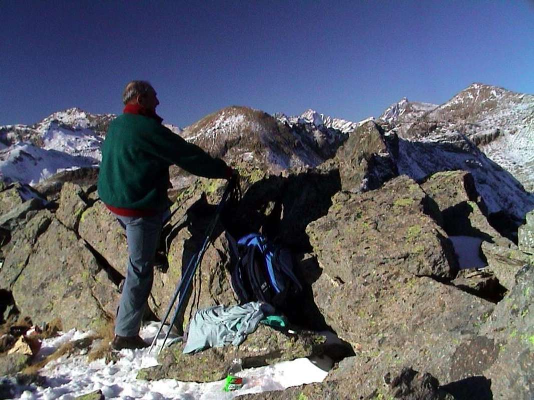
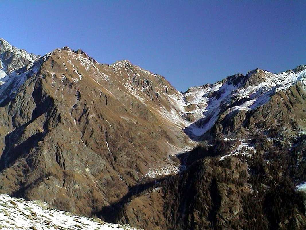
5) - Mont Ciosé Central Summit (2.638m). For this part of the ridge, like the previous one, not having personally done the same, you should use the report appeared on pages 298/9 Guidebook of the C.A.I./T.C.I. "Monte Rosa" by Gino Buscaini, as private information received from the same by Alessandro Gogna, author of the first crossing in direction South/North August 14th, 1982. We describe the crossing of the Central Summit from South to North: from the South Summit still continue to the West-northwest with a slight descent to following altitude reaching the next grassy saddle (2.571m; a passage of II°-); from this ridge is addressed decisively towards the North and avoided Southwest a first gendarme with drop of about 20 meters (I°; after this climb the ridge via a small gully of debris) on the Southwest ridge, cross in succession the Quotas of altitude 2.586m, 2.583m, 2.609m (one step III°- on the second gendarme and climb the next great tower). With some workarounds to the right (East) prevents a pointed third spire reaching the next notch (EE/A; 1h'00 from Southern Summit; 2h'45/3h'15 from Ranzola; EE/A; 6h'30/7h'00 from Estoul, round/trip). You can probably go down to the West (see photo Overview) into large channel between Central/North Tips.
6) - Mont Ciosé Southern Summit (2.647m). From Estoul parking with private dirt farms road in East towards Fenilliettaz little Village (1.840m), alternative 1.850 meters to Upper Fenillettaz and Fontaine Pastures, cross to Moucheroulaz Alpage (1.871m; signal no transit), Murassaz (1883m), Praz Barmasse Désott Pastures (1.928m; signal no transit to Ranzola Hill), Alp Fenêtre (2.057m, 2.083m) to pass. From Ranzola Hill also Arescoll (2.171m), leaving right the vroutes to Gressoney Valley and to Punta della Regina (Queen Summit), continue in North on South-southeast Crest; reach before, through a steep grassy slopes, a partially rocky promontory 2.401 meters, the following small saddle 2.382 meters and the subsequent altitude 2.403 meters. Climbing, through rotten and broken rocks with grassy, just on left and below the thread of ridge to Quotes 2.473m, 2.559m; 2.621m. From this point the ridge splits into two: one branch goes to the East-northeast, forming a "crestone" above the Staller Walloon, while another continues more to the Northwest in the direction of the Southern Summit. Get off ten metres to one notch (I+°/II°-; a short passage delicate and very exposed in the presence of ice) and continue on the ridge with easy climbing sections and walkable; bypassed a final roughness 2.629 meters, in drinking to reach the Southern Top. (2.647m; EE/A; 1h'20/1h'35 from Ranzola Hill; 3h'30/4h'00 from Estoul parking; 6h'00/7h'00 round/trip always Estoul). It can also be done as a day trip Ski-Mountaineering (you should leave your skis at Col Ranzola or on the promontory immediately above) or with Snowshoeing. By making this choice to leave the equipment must you have to go through this route. Descent Variant: to gain time and especially in the winter with the snow is transformed, it should make the descent from the Southern Summit directly to the South-southwest in the direction of the dirt road between the Alpages Praz Barmasse Damon (2.038m) and Fenêtre; in this case, leaving immediately to the right (West) the profile of a small rocky outcrop, descend into a small and wild walloon amongst debris interspersed with large blocks grass and bushes. Do not deal with this descent in deep snow or non-transformed and then springs, but fall through the ridge used uphill. This option makes sure to save time, but is quite boring and not at all profitable. You can not have everything making your choice!
The Lakes" & "Where do we go fishing?
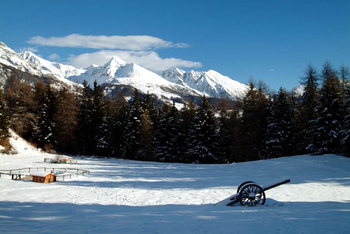
Even for the lakes that the same considerations apply to the mountains on this walloon. Two of them, Estoul and Chamen (this is much more extended), are fairly well known and popular, while others (two in the meeting at an altitude of 2.335 meters of paths that go from Fontaine/Chanlonchère and Fenillettaz/Moucheroulaz) we mention only one to altitude of 2.455 meters, immediately to the West of the two largest. However, not comparable with those of Palasina, even these have their particular features such as insulation.
MAPS:
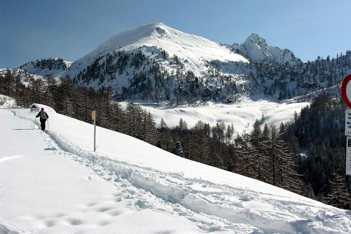
1) - Estoul Lake (2.431m). This is the first of the two Lakes Estoul, located in the walloon of the same name that opens immediately to the Northeast of the small Resort; placed between Mont Bieteron to the West and the Bocchetta of Eclou on the opposite side from his bank down the Torrent de Chamen which slides along the axis of the North/South, meets with Torrents Reine (from Ranzola Hill) and of Graines (from the two Lacs de Frudière) at the Pasture of Ponteille (1.570m) in the nearby Walloon of Frudiera. It reaches from Estoul going through the private dirt farms road up to the next two forks 1.901, 1.958 meters at the entrance of the Bois (Wood) de Moucheroulaz. From this and with the first part of dirt road to the Alp Chanlonchère (2.012m), just neighbor the cross 1.993 meters with the intersection to the Northeast, and through a good path that reaches the small promontory 2.177 meters; from this, crossing Chamen Torrent, the same goes steered to the North. Reached 2.335 meters altitude near two ponds and a subsequent source, in a short time reach the lake, which is the lower of the two Estoul (T/E; 2h'30/2h'45, from Estoul).
2) - Chamen Lake (2.451m). The second lake, said Chamen, is located just North of the former; has an extension of nearly five times higher than the previous year; divided into two parts of which one is lower but emits the Eastern emissary that binds to Lake Estoul. Sited at the foot of the Valnera is lapped on the right (Northeast) from the path, you reach the saddle 2.681 meters, reaches this Summit. (T/E; 2h'45, Estoul).
3) - Unnamed Pond (2.455m). This microscopic and double pond is "perched" under a small rock band of the Easten Slope of Bieteron; rarely, although very close behind the other two, since it reached out "Normal Route" for the Summit Valnera. (0h'15 from Estoul or from Chamen Lakes).
Anche per i laghi valgono le stesse considerazioni inerenti le montagne concernenti questo vallone. Due di loro, Estoul e Chamen (questo ben più esteso), son abbastanza conosciuti e frequentati, mentre degli altri (due presso l'incontro a quota 2.335 metri dei sentieri che salgono da Fontaine/Chanlonchère e da Fenillettaz/Moucheroulaz) ne citiamo solo uno a quota 2.455 metri, subito ad Ovest dei due maggiori. Comunque, non paragonabili con quelli di Palasina, pure questi possiedono le loro peculiarietà come l'isolamento.
 |
 |
 |
Campings
Remember that free camping is forbidden (except for emergency reasons, over 2.500m, from darkness until dawn).Mountain Conditions
- You can get meteo information at the official site of the Regione Valle d'Aosta:
- Valle d'Aosta Meteo
- Meteo: You can find more weather information on the website 3B Meteo:
- Meteo Brusson
Books and Maps
BOOKS:- "Guida delle Alpi Occidentali" di Giovanni Bobba e Luigi Vaccarone C.A.I. Sezione di Torino Volume II (parte II), 25 Maggio 1896.
- "Guida dei Monti d'Italia" Alpi Pennine (Vol. 2) di Gino Buscaini - Club Alpino Italiano/Turing Club Italiano, Luglio 1970 (In Italian).
 |
 |
- I.G.C. Istituto Geografico Centrale Torino "IVREA-BIELLA e Bassa Valle d'Aosta" 1:50.000.
- I.G.C. Istituto Geografico Centrale Torino "Cervino e Monte Rosa" 1:50.000.
- L'Escursionista editore "Alte Valli d'Ayas e del Lys" Carta dei sentieri (8) 1:25.000.
Important Information
- REGIONE AUTONOMA VALLE D'AOSTA the official site.
- FONDAZIONE MONTAGNA SICURA Villa Cameron, località Villard de la Palud n° 1 Courmayeur (AO) Tel: 39 0165 897602 - Fax: 39 0165 897647.
- A.I.NE.VA. (Associazione Interregionale Neve e Valanghe).
Useful numbers
- Protezione Civile Valdostana località Aeroporto n° 7/A Saint Christophe (Ao) Tel. 0165-238222.
- Bollettino Meteo (weather info) Tel. 0165-44113.
- Unità Operativa di Soccorso Sanitario Tel. 118.