
|
|
Mountain/Rock |
|---|---|
|
|
48.01173°N / 121.83256°W |
|
|
Snohomish |
|
|
2420 ft / 738 m |
|
|
Overview
When I first started contributing to Summitpost two years ago, I made an unspoken promise to myself that I would not post any summits that were less than 3000’ in elevation - I considered anything not exceeding this threshold as being ‘unworthy’ of a Summitpost page. Well, as they say, promises are made to be broken.
Once the snows of winter really start flying, I generally pack away the backcountry gear, as I’m not a huge fan of the avalanche beacon, probe, and shovel thing. In its place, I entertain myself with my favorite mode of transportation, the mountain bike. Thankfully, Snohomish County is blessed with literally hundreds of miles of private, DNR, and USFS logging roads that are accessible most months of the year. Some of these roads even lead to summits and panoramic views.
One of my favorite foothills that I visit on a regular basis is one I have unofficially dubbed ‘Explorer Hill’. Recently coming to the realization that I have never actually seen anyone else enjoying Explorer Hill, I began feeling a little guilty, and decided to rescind my ‘3000’ rule’. Explorer Hill takes its name from an impressive little waterfall that resides on its southwest flank. The falls, in turn, take their name from the King County Explorer Search and Rescue unit, which conducts its 'basic training' in this area from September through February each year. Members of Snohomish County Volunteer Search and Rescue (as well as their own Explorer Search and Rescue unit) also use this area for training.
Disclaimer: While I know for certain this summit does not have an official name, I do not know if local peakbaggers have already given it an unofficial name. I was unable to find any information online, other than Point 2420’. Until I hear differently, I will leave this page titled ‘Explorer Hill’. It seems to be a fitting tribute to a group that volunteers its time and efforts to save lives.
While Explorer Falls (WTA page) sees a number of hikers every week (just 1.2 miles from the gate), those continuing to the summit of Explorer Hill would be well advised to do so on a mountain bike. Round trip distance is a little over 12 miles, and elevation gain will be just under 2000’.
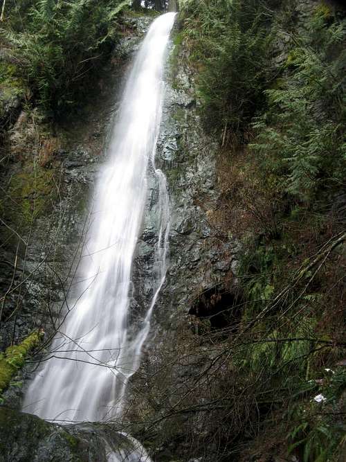
Explorer Falls
Getting There
Copied from WTA:Snohomish-Wenatchee exit off I-5 onto US2 in Everett. At milepost 10 turn left onto 100th St SE (Westwick Road). Just past the French Creek Grange, the road bears sharply to the left (north) and becomes 171st Ave. Continue on 171st Ave SE to a 4-way stop; turn right onto Dubuque Road (36th SE) go east on Dubuque Road for approximately 6 miles; turn left onto S Lake Roesiger Road; bear right at the Y to continue on S Lake Roesiger. Drive 2.3 miles take a right onto Monroe Camp Road. Drive 1.3 miles and then bear left at the Camp Brinkley sign and follow the road to end. There is a yellow gate blocking you from going any further and an area to park on the left.
Please note that there are a number of ways to navigate yourself to the Monroe Camp Road. Simply drive to the Lake Roesiger Store by whatever means works best for you - the Monroe Camp Road begins across the street from the store.
Upon arrival at the gate, you will be at the beginning of what I once knew as the E1000 road (I'm not sure if this designation is still used). If the gate is open, do not be tempted to drive in - this gate may be closed at any time. If you do happen to visit this area when the gate is open, stay out of active logging areas, and yield to all trucks.
UPDATE: (2-8-16) The roadbed just north of Lake Chaplain has been blocked off and tank-trapped. For this reason, it is now advised to use a different 'trailhead' if biking up Explorer Hill. It is located 0.7 miles before (west of) the original trailhead. It is located 1000' after crossing Woods Creek, at N47 58.591 W121 52.619. New map has been posted below.
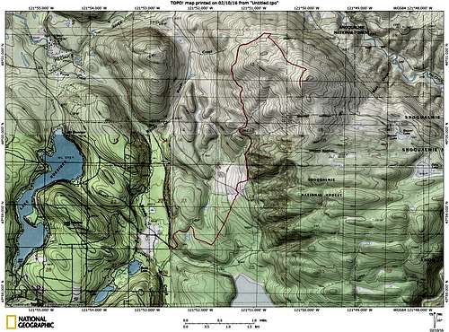
Updated approach map for Explorer Hill
Please continue to use the original map (posted below) for directions to Explorer Falls. If only walking to the falls, the original trailhead is still the best option.
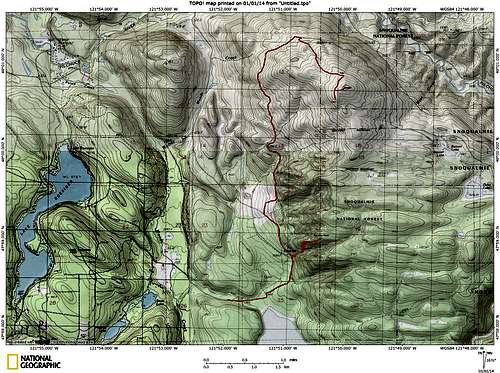
Explorer Hill route map. It is highly recommended that one use a mountain bike if heading up Explorer Hill. For those who insist on walking, it is probably slightly easier (and more aesthetically pleasing) to hike up the Explorer Falls Trail to "Top of the World", then walk logging roads north for 2.5 miles to the summit area.
Route
From the gate on the E1000 road, follow the mainline, avoiding the two spurs that turn off to the right. These spurs are very plainly marked with ‘No Trespassing’ signs, as they lead towards the Lake Chaplain reservoir. At the second right spur, the mainline will turn left and begin heading north. At about 0.3 miles past this point, keep your eyes open for a well-defined trail leading off to the right (N47 58.827 W121 50.879 Elev. 810’). This trail will lead towards Explorer Falls, which is just a few hundred feet from the road. Be sure to budget a few minutes into your day to visit these falls. Continue up the mainline for another 3.6 miles, to a major intersection located at N48 01.275 W121 50.707 Elev. 1750’. (Note: The mainline was washed out a few years ago 0.6 miles past the trail to the falls, so it has been slightly rerouted from the road shown on USGS maps.) At the intersection, turn right, and follow the well-defined spur (not on USGS maps) for approximately one mile to another intersection located at N48 00.832 W121 49.983 Elev. 2250’. From this point, you will have a great view of Mt. Pilchuck’s south flank, and a fairly expansive north through east view.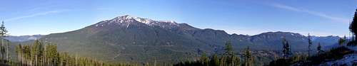
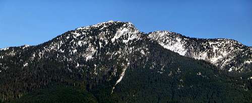
Explorer Hill pano - N to E
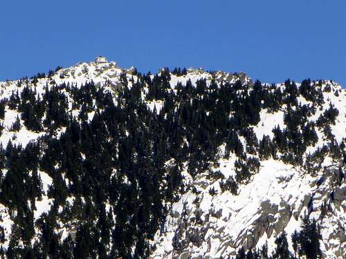
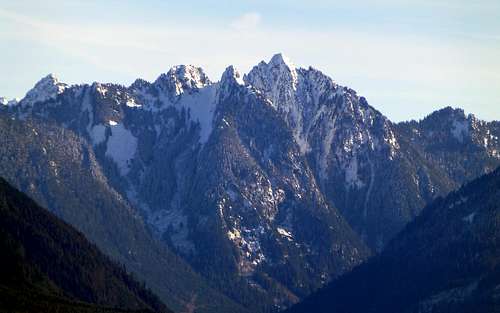
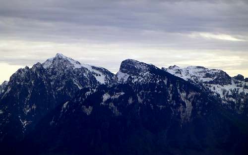
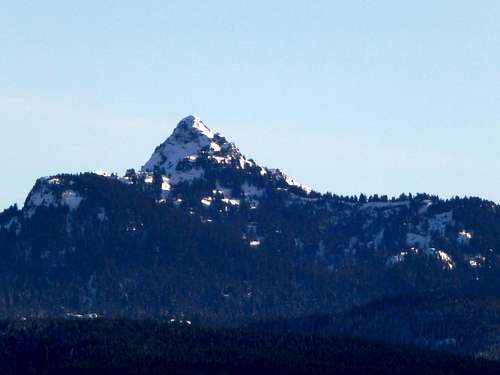
Mount Pilchuck from Explorer Hill (telephoto). If you look closely, you will see a hiker sitting on the lookout railing.
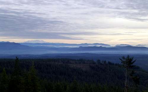
From the intersection, turn right, and follow this spur a short distance, until reaching a pile of logs located at N48 00.689 W121 50.142. At this point, park your bike, and scramble over the log pile. Continue a few hundred yards down this closed road, at which point you will find expansive views from east through northwest. On clear days, this vantage point will provide views of Rainier, Puget Sound, and the Olympics.

Explorer Hill pano - SE to NW
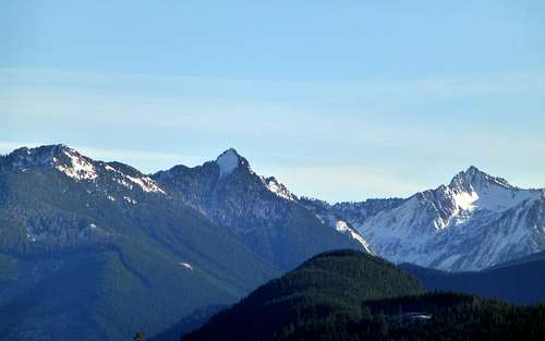
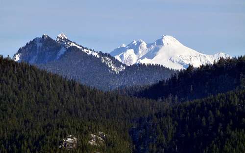
Greider Peak, Static Peak, and part of Ragged Ridge (Point 5145 in photo) from Explorer Hill. 'Little Blue Pill' can be seen at bottom of photo.
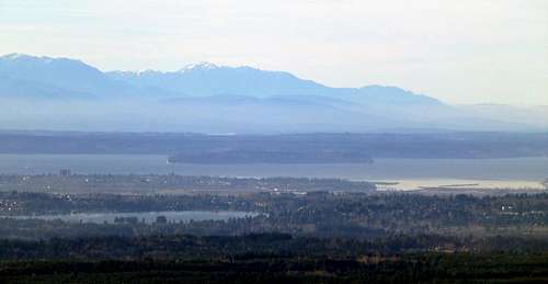
Olympics, Puget Sound, Hat Island, and Lake Stevens from Explorer Hill
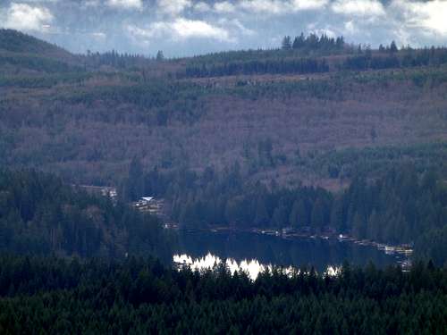
Lake Roesiger from Explorer Hill
For those who just have to stand on the true summit of Explorer Hill, continue up the unblocked spur where you parked your bike at the log pile. Within a few hundred yards, you will be on the summit. The view is really nothing to get excited about, but this point may be popular with peakbaggers as it boasts 840’ of prominence.
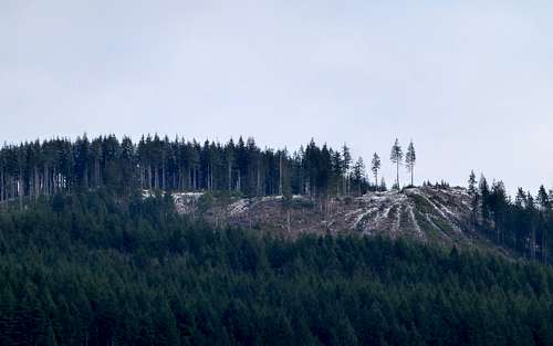
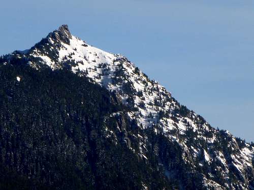
Top of Explorer Hill from Point 1250' (two miles west)
For those who have not had enough abuse, there are two lakes which reside just southeast of Explorer Hill’s summit, Beaver Lake and Echo Lake. While these lakes are certainly not alpine gems, they will give you something interesting to do if you have extra time. To get to these lakes, continue on the mainline 2.5 to 3.5 miles past the intersection at 1750’. If you are a true glutton for punishment, it is possible to continue several more miles to the end of the mainline, and scramble up ‘Little Blue Pill’, a 2670’ summit located immediately to the west of Spada Lake. This peak has no views, and is only of interest to prominence peakbaggers. Assuming one can legally cross the Culmback Dam at Spada Lake, this peak is better accessed from the east.
For those who do not own mountain bikes, and just insist on walking up Explorer Hill, there is an option which is more aesthetically pleasing (and slightly shorter) than walking up the E1000 mainline. From the Explorer Falls trail, turn right immediately after crossing the creek (about 100’ from the road). This very well-defined trail (better than most Forest Service trails) will switchback up to the right of the falls, then pass near the top of the falls (use extreme caution if going off trail in this area). Continue past the falls – the trail will switchback to the top of the ridge north of the creek, then follow the ridge crest to a clearcut located at 1600’. The trail will end at N47 59.005 W121 50.365, where it will intersect with a logging road. This point has been dubbed ‘Top of the World’ by members of ESAR, and gives limited views towards the west. From this point, one can follow logging roads for approximately 2.5 miles to Explorer Hill’s summit area. These roads are not shown on USGS maps, so it might be prudent to print up a satellite-view map from Google Earth or Google Maps if you choose this option.
Red Tape
A parking pass is not required at this 'trailhead'. Please note that the E1000 road will at times be used for logging operations. This has never been a problem for me in the past - be respectful, stay out of active logging areas, and yield to all trucks.When to Climb
Any time the E1000 road is not covered in snow. If you are able to bike to the 1750' point, the top of Explorer Hill will be within reasonable walking distance. As with all Western Washington mountain biking, it is recommended that you equip your bike with fenders during the winter months.