
-
 5227 Hits
-
 71.06% Score
-
 1 Votes
|
|
Area/Range |
|---|---|
|
|
40.02570°N / 20.87052°E |
|
|
Hiking, Mountaineering, Trad Climbing, Sport Climbing, Bouldering, Ice Climbing, Scrambling, Canyoneering, Skiing |
|
|
Spring, Summer, Fall, Winter |
|
|
8652 ft / 2637 m |
|
|
Overview
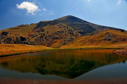
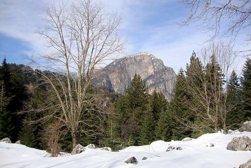
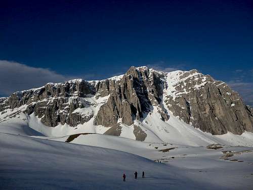
The Aoos valley is a river valley north of Ioannina in the Greek region of Ypirous. The large river of Aoos or else Vjosa flows through the valley and is fed by the four large mountains in the area: Mount Smolikas (2637m), The Tymfi massif (2497m), the Vassilitsa dual peaks (2249m) and, Trapezitsa (2022m).The area receives a lot of snow during the winter as many storms get 'trapped' between the peaks. The area is also home to the well known vikos gorge, an important canyon south of the Tymfi massif.
The Greek portion of the valley is walled by Konitsa on the west, the Vikos gorge on the south, the peak of Smolikas to the north and the Vassilitsa ski resort base to the east. The total area is somewhere under 565.2072 sq km with multiple villages but most notably the city of Konitsa.
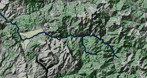
Aoos Valley Map
Denoted with purple is the Vikos gorge,
Denoted with orange is the peak of Astraka (2432m)
Denoted with green is the peak of Gamila (2497m)
Denoted with deep blue is the peak of Trapezitsa (2022m)
Denoted with yellow is the peak of Smolikas (2637m)
Denoted with deep red is the dual peaks of Vassilitsa (2249m)
Getting There
To reach the valley you have to head to the city of Konitsa. From there you can easily access the river, although to reach the Vikos gorge you will have to exit the Patras - Konitsa highway before Konitsa.From Athens you can take the E65 highway until Patras, from there head north through the Rio Antirio bridge and drive the E951 up to the city of Ioannina, from there continue north through E853 and about after 1 hour you will reach Konitsa.
To reach the village of Vikos you must exit for Aristi.
Mountains
The valley has 6 mountains with many more individual peaks. Sadly it has limited opportunities to peak bag through the peakbagger website. Here are all the links to the mountains:
Note that Astraka is considered a part of the Timfi massif although it is geologicaly a different mountain. Furthermore Gomara is also a subpeak of Vasilitsa but are due to road construction considered different mountains.
Things to do
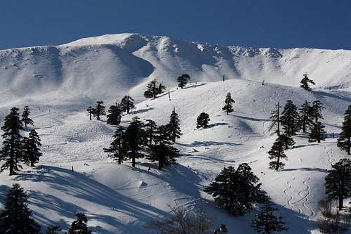
You can do many things in the park ranging from skiing, hiking to climbing and white water rafting. The park is very large in size and includes several villages, lakes, rivers and well; peaks.
| Hiking | Mountaineering | Canyoneering | Climbing | Resort Skiing | Touring/Mountaineering Skiing | White Water Rafting |
| Smolikas | Smolikas | Vikos gorge | Smolikas (Stontzi) | Vasilitsa | Smolikas | Vikos Gorge |
| Timfi | Timfi | Aoos gorge | Timfi (North) | Gomara | Timfi | |
| Vasilitsa | Astraka | Valia Kirna (Smolikas) | Vasilitsa | |||
| Trapezitsa | Trapezitsa | |||||
| Astraka | Astraka | |||||
| Gomara | Gomara |
Camping
As always in Greece you can camp on the mountains anywhere you like. Try not to camp near homes as that might be the only way to get in trouble (in case they call the police, greek villagers don't like campers in their villages). It is as always, advised to camp above the tree line as it is better for fire hazards. There are no general camping facilities but there are multiple mountain huts on the mountains.Please don't leave any garbage whilst camping.
Refuges
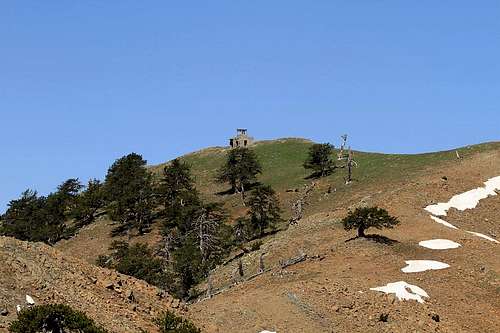
Astraka Mountain Refuge
Astraka Hut
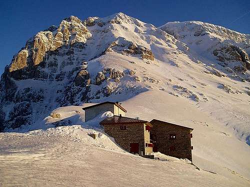
Smolikas Mountain Refuge
The other mountain refuge on the Aoos valley is the one located above the village of Palioselli on the southern slopes of mt Smoikas. The refuge is on the O3 trail (see Smolikas main page) and approximately a 7k drive from the village of Palioselli. It has a capacity of 24 people, fresh running water, it has 3 hot water showers (litteraly the best thing that exists after a long day in the mountains), 2 bathrooms and a fully equiped kitchen. The refuge gets electricity from hydrokinesis. Here is the website link that sadly in Greek: Link.