
-
 26042 Hits
-
 81.18% Score
-
 13 Votes
|
|
Route |
|---|---|
|
|
34.28845°N / 117.71335°W |
|
|
Hiking, Scrambling |
|
|
Spring, Summer, Fall, Winter |
|
|
A long day |
|
|
Class 3 |
|
|
Overview
The traverse from "Big Iron" to Mount Baldy along the San Antonio Ridge is a San Gabriel mountain classic. Starting at the Heaton Flat trailhead and ending at Manker Flats will give you about 10,000 feet of elevation gain in 16 miles. The Heaton Flats trailhead starts at just 2,000 feet and the summit of Iron is at 8,007 feet. Add a few ups and downs and, just to do the first leg of this trip to the top of Iron, involves about the same elevation gain as a hike to Mount Whitney along its trail.From Iron there is a faint use trail for most of the way across the San Antonio Ridge to the summit of West Baldy. If one chooses to backpack the route, the best campsites are found along the way to Iron. Along the ridge good spots might be harder to find. The route can be reversed, coming from Baldy to Iron. This would make the route slightly easier, but would still have plenty of elevation gain and loss due to all the bumps along the big ridge.
The distance between Iron and Baldy "as the crow flies" is only about 3 miles. However, throw in ups and downs and the distance between summits and trailheads and you get a 16-mile one-way trek.
 |
|
|
Getting There
From Interstate 210 exit at Azusa Ave (State Route 39). Drive north until you come to the East Fork Bridge of the San Gabriel River (this will take about 20 minutes) and turn right (east).Go about 6 miles to the fork with Glendora Road and turn left (do not continue on the road where it curves sharply up and to the right). Drive about a mile going past the East Fork Ranger Station and park in the large paved lot at the end of the road. There is a restroom at one end of the parking lot.
 Heaton Flat Traihead
From the gate at the northeast end of the parking lot, hike along the road that parallels the river about half mile to the signed Heaton Trail. It will be on your right just past a smelly outhouse.
Hike up Heaton Trail about 4 miles to a large saddle and trail junction. Straight in front of you will be the beginning of the steep use trail along Iron's south ridge. Continue along the ridge about 3 miles to the summit. The last mile to the summit itself involves 2,000 feet of gain. From trailhead to summit you will have gone a little over 7 miles with 6,600 of elevation gain.
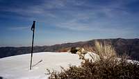 Summit of Iron 2.25.06. The San Antonio Ridge is to immediate right
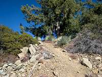 Along south ridge to Iron
Route Description
 Mt. Baldy (L) Iron Mtn. (CR) and the San Antonio Ridge sweeping left to Baldy
|
|
|
|
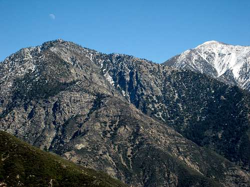 Iron Mnt. (L) and Mt. Baldy (R) seen from south ridge of Rattlesnake Pk
Essential Gear
There is NO water along the route save for snow patches in winter and spring.Crampons and possibly an ice axe may be necessary in winter and early spring for safely traversing the ridge.
Pants are a good idea due to heavy buckthorn along the long ridge.
Trip Reports
Graham'sRick Kent's
Mountain Impulse's
Brennan's detailed chapter with map, high point elevations, and escape routes
Seahorse - Sep 11, 2007 1:11 am - Hasn't voted
Re: Heatongood catch!