"I see my path, but I don't know where it leads. Not knowing where I'm going is what inspires me to travel it." -Rosalia de Castro
"Twenty years from now you will be more disappointed by the things that you didn't do than by the ones you did do. So throw off the bowlines. Sail away from the safe harbor. Catch the trade winds in your sails. Explore. Dream. Discover." -Mark Twain
It is mountains like this that makes mountaineering such an exciting part of my life. When I heard that I had an opportunity to climb Mount Logan, I instantly knew that this was something special. My family and friends were telling me that they had never known anyone who wanted to go on as many adventures as me. My feet were still blister from all the climbing I had done during July, but when offered a great opportunity, there is no way that I can decline. After all this is my passion.
The weather had not gotten any better after Jack Mountain which is usual for the state of Washington. Even after halting the climbing date for Mount Logan, there was a point which we had to take a chance, hope for the best and go for it. This turned out to be a great decision. Yem came over to my house late in the day in order to get to the trailhead by night and get a early start for the hike though the Thunder Creek Valley. I had never packed so much food for a single trip before, but knew it would be necessary.
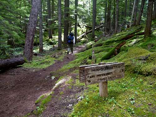
Day 1: Hiking through the Thunder Creek Valley
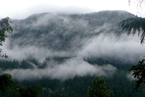
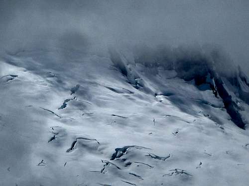
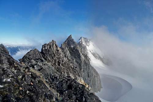
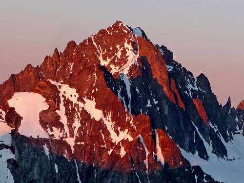
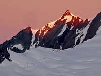
Ruby Mountain with Clouds
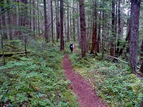
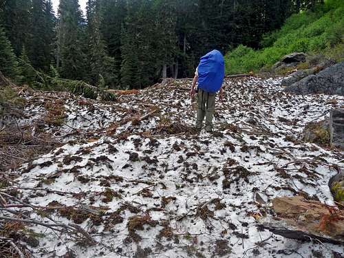
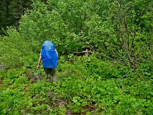
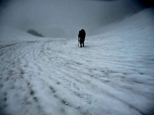
In the morning it was a cloudy day with some views of the mountains we could see through the trees. We started hiking from the Colonial Creek Trailhead at 6:45 a.m. along the Thunder Creek Trail. We were in for a 15 mile day with heavy backpacks, but at least much of the terrain was relatively flat. Along the way we crossed over Thunder Creek using the bridge provided (the creek is like a river) and saw many wild flowers along the way. Unfortunately we did not see many mountains because there would either be trees in the way or there would be too much cloud cover. The one bad thing about the thunder creek hike is that many of the miles feel the same with traveling through the same woods mile after mile. But at least I'm in the mountains with good company, fresh air, and am on a great adventure.
Foresty Spot Lights
Purple Flower
White Flowers
Walking through the Forest
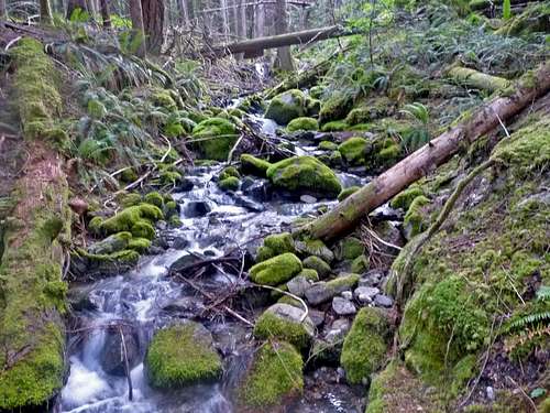
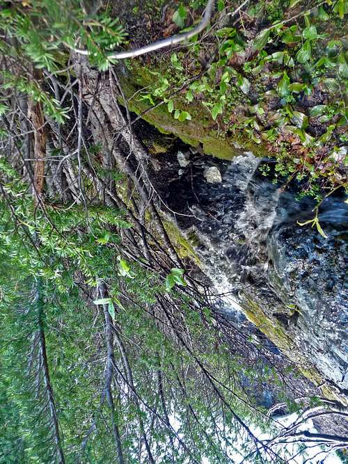
One of the Many Creeks
Along the way there were many creeks which I had to be careful for because I was wearing approach shoes that get wet easy, and I could not afford to make my blisters any worse than they were for this trip. We did take a few breaks along the way, although setting down the pack was pleasant on my shoulders, I was not a fan of all the mosquitoes when trying to get a bite to eat or drink. But it's to be expected during the month of July in the mountains.
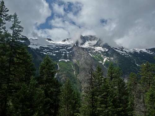
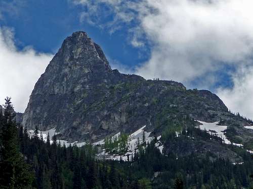
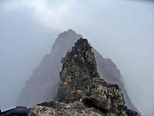
Tricouni Peak with Clouds
It's neat to think that during the month of July I been in the mountains so often that it felt completely normal for me, almost as if it was a life style. Most people when making it to the top of a mountain are in a hurry to go back home and go about there daily lives, for me it's more the opposite. I find the life style of the city for me to be too dull and unattractive. Although I will admit after a while I do at times miss my family and friends, so I try not to be constantly in the mountains the entire summer, although perhaps most of the time.
Log Crossing
Thunder Valley
Waterfall on Tricouni Peak
Nice Log Crossing
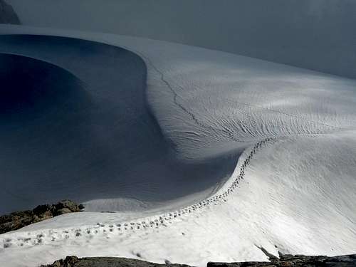
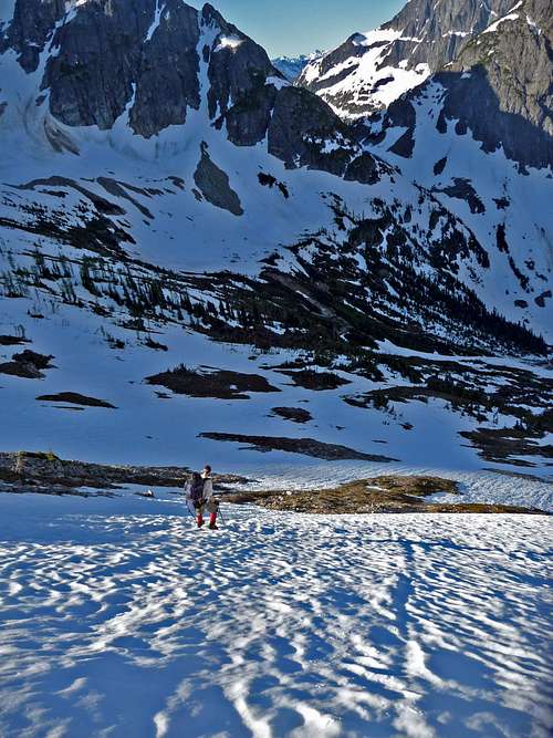
Half Way to Parks Creek Pass
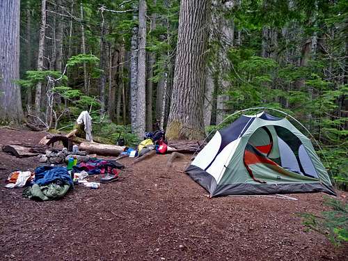
After reaching the part of the trail called "Junction", we are at the half way point to Parks Creek Pass. From here we travel a little ways further only to reach a part of the trail which we have to loose a 1,000 feet of elevation. The thought that comes to mind is "wow, won't this be fun on the way back out". After going down to the valley floor we soon come to our camp site which is called Skagit Queen. From here we enjoy a nice dinner of hot chocolate, tea, salami, cheese, and top romen. That night I slept very good after about 15 or so miles of travel.
Skagit Queen Camp
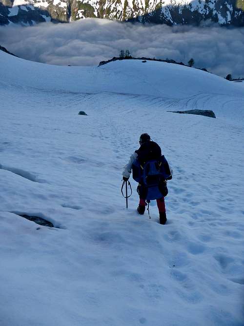
Day 2: Traveling into Snowy Lands
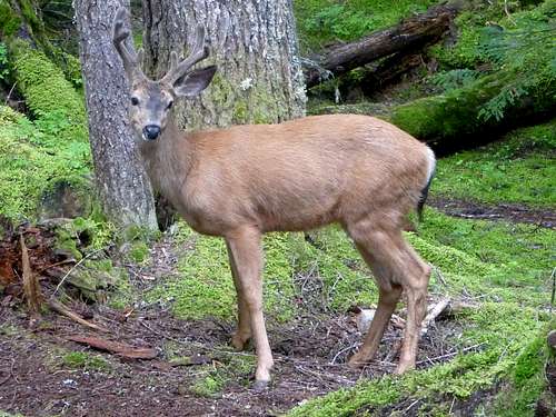
Deer Near our Camp
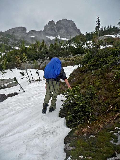
In the morning I woke up to a deer traveling around our tent as well as a squirrel running away as I got up. By the end of the previous day it had actually looked as though it would clear up, but over night it had gotten cloudy again. We got a late start at about 10:15 a.m. in the morning, the trail was in good condition although there was a few trees in the trail that we had to go over. While switch backing along the trail we came across an old mining house as well as a old pine line that went through many of the switch backs. As we got further in the valley we came across our first encounter of snow, this was a ideal place to leave the shoes behind and swap to climbing boots. There were many places where avalanche debris was covering the trail, although some dry patches of trail.
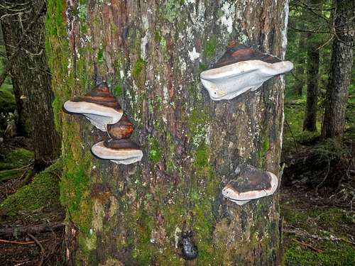
Mushrooms on the Tree
Avalanche Debris
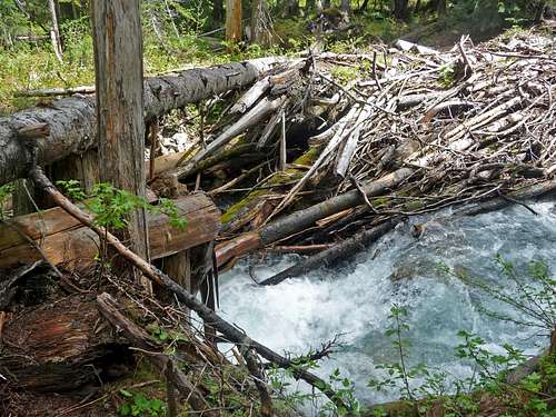
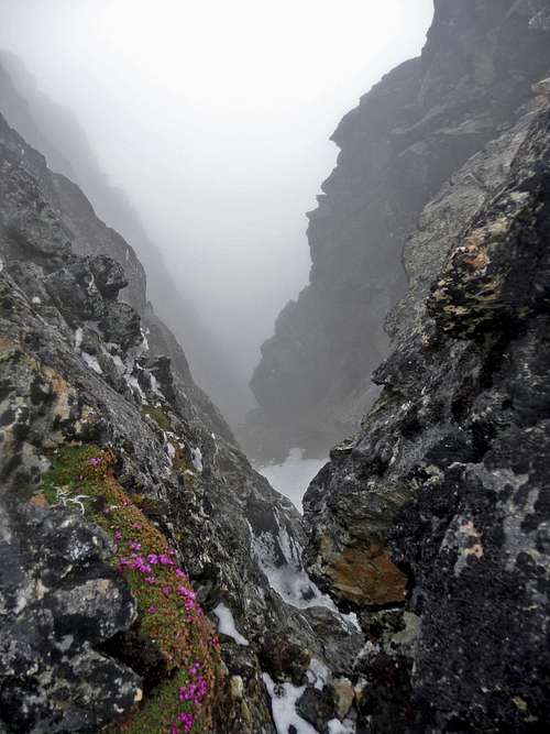
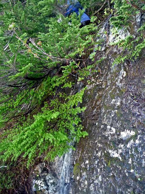
After this the valley vegetation increased dramatically making the environment look semi jungle like. From here we came across the thunder creek crossing, I was not in favor for getting my feet wet. We went a little ways back and found a nice log crossing, we had to do the old fashion sit and edge our way across. At one point my shorts got caught on it which slightly ripped them, but it was better than not using the log.
The easy way across
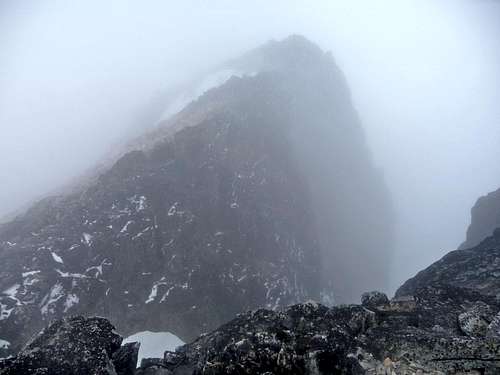
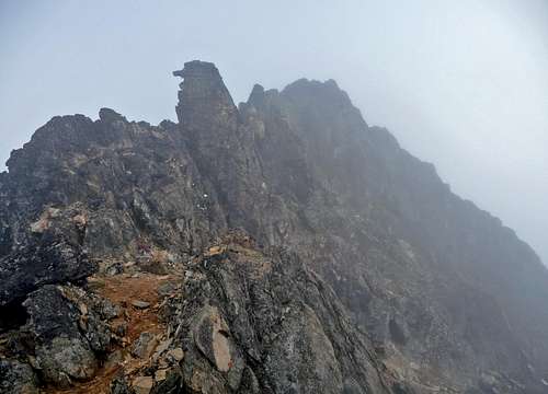
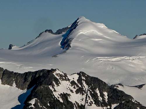
Mount Logan's Towering False Summit
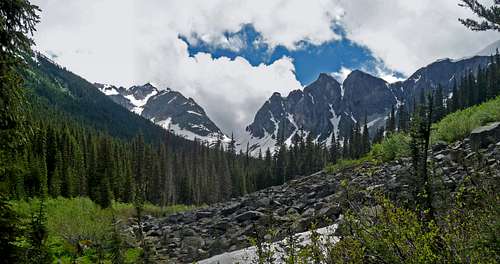
Park Creek Pass
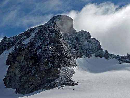
Now we were close to the Thunder Basin Stock Camp, we took a nice break and had to make a decision whether to go all the way to Parks Creek Pass or take a short cut and go straight up the mountain. We finally decided to take the more direct route and follow along the right side of the towering false summit (Point 8,000).
Going into the Brush
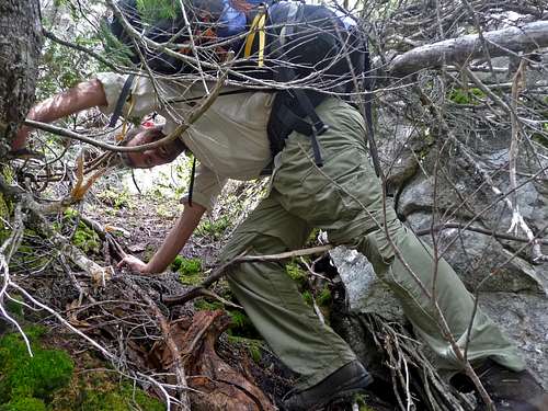
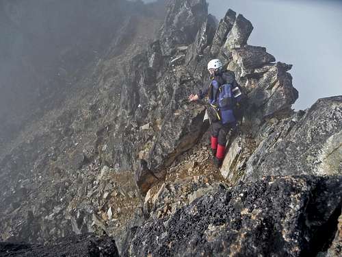
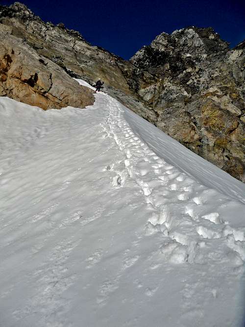
At first it was a little brushy entering into the woods, but as soon as we got onto the lower slope of Mount Logan, things became much nicer... or at least for the first few hundred feet. As we climbed up we used veggie belays and such to help keep us stable on the slope. Sometimes the ice axe would get caught, but even worse was when one of my backpack straps would get caught which I would have to maintain balance until I got it untangled. As we climbed higher we came across mini cliff bands and steep sections that made traveling tedious, it got to the point where I started to wonder if we would reach a point where we could not climb any higher.
Crawling through a Tree
After doing a bit of navigation we managed to get through without anything too dangerous. We went up a little ways further to the left and now where out of the woods and nearing the Fremount basin.
Finally into a Clearing
Rolling Mist
On the Upper Snowfield
Entering the Basin
Evening on Logan
Marsh Marigold
Dark Sky
Rising Clouds
Primus Peak
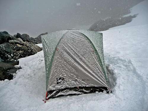
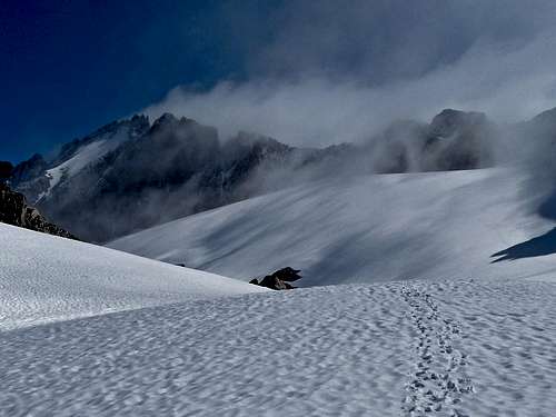
The clouds all around were getting darker which did not seem like a sign of the weather getting better any time soon. From here we hiked up the basin to a flat area around 8,000 feet high. As I broke trail it began to rain a little, further up the winds were picking up and it became colder. Keep in mind I was still in a t-shirt and shorts, but now I was on a slope that was a little steep to be taking off my pack, plus we were almost to our destination of the day. As the wind was blowing it suddenly changed to snow which my arms and legs were getting quite cold by this point. Once I got to the top of the hill I had to put on everything that I had to regain warmth. I had a hard time putting on my gear because my hands were becoming numb and I had to be careful about clothes blowing away. A moment later we found a flat spot which was great for setting up camp.
Snowing on the Tent
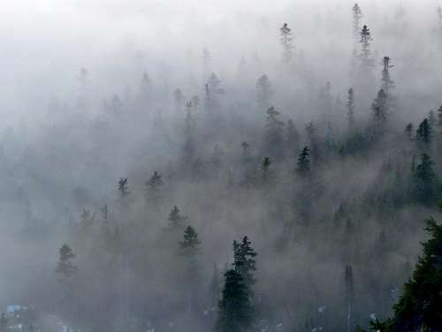
After stomping around for a while on the snow to make a flat spot for the tent, Yem started up cooking for dinner. Looking all around I couldn't help but feel as though I was in a winter wonderland. The sky was getting dark, and the fog continuously would pour in from the valley below. Only for a split second could we faintly made out Mount Logan through the clouds, it then went back to the same old cloudy views. After dinner we finally went into the tent to make attempts to sleep that did not come easy. As we talked I could see the flashing of lightning above, I was a bit worried but they seemed distant. After a while we finally fell asleep.
Day 3: Going for the Summit
Waking up early in the morning the weather had not improved one bit, we decided that it would be best to wait out the storm before making a summit bid, even if that meant crossing the glacier late in the day. I rolled around a bit having a hard time going back to sleep only to realize that my air mattress was popped which is why I could feel a lump in my back. But it was still better than being at home. A few hours later I woke up seeing that it looked bright outside the tent, for a moment I was excited. When looking outside it was once again just bright fog with a few minor clearings from time to time. Eventually we got out of the tent when I spotted a clearing in the sky which raised hopes for some views. For about 30 or so seconds Mount Logan came into view which I frantically took some photos of the view.
Light Dusting of Snow on Logan
Temporary View of Mount Logan's Summit
And then back to the same old cloudy view. After watching the clouds for an hour, Yem and I noticed there was a pattern with how the clouds would blow in. First you would see a few holes, then a view of a few peaks, and then back to being socked in. Then it would repeat itself again.
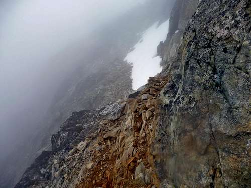
The Boston Glacier through the Fog
Looking at my food supplies I realize that we have to summit today, plus I had another adventure lined up as soon as I got off this mountain. The mountain itself had not come back into view, so in a sense I was taking two risks if we went for it. 1: Not being able to see exactly where we need to go. 2: We risked not getting the incredible view of Logan from the summit. At the end of one of the clearings we finally decided that it was worth a shot, so we packed up our climbing gear, put on our harnesses, and made way for the summit.
It was 3 p.m. when we finally left camp. I was in lead which now all I could see was the lower face of Mount Logan with clouds all around and my partner. I knew from a earlier clearing that there were two gullies, which I went for the first one on the right assuming that it was the cross over spot for the ridge. After traveling up a snow slope we reached the bottom of it, it looked like class 4+ all the way up with a lot of exposure. Yem and I were not pleased with how it looked, we even saw a foot print in the dirt which seemed like evidence that it might be the route. "Hang on a second, perhaps there is another way" Yem finally announced. I decided to pull out my camera and look at former photographs that I took earlier in the day. Remarkably it helped us figure out where we were, and where we needed to go.
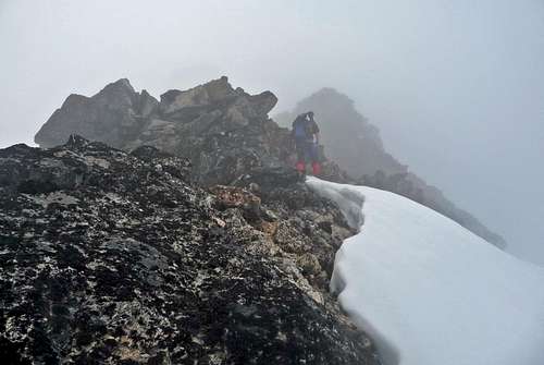
After down climbing off of the steep section, Yem suggested that I stay high on the snow ridge. This turned out to be a very good idea. As we travel along the ridge, it felt as through we were constantly going to the right. Almost as if it was endless. It was at this moment that I thought of a quote "I see my path, but I don't know where it leads. Not knowing where I'm going is what inspires me to travel it". It was exciting traveling the ridge, faintly through the fog I could see it glowing. Pretty soon I came across what appeared to be a cornice, when deciding to travel on it to my relief it was the hogsback. We were officially on the route again.
The Hogsback a Few hours after getting to the base of it (after the fog cleared)
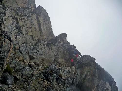
From here we climbed over the Hogsback and on to a section where we had to cross over the ridge. We took off our crampons and left our ice axes to save weight. We knew that any snow on the east face would be too treacherous to be traveling on which is what made leaving gear a acceptable choice. Once we crossed over onto the east side of Mount Logan the terrain suddenly became quite rugged, I'll admit that for a few minutes I became a bit nervous. After finding some good scramble spots I became comfortable again, this was perhaps the best class 3-4 terrain I have ever been on. Despite the exposure, the rock was remarkably solid. After making a few careful moves and looking back down, I smiled in excitement. The climb was on.
The Section just before Crossing over onto the East Face
The First Climbing Section
Once past this section it became flat with a bit of exposure. We carefully traversed this spot and came to a snow field. Yem announced that it would be best to stay as much to the left as possible to avoid the snow. From here it looked like we were virtually at the summit. But like many mountains when fog covered, it was a teaser summit.
Misty Summits
Going around the Snowfield
One of the Many Gullies Below
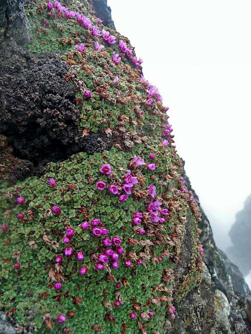
Pink Flowers
Yem and I had to do a bit of a down climb move to continue along the ridge, but fortunately there was not a whole lot of exposure here. From here there was one last traverse with a scramble ending with more fun moves. We were officially on the summit. I was in awe that we had made it.
Down Climb Section
Views from the Summit
Looking Back at the Summit
It was getting late in the day, so we decided to spend only enough time on the summit to have a quick snack and mini celebration. Going down was much easier than I had expected. On our way down we could see clouds rising in fast motion, and soon enough we got a major clearing.
Brocken Spectre
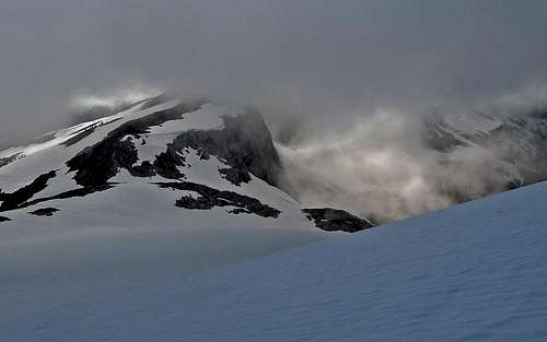
The False Summit Clearing Up
The Ridge through the Clouds
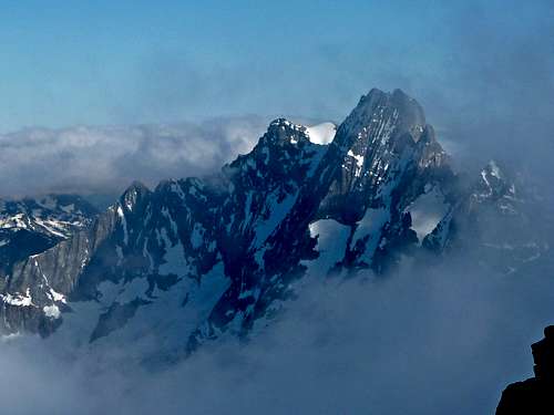
Mount Goode through the Clouds
The Views to the South
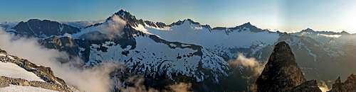
This was the moment we had been waiting for all along, the views of mountains kept pouring in through the clouds. It was more beautiful than if it had been clear skies all day. When crossing over the ridge I could see that the Hogsback was glowing brightly with a ultra contrast lighting to it. "It doesn't get much better than this" I whispered to myself as I descend onto the slope below.
In the Dark Shadows of Mount Logan
The Views Below the Mountain
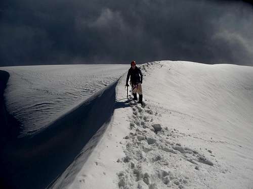
Looking Down the Hogs Back
Yem heading down the Hogsback
Cross over Spot
When we Backed Down
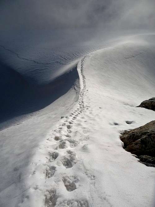
Tracks going to the Route
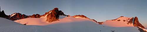
From here it was a easy descent back to our camp which this time we got to travel on mostly flat terrain due to us being able to see where we were going. At camp Yem boils the water for my top romen, when it finally cooled down I got to enjoy the sunset with glowing peaks with tasty warm food. This in my mind was an example of a moment of perfection in the mountains. We took photos until our hands became too cold from the cool air, and we then went to sleep feeling great from an amazing day.
The Views to the Southwest
Alpenglow on Mount Logan
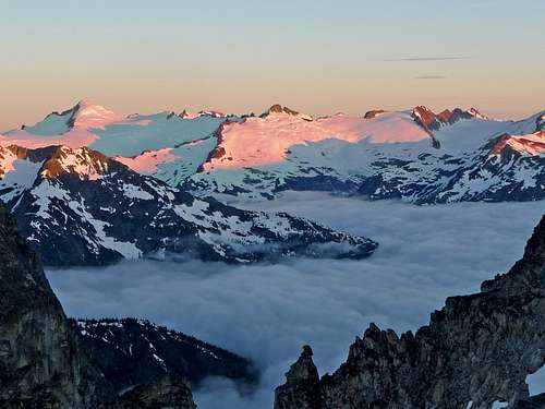
Clearing Mountains
Eldorado with Rising Clouds
Sunset over the Clouds
Yem watching the Sunset
Bright Shining Clouds
Sun Setting over Primus
Primus Peak with Clouds
Fire Across the Sky
Primus Peak after Sunset
Beautiful Eldorado Peak
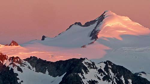
Alpenglow on Bonanza Peak
Evening View from Camp
Day 4: The long journey Home
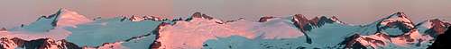
In the morning I woke up around 5 a.m. Normally when this tired I would go back to sleep, but I very much wanted to see the sunrise. So I put on my boots and scrambled up a few hundred feet to get views of Jack Mountain as well as a few others. Then I went back down to camp to see the rest of the views during the sunrise.
Sunrise on Eldorado, Klawatti, and Primus Peak
Sunrise on Buckner Mountain
Above the Clouds in the Morning
Sunrise Colors on Jack Mountain
Sunrise on Eldorado Peak
Sunrise on Ripsaw Ridge
Boston Peak Alpenglow
Sahale Mountain
Forbidden Peak
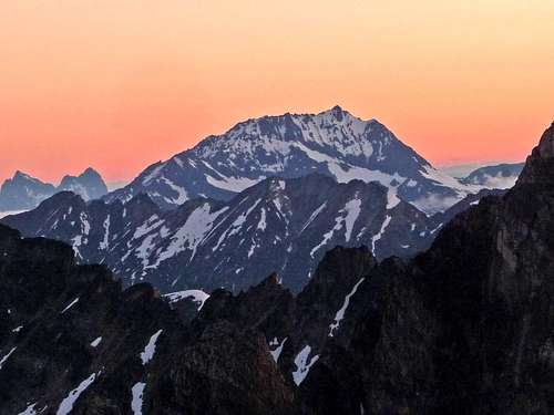
Primus Peak
Morning View of Mount Logan
Sunrise on Klawatti Peak
Brooker Mountain
Boston and Sahale Mountain
From here we knew that we had a long day ahead of us with over 20 more miles of traveling left. After breakfast we packed up camp, refilled water at a near by creek and were ready to go. I'll admit the descent was a bit hard on my ankles and knees because of the crampons on the hard snow on steep slopes. Below us were still come lingering clouds in the valley below, ironically now I was wishing for some cloud cover to help made going back a bit cooler. After all there are not a lot of views from the woods even when there is no cloud in the sky.
Heading Down the Fremount Basin
Going towards Park Creek Pass
Eldorado Peak during Late Morning
Once we were near the pass, Yem decided to take a short cut down one of the side gullies. This turned out to save us time, although it had an interesting section near the bottom. It was a little bit difficult with crampons on, we had to travel over a tree with a mini water fall that had to be avoided.
Looking Down the Mini Waterfall
Yem Down Climbing using the Tree
Misty Forest Down Below
Snake in the Woods
Hiking Back Up Hill
From here it was a walk down to the basin where Thunder Creek began to form. We took off our crampons here and took a rest. Looking at my food supplies I found that I had a limited amount of food, but enough to make it back home. At first finding the trail was a bit difficult because of all the avalanche debris, but as we got further down the valley we found it. A few miles further down the trail we came to my approach shoes which I was pleased because this meant that I did not have to wear my blistering boots. But at the same time I was disappointed that they were soaking wet from the rain the previous days. To make the trip quicker we ran down some of the down hill sections.
Many miles later of traveling through the woods we finally reach the part that we all dreaded. The 1,000 feet of elevation gain. This was certainly one of the hardest parts of the trip, plus the fact that it was hot out did not make things easier. After pressing on for hundreds of feet up the hill, I was becoming quite tired by this point, as well as my shoulders hurting (I know, I sound like a complainer. But I want the audience to know that just because it was the way back doesn't mean it was easy).
Cornices across the Valley
Jungle Like View
Tricouni Peak
After another mile or so we reached Junction, from here we decided to cook our last meal of the trip. Unfortunately not only were there lots of mosquitoes, but there were lots of black flies. I kept getting bite marks all over my legs (even a week later they were still itchy). This made it hard to sit in one place during lunch. As soon I was done, I was wanting out of Junction to get away from the bugs. For the next 9 miles we ran down the mountain, I'll admit it was a bit monotonous, but I was still having fun. After more hours of walking through the woods we finally reach the trailhead. "Finally I can rest" I announced as I take a bite into a cookie that I had a stash saved up for me for the ride home. As I start to fall asleep I realize "My adventure is not yet over, tomorrow I have a climb for Vesper Peak, and the next day Mount Rainier". I smile at the thought that I am having an amazing summer with never ending adventures.
Thanks Bearqueen. The views were most certainly excellent, one of these days it would be nice to have you come along for a scenic trek into the North Cascades. Hope things are going well for you.
Thanks! It was a very interesting experience, although I said most of what went on during the trip, it still feels like a summary of all that happened on this mountain.
Thanks etsnyd! Your profile says it right on "The Great State of Washington". I was very pleased that the clouds had lifted and we were not clouded over the whole time. But even if we were, it still would have been an amazing experience. After all, to me that is the most important part of mountaineering.
Well Gimpilator is someone who goes on as many "crazy adventures" as myself. But yeah, not that many are willing to climb all the time even when given the opportunity.
Thanks Gimpilator! I certainly recommend that you visit this mountain some day, we have had a few great adventures together so far this summer. I hope in the future I can still go out climbing as much as I have this summer.
Although it is a nice state, this summer has been especially cloudy. Even today it's been cloudy in the mountains. So if you don't mind the rain and cloudy weather, than this is a great part of the world to live in. For me I have learned not to mind cloudy weather.
During the month of July I had an outrageous amount of adventures, I'm sad to say its almost been a week since I been mountaineering which is a record amount of days out of the mountains since early June. But I plan on going on more trips soon. I would love to go to Yukon, but the passport deal is what is preventing me. As it is I have difficulties paying for my trips (and gear) which I spend just about every ounce of my cash on. But in the future I certainly plan on doing major climbs.
Children refers to the set of objects that logically fall under a given object. For example, the
Aconcagua mountain page is a child of the 'Aconcagua Group' and the 'Seven Summits.' The
Aconcagua mountain itself has many routes, photos, and trip reports as children.
Parents refers to a larger category under which an object falls. For example, theAconcagua mountain page has the 'Aconcagua Group' and the 'Seven Summits' asparents and is a parent itself to many routes, photos, and Trip Reports.


Comments
Post a Comment