"You can take the man out of the woods, but you can't take the woods out of the man" -Gary Paulsen
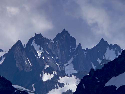
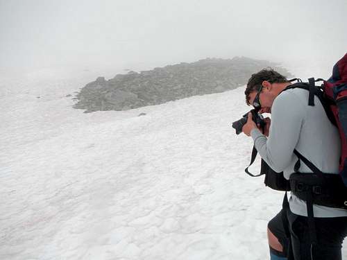
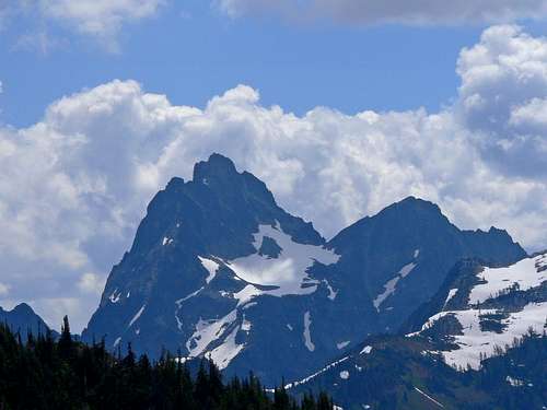
This was the most exciting adventure of the year. I had been wanting to do the Ptarmigan Traverse for a very long time. From having an attempt on this route and climbing Dome Peak the previous year I knew both ends of the traverse quite well. But hidden within a fortress of mountains lied a handful of surprises. The traverse included miles of glacier travel, white out conditions, steep snow climbing, rappelling off a cornice, navigation, and one of the worst bush whacks I have ever done. By the end of the adventure my feet were the most shredded they ever have been in my entire life! I'm still taking antibiotics and taking it easy.
The trip began when Eric Darsow emailed me while I was on a Beartooth Range adventure. I immediately agreed knowing that any opportunity at this would be too great to pass up. The weather forecast was calling for perfect weather which I was shocked. For many years it's been terrible weather during early July. But as fate goes, somethings are too good to be true. Fortunately the adventure went well beyond my expectations and took me into one of the most remote places in Washington. This was well worth the years of waiting.
Day 1: The Journey Begins
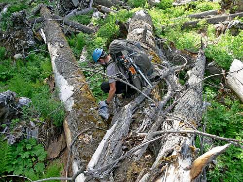
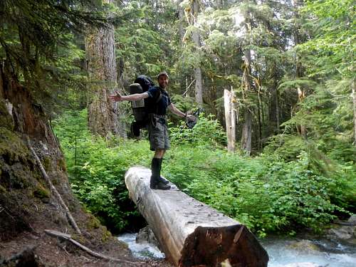
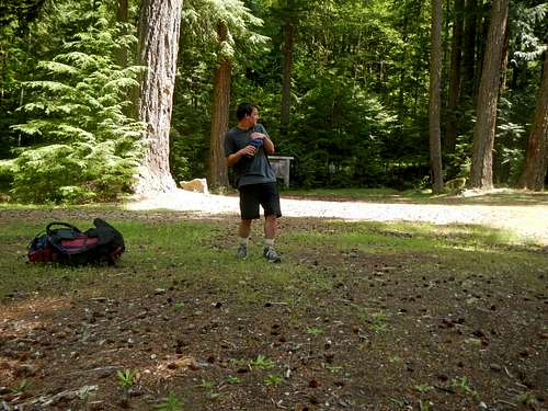
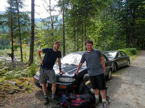
After staying up until 4 a.m. packing and researching I get some well deserved rest. In the morning I head on to my math class and head back home shortly before Eric Darsow arrives. Considering that we didn't have a bike rack we placed both bikes on top of the car with a blanket and bungie cables. After a few hours of driving and chatting we were at the Suiattle trailhead. On the way we ditched our packs to save effort while biking down the 12 mile road. After having a few more mini donuts and some final packing we set off for the Ptarmigan Traverse. The 12 miles was mostly moderate with many down hills. As I picked up speed I couldn't help but smile as the wind rushed on me. Excitement was now roaring, I knew this was going to be an amazing experience. As we biked along I saw one of the strangest things I've ever seen. A fern plant appeared to be dancing back and forth in a wild like motion. I waited to see if an animal had bumped it, but I saw none. I guess one can see new things each time they enter the forest, even after years of seeing what they believe to be everything. Near the end of the road we picked up our packs from a huge ditch area and biked the rest with our heavy packs on. At the end of the road we ditched our bikes in the bushes.
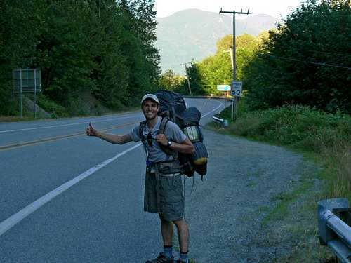
Getting on the other side of the road we pulled out our thumbs for the hitch hike section of the trip. "An escalate will never pick us up" Eric said. "I know, but it's always worth a shot" I laugh as I put down my thumb. After about an hour or so we were given a ride to Rockport. From Rockport we stayed for a while in attempts to get another ride. While we were waiting my buddy Gimpilator came by and had a quick chat with him. He would have helped us out, but not only was he going a different direction, but it wasn't even his car.
Hitch Hiking to Marblemount
After waiting another hour or so a truck driver gave us a ride to Marblemount right next to the Cascade River campground. We attempted to hitch hike up the Cascade Valley that evening. Even though it was a week day quite a few cars came by late in the day. Once it was sunset we finally gave up and Eric paid the man $10 to stay at the campground. I guess it pays off to bring money even on an adventure.
Day 2: Approaching the Mountains
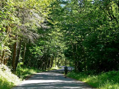
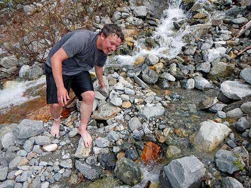
We started our hitch hiking attempts at 7 a.m. A little after two hours a nice woman gives us a ride 4 miles up the road. Every little bit counts. With as many vehicles that went by I figured we would have gotten a hitch. Eventually we realized no one was going to help us. Didn't matter if the truck beds were entirely open and it had little to do with how much space there was in the cars. We saw just about every combination of car setup. We even saw two seater cars that looked like they were from the 1930's. "Well, looks like we gotta hike it" I sighed. It got pretty warm walking along the road with the valley catching the humidity. The forecast said something like 97 degrees for Marblemount. A ways into our walk I noticed my feet already hurting. "This can't be good" I thought to myself. Eric had the same issue. A row of cars come by, surely one of them would give us a ride - right? Nope. One of the drivers looked just like Gimpilator. Imagine seeing someone who looked just like one of your best friends driving by. Giving you a death stare and then ignoring you. It was as if it was in slow motion, like a movie. "You've got to be kidding me!" Eric would say in anger. I couldn't blame him one bit. Before starting up I saw that my chocolate donuts were melted. At least they are still tasty as ever.
Walking up the Cascade Valley
Eric with Dorado Needle
Flowers along the Way
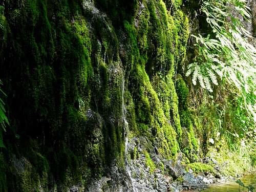
Contrasting Moss on the Side of the Road
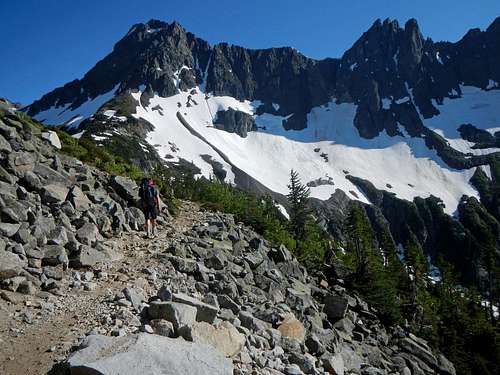
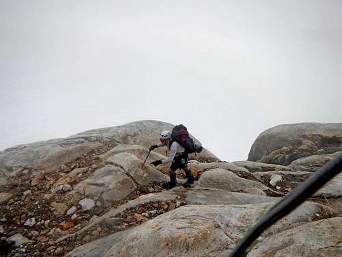
After hiking for about 10 miles we see a car coming. We had long since believed we would have to walk the full 19 miles of the road, but a shred of hope still remained. This time we were in luck. Both of us were ecstatic! I've seen time and time again the people you wouldn't think who would give you a ride do. Old married folks, a mom with her kids with a almost full car, and solo people. In society we often hear little phrases like "things will just work out" or there is always someone to help". That's not always true. There are those who "slip between the cracks". It happens all the time, but few seems to care. Fortunately I was lucky in this case. Arriving at the trailhead we thank Don and his wife for the ride. It was now possible to make it on schedule to get back by Sunday. But even with the lift it wasn't going to be easy. The trail up to Cascade Pass was in great condition and was mostly snow free. Near the end I had to be careful considering that I was in tennis shoes.
Hiking up to Cascade Pass (Taken by Eric)
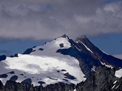
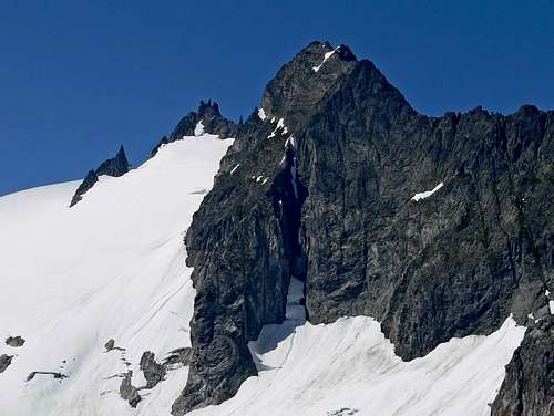
The Triad
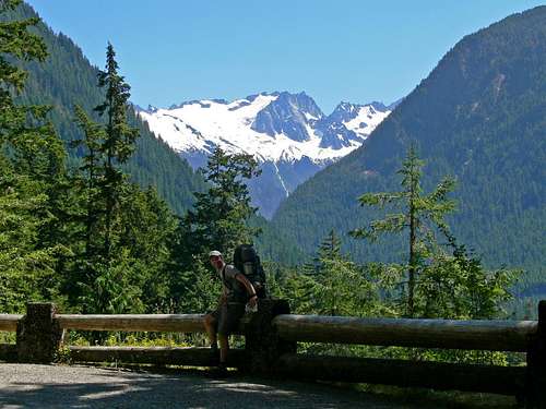
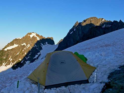
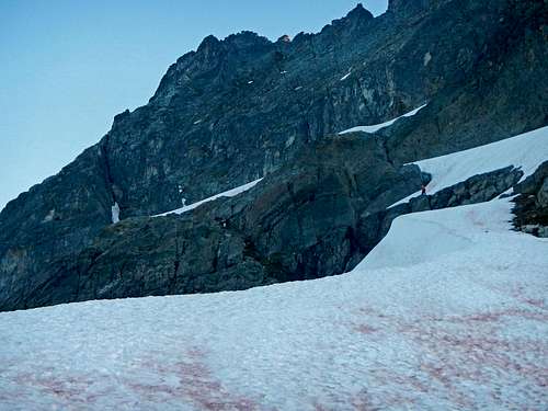
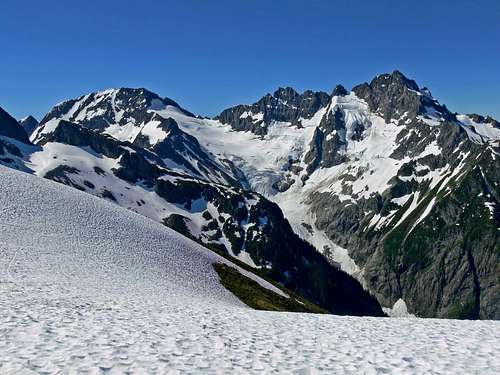
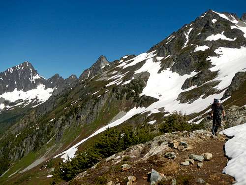
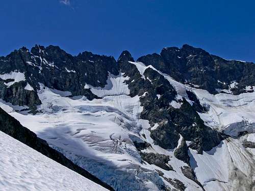
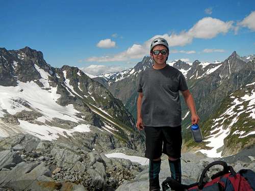
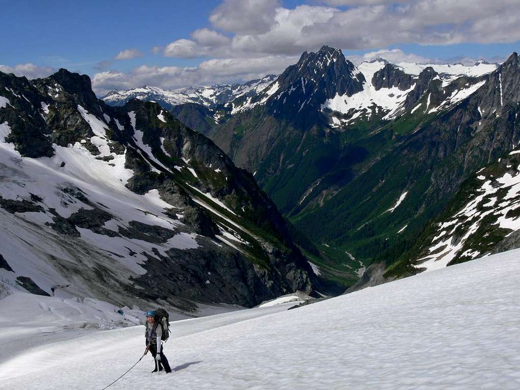
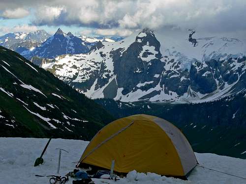
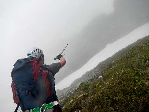
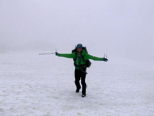
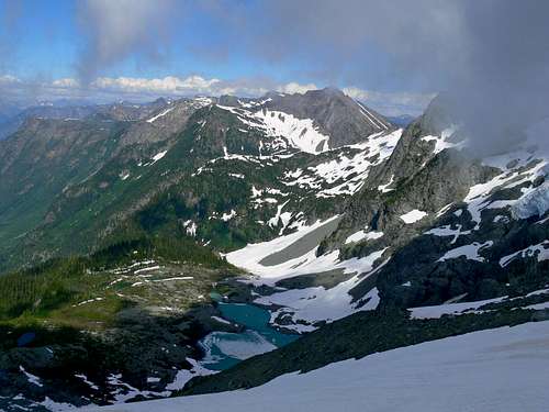
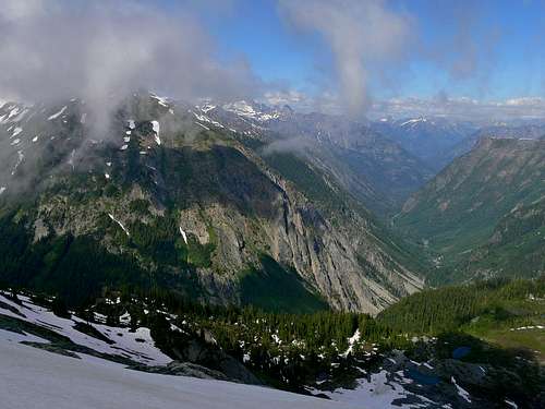
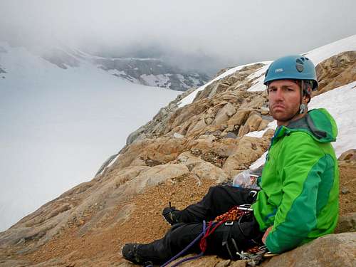
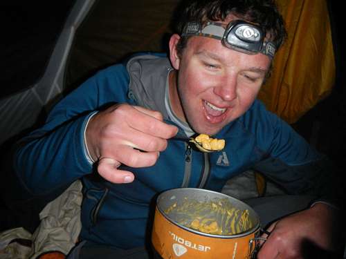
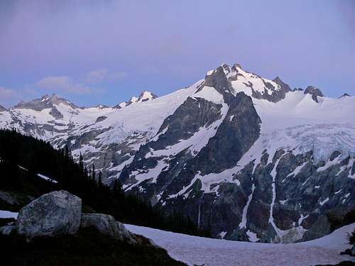
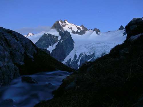
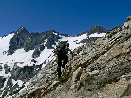
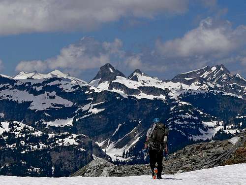
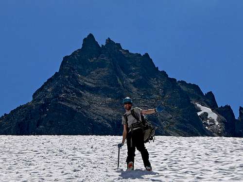
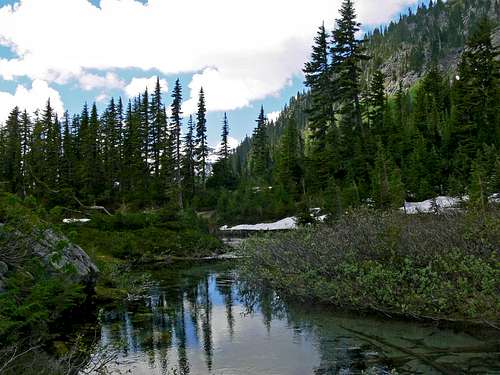
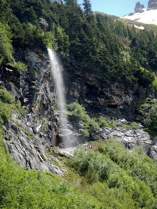
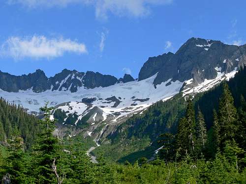
At the pass we took a long break enjoying the views around us. It was time to put on the plastic boots for almost the rest of the trip (well except for when I'm in camp). Considering that I knew the way I led the way around the edge of Mixup Peak. You could see the trail every now and then, but it was mostly snow covered. Near the Cache glacier was a perfect camping spot on a snow field. Eric and I dug out a platform and set up the tent. During sunset I went to a near by waterfall to fetch water for cooking and drinking. It felt good to be in my favorite region of the world.
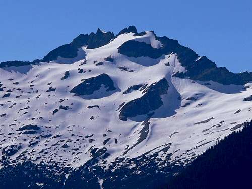
Brooker Mountain
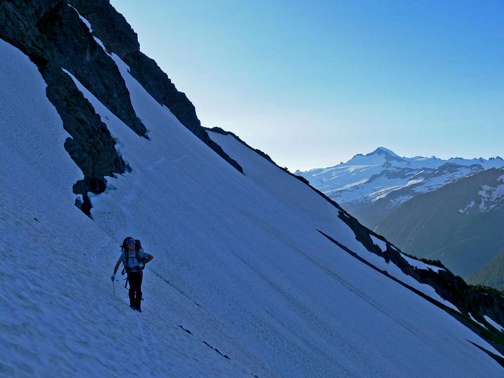
Heading up the Slope
Mount Torment and Forbidden
Snow Slope to Camp
Eric Traversing the Slope with Eldorado Peak
Our Camp with Magic Mountain
Mount Buckner's South Face
Sahale Mountain with Green Colors
Alpenglow on Magic Mountain (Eric)
Filling up Water on Mixup Peak (Eric)
Eldorado Peak during Sunset
Evening from Camp
Day 3: Beginning the Traverse
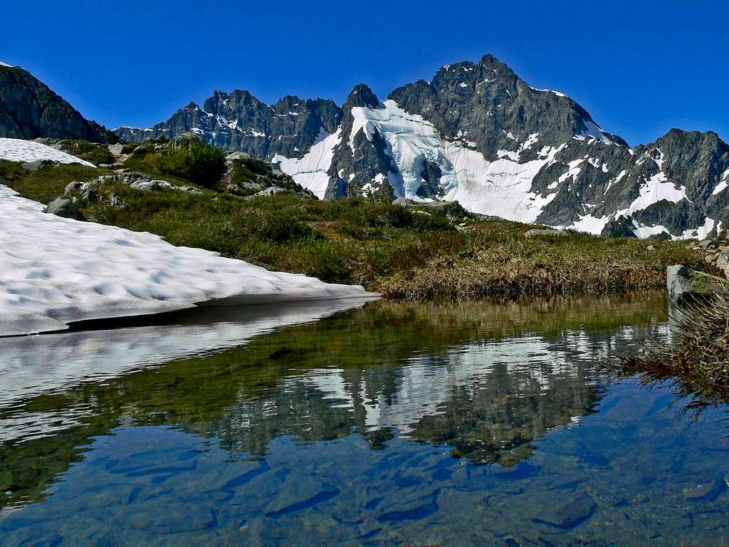
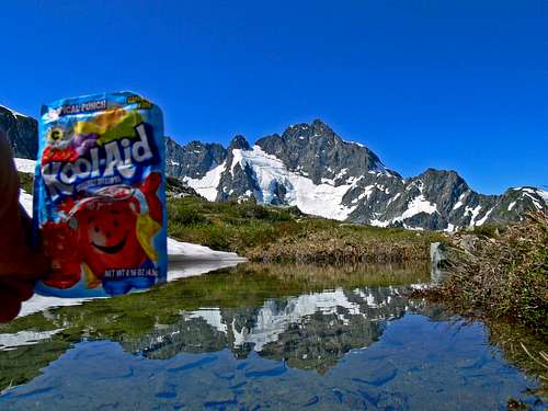
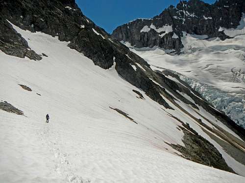
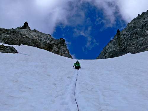
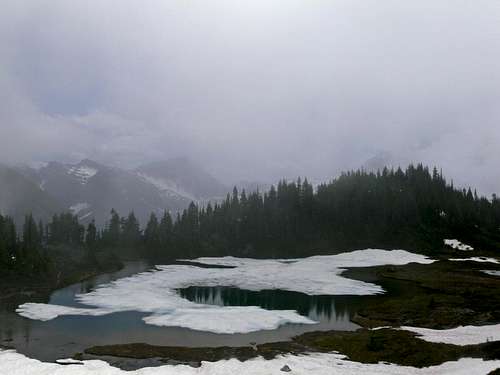
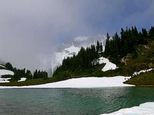
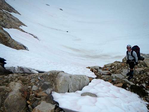
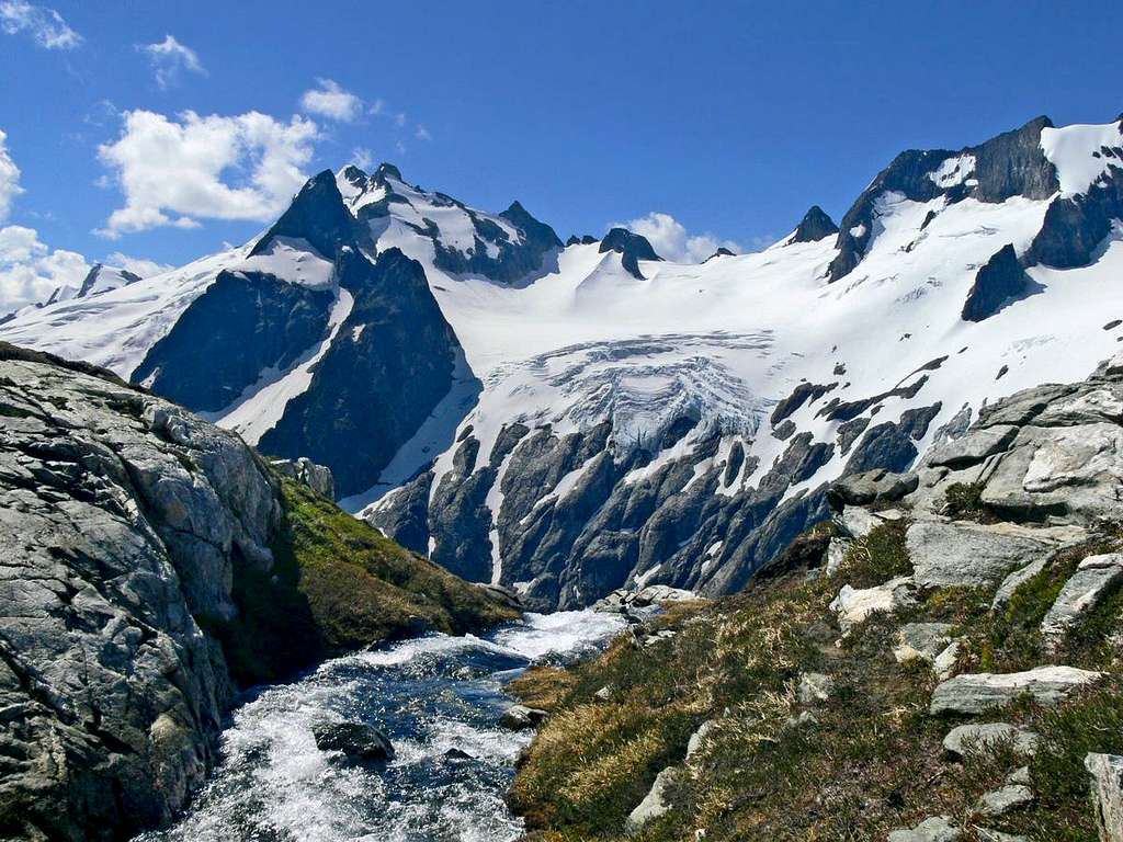
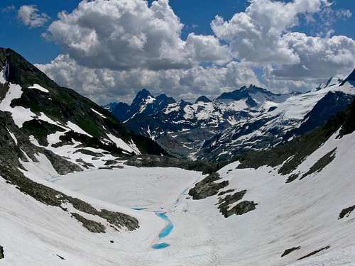
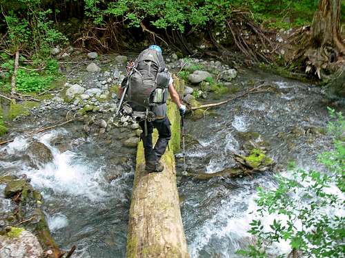
The next morning after putting away the tent we walked down to the Cache Glacier. We roped up and set up butterfly knots to create rope drag in case anything happened. After crossing the Cache Glacier we had a small scramble section before arriving at the Cache Col. From there we descended down to Kool Aid Lake.
Heading up the Cache Col
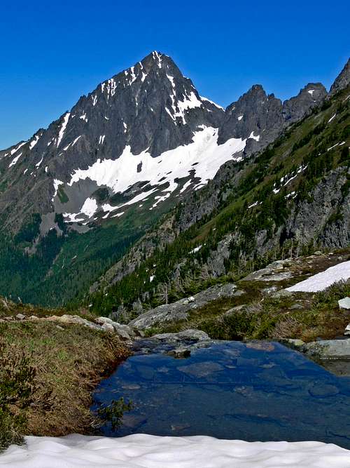
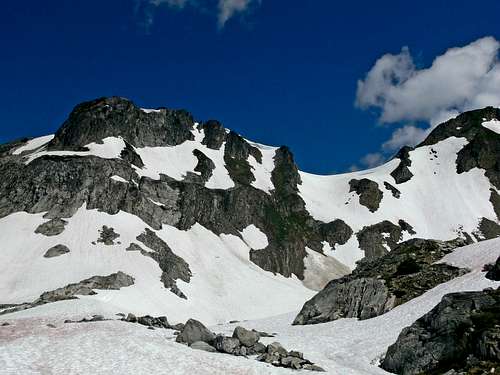
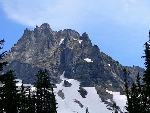
Mount Formidable and Spider Mountain
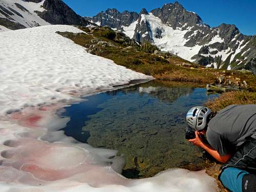
At the lake we took in the views, pulled out my Kool Aid, took some photos, and started back up again. Eric noticed clouds coming in. At first I didn't think much of them, figured they were just passing clouds. I wasn't 100% sure where the red ledge was, but figured the ledge that had a red color had to be the one.
Mount Formidable Reflection from Kool Aid Lake
Photographing Mount Formidable (Eric)
The Red Ledge
Oh Yeah! Kool Aid Lake with Kool Aid
Where We Came From (Eric)
Johannesburg with Kool Aid Lake
Thumbs Up (Eric)
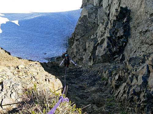
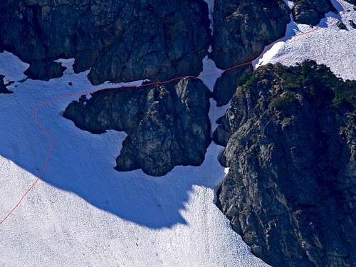
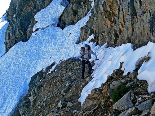
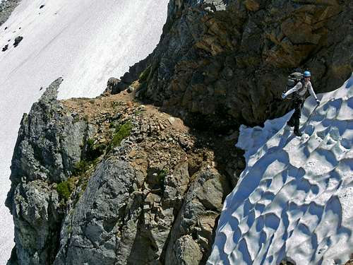
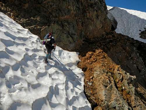
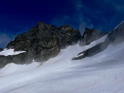
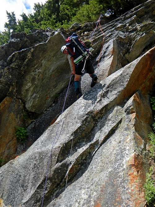
As we came closer I saw what appeared to be ski tracks. Always a lovely sight. As we get near the red ledge, the slope steepens and our pace slows down. I start making bucket steps for both Eric and for my own comfort. Had I not had plastic boots it would have been very difficult to make the steps. About 20 feet before getting on the ledges was the hardest part. With a small amount of being nervous I make every step solid and with each ice axe plunge. Below was a cliff. In normal conditions one could simply walk right onto the ledge, but the icy snow made it a bit more tedious. Once we arrived on solid ground the ledge crossing was a lot friendlier. At the second snowfield the exposure was greater, but was a lot easier to work the steps.
Eric on the Red Ledge
Crossing the Second Snowfield
Myself Heading for the Moat (Eric)
Descending Down to Middle Cascade Glacier (Eric)
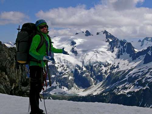
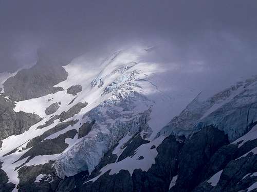
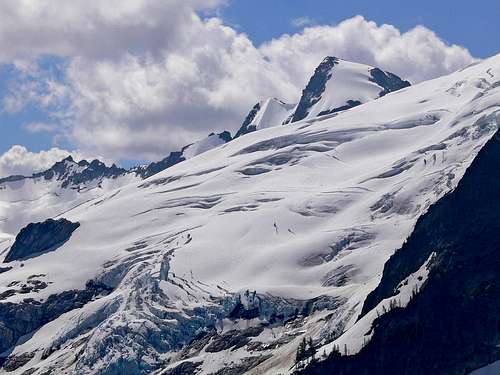
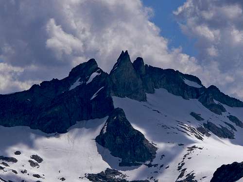
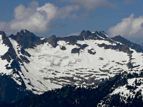
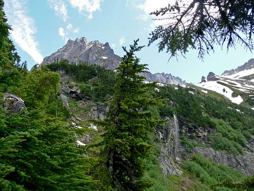
Eric didn't like the look of the ending snowfield. So I decided to climb it, see what was ahead, and then down climb a moat. I dropped off my pack so that I could port both of our packs up though the moat (there was a rock step). With a little careful scrambling Eric was at the top of the moat. I was pleased that getting to the Middle Cascade Glacier would not be difficult nor dangerous. After having a lunch break we made our way down and around a cliff edge. With a bit more snow travel we arrive at the Middle Cascade Glacier. Clouds were now hitting Mount Formidable and weather was becoming a concern.
Mount Formidable from the North
Sahale and Boston Peak
Johannesburg with Eldorado Peak
Excited to be Here (Eric)
Eric with the Middle Cascade Valley
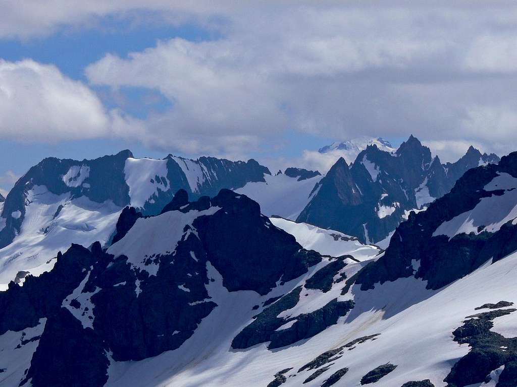
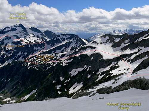
In a little over an hour we crossed the glacier and arrive at the Formidable Spider Col. I was in awe as we walked towards the edge. It was like a fortress of mountains covered in glaciers. What a joy it was to see this. Looking down below my smile quickly faded. We were surrounded by sketchy terrain. From cliffs to sketchy slopes the route down looked questionable at best. "Maybe we arrived at the wrong col" I announce to Eric. After looking at the map, we were indeed at the right col. A few moments earlier we passed a small col that appeared to drop off the earth.
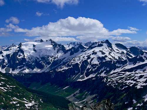
The Rest of the Ptarmigan Traverse
Need I Say More?
Looking into Wonderland
The Gloomy Castle of Spire Point
The Fortress Wall of Mountains
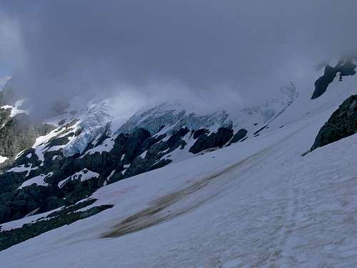
"Let's at least give it a look" I yell back in hopes that it goes. "I don't like the look of it" Eric replies. In mountaineering when your out of options you have to try out the ones you don't think are going to fly. It wasn't that I was taking a blind leap into the unknown, but putting out a leap of faith into what may be the only way. I finally got Eric to agree to allow me to explore it so long as we placed in snow pickets. The snow took us down further. Eric was still not convinced that it went. "Let me check just a little further" I said with a smile. After heading down a hundred or so feet I could slowly see the route would indeed go. I was so pleased to see this.
Heading down the Formidable Col
Old Guard and Sentinel Peak
As we head down the snow, the clouds drift over the mountains making a white out a serious possibility. Each step became painful as the padding of my boots pressed against my blistered skin. Making it to Yang Yang lakes that night was cast out of the possibilities. We were tired and the weather was not going to hold for long. We found a nice flat spot on the snowfield near some large boulders. At camp we had dinner, Eric helped pad my blisters, and watched the sky go away. Eric sat out on the rocks reading one of his two books. As it got dark the clouds followed and all that was left was a misty view.
As the Clouds Drop
Excited Eric
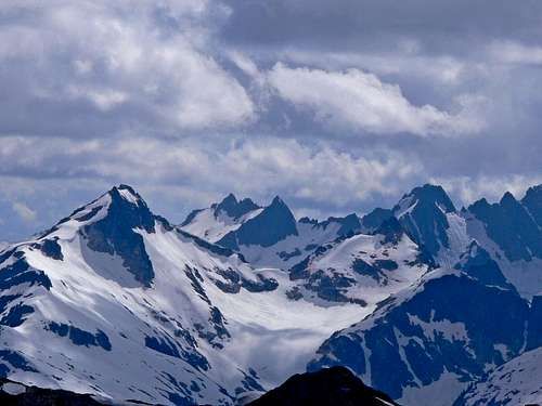
Cloudy Peak in the Distance
Mountains Clouding Over
Agnes Mountain North Face
Storm over Le Conte
Le Conte Glacier Pathway
Bad Weather Arrives (Eric)
The Route to Yang Yang Lakes
Our Camp on Mount Formidable
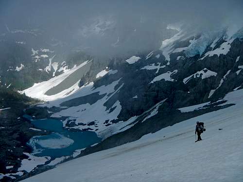
Day 4: Miles of Fog and Glaciers
Considering the nasty weather outside we slept in. "What do you want to do Josh" Eric announced. "Proceed" I replied". "But there is almost no visibility" he said. "I have pictures from the previous day showing the way" I reply. With some observations Eric decides to give it a try.
Mount Formidable Clearing
Standing at the Edge of Cloudiness
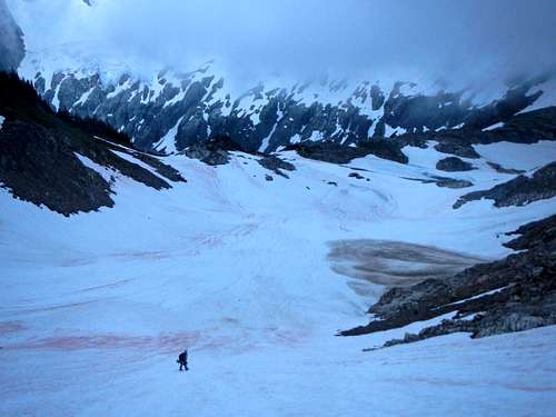
Considering the steep snow slopes to get to Yang Yang lakes, we decided to take the lower route. This is where my years of navigation though storms paid off quite well. We did a combination of descending and ascending through snow slopes and shrubby areas. At one point I wasn't quite sure which way was the right path. Pulling out the camera I see a "C" shaped snowfield right near by me. Using photographs and piecing together the evidence I figured out exactly where we were. With a bit of descending we arrived at Yang Yang lakes. We were both pretty pleased. For what ever reason the weather at the lakes was a bit better and allowed for minor openings in the clouds. But not enough to get much information on how exactly to go about our route.
Pointing Out the Way (Eric)
Yang Yang Lakes View
After having lunch at the lake I decided that following the trail was the best option. I'm not always into conformity but in this case it looked as if any other options could lead us onto places that are less than ideal. The trail faded off into a snowfield leading us up to the proper gully. As we enter the gully Eric announces that he does not feel comfortable with the idea of heading up into bad weather when neither of us know exactly where the route goes. "No worries Eric, I'm glad that you were willing to give it a try" I reply with a smile. For myself, the attempt was not in vain. We went back to south Yang Yang lake. "Our level of risk taking is quite different" Eric said. "I know". "So your okay with going into a white out with howling winds, possibly stormy weather, and not exactly sure where you are going" Eric replied. "Yeah" I whisper back. While bad weather was a possibility, it was not a certainty. Bailing on the Ptarmigan Traverse isn't such an easy task. It's a committing route. Eric and I were very aware of this fact. I told Eric that I was more than willing to bail, but that I believed that we could proceed safely. Eric examined his map figuring out our escape options and how far we still had to go. There was only one reasonable escape option which involved hiking down a potentially very bad bushwhack valley (Flat Creek) and then hiking up the Stehekin river all the way up to Cascade Pass. Then it would involve another round of possible hitch hike difficulties plus a 12 mile bike ride.
View from South Yang Yang Lake
We had much debating of our options and thought it over for a long time. Eric finally came to a conclusion. "I don't think this is a good idea, but I'll go for it" Eric announces. With quick time we hike back over from the lake to the bottom of the gully. The rest of the gully was not as bad as it looked. At the top of the gully we started descending the nearly flat ridge toward Le Conte Mountain. Eventually I found the trail! We were both ecstatic. After a while the trail faded into snow. Seeing a cornice near by was a good sign of us being on route.
Making the Best of It
As I traveled along the snowfield it appeared to steepen with cliffs below. "I'm not liking the looks of this" Eric said. He suggested the snowfield that was above. I didn't like the idea at first considering that it conflicted with evidence that I had, but I undermined the distance of a photograph. Nearing the top I take a look at my photos again and was pleased to announce that we were on route. From here the snow gently traversed along the edge of Le Conte Mountain. As I traversed the snow, I found the ski tracks again. "Well I'll be darned" Eric said with excitement. It was a neat time frame to see the Le Conte Glacier hanging over cliffs with a beautiful blue lake below and to be heading into a white out.
Using Pictures to Figure Out the Way (Eric)
Myself with Le Conte Lake (Eric)
Le Conte Glacier though the Clouds
Following the Ski Tracks
Looking down on Le Conte Lake
Flat Creek Valley
Near the edge of the glacier we found a rock spot to rope up. There was just enough room for the two of us to carefully get our gear together. It was a little bit tedious. Any wrong move and it could sent my backpack, ice axe, or other equipment flying down the cliffs below that go into a glacier. When we were all set I decided it was best to have my camera away. Eric fortunately took a few picture on the next part of the trip. As we walk onto the glacier, the views disappear and we are back into a whiteout.
The Cliffs Above
Crevasses on the Le Conte Glacier
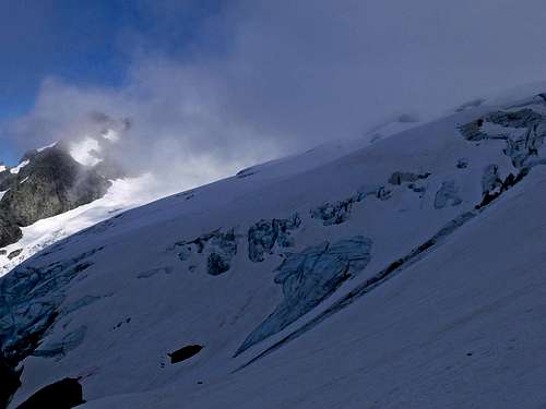
The glacier was in mostly good shape with a few crevasses to walk around. "Eric look, a arch shaped crevasse!" I yell. "I don't even want to look" Eric replies as he watches each step carefully. It had multiple layers to it. It almost had the appearance of an arch from arches national park. As the slope flattens out I start heading to the glaciers edge in hopes for it being our exit. As I look above I see nothing but dark gloomy cliffs. The place was anything but inviting. I decided that if this wasn't the way, either I passed it or had to try going higher. I decided it was best to try up before going back. Fortunately going up was the right call.
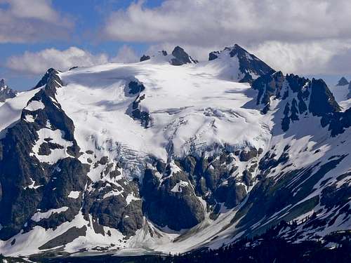
As we arrive at the second flat section I head back to the glaciers edge. "This is the gap" I yell in excitement". I show Eric the man made rock camp site. Eric was thrilled about this. At the very least we had a bail spot. But to maximize our time we decided to keep going. While traversing the edge of Sentinel Peak I had no more photographs to help give any evidence of where we were going. Fortunately I found the ski tracks which we followed for as long as possible. Eventually they led us to a series of cliffs. Through the fog we could see the glacier down below, it looked so massive. Perhaps one of the biggest in the state. With a little bit of looking around I found a ramp down onto the glacier.
South Cascade Glacier Below (Eric)
Is this Going to Go?
Exploring the Cliff Edge (Eric)
Taking the Ramp onto the Glacier (Eric)
We passed by a man made over sight. To my surprise the glacier did not have many crevasses. Yeah, there would be a baby one here and there, but no big deal. As time goes by I'm in a constant slog walk going up. Not entirely sure where to exit. We were lucky to have had a break in the clouds to see our exit. But the way it happened made it still some what of a mystery. "Josh, you need to head right" Eric would yell. I'd walk a bit right, but then eventually go back in the habit of following the curved glacier streaks. Perhaps it was because I was so tired. Eric told me again later, so I had us go diagonal to what we had been going. The slope steeped and eventually required a traverse. After crossing the snow we arrived on rock. After doing a bit more exploring I saw what appeared to be a saddle. Excitement roars as I tell Eric "I think this is it!". Heading down onto it I quickly discover that it was a cornice.
The sky was getting dark rapidly. I could see white rock lakes down below. I explained the situation to Eric. He was not pleased. Not only would we have to belay each other off the cornice but we were not even sure if the slope safely went. "Josh, we don't know if this goes" Eric yelled. "We are running out of time and we don't have a lot of options" I yelled back to Eric. There were only two passes that we saw. One was a high pass and the other was a low one. We were on the low one. Logically this made sense for this one to be the one, especially with what I remembered from looking at maps. But I could not confirm it. Eric seemed quite worried about this. I was a little bit as well. "We have to at least give it a try, waiting here won't solve anything" I said. Eric agreed. I set up the anchor while Eric took care of the rope. Eric decided to go first, I got the belay ready, and he was on.
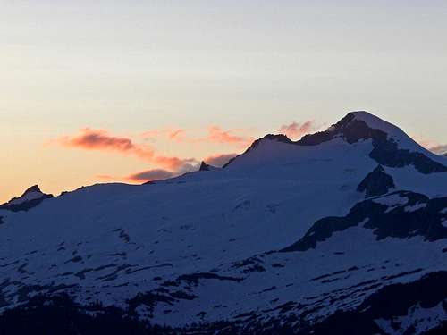
As I was belaying Eric off the cornice I saw one of the coolest things I've ever seen. Glacier Peak popped out of the clouds with full on alpenglow color. It dwarfed Dome Peak which looked huge in itself. Seeing it all in one setting was beyond words. It was for my eyes only. I couldn't take a picture because I was kinda sorta belaying my partner off a cornice. And it's kinda a big deal for me to make sure that goes well. By the time he was down the colors were gone. It was time for me to head down. Face in the slope, place axe in well, and kick in the snow. At the bottom we followed the bottom of the cornice to the other side where it seemed safer. Still racing the clock I quickly plunge step down the snowfield to make sure it goes. Once Eric arrived I did the final traverse and could happily announce "it goes". The rest of the way down was a snow walk to the lake. After looking around for a little bit we found a flat spot a set up camp. "That was the most absurd day of my life" Eric exclaimed.
Heading Down to White Rock Lakes (Eric)
So Excited for Dinner (Eric)
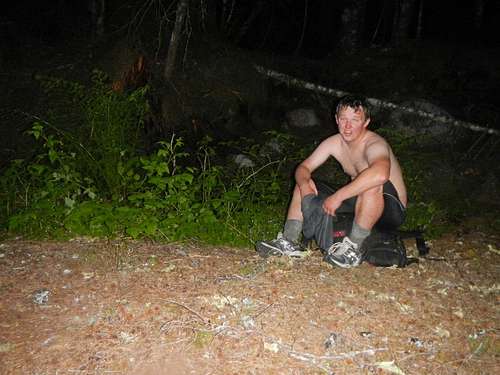
I walked down to West Agnes creek to fill up water for cooking and drinking. The view was so beautiful I decided to return for a night shot. After some tasty cheese pasta and good food I slept great that night.
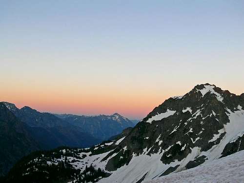
Dome, Sinister, and Gunsight during Evening
Dome Peak during Evening
Day 5: Bushwhack City
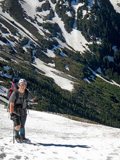
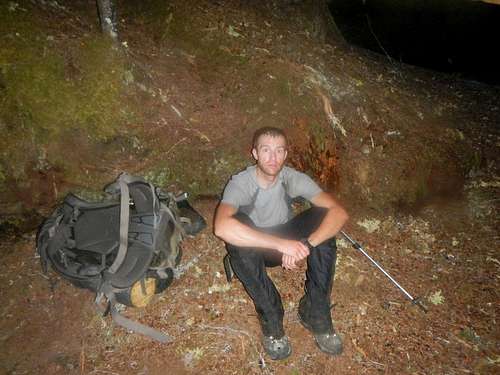
Once again we slept in a bit due to how tiring the previous day was. Eric helped bandage me up due to my blisters being even worse. "Josh, I know how you like your adventure. So how would you like to solo the rest of the way and I'll head down the Downey drainage?". It was indeed a tempting offer. I could avoid serious buchwhacking if I did this route. However there were some serious red flags that were raised. The gap over Spire Point had a cornice. There were some crevasses over the glacier. The Downey creek drainage had some steep contours. If either of us got injured, it would very very serious. With all these red flags I decided against the idea. "I appreciate the offer, but I'm going to have to decline" I said after a while of thinking it over. I've seen a lot of trouble in my time from splitting up. After having a bowl of cereal we packed up camp.
Creek View of Dome Peak
Spire Point's Northeast Face
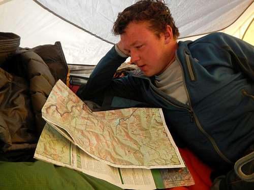
Looking over the Maps (Eric)
Sinister Peak's Northwest Face
The Pass we Came From
Agnes Mountain's West Face
Heading up to the Pass
White Rock Lakes View
Gunsight Peak
Yours Truly with Dome (Eric)
Spire on Spire Point
Old Guard Peak's Summit
Crevasses on the Chickamin
We passed by Agnes creek and filled up our water. I was going to miss this place, but at least I plan on being back. We hiked up to a pass above White Rock lakes just north of the German Helmet. We took a break and then proceeded down the last valley. Going down the snow wasn't bad at all.
Heading over the Last Pass
Mount Buckindy East Face
Hoch Joch Spitz South Face
Eric with the German Helmet
Pond Reflection
The German Helmet East Face
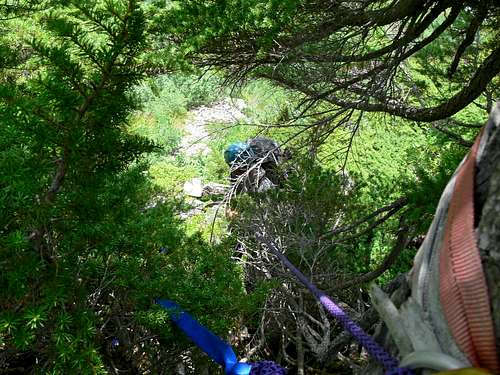
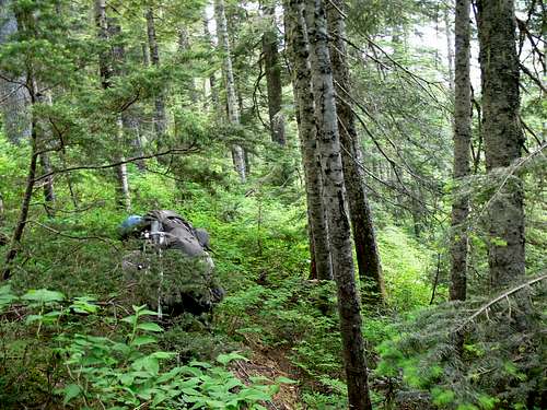
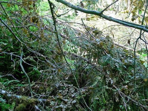
Eventually we start getting back into the woods. This is where things got interesting again. As we went down the route appeared to drop off a cliff. I decided to traverse slightly upward towards the German Helmet. To my luck I found a 5 slinged rappel station. It looked like the only reasonable way down. The rope would not reach with a traditional rappel. Fortunately Eric knew how to setup a pull cord. After a while of setup Eric carefully rappelled down and so did I. As I went down I made sure there was no tangles on the tree. At the bottom I pulled the rope and it came off cleanly. This was the beginning of what became one of the worst bushwhacks I've ever had.
Rappelling Down from the Woods
Waterfall Below the German Helmet
Finishing up the Rappel (Eric)
Near by Waterfall (Eric)
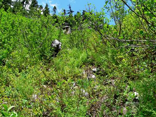
The bushwhack started out moderate. The slope was steep enough to knock rocks down and require many veggie belays. As we went down further there were snow patches that went over a small creek. At times you had to hope you wouldn't fall in. Sometimes you did anyways. There were so many bugs in a few spots. At one point I was constantly picking them off of me and holding my breath. It didn't help that it was humid, hot, and I was covered in sweat. For a short period of time we escaped the bushwhack and onto boulders. I could finally take off my plastic boots and gear down to tennis shoes. But before doing that I had to inspect my feet. They felt terrible! The band aids and bandages were old, leaving me no choice but to take them off. It wasn't pleasant. Eric pulled out his first aid kit while I washed my feet off. Eric used a ciringe to pressure wash the wounds on my legs. He took good care of me which was deeply appreciated. After everything was all set we started hiking down the boulders. Every step was painful by this point. Every now and then I would almost sprain my ankle. Eric saw this and was concerned. So was I. Each step had to be made with caution. But due to my fragile state my carefulness wouldn't hold up forever. At one point I lightly rolled my ankle. Fortunately it wasn't bad so I was still able to proceed with a fair pace.
Heading Down into the Bushes
My Feet Before they Got Worse
Veggie Belaying Down (Eric)
Happy to have Washed my Feet (Eric)
As the slope eases the creek bed nearly ended and the bushes took over. This is when things got ugly fast. Following the creek would never word, so we decided that heading into the woods was the best option. The edges between the woods and the creek were the worst spots making it a annoying zone to cross. The woods at least provided some relief, although they weren't that good either. It slowly got worse and we ended up seeing fields of devils club. Fallen over trees were either our best friend or at other times our enemy. Some trees would "explode" as you walked on them, but it is worth the risk considering how much time they saved. There was no where good to camp. In fact there was no where bad to camp, it was all terrible. After hours of bushwhacking we see another major creek drainage. "I think this is Bachelor creek" Eric said with a happy tone. "Sorry to bring the bad news, but this is not Bachelor creek. Above is the Spire Glacier" I replied. We were both disappointed by this fact. This meant we had hours to go before arriving at camp.
Friendlier Bush Whacking
Spire Point from the Northwest
Messzilla
Going from One Tree to Another
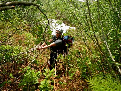
The forest became more and more epic as we went along. Jump here, climb over that tree, get scrapped up by devils club, cross this creek, head up hill a ways, go back down. Soak soak, my feet just got soaked. I'm sure that will help add to the blister situation. It wasn't like this happened every now and then, it was constant. I was constantly out of breath, constantly sweating down my face, getting new scrapes, hurting my feet, getting more exhausted, running out of time, becoming more fatigued, head ache starting up, jump, jog, walk across the log. Suddenly it collapses and I hit my shin super hard on a hidden log sticking out. "Awwwwwwww ha ha!" I yell in pain. Almost like being stabbed, oh wait I kinda was. I saw blood coming out my sock. This was the worst battle scar from the trip.
Crossing a Creek
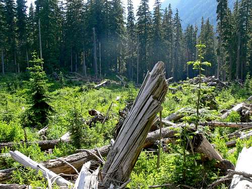
Looking above I saw the ridge going down. But it had been going down all along. Or so that's what it looked like. "When will it end?" I laughed with hysteria. With each motion, each push, and every breath I knew that if I give in just a little bit I would be forced to sleep out in these terrible woods with no tent and getting bit up all night. After many more hours of bush whacking the woods finally curve, we rise up in elevation, and I knew we were close. The woods were getting dark but we arrived just in time to the Downey creek trail. "YESSSSSS!" I exclaim in a joyous moment. We soon arrive to a flat area where camp was set up. I filled up water and sat down. I had spent almost everything I had to come this far. I was so fatigued I couldn't help Eric setup the tent. Well I could have, but by the time I would clip in a item or two he would have done at least 10 times more work than me. I just lied down under all my weakness. After some well deserved food and water we went to sleep.
I Don't Feel Like Getting Up (Eric)
Are We Done Yet?
Day 6: Leaving the Mountains
Eric bandaged what he could of my feet. "Those are the worst looking feet I have ever seen" Eric exclaimed. "This is the worst my feet have ever felt" I replied. I wasn't quite sure how well my feet would hold up that day, but I wasn't about to give up now. The start of the trail was decent until we crossed the Downey creek bridge.
Back Into the Bushwhack
The trail was in terrible shape. "What is this?!" I yelled as I saw dozens of fallen over trees and devils club on the trail. There's no easy way out. I smiled knowing that's how it usually goes down. But I didn't come here for easy adventure. The devils club even grew over parts of the bridges which was a huge surprise to me. Last year when I climbed Dome Peak the trail was in great shape. Now it was one of the worst looking trails I've ever seen. After many more miles of bad trailness we arrive at the Suiattle river road.
What is This?
The rest of the walk home was just enduring miles of road walking while being quite tired. Eric made me remember a poem as we walked which to my surprise I remembered. We had many other fun conversations during this trip. When we arrived near the trailhead I said "the mind see's what it wants to see" as I thought I imagined seeing the gate. Sure enough I saw it again. "I wasn't imagining it" I yell happily. I instantly bit my tongue. At the car I was so happy to take off my pack, shoes, and socks.
Paranoid of Hornets (Eric)
Happy to be Back! (Eric)
After the trip I went to see a doctor for my feet. They gave me over 10 days of antibiotics to prevent my legs from getting infected. My legs on some days would be so swollen that I would almost skip college, but I knew that would defeat the purpose of rushing on this trip. So I went anyways. It wasn't until 11 days later that I could comfortably run again. This was an experience I will never forget.
way to make the right call at the Spider-Formidable col, we went straight down from the larger gap and had to down climb some chossy nonsense.
why did you decide to go down downey creek instead of continuing over Spire Col to cub lake and the, as you know, not really that bad bushwhack?
I wanted to go over the Spire col. But Eric was tired of climbing over mountain passes and wanted to get out of the mountains as soon as possible. I knew that going solo the standard way would be way to hazardous for both of us. Eric wouldn't have had a rope for the rappel, I could have had to travel on glacier unroped and go over a cornice. We could have tried to figure something out or go for the Dana Col but again, he felt that he had enough. I can't say I blame him.
The bushwhack down Bachelor was friendly, almost non existent. I wish it was like that going down. But we made the best of it and got a good adventure out of it.
I've always wanted to do the ptarmigan traverse, but after reading this I'm having second thoughts... sounds like the last couple days were terrible! lol, I'm glad you made it back ok and that your legs and feet weren't worse off then they were! Excellent report!
Thanks Aaron. I was happy to have waited. The bad weather, limited time, and taking the wrong exit contributed to it being an epic adventure. I certainly recommend going when you feel ready. What ever you do, don't take the upper Downey creek drainage.
Well done on surviving the bushwhack down Downey creek. Bushwhacking in the Cascades is possibly the hardest thing to do in that range (or anywhere). It makes glacier travel seem easy and straighforward! My buddy and I also wanted to bail at White Rock Lakes, and we decided to go down West Agnes Creek and try and hook up with the PCT, which was a terrible idea. We got trapped by raging glacial melt creeks and slide alder and had to be helicoptered out.
Dana glacier and Spire col look so steep from White Rock Lakes, especially after being so tired and mentally exhausted. Every time I think about that trip, I think, "we should've taken a rest day," and just gone over the Dana Glacier. Looking back at photos and maps, it's no steeper than the stuff we had already gone over, like that steep descent from Spider-Formidable col and the descent to White Rock Lakes. And even going up LeConte glacier.
Anyway, that helicopter ride is the low point of my mountaineering career, but calling for help did seem to be the right decision. The guys who rescued us told us that if we hadn't gotten trapped, it would've taken a week to navigate all the deadfall and brush to get back to the PCT. Apparently the trail shown on the map up West Agnes Creek from the PCT hasn't existed for years.
Lesson learned. No bushwhacking in the Cascades, especially going DOWN unknown terrain!
Children refers to the set of objects that logically fall under a given object. For example, the
Aconcagua mountain page is a child of the 'Aconcagua Group' and the 'Seven Summits.' The
Aconcagua mountain itself has many routes, photos, and trip reports as children.
Parents refers to a larger category under which an object falls. For example, theAconcagua mountain page has the 'Aconcagua Group' and the 'Seven Summits' asparents and is a parent itself to many routes, photos, and Trip Reports.


Comments
Post a Comment