
-
 5590 Hits
-
 77.3% Score
-
 8 Votes
|
|
Area/Range |
|---|---|
|
|
50.76286°N / 15.49897°E |
|
|
Hiking, Sport Climbing, Skiing |
|
|
Spring, Summer, Fall, Winter |
|
|
INTRODUCTION
At the beginning of this presentation we ought to consider how to name these mountains in English. In Polish they are called “Góry Izerskie”; in German they are known as “Iser Gebirge”; in Czech they are “Jizerske Hory”. Three nations which border here create the name taking a core of the word from the name of a main river, Izera or Jizera, which flows between both, Polish and Czech parts of the mountains. Then, starting in Poland with the name creation, the Izera Mountains is a proper short indication.The Izera Mts. are composed of many ranges extended in SW Poland and NW Czech Republic. This item of Areas & Ranges relates to the Polish part of these mountains. Border of both states is going southward, west of Czerniawa Zdrój. Near Czerniawa Zdrój there is also a border crossing to Nove Mesto. Next, the border runs between summits of Smrek (1123 m asl) and Smrk (1124 m asl) and subsequently exactly along the Izera river up to Harrachov.Today the Izera Mts. are not inhabited. Only three hostels called “Orle”, “Chatka Górzystów” and “Na Stogu Izerskim” are at disposal here. However, in the past, people were more active in this area. In Orle, a large glasswork was located. On Hala Izerska, where now only Chatka Górzystów is for
tourists, previously there existed a large village called “Gross Iser”, probably since 1630. After 1945, this original village was almost completely destroyed. In Poland, two larger cities are close to the Izera Mts., Szklarska Poręba Górna and Świeradów Zdrój.

Scheme map of Izera Mts (Góry Izerskie & Jizerske Hory) - mountains (green), cities (brown), border cross (yellow arrows), waters (blue), main roads (grey lines), state border (red broken line), mounts (red triangles), hostels (violet rectangles), small settlements (red circles)
OVERVIEW
The Izera Mts. and Jizerske Hory are cut by a state border. Their Polish part is separated from the Lusatian Mts. by a deep Czech Gate (240 m asl) in a valley of the Nysa Łużycka river. Steep slopes along a line Świeradów Zdrój-Przecznica-Proszowa-Chromiec are directed northward, where the Izera Foothills stretch. The Stara Kamienica Lowland separates them from Kotlina Jeleniogórska (Jelenia Góra Hollow). The eastern border of these mountains is Zimna Przełęcz, 525 m asl (Cold Pass) and it distinguished them from the Rybnica Highland. Deep and long valley of the Kamienna River is the border between the Izera and Karkonosze Mts.

Scheme map of Izera Mts. and other mountain ranges in Sudetes (SW Poland)

A forgotten trail on the northern slope of Świeradowiec (1002 m)
SHORT GEOLOGY
The Izera Mts. are built by variscan granite and by surrounding metamorphic rocks like gneisses, granitoids and mica schists. History of these rocks starts with the Caledonian orogenesis in the Paleozoic Era. Here one can find ring-eyed, fine-grained or fine-eyed gneisses. Granitoids of a special type with blue sapphire quartz are called the Rumburk granite, another one is a light leucogranite. In the Rumburk granite on the Kamienicki Range and on slopes of the Mount Smrek, nice pieces of smoky quartz could be found. Slates composed of muscovite-sericite-chlorite are grey, silvery-grey or green-grey and constitute the northern part of the mountains called Grzbiet Kamienicki (Kamienica Range). Very hard dark fine-grained hornfelses created by the metamorphosis of slates under high temperature are the main component of Wysoki Grzbiet (High Range). They are especially common within a contact zone between geologic massifs of the Izera Mts. and Karkonosze Mts. In metamorphic rocks, there was a crystallization of a huge vein of pure quartz in the Izerskie Garby (1084 m asl) as well as appearance of basalts along a line of a tectonic fault between Stara Kamienica and Rębiszów. On Izerskie Garby, a large mine excavating quartz was active through a long time and as a consequence of this, almost a half of the mountain has been devoured. Fortunately for the nature, this mine is closed for several years. Today this image of Izerskie Garby creates new offers for people learning the geology and mineralogy of these mountains besides being suitable for new pioneer plants and animals. In the eastern wall of the mine, a vein of skarn, some kind of metamorphic calc-silicate rock, contains many minerals: wollastonite, stilbite, apophyllite, diopside, vesuvianite, garnets (grossular, hessonite), fluorite, calcite, tremolite and actinolite. Another part rich in minerals there are northern slopes of Grzbiet Kamienicki where many ores like cassiterite, safflorite and smaltine were mined from slate layers. It is also possible to find beautiful almandine garnets and crystals of chalcopyrite, arsenopyrite and galena in these slates. In the Izera Mts., especially in their central part in Hala Izerska since the XVIth century, precious and semi-precious stones were gathered in the Jagnięcy Potok. This stream starts from springs on slopes of Wysoka Kopa Mt. and eroding the bottom it accumulates many heavy minerals in alluvia. Nice specimens of ilmenite, gold, sapphires, zircon, corundum, beryl, topaz, garnets and tourmaline were found here.

Scheme map of Góry Izerskie with general data on geology - state border (red broken line), mounts (blue triangles), main tectonic faults (black lines)

Tectonically altered piece of quartz on the red trail leading to Izerskie Garby Mt. (1084 m)
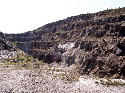
The western wall of the abandoned quarry on Izerskie Garby (1084 m) with slide cones formed by eroded rocks.

Skarn breccia exposed on the eastern wall in the quartz quarry on Izerskie Garby (1084 m)
GEOMORPHOLOGY
Orography of the Izera Mts. is determined by their geology, the granite centre and metamorphic surroundings. Mountain ranges are formed accordingly to parallels. During the Tertiary Period, the area was tectonically dissected and elevated up to 1000-1100 m asl. Summits are flat, forested by spruces, mountain pines and, today, by planted larches. At many sites, on round mild summits, the peatbogs getting water only from rain or snow were formed during the post-glacial period (ca 10,000 years ago). The Polish Izera Mts. are composed of two parallel ranges, the northern lower range called Grzbiet Kamienicki (the Kamienica Range) with the highest mountain Kamienica (975 m asl), and southern, higher range called Wysoki Grzbiet (the High Range) with Wysoka Kopa (1126 m asl), as the highest mountain in all the Izera Mts. (Polish and Czech). Southern slopes are not steep, mainly forested, sometimes covered by bare rocks. However, the northern ones are distinctly more difficult for hikers. Some summits like Wysoki Kamień (1058 m), Zwalisko (1047 m), Czerwone Skałki (948 m), Kozi Grzbiet (945 m), Granicznik (870 m), Krogulec (1001 m) or Kobyła (907 m) are crowned by naked rocks suitable for climbing or bouldering.

Many peatbogs were developed on flat summits in Góry Izerskie. Peatbog on the red trail leading through Podmokla (1001 m) and Szerzawa (975 m)

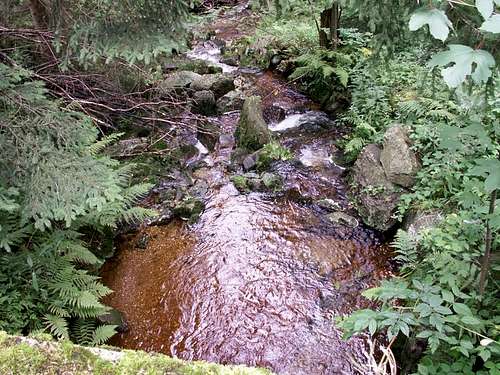
Granite boulders are characteristic rock deposit in river beds; Kamienna River, Szklarska Poręba Górna - Huta

In lower parts, gravel alluvia are formed in river beds. Gravel alluvium in the Jagnięcy Stream flowing through Hala Izerska.

Rocky outcrops dominate on some mountain summits. Hornfels outcrops on the summit of Zwalisko Mt. (1047 m)
CLIMATE
In the Izera Mts. there are lower temperatures and more rainy and snowy days than in any other part of Sudetes. Above 800 m asl, the average temperature is only 4.5oC and vegetation starts at the end of April and lasts through 75 days with an average daytime temerature of ca 10oC. Annual precipitation (rain and snow) equals ca 1200 mm, sometimes 1500 mm (maxima in July and February/March). Through ca 110 days the Izera Mts. are snowy. September is sunny but the next month is very cloudy and misty. On 29th December 1996 a very low temperature, -36.6oC, was noted on Hala Izerska, a meadow located low between surrounding mounts. This meadow is sometimes called “a Polish polar pole”. A snow
cover in the Izera Mts. is probably the best in Poland for ski races. In March a winter “Bieg Piastów” (the Piasts’ Race) attracts many participants. Also, near Jakuszyce, famous winter dog races are organized here. All this is done due to good snow cover. In some places its thickness even amounts to several meters. Frosty days in June and July are not uncommon. Heavy rains and thunderstorms often occur in July. However, at present, a distinct weather change is noted. Annual precipitation is reduced and the temperature increased.

Morning clouds in Szklarska Poręba, Karkonosze Mts. behind.
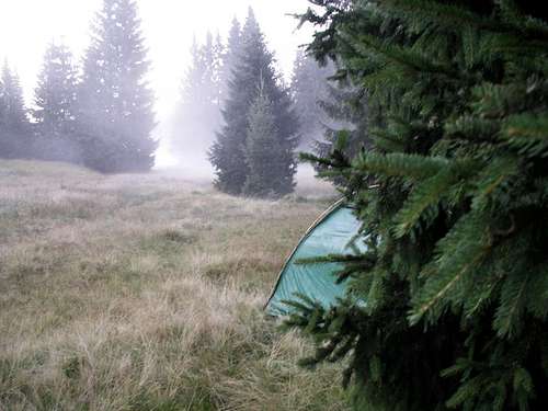
Misty morning at my camp over the Kamionek Stream (August 2016)

Snow and ice accelerate erosion of rocks. Hornfels rock on Zwalisko Mt., winter 2015
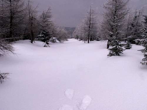
Some winter days are very cloudy and dark - just on a pioneer snow route
WATERS
In the Izera Mts. a border between two river catchments tributing the North Sea (the Labe River) and Baltic Sea (the Odra River) goes through the Wysoki Grzbiet.. The Odra River collects waters from tributaries like Nysa Łużycka, Smeda, Bóbr, Kwisa and Kamienna, while the Labe River takes water from Izera.Main rivers of these mountains are: Izera flowing between Polish and Czech parts of the mountains, Kwisa separating two mountain ranges in Poland, Wysoki Grzbiet and Grzbiet Kamienicki, and Kamienna which starts in Karkonosze Mts. and divides the Izera Mts. from Karkonosze. Springs of the Izera River are located in a large area of peatbogs, little southwards from summits of Smrk-Smrek. Kwisa starts from several springs called Widły I, II and III on the northern slopes of Izerskie Garby and a massif of Wysoka Kopa and Przednia Kopa. The beautiful and wild Kamienna has springs on the northern slope of Mumlawski Wierch in Karkonosze. The peatbogs are very characteristic formation in the Izera Mts. They are mainly situated on flat surfaces of mild summits and stain the waters dark brown. A lot of small streams collect water from these peatbogs and tribute it into these rivers. All these streams are very wild and picturesque and especially interesting for mineralogists. In their alluvia, many valuable stones were found, e.g. in Izera, Jagnięcy Potok, Kobyła, Kobylka or Mokrzyca.Springs are also created by underground water flowing from rocky clefts or slopes covered by stones and boulders. High precipitation, underground clay and steep slopes cause a very quick run-off, especially during spring thawing of snow and summer storm rains. Consequently, sometimes dangerous floods can occur in this area.My being here to look at rocks, minerals, plants, animals and beautiful landscapes coloured by sunrises and sunsets would not be possible without these waters, needed to prepare meals.

Scheme map of main waters in Izera Mts.
The Mokrzyca Stream on the northern slope of Podmokla (1001 m)
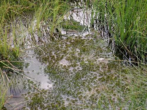
Sedges and Sphagnum growing in peatbog water (Podmokla 1001 m)

Long and shallow (ca 50 cm in depth) water reservoir on the fifth mining level in the abondoned quarry on Izerskie Garby (1084 m); view towards NW.
FLORA
The area lies mainly on the level of deciduous forests and only a part of Wysoki Grzbiet is on the level of coniferous trees. The past natural forest was composed of beech, fir and sycamore. During the XIXth c., these mountains were deforested due to the activity of glass- and metalworks and spruce trees were commonly planted. During 1970-1980, the area was heavily polluted by huge brown coal mines located in Turoszów (Poland) and Zittau (Germany). Acid rains and the following invasion of insects killed spruce forests on almost all the territory of these mountains, firstly in Czech Republic and next in Poland. The same occurred in the close Karkonosze Mts. Since 1978, weaken forests were invaded firstly by a small moth Larch Tortrix, Zeiraphera griseana and next by Bark Beetle, Ips typograhus. The Izera Mts. have been completely abandoned by tourists. The image of mountains was sad and even terrible. Many woodcutters, also from Romania, cleared this area of dead trees. Nobody visited this place. No bird, no viper, no mushroom was seen on devastated surfaces. Next, a revitalization of these mountains started due in part to European Union funds. Slopes were forested by new species like beech, Sorbus aucuparia, birch and larch. In the lower parts, near streams Alnus glutinosa and A. incana were introduced. On summits, where thick snow cover lies through a long time, shrubs of Pinus montana were planted. At present, only in some parts, we can observe signs of the past disaster, e.g. on summits of Smrek, Wysoki Kamień or Kamienica. However, in general, these mountains are again beautiful and full of life.In some lower parts, the old beech forests were preserved. Their undergrowth is composed of Mercurialis perennis, Asperula odorata, Lamium galeobdolon, Viola silvestris, Galium hercynicum and Lilium martagon. On a ridge of meadows, one can easily see different colour variants of Digitalis, yellow Senecio fuchsii, Cirsium helenioides or Meum athamanticum. In the spruce forest, we can find Vaccinium myrtillus, Empetrum nigrum, Deschampsia flexuosa and D. caespitosa. Aconitum, Mulgedium alpinum and Mimulus guttatus grow near streams, the last one being of an American origin. Vegetation of many peatbogs is formed by trees of Pinus montana, Picea abies and Betula nana. Open area is covered by Rubus chamaemorus, Vaccinium myrtillus, V. uliginosum, Oxycoccus palustris and Andromeda polifolia. Common sedges and rushes are Eriophorum vaginatum, E. angustifolium, Baeothryon caespitosum, Carex rostrata and Juncus filiformis. Within a mosaic carpet of Sphagnum one can observe S. fallax, S. riparium and Drosera intermedia, D. rotundifolia and very rare D. anglica.Two types of vegetation were distinguished on a meadow lying on the eastern slope of Andelsky Vrch (572 m), near Czerniawa Zdrój. They are: a poor and dry vegetation versus a rich one growing on swampy soil. Both species of Deschampsia, D. flexuosa and D. caespitosa, dominate here. In addition, other grasses, rushes and sedges: Agrostis vulgaris, Holcus mollis, Festuca rubra, Nardus stricta, Carex fusca, Scirpus silvaticus, Juncus conglomeratus and J. effusus grow over there. Stellaria graminea presents subtle habitus and white flowers. Hypericum perforatum, Lysimachia vulgaris, Ranunculus repens and Potentilla erecta create yellow patches on this meadow. Near small streams, I found two species of willow, alder trees, and beautiful tufts of Athyrium filix-femina. Viola palustris, Cirsium palustre, Epilobium palustre and some orchids (see pictures) are rare here. Leaves and young twigs of Frangula alnus are eaten by deers and roes. On meadows, many plants are dispersed from surrounding forest, e.g. Prenanthes purpurea, Vaccinium myrtillus, Galium hercynicum.

Baeomyces rufus, a lichen (N slope of Podmokla 1001 m)

A weeping mushroom nearby the Mokrzyca Stream (N slope of Podmokla, 1001 m)

Dicranella sp., a moss, on gneiss

Tufts of Nardus stricta, a grass, on the red trail, Świeradowiec 1002 m.
FAUNA
Many carnivorous large mammals (bear, lynx, wolf) and spectacular birds (eagle, falcon, eagle owl) disappeared through many centuries from the Izera Mts. Serious pollution of waters and pearl-fishing eliminated swan mussels from the Kwisa River. Restitution of large mammals like bears, wolfs or lynxes, is not possible at present because of the increasing tourist movement in these mountains, especially in the Czech part. Now, in the Izera Mts. and at their bottom, one can find the same large mammals which are also common in other parts of Poland and Czech Republic. Lower sites, wet deciduous forests, meadows near rivers and water reservoirs are habitats for boars. Higher places, spruce and larch forests are visited by roes and deers. Especially, spectacular for tourists there is a deer’s rut in September/October when roars of males can be heard from a long distance. Their mating place is called Jelenia Łąka (north of Krogulec Mt., 1001 m asl). Other animals there are as follows: foxes, badgers, Raccoon Dogs, squirrels, martens and bats. South of Czerniawa Zdrój in the abandoned adits of a cassiterite mine on slopes of Czerniawska Kopa (776 m) and Mała Góra (728 m) bats nest and rest during winters.Acid rains caused by the brown coal mines and power-stations near a meeting point of Czech, Germany and Poland borders destroyed in the Izera Mts. spruce forests completely. Now on decaying trunks many new insects live. The rare and relic fauna can be well preserved in areas which are not often visited by tourists. Peatbogs are such localities and they are especially carefully protected. The linked Polish-Czech peatbog reserve called “Torfowisko Doliny Izery – Raseliniste Jizery” is protected in the form of “Natura 2000” area.In the Grzbiet Kamienicki, a mating play of White-tailed Eagles was observed and their nesting is documented today. Another beautiful and very rare bird, Peregrine (Falco peregrinus) has a nest in the Czech part of the mountains. I observed a hunting couple on the summits of Podmokła (1001 m) and Szerzawa (975 m) and a single bird several times at other sites. Summits of dead and standing trees are good points for carnivorous birds to rest and observe an area. I also noted other interesting behaviour of various animals which are as follows:
- anunsuccessful hunting of a female of hawk on a hare (the northern slope of Wysoki Kamień; at the end of March)
- a flock of Ravens above this mountain
- a mating dance of a male of Black grouse near Rozdroże pod Cichą Równią and onthe summit of Izerskie Garby (3:00 AM)
- a mating song of Pelobates fuscus onthe eastern slope of Smrek (on an early spring)
- a melanistic form of Lacerta viviparahiding from me at the bottom of shallow pond (Grzbiet Kamienicki)
- the butterfly, Camberwell Beauty, Nymphalusantiopa, was seen many times on Grzbiet Kamienicki and Wysoki Grzbiet nearRozdroże Izerskie
- the butterfly, Brimstone, Gonepteryx rhamni,numerous and in many places
- large gold-green individuals of Chrysolinasp. on slopes of Smrek.
Listening to voices and looking at tracks and excrements one can add new data on the presence of animals in the Izera Mts.:
- birds: Cranes (peatbogs in the Izera Valley), Nutcrackers (Biały Kamień), Wood Pigeons, Buzzards, Jays, Cuckoos, Black birds, Woodpeckers, Tits, Finches, Bullfinches, Thrushes, Wagtails and a lot of small singing birds. I hike in these mountains throughout the year but exceptional concerts given by hundreds or even thousands of birds can be heard only during their mating and nesting in April/May, just before sunrise. Other beautiful presentations are evening concerts given in summer by many males of Blackbirdin the Izera valley.
- reptiles and amphibians: viper, fire salamander, common and green toad, various species of frogs (ca 30-50% of their eggs is destroyed when warm but tooshallow puddles dry)
- insects: various species of bumblebees, large and beautiful Carabidae, as wellas Hypoderma diana and small Simuliidaewhich are unbearable to people.
One should remember that males of cuckoo can awake us at 2:00-3:00 a.m.,much earlier than any other birds. This happened during my spring camp in theWhite Valley near Szklarska Poręba!

Lacerta vivipara in the abandoned quarry on Izerskie Garby (1084 m). This reptile was observed in the lowest mining level, nearby the small lake

Three ladybugs in the quartz quarry, Izerskie Garby, August 2016

Viper

Traces of deer in snow
HISTORY
The area situated north of the Izera Mts. were inhabited since the IXth century by a Slav tribe called Bobrzanie. During the mediaeval period, settlements were set in the mountain foothills, close to present cities, Mirsk and Kamienica. Most of the present villages and cities were established in the XIIIth century. At the beginning of the Xth century, this area was ruled by Przemyślid’s dynasty from Czech, but at the end of this century, the territory was conquered by the Polish Piast dynasty and then by the German emperor Conrad II. During this time, the area was ruled by Polish, Bohemian and German kings but later by Bohemian and Austrian rulers. After the first Silesian War between Austrian Empire and Prussian Kingdom (1740-1742), a border was established almost the same as the one between Poland and Czech Republic seen today. An interesting history relates to the coldest point of the Izera Mts. called Hala Izerska. In the XVIIth century (ca 1630), Bohemian protestant escapers settled a village here, called Gross-Iser. Its development was very slow because of a
heavy climate and swampy bottom. In 1734, this settlement accounted 13 farms. Inhabitants were active as shepherds, poachers and smugglers. No crops and gardens were cultivated here. This place was called Small Siberia. When a nearby city, Świeradów Zdrój (Bad Flinsberg), was developed as a spa, Gross-Iser became very attractive for patients and tourists. In 1933 Gross-Iser was inhabited by 133 persons keeping 43 houses, 3 inns, 2 hostels, 2 custom huts, 1 hunting hut, 1 coffee house, 2 schools (old and new, the latter built in 1935), fire-brigade house and forester’s cottage. After the World War II any access here was restricted. Houses were destroyed and only the new school was preserved and today this house is called “Chatka Górzystów” and it is used as a small hostel. The Bohemian Protestants also settled near a cobalt mine in the western vicinity of Świeradów Zdrój. Bohemians’s houses were situated in the deep valley of Czarny Potok (Black Stream). The village was called in German Bad Schwarzbach and in Polish Czerniawa Zdrój. Next, the village was developed as a small spa. Today this old spa is a part of the city of Świeradów Zdrój. Old pictures of the area presented in this page in the form of old postcards relate
mostly to these two spas, Świeradów Zdrój (Bad Flinsberg) and Czerniawa Zdrój (Bad Schwarzbach) and are taken from a private collection of my friend, Jurek Błaszczyk. I express my great gratitude for him.

Stone or artifact? (N slope of Świeradowiec, 1002 m)

House ruins nearby the blue trail leading from Świeradów Zdrój to Polana Izerska

Artifacts collected from the Kamionek Stream, nearby the Orle settlement (August 2016)

Granite old route sign (1889) in Polana Izerska

Panorama of Świeradów Zdrój (Bad Flinsberg), ca XIX/XX c.
![1901 ...]()
View of Czerniawa Zdrój (Bad Schwarzbach, 1901)![Hernsdorf ...]()
View of Hensdorf Road to Świeradów Zdrój (Bad Flinsberg). Herndorf was a small village situated between Czerniawa Zdrój and Krobica and next Świeradów Zdrój. This postcard was probably edited at the beginning of the XXth c.

View of Czerniawa Zdrój (Bad Schwarzbach, 1901)

View of Hensdorf Road to Świeradów Zdrój (Bad Flinsberg). Herndorf was a small village situated between Czerniawa Zdrój and Krobica and next Świeradów Zdrój. This postcard was probably edited at the beginning of the XXth c.
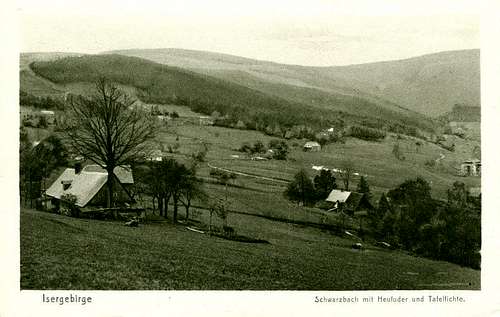
View of Czerniawa Zdrój (Bad Scharzbach) and Stóg Izerski (Heufuder, on the left) and Smrek (Tafelfichte, on the right)), the I-st half of the XX c.
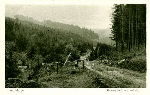
View of a forest road in the Czarny Potok Valley (Schwarzbachtal), the I-st half of the XX c.
HIKING AND WINTER SPORTS
The summer hiking is easy in these mountains. From cities surrounding this area, Świeradów Zdrój, Szklarska Poręba Górna and a Jakuszyce settlement, the convenient roads are built into the massif. In the massif, roads are made of pure quartz mined in the Izerskie Garby quarry. They are very useful for bicyclists and hikers. Other trails penetrate forested and swampy parts of the mountains which are heavier for trekking.Winter hiking in the Izera Mts. is completely different and it is reallyspectacular. We have an access to extensive snowy fields. Almost nobody campshere during long winter nights. However, winter mornings are exceptional - fullof sun, sharp whiteness of snow and an excellent silence. All the large animalsmoved down toward lowland because of a very thick snow cover. During hiking,one can only see tracks of small and light animals, like mice, foxes and birds.Winter sports, especially skiing, are very popular in these mountains. Famousraces are organized here for skiiers and for dogs. Jakuszyce is a center forthis activity during the winter months. At present, however, winters are milder and snow precipitation is lower. The mountains are visited most often by Poles,Czechs and Germans.

Stop at hornfels rocks, slightly below the summit of Wysoki Kamień (August 2016)
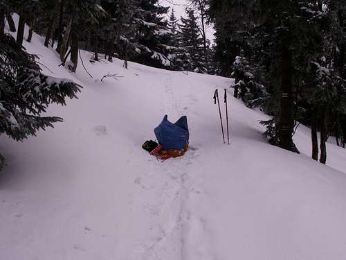
Snow cover is just right for tobogganing...

Information on tracts for ski runners in the vicinity of Jakuszyce settlement

Young ski runners, winter 2013
GETTING THERE
Wrocław (Poland), the main city of the Lower Silesia province, can be reached by planes. There is a very convenient railway connection with trains that run often between Wrocław and Jelenia Góra and buses which run less frequently. Then, to hike in the Izera Mts. we start from Wrocław, the capital of the province, Lower Silesia. We are traveling to Jelenia Góra by train or by bus (it is more convenient) or by train we are travelling to Jelenia Góra. Some trains also go directly to Szklarska Poręba Górna, and some buses go to Świeradów Zdrój. These two cities are situated on the edges of these mountains. A bus travel from Wroclaw to Świeradów Zdrój lasts more than 3 hours. Both cities can also be reached by cars and buses from the main city of the region, Jelenia Gora. At present, an old railway between Szklarska Poręba and Harrachov is renewed and a trail leading through the beautiful valley of the Kamienna River, next to Harrachov and finally to Germany will be proposed for tourists. An access from the north into Grzbiet Kamienicki is possible from several villages like Piechowice, Antoniów, Proszowa, Przecznica, Gierczyn and Krobica. They are connected by good road suitable for cars. Moreover, such places as Czerniawa Zdrój, Świeradów Zdrój and Szklarska Poręba can be reached by road meandering between Grzbiet Kamienicki and Grzbiet Wysoki, Traveling from Szklarska Poręba Górna, through a small settlement Jakuszyce, one can reach the Czech border, nearby Harrachov. From Jakuszyce, we can easily reach Orle by car or by a pedestrian route. From Szklarska Poręba Górna you can reach the summit of Szrenica Mt. in the Karkonosze Mts.

Railway station in Szklarska Poręba Górna
ROUTE INFORMATION
When you are going to ascend the Izera Mts., you can start from two cites in Poland, namely many nice summits offering broad panoramas around, northward to Kamienicki Range and
southward to other parts of Izerskie Mts. as well as Jizerske Hory in the Czech Republic. Following a red trail, we will ascend firstly to Wysoki Kamien Mt. (1058m) composed of hornfels rocks, and the next ones are the following summits: Zwalisko (1047m), Izerskie Garby (1084m) with a past mine of quartz, Przednia Kopa (1114m), Sine Skalki (1122m), Rudy Grzbiet (945m), Szerzawa (975m), Podmokla (1000m). Next we reach a lower flat area called Polana Izerska. From this point we can choosesome more difficult and steep way still along a red trail leading to Stóg Izerski Mt. (1107m), an eastern neighbour of Smrek, or we can go by the so called “Droga telefoniczna” (a Telephonic Way) and reach the pass Łącznik between Stóg Izerski and Smrek. At this point we will see a small wooden hut called a “Hunters Hut”. Now, we are on a green trail leading us directly through the state border to the summit of Smrek. The above variant of trekking offers one-day trekking through the Izera Mts. There is another Polish variant from Świeradów Zdrój through a red trail leading to the rather steep northern slopes of Stóg Izerski and then via Łącznik and a green trail one can ascend the summit. During my last hiking trip in Izerskie Mts. and Jizerske Hory I began from Świeradów Zdrój going westward to Czerniawa Zdrój. At present Czerniawa is the most western part of Świeradów Zdrój but in the past it was a very nice independent spa. From Czerniawa two green trails starts toward the summit of Smrek-Smrk. One trail is going westward Opaleniec Mt. (825m) and through Stóg Izerski and Łącznik leads directly to the state border at the summit of Smrek. The other one is going through steep northern slopes of Czerniawska Kopa (776m), and then along a state border it reaches a wooden Frontier Hut. This hut was previously used by soldiers having a guard at the border. I my opinion the last version of the hiking is very nice. It leads through forests, grasses and ericaceous shrubs; in the ground we go on a stony surface composed of a rumburk granite with blue grains of sapphire quartz. I have hiked trough all the mentioned trails. They are not very difficult; however, they are not proper for disabled or very old persons. Other trails penetrate the mountains between the Czech village called Jizerka to Orle and next to Rozdroże pod Cichą Równią and to Izerskie Garby. From this Rozdroże we can reach Szklarka Poręba Górna by a blue trail. A long way, blue and red, is leading between Świeradów Zdrój, through Hala Izerska with its characteristic hostel called Chatka Górzystów to Orle and finally to Jakuszyce. Rozdroże Izerskie is a cross-point in the middle of a way between Świradów Zdrój and Szklarska Poręba where several trails join together, a blue, red and yellow from the Kamienicki Range with yellow and green from the Wysoki Grzbiet.Snow precipitation in these mountains reaches even 800 mm and therefore therefore offers good trails for ski tours. A very long and easy ski trail starts from Jakuszyce in Poland and runs through almost all summits:
Wysoka Kopa (1126m)
Przednia Kopa (1114m)
Sine Skalki (1122m)
Szerzawa (975m)
Podmokła (1001m)
Łużec (1037m)
Stóg Izerski (1107m)
Smrek (1123m) and next it penetrates the Jizerske Hory in Czech Republic.

Tourist signs on the wooden bridge leading over Izera River, between Orle settlement and Jizerka, the Czech village
Red trail leading through summits of Szerzawa Mt. and Podmokla Mt. (August 2016)

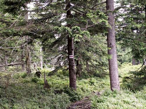
Old granite tourist sign on the red trail leading through u015awieradowiec Mt. (1002 m)

Tourist information at the trail cross Rozdroze pod Zwaliskiem, a little westwards of Zwalisko Mt. (1047 m), March 2015.
CAMPING
Tourists and hikers here have a lot of hotels and hostels at disposal, especially in Świeradów Zdrój and Szklarska Poręba (see www links). The hostels inside the mountains are situated in Poland on the summit of Stóg Izerski, Chatka Górzystów on Hala Izerska and in Orle near a cross-border to the Jizerka village in Czech. To reach Stóg Izerski from Świeradów Zdrój you must surmount the steep northern slope of the mountain. Then you are very near to the summit of Smrek. For another hostel “Chatka Górzystów” you can go along a blue trail also from Świeradów Zdrój to Hala Izerska. In general, a free camp is only possible at tourist trails, not in forest and only in the night. Such a form of hiking is not practiced in the Izera Mts. Hikers have some additional sites where they can sleep and be protected against wind and rain: a small interior of the past Frontier Hut and, when it is closed, a wooden veranda before it; a wooden veranda of the Hunters Hut on the eastern slope of Smrek, a small wooden hut painted in green and called "Zielona Budka" (Green Hut). This hut is situated a little southward from Polana Izerska at the blue trail leading from Hala Izerska to Świeradow Zdrój. I have had a camp in "Zielona Budka" and I put up tent inside it during very rainy or cold nights. In addition, on the trails, several simple wooden huts are also at disposal (Rozdroże pod Cichą Równią, Jarzębcza Polana, Mokra Przełęcz, Polana
Izerska and some in the vicinity of Świeradów Zdrój).I think that any free camp out of forest and in the vicinity of cities is also notforbidden. I have often had such camps near Szklarska Poręba and Świeradów Zdrój.

Small hostel on Wysoki Kamień (1058m)

My camp over the Kamionek Stream, nearby the Orle hostel (August 2016)

Chatka Górzystów on Hala Izerska, winter 2013

Zielona Budka, a small wooden hut is situated nearby Polana Izerska
RED TYPE
At present, some part of the Izera Mts. lying in the Izera River valley are protected by the creation of a large peatbog reserve “Torfowisko Doliny Izery”. It is joint together with an adjacent part in the Jizerske Hory “Raseliniste Jizery” into one large protected area where any visit is forbidden. However, all the area of the Polish part of these mountains is established as an “Natura 2000” object and therefore any human activity ought to be considered according to “Natura 2000” rules. The Izera Mts. are open for everybody to hike, bike or skiing. Marked trails are easy accessible. Some areas, especially those which are more difficult for tourists and ecologically more fragile like peatbogs or steep slopes with
original flora and fauna are less visited.

Podmokla (1001 m) - Szerzawa (975 m) - Rudy Grzbiet (943 m)- Special Area of Conservation - Natura 2000 "Peatbogs of the Izera Mts."

The pedestrain trail leading through the Natura 2000 Area u201cPeatbogs of the Izera Mts.u201d devastated by bikers and motocross riders

A forest tract in the Natura 2000 area (peatbogs and birds protection) deeply eroded during harvesting of cut trees
MAPS AND BOOKLETS
When I plan to hike in the Izera Mts., I use two Polish maps, "Góry Izerskie" 1:50 000 edited by PPWK and another one entitled "Góry i Pogórze Izerskie, Przełom Kwisy" 1:40 000 edited by PLAN. A Polish part is also described by Krzysztof Mazurski & Janusz Czerwinski in a booklet "Góry Izerskie". This book was edited in 1991 and, therefore, its information
is not very accurate.

Two maps of Gu00f3ry Izerskie which are commonly used in Poland
EXTERNAL LINKS
http://www.szklarskaporeba.pl/
http://chatkagorzystow.prv.pl/
http://www.stogizerski.pl/schronisko.html
http://polbus.pl/rozklad-jazdy - Wrocław
www.jakuszyce.com.pl
www.jakuszyce-biathlon.pl
