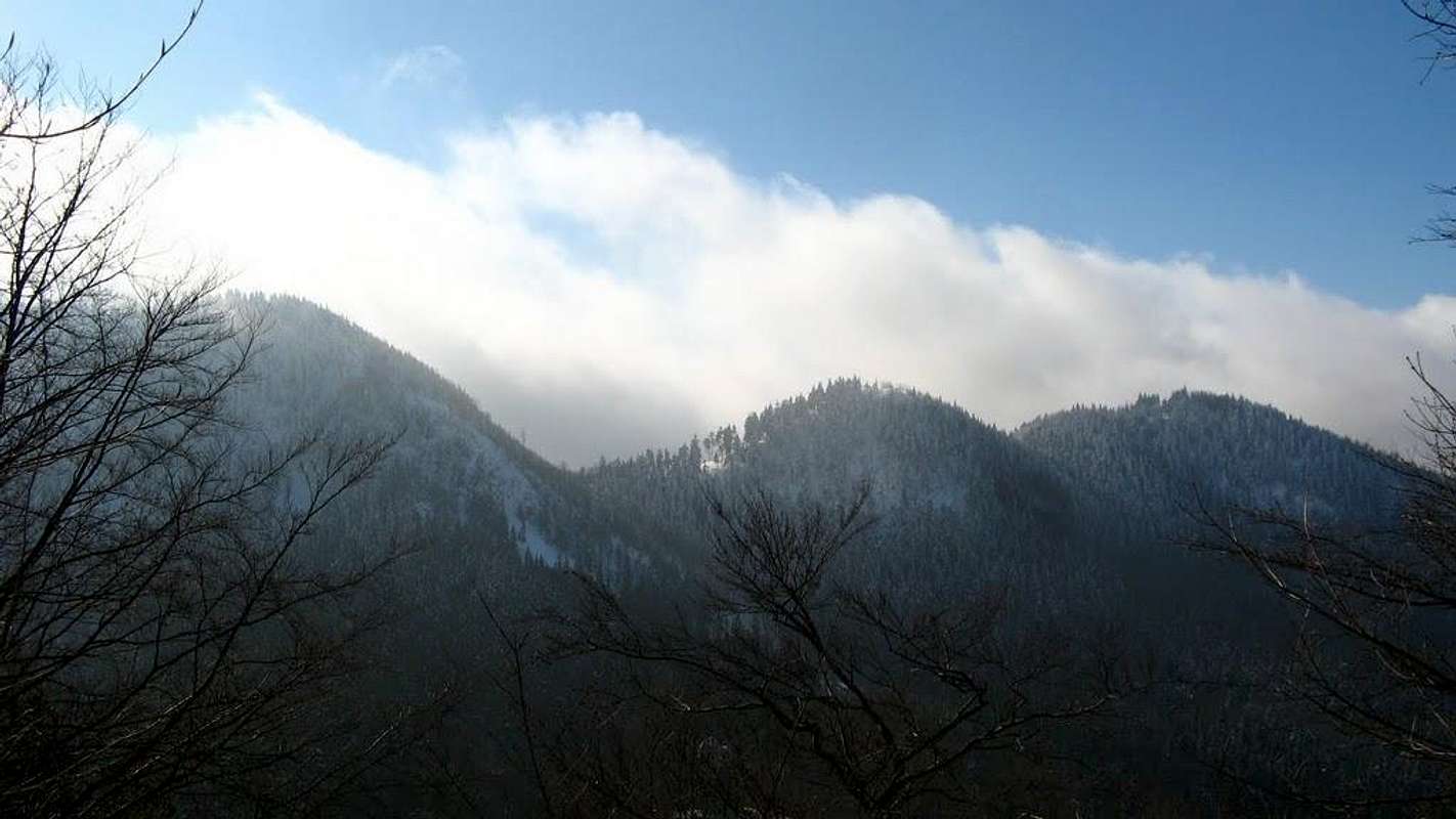
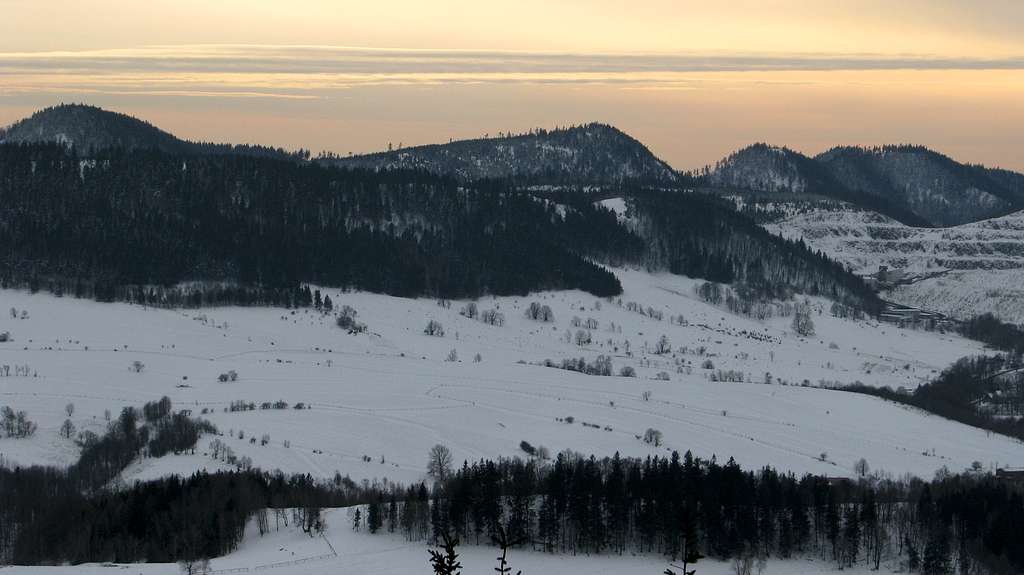
Four highest hills from SThe tablelands of the Central Sudetes (please see this map and study its description) are bounded on the northwest and the northeast by the Kamienne (Stone) Mountains - several ranges of hills made of hard volcanic rocks, namely porphyries, late-Paleozoic of age and reddish in colour. The eastern part of these mountains, which straddles the Czech-Polish border south-east of the upper course of the Ścinawka River (and the national road 35), is called the Suche (Dry) Mountains by Poles, whereas Czechs call them the Javoří (Sycamore Maple) Mountains. They are all covered with woods in which sycamore maple trees are not uncommon, so there is no mystery behind the Czech name. But one may wonder why such green hills have been labelled "dry." The answer lies in many dry valleys and few springs, which results from, as you may guess, the geologic features of the area.
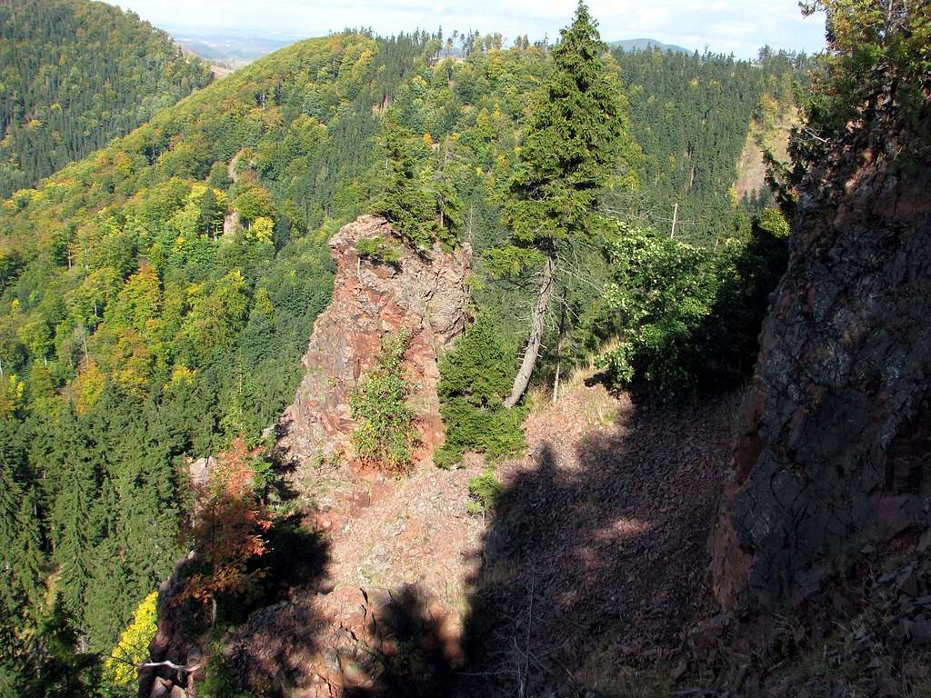
Czerwone Skałki (Red Rocks) on Suchawa
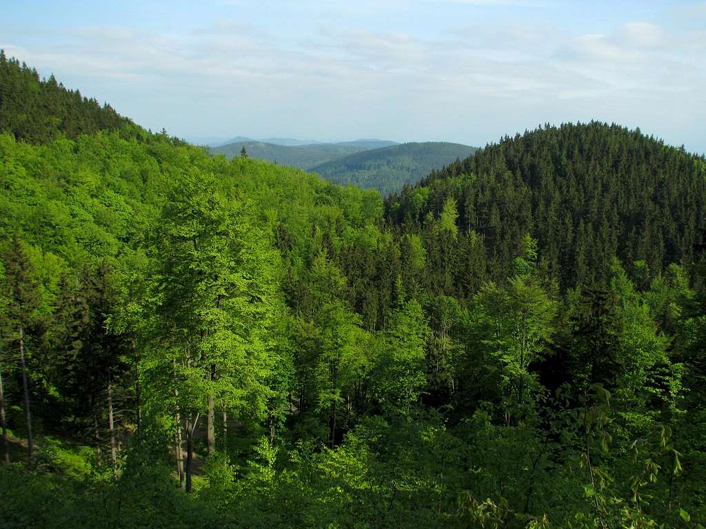
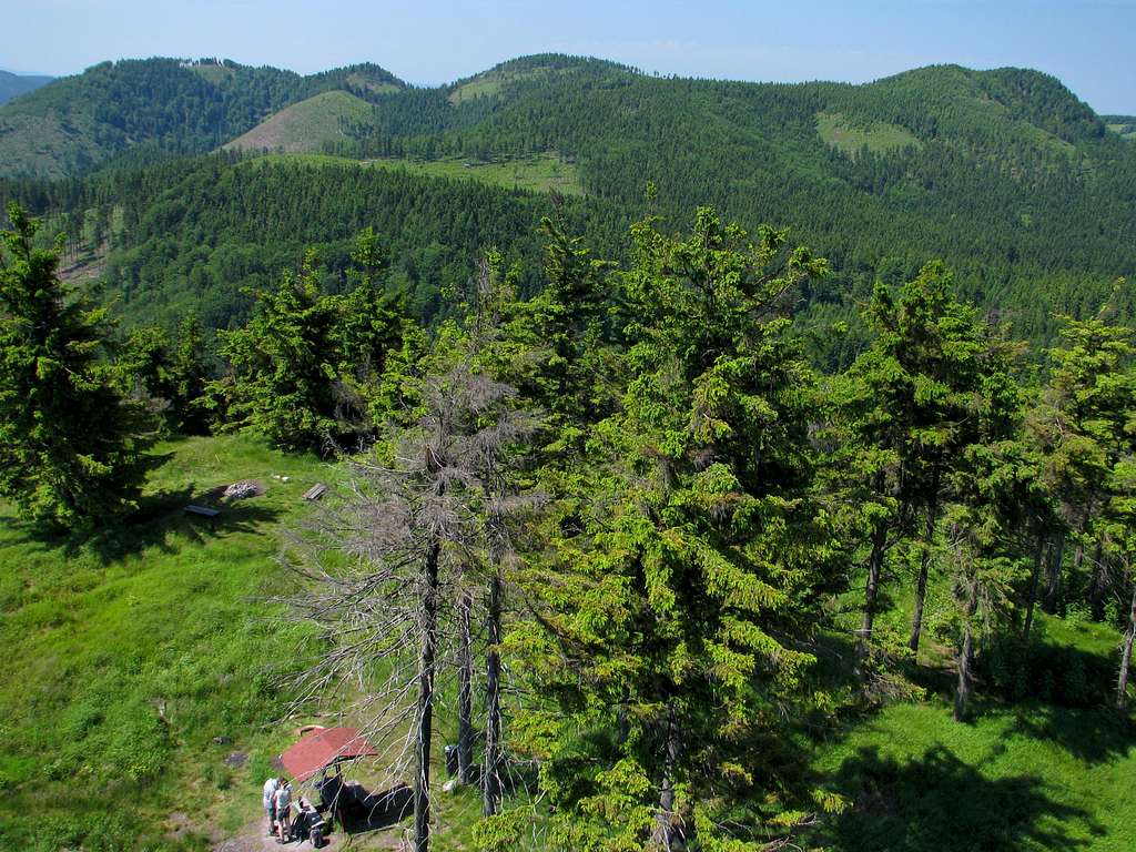
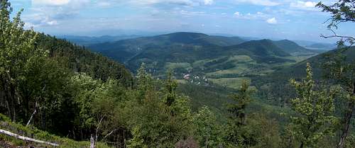
The most interesting part of these green dry mountains is their northeastern chunk between Sokołowsko (once a famed health resort of Görbersdorf) and the town of Głuszyca. This area contains several hills at around 900m. This is the highest part of the Suche/Javoří Mountains, the Kamienne Mountains, and also of what German geographers call Waldenburger Bergland (both the Kamienne and Wałbrzyskie mountains). Thanks to what they are composed of these porphyry hills have surprisingly bold, often conical silhouettes, contrasting with the flat tops of the other mountain ranges of the Sudetes that surround them. Even on the waymarked trails hiking can be surprisingly challenging, owing to the steepness of the slopes. On a couple of trails, there can be plenty of hiker-made scree under your feet because the local rock, despite being very hard, tends to be very crumbly. Nevertheless, part of any hiking route will also contain stretches of dirt forest roads, whose network is pretty dense there, just as the network of waymarked - hiking and biking - trails. Still, most of the mountains has a wide feel, which seems to be getting even wilder since the return of the wolf in the 2010s.
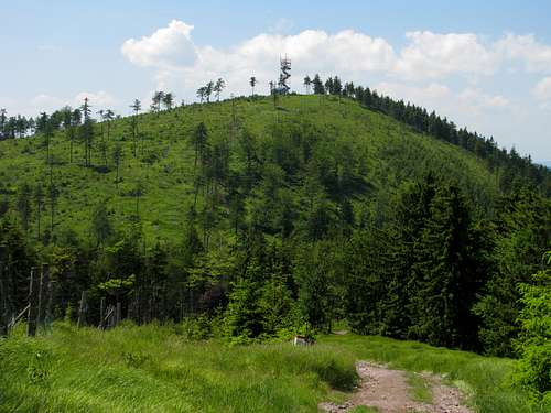
Four highest hills from NE
Interesting summits
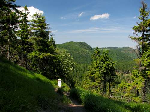
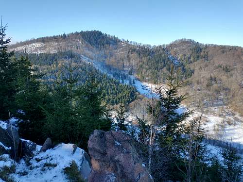
Waligóra from Ruprechtický Špičák
Waligóra
Old German name: Heidelberg
Elevation: 934m
Prominence: 366m
Despite being the highest summit in the Kamienne/Suche/Javoří Mountains as well as one of the highest mountains of all in the Central Sudetes, in my view Waligóra isn't a most attractive hiking goal since it attracts crowds and its top, covered with trees, does not provide any views. The mountain stands in the backyard of Andrzejówka Hut, from where it can be climbed in less than half an hour. (I must confess I had visited the Suche Mountains several times before I climbed Waligóra.) There is an SP page by visentin focusing on Waligóra as well as the area at its foot, around the hut, which makes for a little ski resort in winter.
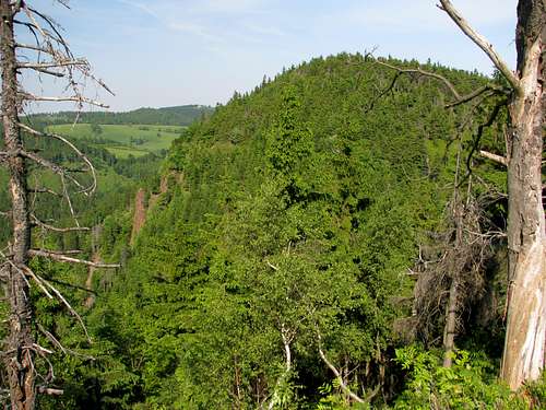
Suchawa from Kostrzyna
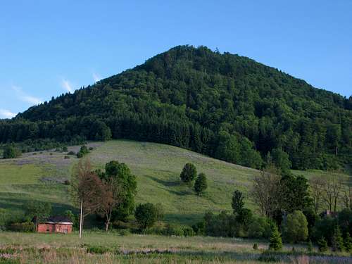
Suchawa
Old German name:Dürreberg
Elevation: 928m
Prominence: approx. 65m
At 928m Suchawa is the second highest hill in these mountains. It is the highpoint of a three-summit massif which towers over the valley and dirt road linking the resort of Sokołowsko to the Andrzejówka Hut. The massif's western summit is called Włostowa (903m), the middle peak is Kostrzyna with a conical top (906m), whilst Suchawa forms the eastern part of the massif. Just east of Suchawa, beyond a relatively deep valley, rises Waligóra. The top of Suchawa only affords a limited view, to the north-west. Far better views are provided by the nearby top of Kostrzyna. But on the northwestern slope of Suchawa a unique phenomenon in the Sudetes can be seen: An active cliff-talus system within the forest zone. (! Please do not try to climb the rocks or tread on the talus cone for two reasons: 1- the place has been designated a nature monument; 2 - the rock is extremely chossy. However, one can climb up around the talus and cliff, which involves walking elusive deer paths as well as bushwhacking.) It has developed in the upper part of a deep-seated landslide. Ancient landslides, which are believed to have been active some 10,000 years ago, are common in the Suche Mountains as the igneous bulk of the mountains is underlain by clayey sedimentary rocks.
This hill is situated in the northwest corner of the Suche Mountains, north of the resort of Sokołowsko, just by the village of Unisław Śląski. The hill takes its name, which translates as Great Cone, from its shape. Despite sitting by a village, its steep north face, across which the waymarked trail winds, looks pretty wild. (Beware of falling trees!) There is a solid, spacious shelter just below the summit. Views from the summit are very limited.
Rogowiec Castle: The walls of Rogowiec Castle (German name: Hornschloss) built in C13/14 on a 870m summit in the northeast corner of the Suche Mountains, among sycamore maple trees, were partly natural. The castle was founded by a Polish prince Bolko I over 700 years ago. More images and info (in Polish) here.
Radosno Castle: Part of the dungeon is all that is left of the castle of Radosno (German name: Freudenburg) built in the 13th or 14th century. It is not known who founded the castle, whose ruins sit on a lesser hill at the foot of Suchawa, just about five kilometres west of Rogowiec Castle. It is possible that it was originally a Czech castle and the border ran a bit differently then. More images and info (in Polish) here.
16th century wooden church in Grzmiąca, at the northeast end of the Suche Mountains
17th century wooden church in Rybnica Leśna, in the northern reaches of the mountains
Rogowiec
Radosno
Grzmiąca
Red Tape, Camping and Accommodation
No red tape except that camping is not allowed.
Wolves found home here in the 2010s: Keep your dog on a leash.
The mountains lie several kilometres to the south of the Polish city of Wałbrzych (Waldenburg before World War II), which has good railway and road links with Wrocław, the capital city of Lower Silesia. From Wałbrzych minibuses or buses run to Sokołowsko and Głuszyca. Although the railway station in Głuszyca has been closed down, the railway line (Wałbrzych-Kłodzko) is still in use.
The Czech hikers will most likely start their walking trip in the village of Ruprechtice (bus terminus), which is situated just a few kilometres north-east of the town of Meziměstí (train, bus).
Children refers to the set of objects that logically fall under a given object. For example, the
Aconcagua mountain page is a child of the 'Aconcagua Group' and the 'Seven Summits.' The
Aconcagua mountain itself has many routes, photos, and trip reports as children.
Parents refers to a larger category under which an object falls. For example, theAconcagua mountain page has the 'Aconcagua Group' and the 'Seven Summits' asparents and is a parent itself to many routes, photos, and Trip Reports.

 NW part of the Kamienne Mts - photo by visentin