
-
 6739 Hits
-
 76.67% Score
-
 8 Votes
|
|
Mountain/Rock |
|---|---|
|
|
47.67350°N / 11.90608°E |
|
|
Hiking, Mountaineering, Skiing |
|
|
Spring, Summer, Fall, Winter |
|
|
5735 ft / 1748 m |
|
|
Overview
 Jaegerkamp seen from Rauhkopf
Jaegerkamp (1.748m) is a mountain in the Bavarian Pre-Alps in Germany. It is near Spitzingsee a little Ski-touring area 40km south of Munich. Jaegerkamp is climbed the whole year especially in winter by ski. From top you have a good overview of the Bavarian Pre-Alps between BAD TÖLZ and BRANNENBURG. You can combine other mountains like Benzingspitz, Tanzeck and Aiplspitz to a great roundtrip.
Getting There
From North and West: MUNICH - A8 (Highway #8) to SALZBURG - EXIT #98 "WEYARN" towards MIESBACH, via B472 and B307 to Schliersee, NEUHAUS and Spitzingsee.
From East: SALZBURG - A8 (Highway #8) to Munich - EXIT #99 "IRSCHENBERG" towards MIESBACH, via B472 and B307 to Schliersee, NEUHAUS and Spitzingsee.
From South: KUFSTEIN - A93 (Highway #93) to ROSENHEIM - EXIT # 59 "OBERAUDORF" towards BAYRISCHZELL, via Tazlwurm and B307 to Spitzingsee.
When To Climb: Weather, Webcam and general Informations
Normally you can climb Jaegerkamp the whole year securely. In winter and spring you have to observe the rules of avalanche-security.
WEATHER IN THIS REGION
DANGER OF AVALANCHES
WEBCAM OF SCHLIERSEE AND SPITZINGSEE
CAMPING AND HOTELS IN SCHLIERSEE
Routes to Jaegerkamp
 Jaegerkamp seen from Benzingspitz
1)
From JOSEFSTHAL: JOSEFSTHAL is south of NEUHAUS. Origin for this route is the parking at "Spitzingstraße" half way between NEUHAUS and Spitzingsee. The ascent of Jaegerkamp follows the track #SB2 towards the summit at its northside.
2)
From SPITZINGSATTEL: From SPITZINGSATTEL (parking with costs) via #W23 towards Schönfeldhütte (1410m) and Obere Schönfeldalm on track # SB2 towards BENZINGSPITZ and westward to Jaegerkamp summit.
3)
From SPITZINGSEE by Ski: Ski-Mountaineers follow the skipiste towards Schönfeldhütte (1410m) and continuing route #2.
4)
From mountain-station of "Taubensteinbahn": From the mountain-station nothwards via RAUHKOPF (1689m) and Schnittlauchmoosalm to Benzingspitz and Jaegerkamp.
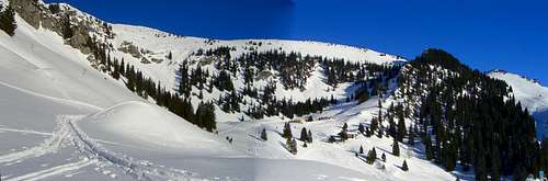 Ski-ascent: View from Schoenfeldhuette
Maps and books
- Kompass WK 008 Bayrischzell-Schliersee - 1:35.000 - ISBN: 3-85491-352-4
- Kompass WK 8 Tegernsee-Schliersee-Wendelstein - 1:50.000 - ISBN: 3-85491-010-X