
-
 2418 Hits
-
 80.49% Score
-
 12 Votes
|
|
Trailhead |
|---|---|
|
|
46.39344°N / 14.49979°E |
|
|
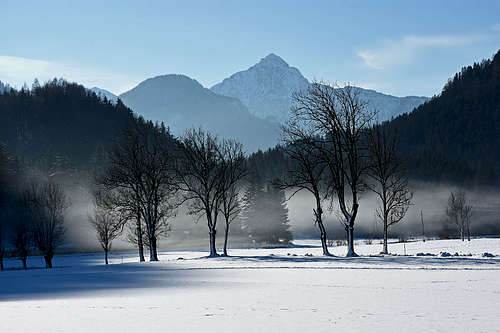
Spring, Summer, Fall, Winter |
|
|
2953 ft / 900 m |
Overview
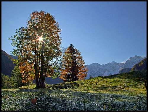
One of the most beautiful places in Slovenian mountains is a well developed tourist resort. But for mountaineers it's also a place of several trailheads, for many outdoor activities, summer and winter.
As a trailhead, I'm showing here Jezersko from a bit broader perspective, through the eyes of somebody who stays there eventually a weekend or holidays. But detailed mountains and routes descriptions you have to find elsewhere on SummitPost.
The Name and History
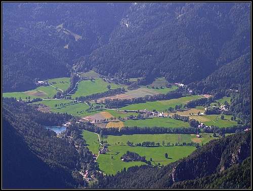
Jezersko means Lakeland. And indeed the valley was once filled with a quite big lake. Supposedly it was in the 14th century, when a big earthquake created cracks, causing water to flow out. Nowadays even some wet places are drying. The today's small lake (Planšarsko jezero) is not a relict of the ancient lake, but is of artificial origin.
Historically over what is today the Jezersko road pass, since pre-history an important trade route has been running. Once it was desperately long, hilly and winding route, but still a good connection between the Adriatic coast and Central Europe. The people of Jezersko were benefiting wery much from it, but after a more modern road connection was built over the Ljubelj pass, the trade over Jezersko became less important.
Geography
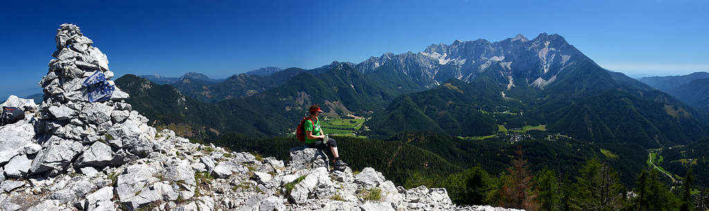
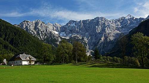
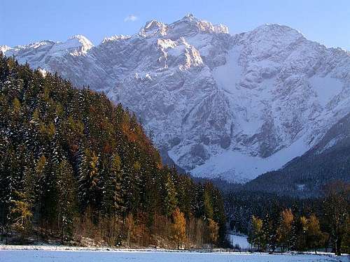
Jezersko lies between two big mountain groups: Karawanks on the NW and Kamnik & Savinja Alps on the SE. The latter are much higher, rugged, suitable also for big walls climbing, but the Karawanks have also their charm - of a remote, quite forested area with some very panoramic peaks. So, staying in Jezersko, you should go on both sides.
From Jezersko two side valleys are reaching the very heart of Kamnik & Savinja Alps. These are Makekova Kočna and Ravenska Kočna. By the way - Kočna is indeed a summit, but it's also a generic name (very old, perhaps celtic) for a valley, where red, crumbly rocks are found. The third valley (Belska Kočna) is further to the NE, already on the Austrian side. From the backbone of Kamnik & Savinja Alps, three strong side ridges are descending roughly towards the N, also hosting some valuable hiking goals.
On the other side of Jezersko, the long range of Karawanks is passing mostly north of the valley, but sending a side ridge also towards the SW.
Jezersko area is also the source of Kokra river, flowing then by a deep canyon towards the south. But in the core Jezersko only its tributary Jezernica has its source, while Kokra itself has its source in the side valley in Karawanks.
The Interactive Map
Explore the below interactive map to find all the features mentioned in the text further below! You'll find trailheads (parkings), summits, some normal ascent routes, pictures and other interesing features to visit. Easier (up to the Swiss T3) and well beaten trails are depicted as solid lines, weak and more difficult trails and ferratas are dotted. Unmarked trails are brown. All hiking routes difficultiy grades are on the Swiss Hiking Scale. Many routes are missing - for more details see the relevant SP mountain pages and routes pages! Use also other trails and mountain roads, shown on the base map - the big majority is drawn correctly.
|
Explore the interactive map on the left to find all the features mentioned in the text further below! You'll find trailheads (parkings), summits, some normal ascent routes, pictures and other interesing features to visit. Easier (up to the Swiss T3) and well beaten trails are depicted as solid lines, weak and more difficult trails and ferratas are dotted. Unmarked trails are brown. All hiking routes difficultiy grades are on the Swiss Hiking Scale. Many routes are missing - for more details see the relevant SP mountain pages and routes pages! Use also other trails and mountain roads, shown on the base map - the big majority is drawn correctly. |
Trailheads
You can start many tours in the centre of Jezersko resort, on some 900 m of altitude. But the parking symbols on the above map show, that you can drive by car also higher: on the Jezersko road pass (1215 m), into Ravenska Kočna valley (1060 m), into Makekova Kočna valley (955 m) and below Veliki vrh (1200 m), into the valley of Kokra sources (up to 1470 m). All those parkings are free of charge, but be aware that the road into the upper Kokra valley is formally closed from June 20th till October 20th.
Hiking Summits and Routes
Karawanks
- Pristovški Storžič / Kärntner Storschitz, 1759 m. Wonderful panorama, medium demanding hike (T3), 1 h 30 min
- Virnikov Grintavec / Kleiner Grintoutz, 1654 m. Wonderful panorama, medium demanding hike (T3), 1 h 30 min to 2 h 30 min.
- Stegovnik, 1692 m. Wonderful panorama, medium demanding hike (T3), 1 h 30 min to 2 h 30 min.
- Pečovnik, 1640 m, Ruš, 1614 m, Bukovec, 1506 m, Robniške peči, 1323 m and other minor summits. You can visit also: Anko waterfalls (7 m, 10 m), tufa ex quarry, Krtina partisan hospital, many picturesque farms and alpine meadows.
Kamnik & Savinja Alps
- Češka koča (hut), 1542 m. Medium demanding hike (T3), 1 h 30 min.
- Kranjska koča (hut), 1689 m. Medium demanding hike (T3), 2 h.
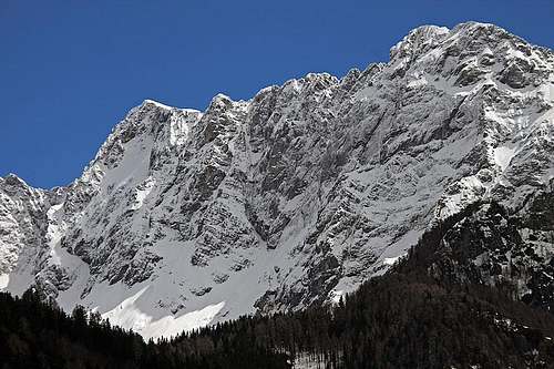
- Kočna, 2540 m. Great panorama, medium demanding hike (T4), 3 h 15 min (from Češka koča).
- Grintovec, 2558 m. Great panorama, medium demanding hike (T4), 3 h 30 min to 4 h (from Češka koča).
- Dolgi Hrbet, 2473 m. Medium demanding hike (T3), 3 h 15 min (from Češka koča).
- Skuta, 2532 m. Great panorama, medium demanding hike (T4), 4 h 15 min (from Češka koča).
- Vratca tower, 1800 m. Medium demanding hike (T4), 50 min (from Češka koča).
- Koroška Rinka, 2433 m. Nice panorama, medium demanding hike/ferrata (T4), 2 h 15 min (from Kranjska koča).
- Velika Baba, 2148 m. Nice panorama, medium demanding hike/ferrata (T4), 2 h 15 min (from Kranjska koča).
- Ledinski vrh, 2108 m. Nice panorama, easy to medium demanding hike (T2/T3), 1 h (from Kranjska koča).
- Mala Baba, 2018 m. Nice panorama, medium demanding hike (T3), 3 h.
- Goli vrh, 1787 m. Nice panorama, easy to medium demanding hike (T2/T3), 2 h 30 min.
- Visoki vrh, 1459 m. By the way goal, quite overgrown, easy to medium demanding hike (T2/T3), 1 h 30 min.
- Veliki vrh, 1742 m. Nice panorama, medium demanding hike (T3), 1 h 30 min.
|
|
|
Climbing & Tour Skiing
Rock Climbing
Many nice routes in the N walls above Češka koča and Kranjska koča (in Kočna, Grintovec, Dolgi vrh, also Skuta and Rinke).
Base Climbs
Many quite demanding routes (in Kočna, Grintovec, Mlinarsko sedlo from the N, Velika Baba ravine, etc.).
Normal Tour Skiing
In Karawanks most of the routes go up by mountain roads, among the summits, only the humble Pečovnik, 1640 m, is suitable for skiing.
In Kamnik & Savinja Alps there are many more possibilities for nice skiing, but among the summits, only Ledinski vrh is nice for a normal ski tour. All other tours go from the high saddles (Savinjsko sedlo) or from just below the N walls above the both huts.
Alpinistic Skiing
Jezersko is the craddle of Slovenian world class alpinistic skiers. The late Davo Karničar and his brothers made many top class ski tours in the Himalayas, Alps, on the Seven Summits (yes, you read it right, he was skiing also the sands of Kilimanjaro), etc. Davo was the first man to ski down from the summit of Mont Everest without interruption (or abseiling). That was in 2000.
Above Jezersko there are many options for alpinistic ski tours, some of them very demanding. For example: Povnova dolina (S5, 1200 m), Mlinarsko sedlo North (S6, 450 m), Fritsch-Lindenbach (S7, 700 m), and others.
Mountain Huts
- Češka koča, 1541 m.
- Kranjska koča na Ledinah, 1689 m.
On Jezersko, there are many private hotels, tourist farms and a camping site. See: https://www.jezersko.info/en/