
|
|
Area/Range |
|---|---|
|
|
50.64888°N / 115.11923°W |
|
|
Hiking, Mountaineering, Trad Climbing, Sport Climbing, Scrambling, Skiing |
|
|
Spring, Summer, Fall, Winter |
|
|
11319 ft / 3450 m |
|
|
Overview
Important update: fees required as of June 1, 2021. See Red Tape section below.
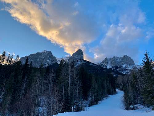
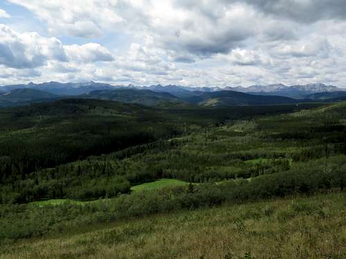
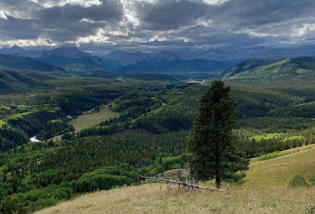
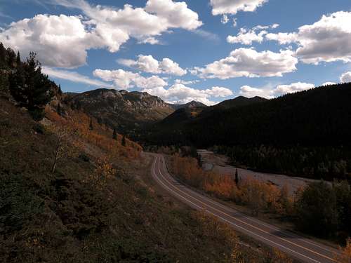
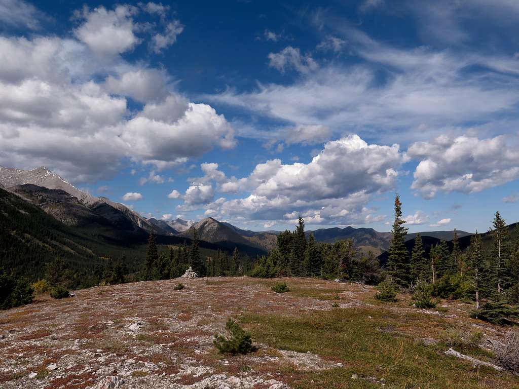
After Banff National Park, Kananaskis Country is probably the most popular recreational area in the Canadian Rockies, and for good reason. Its 4000+ hectares of terrain are incredibly varied, from gently rolling foothills to towering, glaciated peaks and everything in between. Access is very easy, with nearest border being only 20 minutes from Calgary's 1.3 million people. There are many very good access roads, but also expanses of terrain for the backpacker. With everything from Olympic nordic and downhill ski facilities to easy foothills walks to multi-day mountaineering expeditions, K Country as it's often referred to really does have something for everything, and it's just about impossible to get bored here.
Contrary to persistent misconception, K Country is not a provincial park and never was one. Rather, it is a multi-use recreational area with numerous parks within its boundaries. Unfortunately, some 40% of K Country is still unprotected from industrial development (mostly clearcutting), which is a shame given how popular and beautiful it is.
K Country was designated by the provincial government in 1977 as an alternative to the crowded national parks. Then Alberta Minister of Highways and area rancher Clarence Copithorne got the concept started with his plan to reconstruct Highway 40 along the Kanananaskis and Highwood Valleys as a minimal-service outdoor recreation access road. The idea mushroomed from there and we can largely thank premier Peter Lougheed for the much larger area and many more trails that became Kananaskis Country
This superb page page by Old School WB describes the 10 highest peaks in K Country and has many photos of the spectacular high country along the Continental Divide.
There is already a list on SP with all the K Country and surrounding area pages attached, so I'm not going to bother attaching every K Country page to this page (although I welcome feedback if you think I should). Do note, however, that all the peaks north of the Bow River are technically not in Kananaskis Country, although they are nearby so this area is often thought of as part of the Kananaskis region.
Map
The Lay of the Land
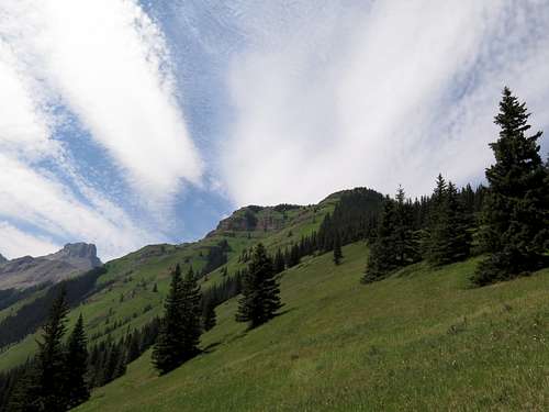
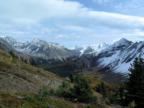
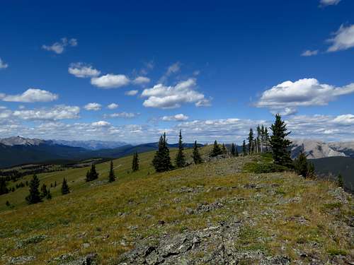
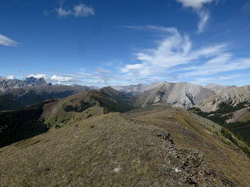
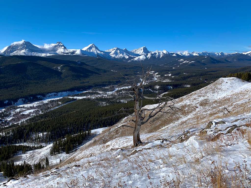
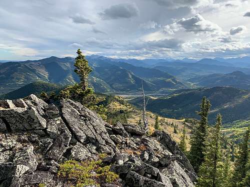
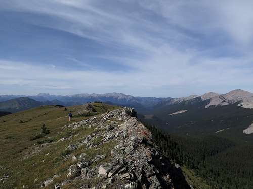
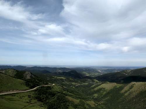
In keeping with the linear grain of the Canadian Rockies, the mountains and hills of Kanananskis Country divide into three regions from east to west: the foothills are a friendly countryside of gently rolling ridges gradually gaining height into the alpine as you head west; the front ranges, where the peaks are mostly dry and valleys are mostly steep canyons; and the main ranges, which tower with glaciers, steep walls and lush forests of spruce and fir.
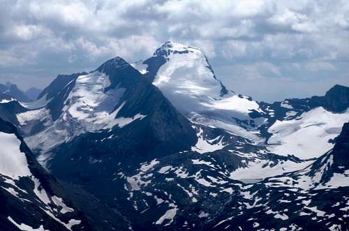
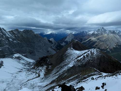
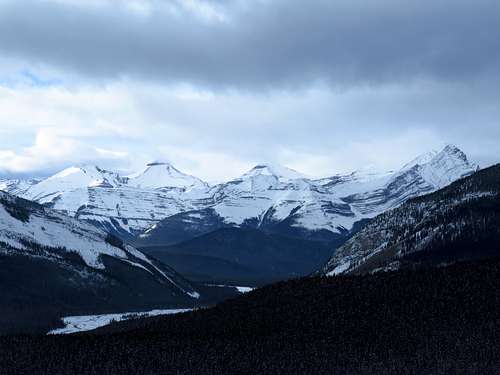
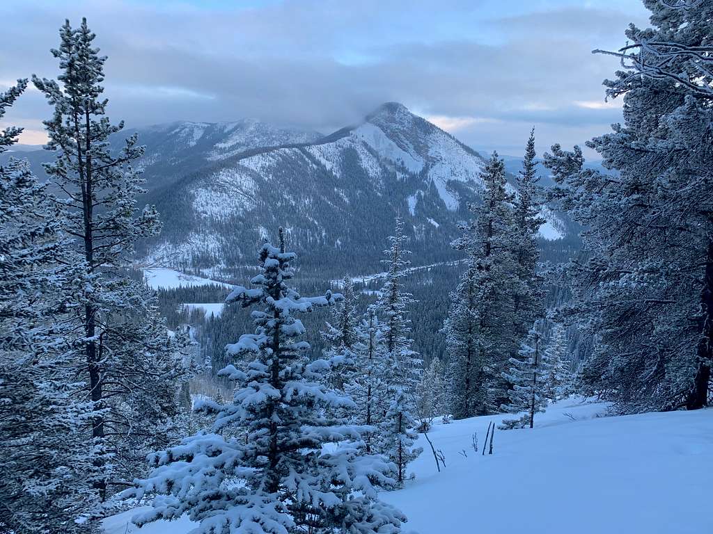
The western boundary of Kananaskis Country follows the continental divide along the High Rock Range, the Elk Range and the spectacular French Military group, then the boundary of Banff National Park along the Spray Mountains and the Old Goat Range. The French Military group and the Spray Mountains include K Country's highest peaks, including the 11,000ers Mount Joffre (3450m/11319ft) and Mount Sir Douglas (3406m/11174ft) as well as numerous glaciers. The northern boundary roughly follows the Trans-Canada highway and the mountain town of Canmore. The eastern boundary follows the edge of the forest reserve and abuts against ranching country, while the southern boundary is a fairly arbitrary line, initially following Johnson Creek Trail, across the pastoral country of Willow Creek and the low alpine ridges above the Oldman River.
K Country is usually grouped into 7 regions along river valleys and access roads. From north to south:
The Bow Valley
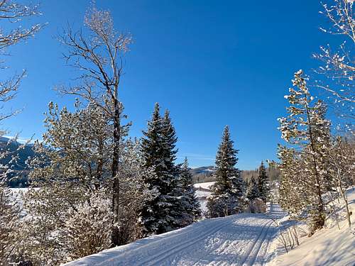
The Bow River is the main river draining the eastern slopes of the central Canadian Rockies. Between the large mountain town of Canmore (population 14000) and where it exits the mountains it forms the northern boundary of K Country. While the valley bottom itself is a flat floodplain, numerous hiking and mountain biking trails criss-cross its slopes. At the far north end near the boundary with Banff National Park, the Canmore Nordic Centre sits on a shelf under Mount Rundle. A former Olympic site, it is Canada's centre for competitive Nordic skiing.
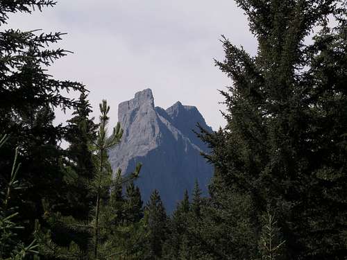
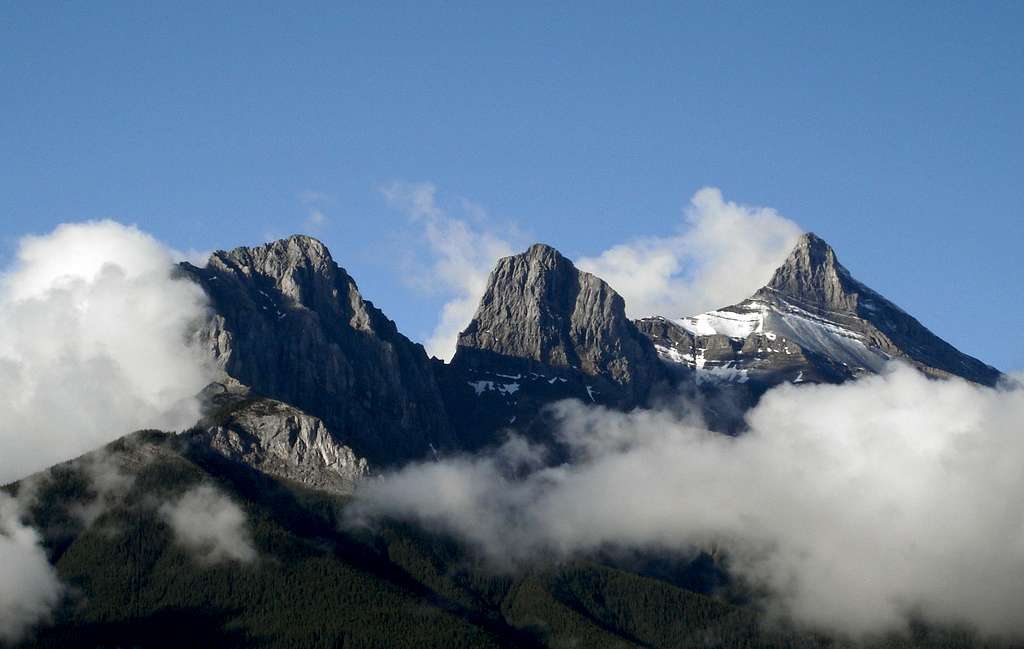
The mountains lining the Bow Valley are dry, rocky peaks offering numerous opportunities for everything from hiking to big wall climbing (and quite a few sport climbing routes). Many of them, such as the Three Sisters and the Windtower, are iconic peaks that frequently grace tourist brochures and the like.
(The K Country boundary through this area takes a rather arbitrary line, so of course the Bow Valley as an area is much larger than the part of it that is within K Country. In order to keep things from being confusing, the Bow Valley area on my map only includes the part within K Country.)
Smith-Dorrien/Spray
To the west of Canmore and the Bow Valley lie the higher-elevation Spray and Smith-Dorrien valleys. They are really one long linear valley with a broad pass in the middle, and a good gravel road (the Smith-Dorrien Trail) running down its length.
The northern section of this long valley, immediately east of Canmore, was turned into a hydroelectric scheme in the 1930s, and along much of its length lies the Spray Lakes Reservoir. The east side of this section is lined by the same peaks the provide Canmore's iconic backdrop, such as the Three Sisters and the Ehagay Nakoda. There are a number of good scramble routes on these peaks (not to mention the extraordinarily popular trail up Ha Ling Peak), and trails run up the dry valleys between the peaks to passes with cliffs on the far side. The pointy Goat Range lines the west side.
Farther south, the valley opens up into a broad junction as it were where there Spray River enters and exits the reservoir. On the south side of the reservoir, the Watridge Lake road accesses some blue alpine lakes and scenic ridgewalks, as well as the Mount Shark cross country ski trails.
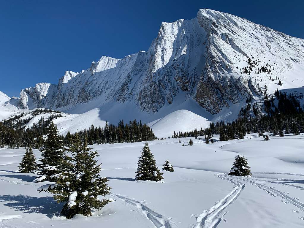
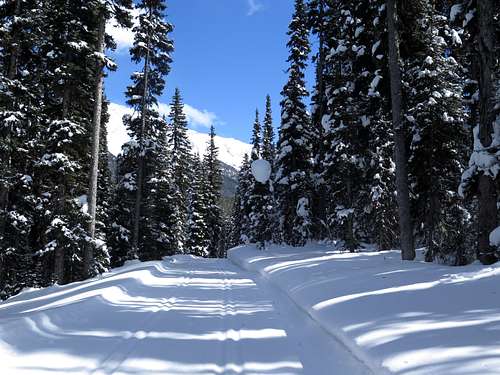
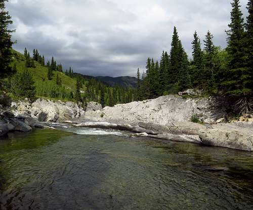
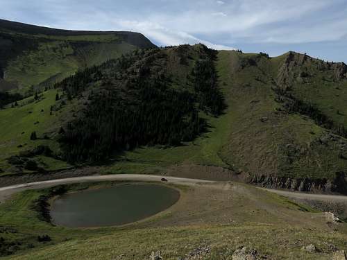
South of Spray Lakes Reservoir and into the Smith-Dorrien valley, the road climbs through subalpine spruce and fir forest. The mountains along this stretch - the Kananaskis Range to the east and the glaciated Spray Mountains to the west - are spectacular indeed. Huge amounts of snow fall here in the winter and it's one of the best areas in the Rockies for backcountry skiing, including such legendary powder slopes as Burstall Pass and Black Prince, although there are plenty of opportunities for hiking, scrambling and mountaineering in the summer as well. This is true high mountain country.
Kananaskis Valley
On the other side of the Kananaskis Range lies the heart of K Country, the Kananaskis Valley, which can logically be divided into two sections: Kanananaskis Lakes and the lower Kananaskis valley.
Kananaskis Lakes
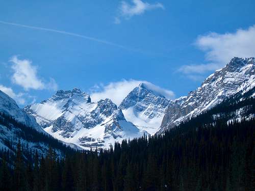
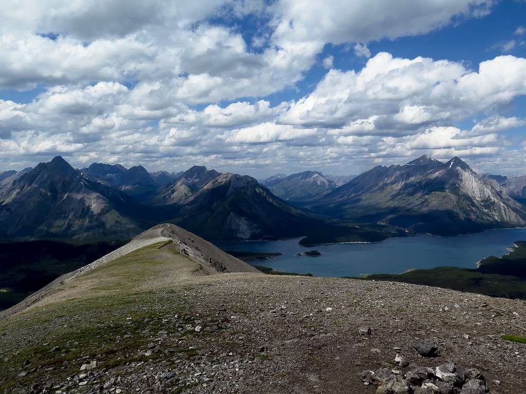
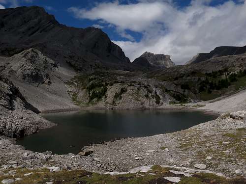
Actually, the upper Kanananskis River has its headwaters on the west side of the Spray Mountains along the Continental Divide. This secluded valley is a popular destination for backpackers and is also home to the Haig Glacier, the largest in K Country.
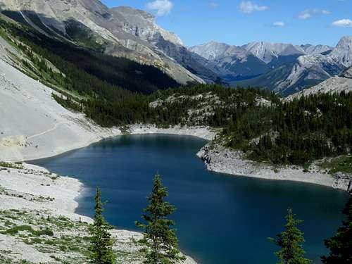
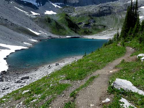
The upper Kananaskis River and Smith-Dorrien Creek both empty into the Kananskis Lakes, two large reservoirs surrounded by mountains. On the west side of the lakes rises the heavily glaciated French Military Group, the highest mountains in K Country (culminating in Mount Joffre at 3450m/11319ft). Kananaskis Lakes Road winds its way past the lakes from Highway 40, giving access to an extensive network of cross-country ski trails and of course the mountains around the lakes. To the south of the lakes lies the very broad Elk Pass on the continental divide, across which is Elk Lakes Provincial Park in BC with its waterfalls, glaciers, lakes and rain. The Elk Lakes are almost always accessed from Kananaskis Lakes Road as a backpacking destination.
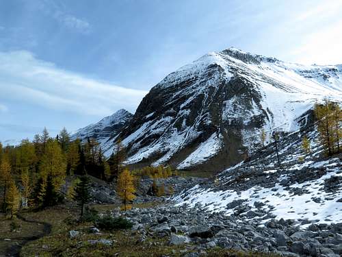
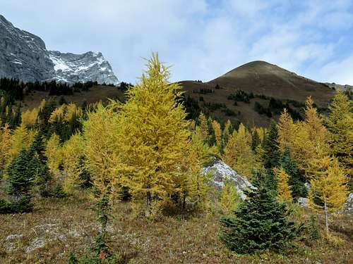
Southeast of the lakes, Highway 40 climbs up the narrow valley of Pocaterra Creek to Highwood Pass, the highest paved road in Canada. Highwood Pass is one of the best places in the Canadian Rockies to see the subalpine larch, and there are numerous beautiful cirques and scramble peaks surrounding the pass.
Lower Kananaskis Valley
At Kananaskis Lakes the Kananaskis River makes a sharp turn to the north. Intially, it and Highway 40 run through a narrow, steep sided valley between the Kananaskis Range and the very pointy Opal Range. Rounding the corner immediately beneath the massive cliffs of Mount Kidd, it opens into a broader plain with pines and aspens ringed with peaks - the Kanananaskis Range on the west and the dry Fisher Range on the east. On the west side of the valley, on the slopes of Mount Allan, is Nakiska Ski Resort (another 1988 Olympic site). Mount Allan itself is crossed by the highest maintained trail in Canada at 2832m/9291ft. All along this stretch are excellent hiking and scrambling routes.
Continuing north, the valley pinches in again and rounds another corner into Barrier Lake before exiting into the Bow Valley just as it leaves the mountains. There are a number of popular scrambling and sport climbing routes in the dry mountains along this stretch, and beneath Barrier Lake the river is used for competitive whitewater paddling. Here Highwy 40 joins the Trans-Canada Highway.
Jumpingpound
Moving east into the foothills, the farthest north of the major eastward-trending valleys is that of Jumpingpound Creek. The creek has its source on the east side of the very dry Fisher Range. The upper part of the valley, accessed by Powderface Trail the road, is home to some good scramble routes and ridgewalks. The lower part, accessed by Hwy 68 (Sibbald Creek Trail) consists of gently rolling pine and aspen covered foothills and grassy flats where cattle graze, and like the rest of the foothills is great for shoulder-season outings. Both roads are well-maintained gravel.
Unfortunately this area is outside the provincial parks and is heavily logged.
Elbow
The Elbow Valley, just west of the hamlet of Bragg Creek, is the closest part of K Country to Calgary, so it is very popular. An excellent paved road, Hwy 66 (Elbow Falls Trail) runs along its length before stopping beneath the eastern wall of the front ranges; past the end of the road, old fire roads closed to vehicles enter the mountains and provide access to a host of scramble peaks. These mountains of the upper Elbow are popular for backpacking.
Seperate from and east of the front ranges, the broad Moose Mountain massif rises from the surrounding foothills and forms a centrepiece of the valley. All along the north side of the valley, on the slopes of Moose Mountain and through the pine-covered hills, is an extensive network of very well-maintained hiking and mountain biking trails, as well as the West Bragg Creek cross-country ski trails.
West of Moose Mountain are a series of high ridges whose summits crest treeline, part of a chain of ridges like this stretching quite a distance down the eastern slopes of the Canadian Rockies; east of Moose are friendly foothills full of trails. Most of the trails in the Elbow are volunteer-maintained by the Greater Bragg Creek Trail Association and the Moose Mountain Bike Trail Society and are of excellent quality.
Unfortunately, except for the upper Elbow in the front ranges and Forgetmenot Ridge, most of the Elbow is also outside the parks and despite some epic battles with the outdoor community is still heavily logged. South of the Elbow River and east of Forgetmenot Ridge most of the land is part of an off-highway vehicle zone and is used and abused.
Sheep/North Fork
The Sheep River Valley and its tributary Threepoint Creek (commonly known as the north fork) are very pastoral valleys of rolling foothills, extensive meadows, aspen groves, deep shale gorges and sweeping views. Although often thought of as the same area, the Sheep and the North Fork are quite different (and have different access roads) so they deserve seperate discussion.
The North Fork
Threepoint Creek is more like a small river, and it has its source in the foothills just beneath the distinctively shaped Threepoint Mountain.
The gravel Highway 549 (McLean Creek Trail) runs up the lower portion of the valley before leaving for the OHV zone to the north, while the very narrow and rough Ware Creek Road (4x4 recommended) heads over some ridges into the scenic valley of Ware Creek. Upper Threepoint Creek, with its impressive shale gorges, is for backpackers.
Lower Threepoint Creek and its small tributary Ware Creek have a lot of gentle foothills with impressive views (and colorful aspens) which make great short day hikes, and the area is also very popular with equestrians. Mesa Butte especially is a classic foothills hike. Sadly, this area too is heavily logged.
The Sheep
It doesn't get much more pastoral than the foothills of the Sheep River Valley.
The eastern Sheep is full of low aspen, pine and spruce covered foothills, often with impressive views of the Front Ranges and extensive areas of meadow.
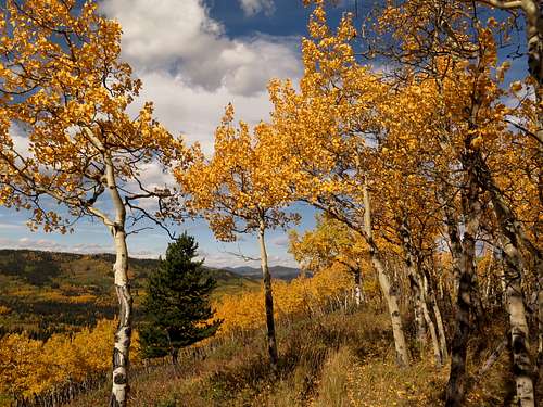
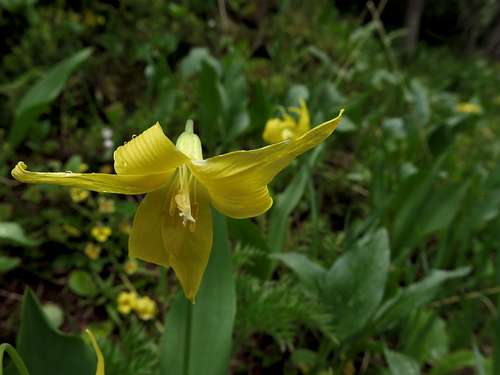
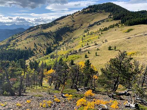
This is one of the best areas of K Country for fall colors, and the displays of prairie and montane wildflowers in early summer are excellent. Farther west, the ridges get bigger and the forest transitions to mostly pine, but the valleys still have extensive areas of meadow and the tops of ridges are usually open and grassy with sandstone outcrops, and many of the creeks (and the Sheep River itself) flow in impressive shale gorges. This is where you find the Rocky Mountain bighorn sheep in quantity.
The westernmost part of the Sheep foothills, after crossing Gorge Creek, are more forested, but the tops are still open and the views of the Front Ranges are very impressive.
Past the end of the road the Front Ranges rise in a series of deep canyons and impressive peaks, culminating in the Misty Range. One of the peaks above the river, Gibraltar, was the scene of the first extended-aid climb in the Canadian Rockies.
The Sheep is accessed by a narrow, winding paved road, Highway 546, that is great for cycling and is a really scenic drive. Branching off Highway 546 is a small gravel road, Gorge Creek Trail, that accesses a number of great hikes in the valley of Gorge Creek. Most of the Sheep is part of Sheep River Provincial Park, Bluerock Wildland Provincial Park or Elbow-Sheep Wildland Provincial Park, and it is the only significant protected area in the K Country foothills.
Highwood
The southern quarter of K Country is referred to locally as the Highwood, although not all of it is actually in the watershed of the Highwood River. It's a fairly large, diverse area, so it makes sense to further divide it into subsections.
The Upper Highwood
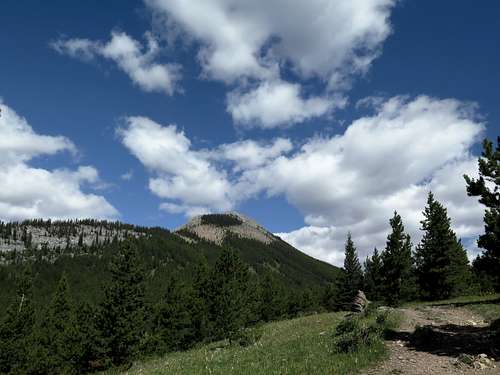
The Highwood River has its source on the south side of Highwood Pass, which as mentioned carries the highest paved road in Canada. The river arises in a series of springs in beautiful alpine cirques beneath the walls of the Elk and Misty ranges, both of which contain a number of ridgewalks and scramble peaks (including Mount Rae, the highest peak visible from Calgary at 3218m/10558ft). The upper end of the upper Highwood has a lot of lush subalpine fir-spruce forest, as well as some of the best alpine larch groves in the Rockies.
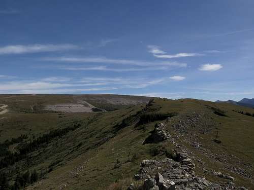
Past Mist Creek, the valley opens up into a broad montane valley between the now relatively low Highwood and Elk ranges. Between these two ranges are a series of scenic foothills, some with summits just below and some with summits just above treeline, interspersed with friendly cow-filled montane valleys.
This area is understandably a favorite for many Calgary hikers. About half of the Upper Highwood is protected in provincial parks. The rest (mostly the lower, more montane areas) remains unprotected, which is a shame given how pristine it is right now.
Running all along the upper Highwood is the paved Highway 40. Highway 40 starts at Highwood Junction, where Highway 541 from Longview meets the Forestry Trunk Road come up from the south and turns into Highway 40. There's a gas station and convenience store here. Just downstream of Highwood Junction, the Highwood River punches through a gap in the mountains (Eyrie Gap) and leaves for the foothills.
The Lower Highwood
Downstream of Eyrie Gap, the Highwood River Valley opens into a uniquely vegetated montane valley surrounded by bulky hills with alpine summits: the Bull Creek Hills on the north side and the Zephyr Creek Hills on the south side. This area has some of the best limber pine (similar to bristlecone pine) groves in Alberta (including the famous Boundary Pine), and is quite popular with locals. Unfortunately, most of it is outside the parks.
The river leaves K Country past the Bull Creek Hills and heads toward the tiny town of Longview through some very pastoral ranching country.
Flat Creek
Flat Creek is a major tributary of the Highwood that joins the river some distance downstream of K Country. It starts in the Highwood Range to the east of the upper Highwood and flows through an interesting valley with numerous ridgewalks, scramble peaks and side trips possible. It is accessed either by biking up the closed Flat Creek Road, which starts from Highway 541 about 10 km east of K Country and travels through leased pastureland, or by backpacking in from the Lower Highwood over Grass Pass and down Wileman Creek. Since I last biked up the Flat Creek Road, a bunch of "No Entry" signs have been plastered on the gate at the entrance to the road, so I don't know if it's still accessible this way. Needless to say, there are no official trails or official campgrounds in this remote valley, but you can camp anywhere as long as it's within K Country.
Cataract Creek
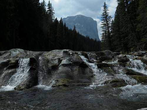
Cataract Creek is a large tributary of the Highwood that most would refer to as a small river. It starts immediately beneath the Continental Divide and flows into a broad intermontane valley which is the result of how the mountains here are arranged and doesn't have anything to do with the creek itself, which tends to flow across the grain of the country. It then crosses the Forestry Trunk Road, sneaks behind a ridge and enters a secluded, darkly forested valley underneath Mount Burke before joining the Highwood just downstream of Eyrie Gap. It is this lower section with its numerous waterfalls that gives the creek its name
Aside from the ever-popular trail up Mount Burke and kayakers tumbling down lower Cataract Creek, the Cataract is probably the least visited area of K Country due to its being very heavily logged (except for the lower Cataract, which is a wildland provincial park). That being said, a number of hills in the area, such as Coyote Ridge, Raspberry Butte and Three Cairns, have alpine summits and are fun to hike up. The Great Divide Trail, a seldom used thru-hiking route (although well-maintained in this section), runs immediately beneath the east wall of the Continental Divide through some beautiful alpine plateau country and can be accessed by a number of logging roads cum snowmobile trails. Speaking of snowmobiles, the entire Cataract is a snowmobile area in winter.
Upper Livingstone
Only the uppermost headwaters of the Livingstone River are within K Country, but the mountains surrounding this valley are pretty interesting. On the west side is Plateau Mountain, the only example of a nunatak in the Canadian Rockies. Untouched by ice age glaciers, the summit of Plateau is a broad, flat alpine table full of rare plants and butterflies. The very rough and steep Plateau Mountain Road climbs up to around the 2250m/7400ft level just below treeline, after which the road is gated and you can bike up. There are also a few scramble routes up the side. The entire summit plateau is contained within the Plateau Mountain Ecological Reserve, although there are a few grandfathered gas wells on top (hence the road).
On the other side of the valley is Hailstone Butte, which I'll discuss in the next section. Unfortunately, the valley itself has been pretty well completely logged out in the last few years.
Willow Creek
Willow Creek is the southernmost of K Country's foothills valleys. The valley is guarded at the west end by the grassy alpine ridge of the Livingstone Range (not to be confused with the Livingstone Range in Montana's Glacier National Park, although from many places you can see both ranges) - Hailstone Butte on the north side and the Windy Peak Hills on the south. The gravel Hwy 532 (Johnson Creek Trail) crosses this ridge at a pass known as The Hump, which is above treeline and feels like it's on the edge of the world. Hwy 532 marks the southern boundary of K Country.
Willow Creek itself flows north-south through the valley, while Johnson Creek joins it at right angles coming down from The Hump. On the west side of Willow Creek, hills rise up against Hailstone Butte, including the rock pinnacle of Cougar Hill. On the east side, the Willow Creek Hills form an independent ridge, which at its south end just above the road becomes a narrow fin of rock that is fun to hike along. Unfortunately, in the last few years there has been a wave of unprecedentedly heavy logging in the valley which diminishes its pastoral appeal somewhat, although there are still some great hikes here.
Getting There
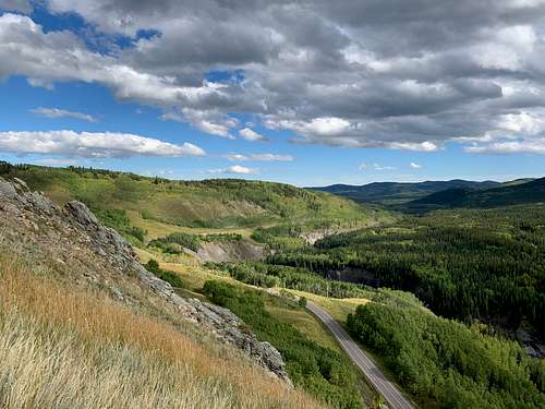
Access roads are mentioned in the main text. Highway 40, the Smith-Dorrien Trail and Highway 68 are accessed from the Trans-Canada Highway heading west out of Calgary. The rest of the access roads, including the south end of Highway 40, are accessed off Highway 22 (the Cowboy Trail), a scenic highway through classic Alberta ranching country and a number of small towns (Bragg Creek, Turner Valley, Black Diamond and Longview). The Trans-Canada and Highway 22 meet about 15 minutes west of Calgary just south of Cochrane.
There are a number of winter/spring road closures in K Country, mainly for wildlife management reasons (i.e. keeping hunters away from overwintering elk and bighorn sheep). Highway 40 between Kananaskis Lakes and Highwood Junction is closed December 1-June 14, Highway 66 in the Elbow west of Elbow Falls, Powderface Trail the road, Highway 546 in the Sheep west of Sandy McNabb, Gorge Creek Road and Ware Creek Road are closed December 1-May 14, and Highway 549 in the north fork and McLean Creek between Fisher Creek day-use area and McLean Creek campground, Highway 532 in Willow Creek west of the bridge over Willow Creek, and the Forestry Trunk Road between Cataract Creek campground and Wilkinson Summit are closed Dec 1-April 30. The paved roads that are closed - Highway 40 (especially), Highway 66 and Highway 546 - are classic spring bike rides.
Red Tape
Very little red tape for non-motorized users. Random camping is not allowed in provincial parks or provincial recreation areas (though it is allowed in wildland provincial parks) due to high use. This mostly applies to roadside day-use areas and campground areas as well as the Smith-Dorrien, most of the Kananaskis Valley and most of the Sheep Valley.
Important Red Tape Update
As of June 2021, a mandatory user fee will be in place for Kananaskis Country - 90$ for an annual pass or 15$ for a day pass. More information: https://www.alberta.ca/kananaskis-conservation-pass.aspx
Recommended resources
Gillean Daffern's five volume Kananaskis Country Trail Guide is a superb, and very detailed, compilation of almost every conceivable hike in Kananaskis Country, all of them done by the author who has been exploring these mountains for over 50 years. Highly recommended. Here's a fascinating interview with Gillean done by mountain legend Bob Spirko. You really can't write anything about K Country without mentioning the Dafferns.
The best maps for K Country are produced by Gem Trek Publishing, and are excellent 1:50000 topo maps with all official trails shown. You can also use the National Topographic System maps (especially for the few corners of K Country not covered by the Gem Trek maps), but these are less detailed and don't show up-to-date trail information or park boundaries.
Disclaimer: I was not sponsored in any way to make these recommendations, nor am I in any way affiliated with the authors of these resources. These recommendations are intended to be helpful, not promotional.
External Links
Kananaskis Country, Alberta Parks
Cross-country ski conditions in K Country, Banff National Park and Calgary: skierbob.ca
Alberta Parks information and facilities pages (PP=provincial park, WPP=wildland provincial park, ER=ecological reserve, PRA = provincial recreation area)
Don Getty WPP (not a single park but a series of small units up and down the eastern slopes)
There are way too many small recreation areas (i.e. just a parking lot or campground) in K Country to list here, so relevant links are under campgrounds.
Camping
There are numerous campgrounds in K Country. Rather than list them all, I provide you with this link to a handy interactive map showing all campgrounds, both frontcountry and backcountry, in and around K Country: Camping in Kananaskis Country. Alberta Parks campgrounds are generally very well-maintained and pleasant to use.
Management update
In early March 2020, the new Alberta provincial government, with no consultation, prior announcement, or platform description, released a plan entitled "Optimizing Alberta Parks". This plan met with a tremendous amount of protest from the outdoor community, and for good reason: the legendery Peter Lougheed Provincial Park, Ribbon Creek and Mt Shark ski trails would no longer be groomed, several visitor centres would close, and most trailheads and a number of campgrounds outside the provincial parks (including all the trailheads in the Highwood areas) would be eliminated from the parks system. This incredibly short-sighted decision will, in addition to the obvious loss of the ski trails, make parking and camping difficult in a lot of areas, especially the Highwood. See CPAWS' and Friends of Kananaskis Country's statements about this.
Final Note
If you have any suggestions for improving this page, please do let me know. I'm honestly really surprised nobody has made an overview page for K Country yet, given that there are around 100 SP pages for the area already in existence.