
-
 17112 Hits
-
 80.49% Score
-
 12 Votes
|
|
Area/Range |
|---|---|
|
|
46.83670°N / 13.13420°E |
|
|
9134 ft / 2784 m |
|
|
The Kreuzeck GROUP
The Kreuzeck Group is situated in the south of the National Parc Hohe Tauern, witch is the biggest nature parc in the Eastern Alps., between the valley of the Drau (Drava) and the valley of the Möll. This group isn't as fameous as the major groups of the parc :
The following 3 groups are just like Kreuzeck Group relatively unknowned :
Goldberg Group,
Granatspitze Group,
Villgraten Group. Some of the major mountains in the Kreuzeck Group are : Some information about the Group : The Kreuzeck Group is on both (north and south) side borderd by two rivers, the Möll in the north and the Drau (Drava) in the south. Cause the geologic construction and massif amount of water are the flacks of the mountains in this group overloaded with gras, the green ground goes until most of the summits itself. This is also the reasson why you can find shuch a viarity of flowers here. (Enzian, Alp-roses, Edelweiss even the White Alp-rose you can find here).just klik the flowernames to see a photo of them. The Kreuzeck Group has for the biggest part a mid.Alpine character but there's also a little part high.Alpine character. Most of the ridges are between 2500m and 2800m, And the three border is around 2000 meter. There are alot of firn-fields but now summit is the whole year through covered in snow. The snow border in that region is a littlebit higher above 2900m. Cause there is much of water in the group there are alot of lakes there. (around 60)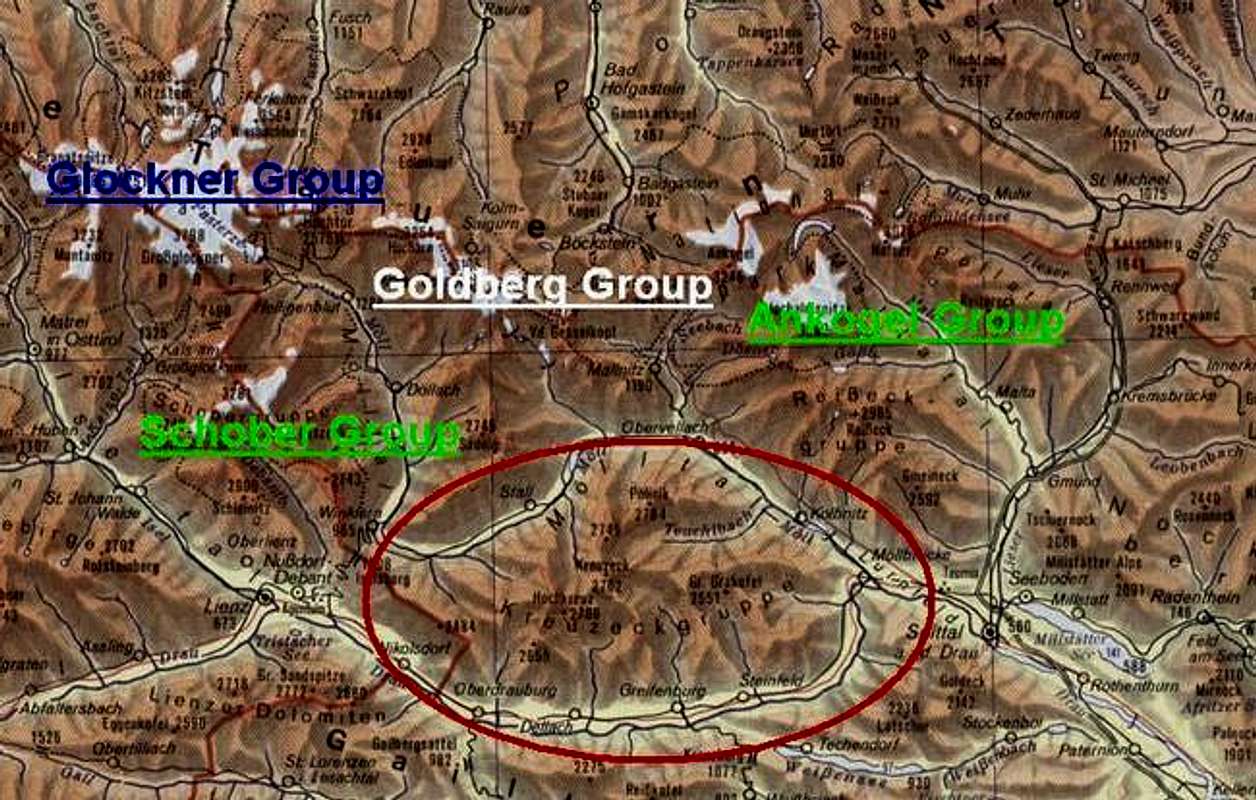
This map is active, just go over it to see the names and links to other Groups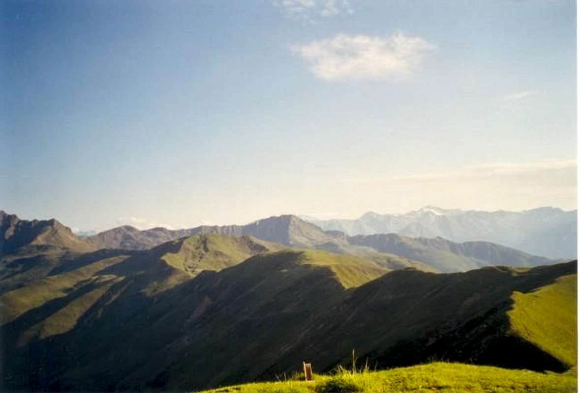


Trekking and climbing in the Kreuzeck Group

There are 5 major huts in the group that you can use for different trekkings :
- The Salzkofel hut at 1987m in the east of the group.
- The Feldner hut at 2182m. in the center of the group.
- The Hugo Gerbers hut at 2347m. in the center of the group.
- The Polinik hut at 1873m. in the north of the group.
- The Anna-Schutzhaus at 1991m. in the west of the group.
| o Feldner hut 7h | ||
| Salzkofel 2498m. 1h.1/2 | ||
| Kleine (little) Kreuzeck 2505m 1h.1/2 | ||
| Kopen 2158m. 1h | ||
| Knoten 1964m. 1h.1/2 | ||
| Stagor 2288m. 5h | ||
| o Salzkofel hut 6h.1/2 o Hugo Gerbers hut 6h- 7h o Polinik hut 8h-10h o Hochtristen-Schutzhaus 5h | ||
| Kreuzeck 2701m. 2h | ||
| Rothorn 2821m. 1h.1/2 | ||
| Dechant 2609m. 1h.1/2 | ||
| Polinik 2784m. 8h | ||
| Hochkreuz 2708m. 3h.1/4 | ||
| Hochtristen 2536m./Grafische Tristen 2553m. 3h | ||
| o Feldner hut 6h-7h o Anna-Schutzhaus 7h | ||
| Hochkreuz 2708m. 3h1/2 | ||
| Kreuzelhöhe 2624 m. 3/4h. | ||
| Scharnik 2657m. 3h | ||
| Ziethenkopf 2484m 4h. | ||
| o Feldner hut 10h.-12h. | ||
| Polinik 2784m. 3h. | Ebeneck 2122m. 1h.1/2 | |
| Rauchkopf 2176m. 2h | ||
| Gamskar 2580m. 2h.1/2 | ||
| o Hugo Gerbers hut 7h. | ||
| Ederplan 2061m. 10min. | ||
| Ochsenberg 2012m. 3/4h | ||
| Ziethenkopf 2484m. 2h.1/2 |
 |  |
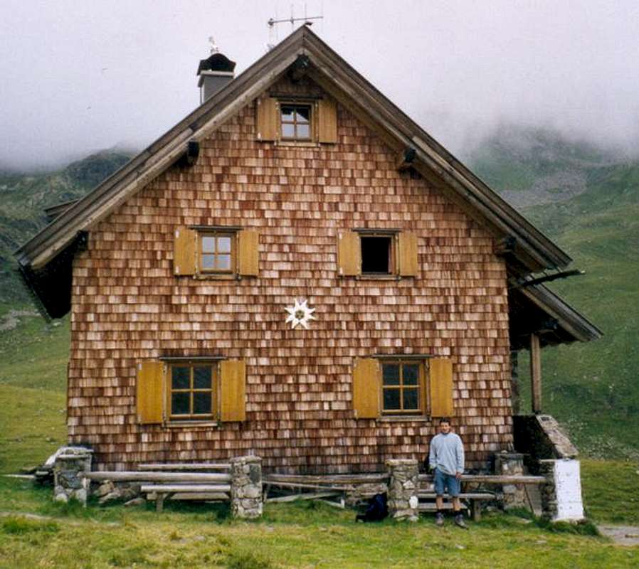
Salzkofel-hut
The Salzkofel hut at 1987m

The Salzkofel-hut is easy reachable from the village Sachenburg. From the trainstation there it's a 5 1/2h acsent to get there. The second option to get in the Salzkofel-hut goes via the Kreuzeckbahn from where it's a 3 1/2h acsent to the hut.
Summits that you can climb from the hut are :
Trekkings to other huts are :
The other option is :
-Or you can go down to Steinfeld on a 7h tour, over Lenkenspitze (2298m.) and Stagor. Steinfeld is a little village in the Drautal at the feet of the Stagor.
 |  |  |
Feldner-hut
The Feldner hut at 2182m.
The Feldner-hut is easy reachable from the village 'Greifenburg' that is situated in the center of the Drautal. From the trainstation of Greifenburg till the hut it's a 6h acsent. It's also possible to drive till the little village of Gnoppnitz that lays 4km closer to the hut, from there you'll still need something like 5h to get to the hut.
Summits that you can climb from the hut are ;
Trekkings to other huts are :
There are two other options :
-To the village called Teuchl (in the south of the Möll-valley) over Kaltseetörl (2481m.) : time required 5h à 6h
-To the village Stall (in the Möll-valley) over Glenktörl (2457m.) : time required 6h
Hugo-Gerbers-hut
.The Hugo Gerbers hut at 2347m. The Hugo-Gerbers-hut is easy reachable from the village 'Oberdrauburg' that is situated in the west of the Drautal. From the village you can reach the hut in a 5h1/2 acsent. Summits that you can climb from the hut are : 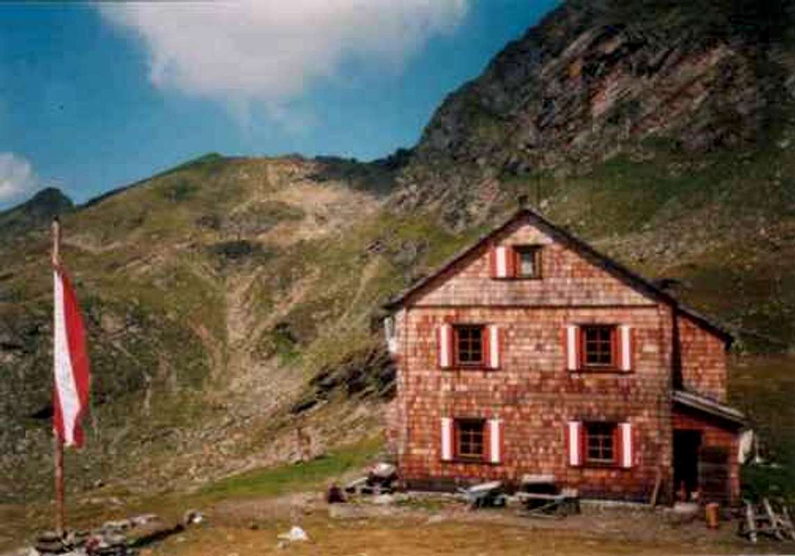
Trekkings to other huts are :
The other option is :
-To the village Irschen over Scharnik : time required 6h (till Oberdrauburg you'll need 1h1/2 more)
 |  |  |
Polinik-hut
The Polinik hut at 1873m.

The Polinik-hut is easy reachable from the village 'Obervellach' that is situated central in the Mölltal (Möll-valley). From the village you can reach the hut in a 3h1/2 acsent, or you can drive with your car till circa.1100m. from there it's a 2h1/2 acsent till the hut. Witch is situated in the north of the group on the 'Stampfer Alm' at a hight of 1873m.
Summits that you can climb from the hut are :
>Trekkings to other huts are :
There are two other options :
-To the village called Teuchl (in the south of the Möll-valley) over Polinik : time required 8h (to do this tour witch is quiet demanding.)
-To Flattach (witch is situated central in the Möll-valley) over Polinik : time required 8h (this is a beautifull way to descent see Polinik page.)

Anna-Schutzhaus
The Anna-Schutzhaus at 1991m.

The Anna-Schutzhaus (hut) is easy reachable from the villages : Dölsach (Doelsach/Eng) (in witch the hut also is situated) from Nikolsdorf and from Winklern.
- From Dölsach : 3h (there is a Tol-street till Streberalm at 1500m. from there it's a 1h1/4 walk untill you can reach the hut.
- From Nikolsdorf it's a 4h acsent
- From Winklern till Zwischenbergen from there it's still a 1h walk.
Summits that you can climb from the hut are :
All this summits are easy walk-ups.
Trekkings to other huts are :
 |
General climb and trekking information
Most of the mountains in the group are easy walk-ups but don't underestimade some of the major summits..-For most of the summits are good hiking shoes the only thing you require, but if you want to climb the highest and steepest mountains of this group or you want to do one of the trekkings, than is a bit of rope and a harnass no luxeury. But with some good working brains and some experience you also can come far.
 |  |
Red Tape
No red tape, for all the mountains and trekkings in this group.When To Climb
Camping
Getting There
Mountain Conditions
External Links
- Austrian Map online
Online digital maps of Austria (OEK 50, OEK 200 and OEK 500) by the BEV (Bundesamt für Eich- und Vermessungswesen) - in German