What's new?
UPDATE MADE: 03/09/2005 Section
Non-mountain pictures added
UPDATE MADE: 03/09/2005 Link to
Hohe Riffl (Glockner GROUP) added
UPDATE MADE: 03/09/2005 Link to
Eiswandbichl (Glockner GROUP) added
UPDATE MADE: 14/08/2005 Link to
Laitenkopf (Goldberg GROUP) added
UPDATE MADE: 29/07/2005 Link to
Boeses Weibl (Schober GROUP) added
UPDATE MADE: 27/07/2005 Link to
Dreieckspitze (Rieserferner GROUP) added
UPDATE MADE: 27/07/2005 Section What's New added
UPDATE MADE: 25/07/2005 Link to
Maresenspitze (Ankogel GROUP) added
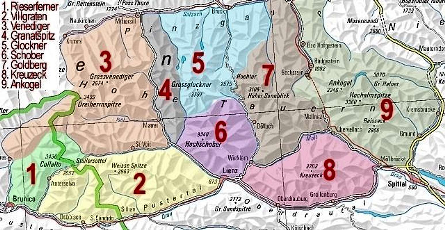
A. Overview
Geographical Classification: Eastern Alps - Hohe Tauern The Hohe Tauern are a big mountain range as part of the main ridge of the eastern Alps. They are 130 km long and 50 km wide and run between the Krimmler Ache river, Birnluecke and Ahrntal valley in the west, the Großarltal valley, Murtörl pass, Murwinkel area and Katschberg pass in the east, the Salzachtal valley in the north and the Pustertal and Drautal valleys in the south The name Hohe Tauern derives from the word "Tauern", a commonly used expression for the passes that have been used since ancient times for crossing the highly glaciated range. The valleys leading in a northerly direction to the Salzach river are stepped and characterised by smooth trough walls, waterfalls and gorges (the Liechtensteinklamm, Gasteiner Klamm, Kitzlochklamm and Siegmund-Thun-Klamm gorges), at the glaciated valley heads are numerous small alpine lakes [according to the Austrian Encyclopedia] A large part of the Hohe Tauern forms the Hohe Tauern National Park. The park is the biggest protected area of middle Europe. It covers an area of 1800 km² and contains some beautiful mountains to climb such as Grossglockner (3798m. and also the heighest mountain of Austria), Grosses Wiesbachhorn (3570m), Hoher Sonnblick (3105m), Grossvenediger (3662m), Hochalmspitze (3360m), Ankogel (3256m.), Hochschober (3240m). The park offers a place where an unique fauna and flora is preserved. That's why the National Park Hohe Tauern is so special... For structuring this big area for mountaineers, we have divided it according to the guidelines of the german/austrian alpine club into the following subgroups:
- Rieserferner group
- Villgraten group
- Venediger group
- Granatspitze group
- Glockner group
- Schober group
- Goldberg group
- Kreuzeck group
- Ankogel group
B. Groups
![]()
Point on big red numbers to see subgroup names, click on them to get SummitPost pages!
1. Rieserferner group
Watch the Rieseferner page The Rieserferner group is situated a little bit outside the borders of Austria. It is a part of Italy. The group is surrounded by the Venedigergroup in the north and the Villgratengroup in the east. The most important city is Brunico. This city lies approximately 75km from Lienz, the capital city of East-Tirol. The most important mountains in this group are:
2. Villgraten group
Watch the Villgraten page The Villgraten group is situated in the southern part of East-Tirol and a small part in the north of Italy. The most important cities are Sillian in East-Tirol and Dobbiaco in Italy. This area is one of the lowest areas of the Hohe Tauern. The most important mountains are:
3. Venediger group
Watch the Venediger page The Venediger group is one of the biggest areas in the National Parc Hohe Tauern. It contains the second heighest mountain of the whole Hohe Tauern: Grossvenediger (3674m.). The most important villages in this area are: Matrei in East-Tirol (approximately 28km from Lienz), Mittersill and Krimml in Salzburgerland. The group is surrounded by the Granatspitze group in the east and the Rieserfemer and Villgraten group in the south. The most important mountains are:
4. Granatspitze group
The Granatspitze group is one of the smallest groups of the Hohe Tauern. It is surrounded by the Venediger group in the west and Schober group and Glockner group in the east. The most important villages are Matrei in Ost-Tirol and Uttendorf in Salzburg. The most important mountains are:
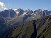
5. Glockner group
Watch the Glockner page The Glockner group is the heighest group of the Hohe Tauern. It contains the Grossglockner (3798m.) which is the heighest mountain of Austria. The most important villages are Heiligenblut (Carinthia), Kals (East-Tirol), Fusch, Kaprun and Zell am See (Salzburgerland). The group is surrounded by the Granatspitze group in the west, Schober group in the south and Goldberg group in the east. The most important mountains are:
6. Schober group
Watch the Schober page The Schober group is situated between the Goldberg group and Kreuzeck group (east) , Glockner group (north) and Granatspitze group and Villgraten group (west). The most important villages are: Winklern (Carinthia) and Lienz (East-Tirol). The most important mountains are:
7. Goldberg group
The Goldberg group is situated between the Glockner group and the Schober group (west), Ankogel group (east) and Kreuzeck group (south). The most important cities are Rauris, Mallnitz, Flattach, Badgastein. The most important mountains are:
8. Kreuzeck group
Watch the Kreuzeck page The Kreuzeck group is the group with the lowest mountains of the Hohe Tauern. It's boundaries are clearly defined by the rivers of the Moell in the north and the Drau in the south plus the Iselsberg pass in the west. Neighbour mountain groups are Schober group in the west, Goldberg group in north west, Ankogel group in north east, Gailtal Alps in the south. Main towns and villages are Lienz, Greifenburg, Obervellach. Some main mountains are:
9. Ankogel group
Watch the Ankogel goup page The Ankogel Group is one of the heighest groups of the Hohe Tauern. The Hochalmspitze (3360m.) is the last mountain covered by glaciers when you go further to the east. We took the Reisseck group as a part of the Ankogel group. Some important villages and cities are Badgastein, Mallnitz, Obervellach, Kolbnitz, Spittal, Gmünd and Malta. The main mountains are:
C. Origin of Hohe Tauern
Author: wuedesau The Hohe Tauern offers some of the most exeptional, complicated and best studied geology of Europe. Therefore I have to make some comments to this chapter: 250 million years ago plates were not drifting together! At that time almost all known landmasses were joined together in one huge continent: Gondwana. The climate was dry that time and large deserts covered the continent. Sandstones give a testimonial of this time in the Hohe Tauern range. But these are not the oldest rocks in this region. The sandstones are erosional products of granites which intruded some 100 million years earlyer as a consequence of the variscan orogeny. These granites, in most places deformed to gneisses by the alpine deformations, are today widespread and form the cores of the Ankogel / Hochalmspitz group, the Goldberg group, Venediger and Granatspitz group and the Zillertal Alps. Granites / Tonalites are also present in the Rieserferner group, but these are very young (they mark the border to the Southern Alps). The granites mostly intruded into slates, schists and phyllites, described as the "old roof" or old crystalline mass. The oldest rocks of the Hohe Tauern suffered even a third orogenic cycle more than 400 million years ago: the Caledonian orogeny which is best preserved in western Scandinavia and Scottland. Magmatic rocks of precambrian age, possibly more than 700 million years old, are present in the Habach Formation, in the north-western part of the Hohe Tauern, containing one of the largest tungsten mines in the world. Coming back to where I started, 250 million years ago, when Gondwana started to break up. A large rift started to transect Gondwana beginning from the east and a precursor of the Indian Ocean (note that India was not part of Asia yet) filled the place between Eurasia and Africa. New ocean floor (basalts, tholeiites) was produced at the mid-ocean ridge later transformed to greenschist and amphibolite. Today rocks of the deepest point of the ocean build up the highest peak of Austria. The Tethys Ocean increased for about 100 million years before it started to close again. In all that time sediments were deposited on the basaltic ocean floor. Large limestone reefs grew in the shallow areas (mainly at the continental margins), fine grained clastic material was sedimented in the deeper areas later metamorphosed to slates, phyllites, and schists today forming most of the northern part of the Hohe Tauern ("Schieferhülle"). While the ocean was closed most of the ocean floor was subducted beneath the Eurasian plate but much of the sediment cover was scraped off forming huge nappe systems representing different sedimentational basins and now stacked one above the other. At the Hohe Tauern rocks of the Eastern Alpine Nappe system and the Penninic Nappe crop out. The Penninic rocks which represent the deepest tectonic unit of the Eastern Alps are exposed by a large window structure the "Tauern Window" (Tauernfenster) reaching from the Brenner Pass in the west till the Katschberg Pass in the East containing almost all of the highest peaks. The rim is formed by the different Eastern Alpine Nappes. Several orogenic phases led to the overthrusting, lifting and folding of these nappes. This process is still going on and the peaks of the Hohe Tauern are still growing. Much more than 10.000 years glaciers covered the Alps. As you mentioned a dramatiaclly climatic change occured about three million years ago. Since that time at least 4 Ice Ages took place with the last one ending about 14.000 years ago. Waterfalls: most of the waterfalls in the Hohe Tauern were formed because the glaciers eroded the main valley much deeper than the side valleys. Most of the side valleys discharge(d) with a waterfall into the main valley.
D. Getting there
As said the Hohe Tauern covers a big part of the provinces Carinthia, East-Tirol and Salzburgerland. To reach the Hohe Tauern from Germany, the main startpoint is Munich. From there you have to drive to Rosenheim. There are 2 possibilities then: Kufstein and Salzburg. From there you can drive to the different places (Mittersill, Zell am See, Bad Hofgastein). To reach Ost-Tirol from Munich you have to drive via Kufstein, then via Kitzbühel, Mittersill and via the Felbertauerntunnel to Lienz. To reach Carinthia from Munich there are several possibilities: - Grossglockner Hochalpenstrasse - traintunnel, Böckstein (Bad Hofgastein) - Mallnitz - Felbertauerntunnel - Lienz - Carinthia - Katschbergtunnel To reach the Hohe Tauern from Italy there are also several possibilities: From Bruneck you have to drive to Sillian (near the border of Italy and Austria), then to Lienz. From Udine you have to drive to Villach via the Karawankentunnel, from there to Spittal. For links check the link section please!
E. Trekking
The Hohe Tauern is a wonderful area and therefore a very good place to make trekkings. The Tauern Höhenweg is an example of a wonderful trekking experience. There lie different routes from Seckauer Tauern till Venedigergroup. Opportunities enough to have a wonderful trekking... (the different routes will soon be posted in the subgroups)
F. Intresting Links
This section is made for 'collecting' intresting links of pages that are not from Summitpost.org. So if you have a visited a nice page or you have a nice page yourself about the Hohe Tauern then just post it by adding a Comment and I'll put it asap in the list!
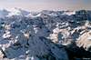
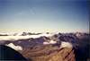
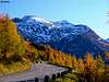
G. Non-mountain pictures
Here you can post pictures that not really have to do with mountaineering. Pictures which are linked to the Hohe Tauern can be post here.

 59497 Hits
 91.45% Score
 35 Votes