
|
|
Mountain/Rock |
|---|---|
|
|
48.05118°N / 121.86004°W |
|
|
Snohomish |
|
|
2375 ft / 724 m |
|
|
Overview
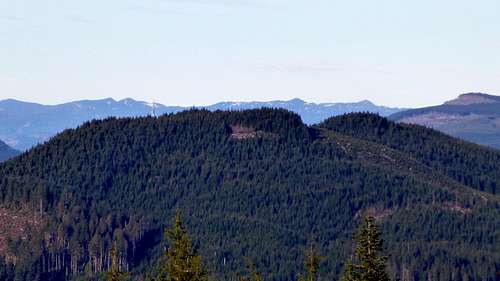
Littler Pilchuck (2375'/955' prominence) from Explorer Hill
Littler Pilchuck (not to be confused with Little Pilchuck) is a small, forested foothill located five miles E-SE of Granite Falls, WA. While not particularly attractive, it does happen to be one of my favorite winter mountain bike outings - although I may be biased, since the 'trailhead' is a mere 20 minute drive from my house. It is also a great place to soak up some quick rays when the Puget Sound inversion layer kicks in, as it did with a vengeance in January 2014. It will often be cold and foggy at my house, while just just a few miles away on Littler Pilchuck, the sun is shining brightly, with relatively warm temperatures. I have also used Littler Pilchuck for years as my own personal 'snow level gauge'. When its top is snow covered, I know the snow level is 2000' or less.
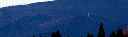 Littler Pilchuck from my living room
'Littler Pilchuck' was the designation given to this foothill in an old 'Footsore' book from my collection at home. While 'listsofjohn' refers to this peak as Worthy Hill, I'm going to defer to the late Harvey Manning on this matter, since his books have been around for decades longer than listsofjohn.com.
Update (10-23-16): Please see the bottom of the route section for important update information.
Getting There
Note: While it is certainly possible to walk up Littler Pilchuck, it would make for a fairly long day. I am working on the assumption that most people who chose to visit this area will do so on a mountain bike.
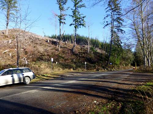 Parking for Littler Pilchuck. Don't be afraid of all the 'No Parking' signs - they are simply there to protect the turn-around. I have been parking here for years with no issues. Try to park off the road as much as possible, since trucks do use this road on occasion.
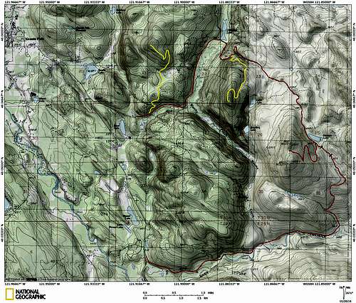 Littler Pilchuck route map. The north red line shows the normal route, while the south red line shows the optional route up the 'P5000' road (Theoretically, a 'Discovery Pass' is required at the P5000 road). The black tick marks on the P5000 route show old road bed that is inaccessible to bikes - it will be necessary to walk from this point if you choose this route. The west yellow line shows an optional trip up Chitwood Peak aka 'Scotty Hill' (1490'/720' prominence/good views), and the east yellow line shows an optional trip up 'Julia's Hill' (1810'/590' prominence/no views). The hill just to the east of Menzel Lake - 'Menzel Hill' (1470'/740' prominence/good views) can be approached from the gravel quarry on Scotty Road, or a gated road on the east side of Menzel Lake Road abeam the south end of Menzel Lake (marked as 549' on the USGS map).
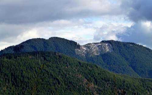 Littler Pilchuck from Chitwood Peak aka 'Scotty Hill'. 'Julia's Hill' is in the foreground.
 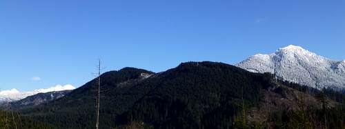 Littler Pilchuck from 'Menzel Hill'. 'Menzel Hill' (another one of my made up names) can be approached from Scotty Road, but the views are better if you approach from the Menzel Lake Road.
Route
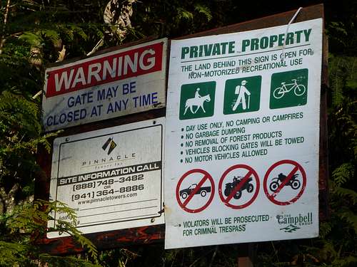 Posted signs on the way to Littler Pilchuck
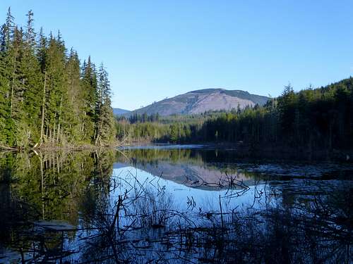 Chitwood Lake on the way to Littler Pilchuck. Olo Mountain forms the backdrop.
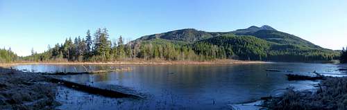 Southwest shore of Hansen Lake at base of Littler Pilchuck. Mount Pilchuck forms the backdrop to to the east.
 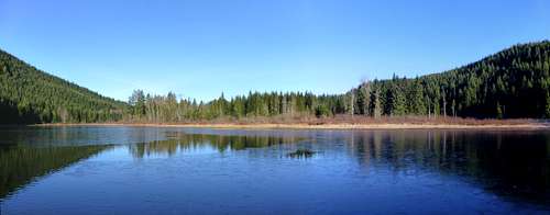 East shore of Hansen Lake at base of Littler Pilchuck
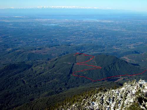 Littler Pilchuck from Mount Pilchuck. Red line shows the final push to the top. Hansen Lake can be seen at lower right.
After traveling 1.3 miles by whatever means worked best for you, the road will split as you arrive at the top of the ridge between Littler Pilchuck's north and south summits. The spur to the right is of little interest, so take the left fork. After several hundred feet, a spur will turn off to the left - you will be returning to this spur to get the big views to the east. For now, continue up the main road for another 100'. At this point, you will have expansive, 180 degree views to the west.
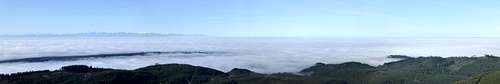 Puget Sound inversion layer from top of Littler Pilchuck. On this particular day, the temperature at my house was 35, with miserable fog, while the conditions on the summit were upper 50's and blazing sunshine. On clear days, expect great views of the Puget Sound lowlands.
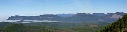 Looking NW from top of Littler Pilchuck. From left to right: Siberia Mountain, Blue Mountain, Wheeler Mountain, and Olo Mountain.
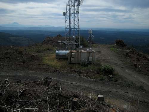
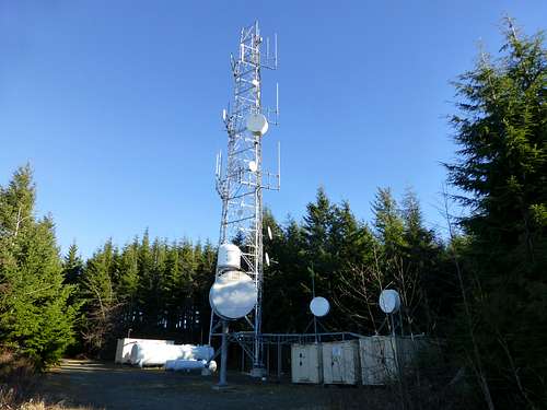 Communication tower on top of Littler Pilchuck
Update (9-10-21): The south summit has recently been clearcut, and now offers pleasing 300 degree views (NE clockwise through N) from Mount Pilchuck to Mount Baker, and has sweeping views of Pugetropolis.
 East view from top of Littler Pilchuck. From left to right: Olo, Baker (barely), Ditney, Green, Whitehorse, Three Fingers, Pilchuck, Bald, Little Greider, Greider, Static, Ragged Ridge, Stickney, Zekes, Index, Persis, Explorer Hill.
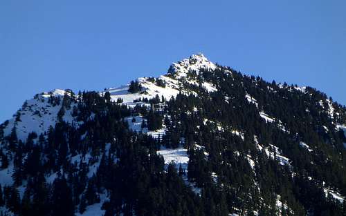 Mount Pilchuck from top of Littler Pilchuck
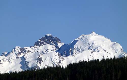 Three Fingers from top of Littler Pilchuck
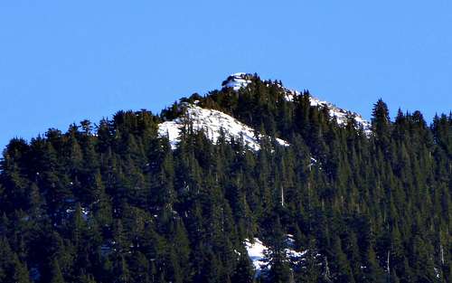 Little Pilchuck from top of Littler Pilchuck. While their names are sometimes used interchangeably, 'Little Pilchuck' refers to the 4600' peak 0.5 miles W/NW of Mount Pilchuck's summit.
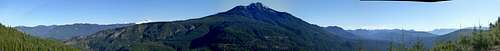
 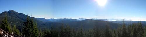 Littler Pilchuck south pano. Photo taken at N48 03.023 W121 51.610
Update (10-23-16): Good news! The Scotty Road logging road system and the P5000 logging road system have been reconnected. It is now very feasible (in fact, probably recommended) to approach Littler Pilchuck from the P5000 trailhead. Approaching from the P5000 road is actually a little shorter, and there is plentiful parking (Discovery Pass required). Of course, there is now the option of doing the full P5000/Scotty Road loop for those who are so inclined. Please see the map below - note that the new connector road is slightly higher and west of the old connector road. Warning - Expect significant logging operations on the southeast side of Littler Pilchuck in 2017.
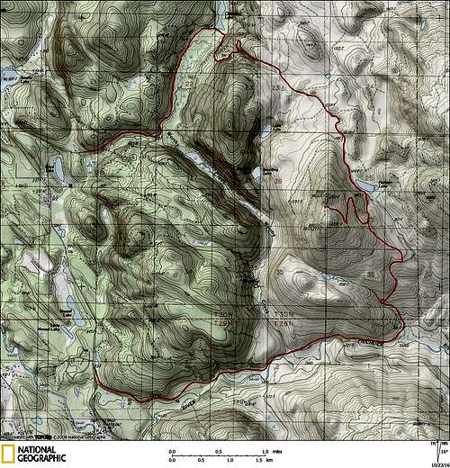 Updated route map for Littler Pilchuck (Worthy Hill)