

-
 17283 Hits
-
 85.36% Score
-
 20 Votes
|
|
Mountain/Rock |
|---|---|
|
|
48.48913°N / 113.76956°W |
|
|
Flathead |
|
|
Hiking, Mountaineering |
|
|
Spring, Summer, Fall, Winter |
|
|
7181 ft / 2189 m |
|
|
 Loneman Mountain
Layout designed for best viewing on a "1024 x 768" screen.
Loneman Mountain is located about 5 miles from an area along U.S. Highway 2 named Nyack Flats. It is here at Nyack Flats that the trailhead to climb Mount Stimson as well as Mount Saint Nicholas (photo link) leaves from the north side of the Middle Fork of the Flathead River.
This area has fewer visitors and more wild animals!
A highlight on this September 2009 trip was seeing a large 6 point bull elk in a basin below the summit with at least 6 cows in his harem. His bugling was heard just as we reached the last half mile of the trail before the mountain’s summit. We also saw a small black bear near the abandoned Nyack Ranger Station.
Loneman Mountain was named in either 1885 or 1902 by J. W. Schultz after he and two companions were on a winter camping trip on Nyack Creek when the temperature reached -33 degrees Fahrenheit. In addition to the above information found in Place Names of Glacier National Park by Jack Holterman he states that he is not sure who Loneman was.
The Kootenai called this peak “Wolf Gun” and the Blackfeet named this peak Nitaina’.
Views This Good Should Have To Cost More!
This climb is a nice diversion from dealing with scree and off trail route finding in Glacier National Park. The 3,900 feet elevation gained on the trail passes easily and quickly and it almost feels like cheating with the rewarding views from the top.In addition to the views of Mount Stimson (photo link) and its close neighbor, Mount Pinchot (photo link), the view along the Continental Divide from Triple Divide Mountain to Red Eagle Pass to Mount Jackson is truly outstanding.
 |

|
|---|---|
 |
 |
Loneman Lookout:
 Loneman Lookout
Another unique element of this peak is the lookout that is located on the summit.
According to the National Historic Lookout Register, Loneman Lookout was built in 1929 and was staffed until 1978. It replaced a lookout cabin that was burned by a forest fire in 1928. It was completely renovated in 1998 and is listed on the National Historic Lookout Register
The only recorded large fire in this area occurred in 1929 and was the Halfmoon Fire which reportedly traveled from near Columbia Falls, Montana along the Flathead River. It traveled on both sides of the Middle Fork and reportedly died out or was put out near Nyack Creek. Perhaps this was the fire that destroyed the Loneman Lookout cabin but the dates are wrong. Perhaps it was more localized fire that burned the area in 1928 and as a result the Halfmoon Fire died out near this area because of a lack of fuels.
Needless to say the Loneman Mountain Lookout was reconstructed in 1929.
The lookouts in Glacier National Park were constructed in cooperation with the National Forest to mutually support and monitor potential fire hazards in BOTH Glacier National Park and the Flathead and Lewis and Clark National Forests. They were successful at monitoring and reporting fires for a number of years. Sadly most of these lookouts have been destroyed and now the Park Service and Forest Service do most of the fire monitoring by air.
The article below is from the National Park Service: The link was not working at the time this page was posted.
The Lookout Package When the Loneman Lookout was rebuilt in 1929 it was more than likely hauled to the site by a pack string. Most lookouts were ordered as a package. The text below describes the features and construction of the fire lookout. Fire lookouts were generally constructed from standardized building packages, packed to the lookout site for assembly. Most were also constructed following the mid-1920s increase in lookout-construction appropriations and prior to the 1930s advent of aerial fire detection and suppression. This use of standard plans and the short construction period resulted in a remarkable degree of uniformity in interior design, not only in park lookouts but also in contemporaneous lookouts built on the forests of the USFS Northern Region. Paneled or vertical-plank doors (like the windows, paired with full-length "storms") provided access. In a classic case of design following function, large multi-light awning windows dominated all four elevations; painted 2" to 4" tongue-and-groove planks covered the small expanse of exposed interior wall. Floors were generally finished with painted 3-inch to 6-inch softwood. Fixed furnishings included the critical and centrally located fire finders, a wood-burning stove, a small cot, a wood table and chair(s), and wall-mounted cupboards located above the window banks, near the ceilings. Ceilings were either open/exposed truss or, if dropped, finished with painted tongue-and-groove planks and containing a hinged door leading to the "attic" storage space. Food and equipment storage areas in the "basement" were unfinished and accessed by vertical-board or paneled wood doors. As befits its function, walls of windows dominate the interior of this small building. Three-inch floorboards, painted grey and paired with 4" baseboards, cover the floors. The same 3" planks (either shiplap or tongue-and-groove) cover the walls and ceiling; this siding is laid vertically below the window and horizontally above. A trap door, also constructed of 3" planks, provides access to the attic storage space. Two inch boards frame all windows and the three-panel/one-light door. Door hardware, included heavy metal hinges, a metal doorknob, and an incongruous decorative latch plate. Fixed furnishings generally include two free-standing cupboard/drawer units, a table (one side supported by the window ledge), a wood chair, a metal bedframe, a crank phone, and the centrally located aledaide or "fire finder," mounted on a wood stand. The basement storage area, created by the elevated construction of the primary component, is unfinished, with dirt floors and exposed frame walls and ceiling. Open shelves and the floor space were used for storage of needed as well as seldom needed items. Source: National Park Service |

The above photo was taken in August 1935 from Loneman Mountain Lookout.
There was another fire in 2003 that burned off a lot of the timber and opened up the views towards the Middle Fork drainage. Now there are numerous small trees crowding the trail and in just a few years it will be necessary for the Park Service to clear the trail or it will become unusable.
Getting There:
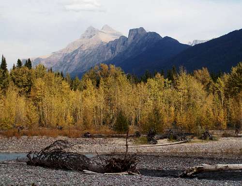
 Middle Fork of the Flathead River
 Middle Fork of the Flathead River
Loneman Mountain is located in Glacier National Park’s remote Nyack region.
This area has few visitors and therefore is wild AND remote. Remember that medical care and rescue is further away.
The Nyack area is accessed along the Highway 2 corridor between East Glacier and West Glacier. The Middle Fork of the Flathead River serves as the geographic boundary along the southwestern border of the park and presents a major obstacle for those who would like to explore this area due to high treacherous water at certain times of the year.
The Burlington Northern Santa Fe Railroad also maintains this portion of the transcontinental railroad corridor in this area and the tracks follow the river from its confluence with Bear Creek flowing from Marias Pass located just east of Essex, Montana to the Middle Fork’s confluence with the North Fork of the Flathead River near Blackenship Bridge.
One of the beautiful things about this side of the park is that there are NO LINES and NO ENTRANCE FEES!
Red Tape:
 Loneman Mountain Trail Conditions 2009
 Nyack Ranger Station Stable
Vehicle single entry fee for Glacier National Park is $25.00 for 7 Days, $12.00 per person for single hiker, motor biker or bicyclist. See Plan Your Visit for other information regarding all of the National Park entrance fee information.
An "America The Beautiful Federal Lands Recreational Pass" for goes for $80.00 which gives entrance to all National Parks, National Forests, BLM, US Fish & Wildlife, and Bureau of Reclamation sites for one year from date of purchase.
If you are planning on visiting Waterton Park make sure you have a passport to simplify crossing the border.
See Rules and Regulations governing Glacier National Park.
CLIMB REGISTRATION: You do not have to register for day climbs in Glacier National Park but it is recommended. Backcountry travel regulations can be found at Backcountry Travel. There is also information from the Park Service on Mountain Climbing in Glacier.
As with all hiking and climbing in Glacier National Park use caution and practice good manners with the wildlife. You are in bear country. Carry bear deterrent spray, don’t hike alone and make some noise. For more information please go to the Park's web site for Bear Information. The U.S. Forest Service also has helpful information on Grizzly Bear Management.
Route Statistics and Information:
 Topo Map
 Trailhead Information
Total Round-trip Mileage: Approximately 13 miles (21 km)
Total Elevation Change: 3,900 feet
Maximum Elevation: 7,181 feet
Topo Map: Nyack View Topo Map in Original Size
Stream Crossings: The Middle Fork of the Flathead River and Nyack Creek
This climb is located in the Walton Ranger District. Here is a link to check current trail status as well as creek flows before you start on this climb.
Directions to the Trailhead:
Drive to Mile marker 164 on U.S. Highway 2, which is approximately 10.9 miles east of West Glacier, Montana, and look for a BNSF Railroad Access road half way between mile markers 164 and 165.
It is also .4 miles west of the Skiumah Creek Trailhead. Another noteworthy feature is the Highway 2 bridge that crosses over the railroad tracks near mile marker 165. Another noted feature is the Red Eagle Ranch that is near the correct road.
However you locate this road turn to the northeast and follow the road to the tracks. At the tracks turn right and follow it for another .3 mile to a parking area. Find a place to park that will be out of the way of the maintenance crews. This trailhead diagram from the National Park Service will also be helpful.
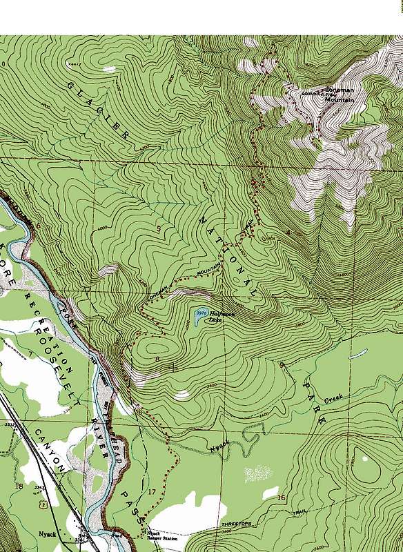
 Vantana fording the Middle Fork of the Flathead River
 Flood Plain of Middle Fork of the Flathead River
 Trailhead Sign
 Crossing Nyack Creek
Trail Directions:
At the parking area walk across the tracks and make your way down the bank to the Middle Fork of the Flathead River.
Make sure you watch for trains in BOTH directions. Many times the Amtrak passenger train flys through this section and it is difficult to hear compared to a laboring freight train.
There more than likely will be more than one channel to cross. Find a suitable place to cross and wade to the opposite shoreline.
Hopefully you have brought some wading shoes and perhaps waders or a dry change of clothes for the rest of the trip.
In September 2009 the Middle Fork of the Flathead River was about 18 inches deep.
Once on the opposite shore continue through the wide river bed and look for a bright orange marker on a tree on the far bank. There was a decent trail leading through the sandbars but it will not always be there depending upon the river's flow and location. The Lower Nyack trailhead sign will also be visible. Hopefully you are at the correct location and it will be easily located.
Hike to the north (down river) passing by the abandoned Nyack Ranger Station just a short distance from the first trailhead sign indicating a trail to Coal Creek. There is a residence (photo link) as well as a stable (see above photo in Red Tape) standing there. Continue on this easy trail until the second creek crossing at Nyack Creek.
Hopefully you still have your wading boots. If not barefooting it isn’t too bad.
In September 2009 Nyack Creek was flowing about 2 ½ feet deep.
 Halfmoon Lake
 Mount Jackson from the trail
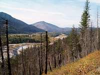
 Loneman Mountain from trail
Just beyond the Nyack Creek crossing the Nyack Trail splits off at the junction and heads up Nyack Creek. DO NOT follow that trail, instead stay left (down river) and follow the Boundary Trail to where the Loneman Mountain Trail leaves the Boundary Trail. This is an obvious junction but if there is any doubt here stay on the high trail. The Boundary Trail, heading downhill, is noticeably more used.
From this junction the trail climbs steeply for about a mile and then the last 4 miles are a series of switchbacks along the ridge leading to Loneman’s summit. The above photos are from the trail. The final ridge (photo link) has great views to the Continental Divide.
Please NOTE: As of Fall 2009 this trail is in decent shape and appears to be used occassionally by horses. There were a few (6) trees over the trail but only 2 required climbing over them. The 2003 fire resulted in NUMEROUS dead trees along the trail and as they fall over and the new growth forest grows the trail will become more difficult.
Although there is no scrambling required on this climb here is some information on climbing in Glacier National Park.
Special Considerations: The rock in Glacier Park is widely varied and it is not unusual to find several different types of rock on any given route. Know your rocks and be certain of your safety. J. Gordon Edwards has an excellent section in his guidebook on rock and climbing safety. Be safe and know your limitations as well as those who are climbing with you. Also refer to the following links for further details: GNP Rock and Grading System and the GMS Climbing Guidelines.
When to Climb and Weather:
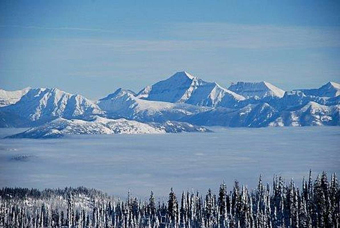 Mount Stimson and Loneman in Snow
This climb would be most easily accomplished after the Middle Fork of the Flathead River and Nyack Creek after they are no longer running at high volumes.
Crossing early season would increase the danger of drowning due to the high flows of the river.
It is possible to walk along the Boundary Trail from West Glacier but this would certainly increase the trip mileage as well as time need to climb.
It is best to make this climb later in the season such as after late August to early October when the river can safely be waded across.
Essential Gear and Camping:
 Parting Shot of Mount Stimson.
Equipment:
Bear Spray
Hiking Poles
Water
Camera
Map
GPS (for those who are navigation impaired)
Hiking boots, but could be done in trail shoes
Sun screen
Camping:
The nearest USFS Campground is located at Devil Creek. it is located about 19 miles west of East Glacier, Montana and 35 miles east from West Glacier, Montana on U.S. Highway 2. Devil Creek Campground has 13 sites that can be used either for RV or tent camping. It is open from May 16 through September 30. The costs to camp there are $10/night. Each campsite has a table and a grill.
The closest National Park Service campground is located at Apgar in Glacier National Park.
Links:
Glacier National Park in PicturesGlacier Mountaineering Society
Visit Montana