
-
 8348 Hits
-
 86.85% Score
-
 23 Votes
|
|
Mountain/Rock |
|---|---|
|
|
37.84752°N / 107.62195°W |
|
|
San Juan |
|
|
Hiking, Mountaineering, Scrambling |
|
|
Spring, Summer, Fall, Winter |
|
|
13222 ft / 4030 m |
|
|
Overview
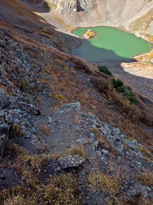
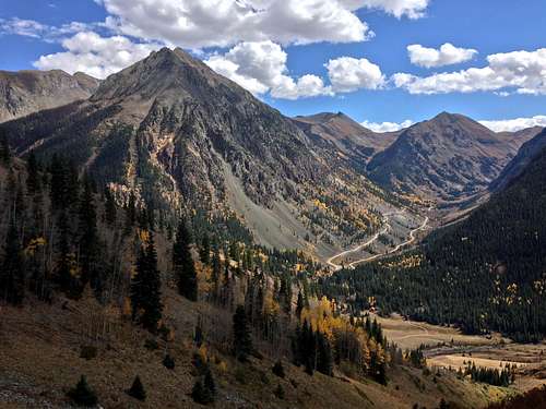 View East from Hematite Trail towards Cunningham Gulch, Stony Pass road, and Galena Mountain
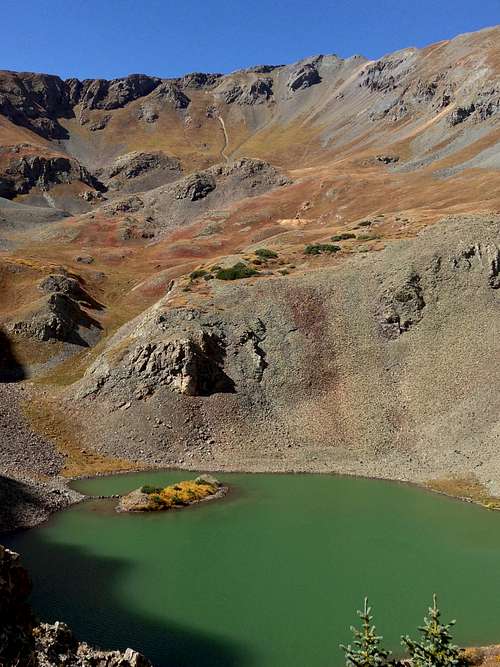 Hematite Lake
Most people combine Macomber Peak with Tower Mountain, which makes a perfect sense since both are located along a horseshoe ridge. Macomber Peak is basically a sub peak of a Tower mountain. It appears as a peak from the distance and Tower Mountain appears only as a bump along a long horseshoe or U-shaped ridge. ![Hematite Gulch]() Hematite Gulch as seen from the CR 2.
Hematite Gulch as seen from the CR 2.![Macomber Peak and Tower Mountain]() Macomber Peak and Tower Mountain as seen from Stony Pass Rd.Hematite Gulch: TH elevation 9,650 feet
Macomber Peak and Tower Mountain as seen from Stony Pass Rd.Hematite Gulch: TH elevation 9,650 feet
Why to make a page? Macomber Peak is named and it is marked on most of the maps.
The easiest and popular access is via Hematite Lake Trail. The trail is well maintained, the lake is spectacular, you can explore a mine higher up in the basin and the views towards Cunningham Gulch across the valley are splendid.
The area is named after the reddish brown stone called hematite, which is the principle ore in iron.
Line Parent: Tower Mountain
Saddle between Macomber peak and Tower Mountain 13,100 feet.
Nearby Peaks:
Tower Mountain: 0.69 miles, Elevation: 13,552 feet (4131 m)Storm Peak A: 1.61 miles, Elevation: 13,487 feet (4111 m)Dome Mountain A: 1.51 miles, Elevation: 13,370 feet (4075 m)"East Storm": 1.3 miles, Elevation 13,325 feet (4061 m)Little Giant Peak: 3.74 miles, Elevation: 13,416 feet (4089 m)Emery Peak: 2.82 miles, Elevation: 13,310 feet (4056 m)Bonita Peak: 3.42 miles, Elevation: 13,286 feet (4050 m)Galena Mountain 3.62 miles, Elevation: 13,300 feet (4054 m)
Getting There
From Silverton, drive north past the county courthouse and bear right on County Road 110. The road becomes County Road 2. Continue for about 4 miles until you can see the first bridge just before the community of Howardsville. The road continues further towards Eureka and onto popular alpine scenic tours over either Engineer or Cinnamon Passes. Stop about 300 yards before this bridge and look for an old jeep track leading up into the grassy field on the left. Park on the side of the road.
Another option is to drive all the way to the bridge and park over there - better parking opportunity.
If you wish to explore alpine scenery in this area, you can approach from Lake City over the above mentioned high alpine passes, but for this you needs high clearance 4WD vehicle and the roads are open from June to October only.
Route
 Hematite Gulch as seen from the CR 2.
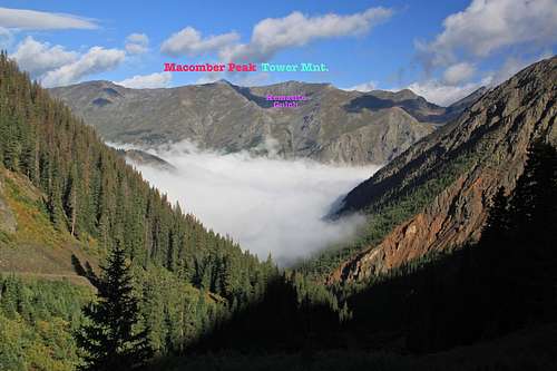 Macomber Peak and Tower Mountain as seen from Stony Pass Rd.
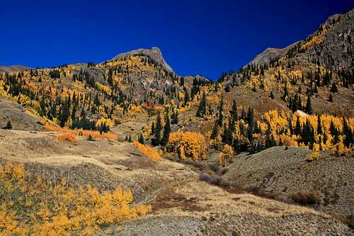
From the TH follow grassy road track up the meadow, gradually gaining elevation on a sloping open grass area. Our route goes up into the Hematite Gulch. Go through the open meadow on an easy trail until you can see the remains of abandoned rusty car. Follow the trail into the gulch and close to the creek. Continue through many switchbacks up the gulch. The views into Cunningham Gulch and Stony Pass on the east side are spectacular. The trail is steep, and in a good condition, it is easy to follow. The basin is supposedly good for checking out wildflowers during the summer (I visited in the autumn). There are few aspens there and the autumn provides nice golden colors. The trail is hard to follow high up in the basin, just before the Hematite Lake, but at this point it is obvious where to go - head for the lake. The lake is beautiful with a little island.
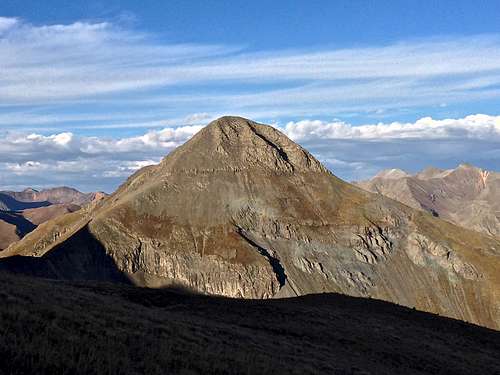
Macomber Peak sits just above Hematite Lake. It appears steep from here, but there is a winding sort of a trail to gain the east ridge of Macomber Peak. There is a small exposure and the difficulty does not exceed class 2+ with careful route finding. Once on the ridge, the route becomes much easier and very obvious. Macomber Peak looks like a peak while Tower Mountain looks like a bump along this horseshoe shaped ridge. The hike is easy, mostly grassy slopes, very little or almost no scree. The summit is not huge, there was no summit register, no cairn (I build a small cairn).
You can either return the same way, but much better and more sensible option is to continue onto Tower Mountain. Drop slightly along an easy ridge, class 1-2 and then start gaining height again on mostly grassy slopes. There is a semi-trail visible at places, but even without the trail the route is obvious. The views down into Hematite Gulch are great, also great views of Storm Peak, all the way into Yankee Boy Basin with Mt. Sneffels, and to the north Handies Peak and high 13ers: Jones and Niagara, just to mention few.
Remember to check the weather report prior this long ridge hike, if conditions worsen (lightning) there are a few places near Tower Mountain where you can drop down into the basin. Otherwise, continue to reach the summit of Tower Mountain - there is some metal signal structure on its summit. Again, I found no summit register, and did built a small cairn.
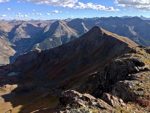
Continue further along the ridge - you have to descend slightly and the ridge gradually turns towards the east, running parallel with the east slopes of Macomber Peak across the Hematite Gulch. You get great views into Cataract Basin with its several lakes, and Dome Mountain A looks really nice and interesting from here. Descend at the end of the ridge via a steep grassy gully. The descent is long, but not technically difficult. It does connect with Hematite Trail way below the lake. Hematite trail takes you back to your car.
Time: I took 4 hrs and felt like a leisurely paste - resting on summits of both peaks and studying map. Guide book for a hike to Hematite Gulch and Lake describes 5-7 hrs. Distance of the loop roughly 7 miles. Keep in mind that most of the ridge hiking is above 13,000 feet.
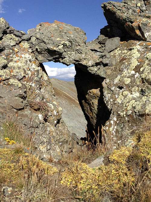 Window between Macomber Peak and Tower Mountain Window between Macomber Peak and Tower Mountain | 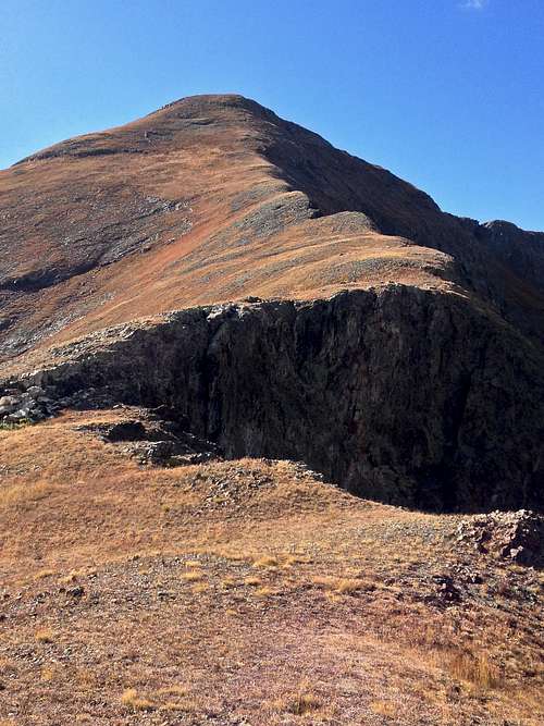 Macomber Peak - east slopes Macomber Peak - east slopes |
 Macomber Peak 13,222 feet as seen from Tower Mountain Macomber Peak 13,222 feet as seen from Tower Mountain | 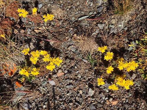 October flowers October flowers |
 Trail above Hematite Lake to gain east slopes of Macomber Peak Trail above Hematite Lake to gain east slopes of Macomber Peak | 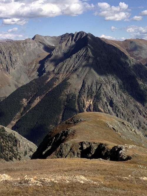 Galena Mountain 13,300 feet as seen from east slopes of Macomber Peak Galena Mountain 13,300 feet as seen from east slopes of Macomber Peak |
 Dome Mountain A Dome Mountain A |  Sunset from Hematite Gulch - Galena Mountain and Cunningham Gulch Sunset from Hematite Gulch - Galena Mountain and Cunningham Gulch |
Red Tape
The trailhead for Hematite Gulch is accessible even during the winter. No 4WD vehicle is needed, passenger cars access if just fine. The dirt road is well maintained.Parking at the trailhead, hiking into Hematite Basin and hiking along the ridge is free.
When to Climb
Anytime of the year. Obviously, summer is easier and you can admire wildflowers. Autum is great in the area typically offering warm dry conditions during the day (indian summer) and nice fall colors. Winter - nice and easy access to the trailhead, expect to break snow making travel slow and steep slopes are prone to avalanches. Spring - again deep snow and avalanche danger.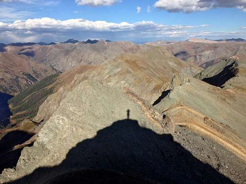 Tower Mountain and its shadow Tower Mountain and its shadow | 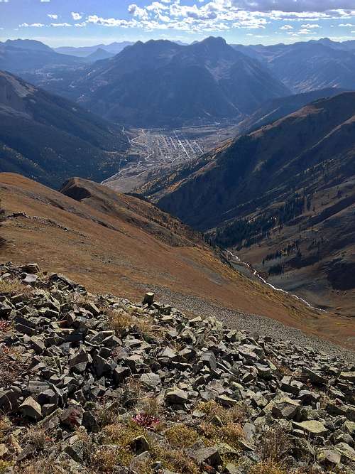 Silverton below Macomber Peak Silverton below Macomber Peak | 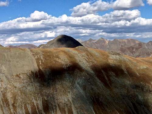 Horseshoe Ridge and Dome Mountain as seen from Macomber slopes Horseshoe Ridge and Dome Mountain as seen from Macomber slopes |
Camping
There is no camping at the trailhead. Nearby areas offer plenty of primitive campsites. Cunningham Gulch is especially popular.Backpacking into Hematite Gulch and Lake is another option if you are willing to carry a heavy backpack. Cataract Basin looked very inviting and remote - there is no established trail into Cataract Basin and one of the possible access points would be from Hematite Gulch, over the 13,000 ridge and drop down into the Cataract Basin. There were several very nice looking lakes.