
-
 10982 Hits
-
 82.48% Score
-
 15 Votes
|
|
Mountain/Rock |
|---|---|
|
|
37.82792°N / 107.56038°W |
|
|
San Juan |
|
|
Hiking, Mountaineering |
|
|
Spring, Summer, Fall, Winter |
|
|
13300 ft / 4054 m |
|
|
Overview
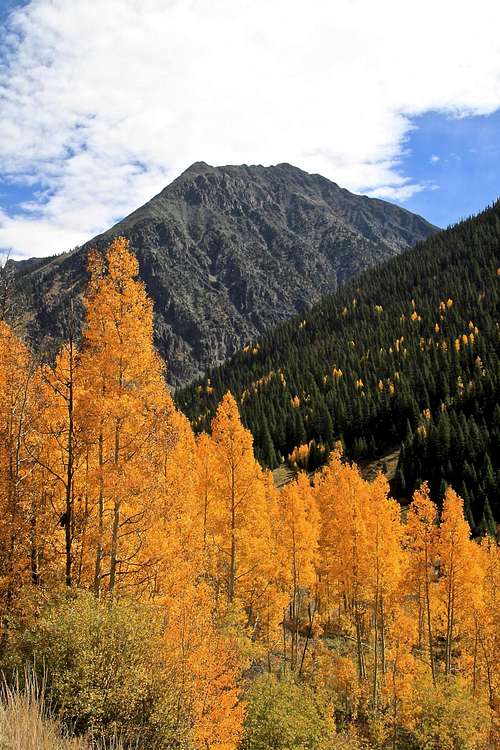
Galena Mountain as seen from CR 2 (before reaching Howarsville)
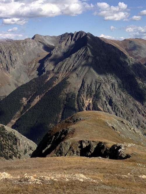
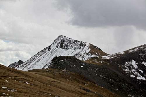
Galena Mountain 13,300 feet as seen from the slopes of Macomber Peak
When viewed from CR 2 near Howardville Galena Mountain summit appears as many little summit points along a high crest. The main summit is only a grass walk over a tundra.
Galena Mountain combines really well with Canby Mountain and unranked "Hardrocker".
Why Galena A? because there is Galena Mountain B 12,893', near Mount Massive; and Galena Mountain 12,500 C near Treasury Mountain.
Guide to Colorado Mountains with Robert Ormes (sort of a bible of Colorado Mountains) briefly mentions Galena Mountain, but gives it an elevation of 13,278'. "Galena Mountain is perhaps best known for its cliff-hanging Old Hundred Mine. At Howardville, 4 miles northeast of Silverton, turn right, and drive up to Cunningham Gulch 2 miles. Then fork left at the jeep road to Stony Pass on the Continental Divide. Take this road for 0.5 mile to where if forks again, and hike up the switchbacks to the old mine in Sterling Gulch. Grassy slopes lead northeast to the summit ridge".
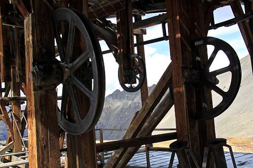
![Buffalo Boy Mine]()
Buffalo Boy Mine![Buffalo Boy Mine]()
Buffalo Boy Mine
Drive to Silverton on Colorado on US 550 = Million Dollar Highway. Continue through the main street of Silverton onto San Juan CR 2 (it is marked as 110, but if you are not sure turn right, the left 110 goes into Silverton ski area). The pavement ends after about 2 miles. Continue on a good dirt road towards Howardville and immediately after crossing Animas River take a right turn for Cunnigham Gulch - well marked. You will get the first glimpses of Galena Mountain from the CR 2.
Colorado Rank: 400
Elevation: 13ers.com and List of John mention 13,300, but Peak Bagger and Guide to Colorado Mountains give it 13,278'. I think the confusion is because Galena Mountain has several summits and the more technical peak seen from county road 2 is slightly lower, then the higher but less aesthetically appearing main summit.
Parent Lineage: Canby Mountain
Class: 1-2
Nearby Peaks:
- "Hardrocker" 1.61 miles
- Unnamed 13069 1.69 miles
- Canby Mountain 2.13 miles
- Cuba Benchmark 2.28 miles
- Green Mountain A 2.31 miles
- King Solomon Mountain 2.54 miles
- "Stony Pass Peak" 2.61 miles
- Little Giant Peak 3.01 miles
- Dome Mountain A 3.13 miles
- Macomber Peak 3.62 miles
Getting There
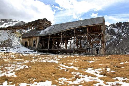
Buffalo Boy Mine
Buffalo Boy Mine
Cunnigham Gulch: There are 2 choices here and it does not matter which dirt road you take, they both connect later on (one follows Cunnigham Creek and the other goes by Old Hundred Mine). When the roads connect, take the dirt road up and left, signed for Stony Pass. The road becomes slightly rougher and more exposed - you do need a 4WD vehicle here. At some point you will come to a smaller dirt road turning left, it is an unsigned turn-off, but there is a handmade sign for Stony Pass marking the better traveled Stony Pass road. Turn left and park cca 0.1 miles at a fork. The road splits here again - left fork goes to the Old 100 Boarding House Trailhead. The right fork goes toward Buffalo Boy Mine. As mentioned above I chose to hike this section of the road, and did well since there was a large fallen tree obstructing any car passage. I am sure they will clear the tree by the next summer of 2017 since Silverton makes business by renting 4WD vehicles and tourists exploring the high country via the motorized access.
Route
As any mountain there are many different ways to reach its summit.I prefer doing loop hikes, going one way up and another way down. I chose to continue on the dirt road towards Buffalo Boy Mine and stopped there for exploring the area. Then I continued up the grassy south slopes to meet the ridge from Canby Mountain extending all the way to Galena Mountain. I walked over the unranked summit of "Hardrocker", 13er named after the famous Hardrock 100 mile running race. The rolling ridge from Canby Mountain to Galena Mountain divides Cunnigham Gulch on the west side from Maggie Gulch on the east. I continued to walk north along the ridge over several small summits until I finally reached the main summit of Galena Mountain decorated with a summit cairn and 2 sign in registers! yes, 2.
For the descent I chose to drop directly south from the summit on grassy slopes. I did a few switchback to save my knees and soon found a nice trail, which I believe is part of Hardrock 100 mile race and continued on this trail until it joined with the dirt road leading towards Buffalo Boy Mine. The trail joined it at a switchback with a small bridge crossing a stream.
The area if full of wildflowers during the summer. I unfortunately hiked in October, but have been many times up Stony Gulch and it is an excellent area for any wildflower enthusiasts.
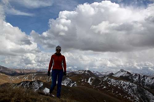 Summit of Galena Mnt. | 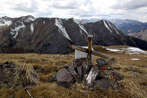 Ridge between Canby and Galena Mnts. |
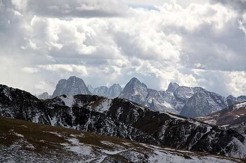 Grenadiers | 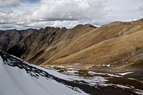 Galena Mountain's summit ridge |
 Canby Mountain | 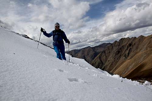 Northern slopes of ridge |
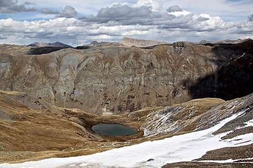 Crystal Lake |  Little summit cairn |
Red Tape
There is no red tape. Driving, parking and hiking are for free, even exploring the remains of Buffalo Boy Mine.When to Climb
Summer obviously provides the easiest access. The road is closed during the winter time. It is a narrow shelf road at places and may be completely impassable with heavy snow fall - meaning even on skis (the road gets completely buried under small avalanches). Always check avalanche conditions when traveling in the winter time.Camping
There are primitive campsites along the road, especially the Cunnigham Gulch area is popular with campers. You don't need 4WD vehicle to get to Cunnigham Gulch, but you do need 4WD for the road up towards Stony Pas.There are some developed campgrounds in Silverton and Eureka area.
Eureka Campground - very popular for fireworks during 4th of July weekend (you have to make reservations early for that particular weekend). Closed in the winter. Eureka has a little hut with a table, stove and bunks (you have to have your own padding and sleeping bag). The cabin is open year round. There is firewood and a candle. The pay is honor based (there is a jar and I think they ask like 10$ donation).