
|
|
Route |
|---|---|
|
|
46.05015°N / 11.33480°E |
|
|
Half a day |
|
|
Overview
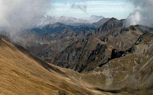
Monte Fravort
Monte Fravort (2383m) grows up, in the Lagorai mountain range, between Valsugana (S) and Val dei Mocheni (E).
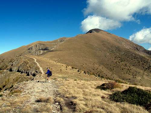
It looks very steep from each side and the access to the summit is normally done along the E5 path that runs N and the S ridges.
Its name comes, probably, from german terms indicating the late-medieval extractive activities that were a feature of the area
Climbing it is easy and requiring only half a day, panorama from the summit is really great on the whole Lagorai group
Getting There
The starting points from Valsugana, are the small built-up areas of Pozza and Cinquevalli (Roncegno)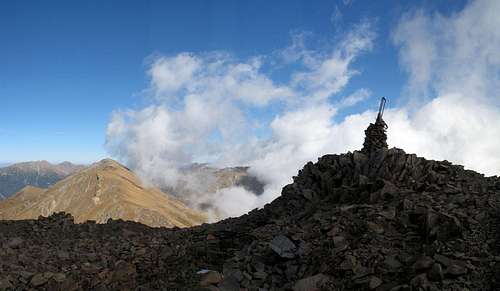
the Fravort summit 2383m.
by car - autoroute A22 (Brennero-Modena)- exit Trento Centro (km 20) - follow the SS47 (Valsugana) direction Padova-Venezia and follow to Levico
by train
nearest airports : Verona (Aeroporto Valerio Catullo) - Venezia (Marco Polo Airport) - Milano (Linate Airport) - Bolzano (Bolzano Sud Airport)
Route Description
The starting point of this hike is the chalet Panarotta (1780m ski-station)From here the trail 325 leads in a few to a saddle (La Bassa 1833 m), then goes on steep along the Southern ridge of Mount Fravort, crossing the minor summit named "the Fountain" (2037 m), and finally, with a steep and long climb goes to the summit .
On the rocky summit, a small building (bivouac) perfectly merged in the scree and the remains of trenches of the First World War.
Beautiful view from the summital Cross
time required :half a day
difference in elevation : 600m
power: 2
psyche: 3
 Monte Fravort |  Monte Fravort |
Maps and Books
 Passo Portella | 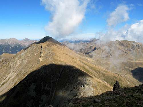 Monte Fravort |