Add Heading Here
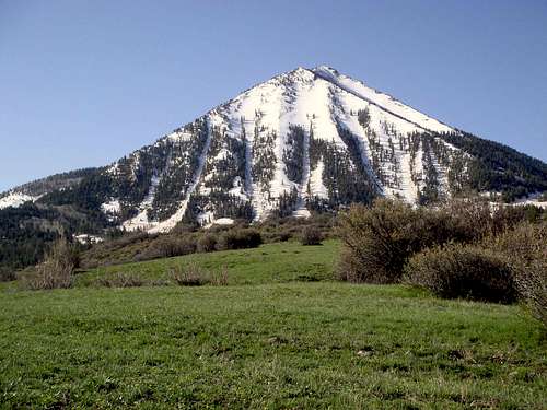
I was up in Paonia Colorado doing a weeklong course on solar installation and really had no intention of climbing Lamborn until I got there. My class was Monday through Friday 9-5 and I arrived on a Sunday up from Phoenix. I had another climb scheduled for Saturday so I had no time to climb this beautiful mountain. Monday in class this is all I saw looking east.
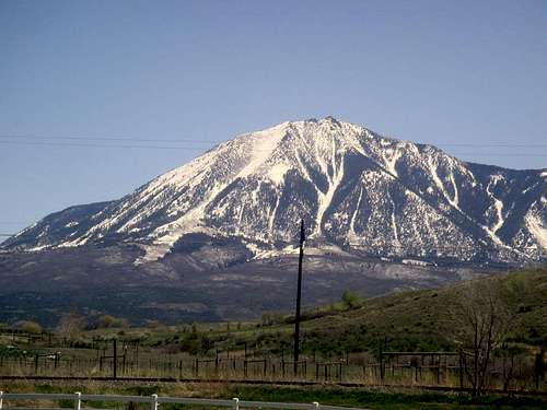
It was hard to concentrate on solar panels! I had my laptop with me so on Monday night after class I pulled up Google Earth and SummitPost and did some cyber scouting. I couldnt really find any good trails or anything but I knew I wanted to go up it. I knew if it was going to happen it would have to be during the week.
Tuesday night after class I did some real scouting up around the north side, but the only trails to be had were elk trails through the bushwack. After 2hours or so through the bush, ravines, and rocks I made the north face and sort of determined the best line through the bush. I plotted an alpinish start for Wednesday morning and decided that maybe it could be done and back before class started the next morning by 9am...
O-dark-fifteen -- time to start the pitchblack bushwack through unfamiliar elk and bear country solo funfunfun.
Wishing I was still in bed not nightbushwacking. Also wishing I could remember to put sunscreen on my lips when I climb.
The navigation was 5x as hard in the dark. At one point I was so turned around I thought I was walking toward the mountain, decided to check my compass, and realized I was walking the opposite direction. The problem is the animal trails just take you... wherever they want, the animals arent trying to get to the mountain. After the slight navigation delay I made the north face and started ascending the north rib.
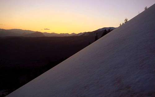
Sunrise coming up along the north rib. Slope was maybe 35-40ish degrees not really sure. Someone with ambitious math skills could probably calculate it off this picture.
Sunup.
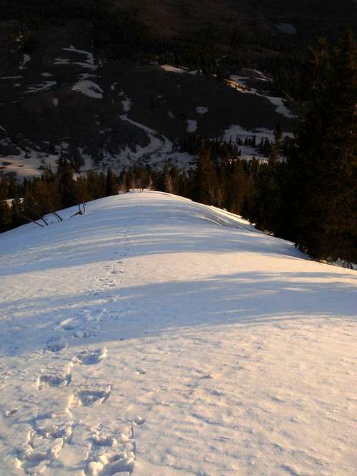
Looking up the north rib.
And looking down the north rib at my snowshoe tracks. The heel elevator function on the snowshoes was handy here.
Gaining the summit ridge.
This is looking down the east face on the backside.
The summit ridge was getting technical and I was moving too fast in too much of a hurry. I booted a section that I should have stopped and put on crampons for.
Time to bail. I decided that my sense of urgency to make my class was compromising my safety and made the decision to descend the east face and head out. The summit block probably would have taken another hour to reach going at a safe pace. I was maybe an 1/8 mile from it and 100-200 feet below it.
Straight down the east steep east face plunge stepping then had some nice glissading on a perfect slope brought me back out by the north face but a little east.
Some more bushwacking on an elk trail/ streambed.
A nice sight for sore legs.
Back at the truck. I was back down to the place I was staying by 9:15, grabbed out a hot shower, wolfed down a breakfast and walked into my class at 9:45. 45 minutes late with a big grin on my face.
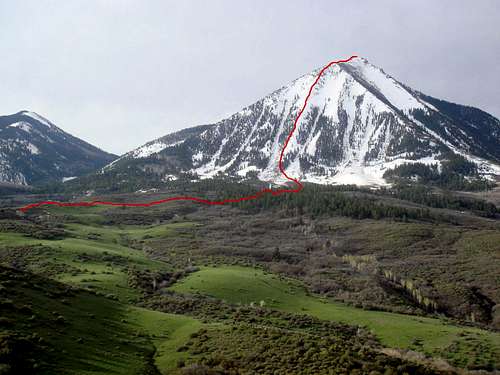
The route in red, although you could probably add a few circles on the approach to simulate my predawn navigation.


Comments
Post a Comment