
|
|
Mountain/Rock |
|---|---|
|
|
47.40494°N / 123.38231°W |
|
|
Mason |
|
|
Hiking, Mountaineering, Scrambling |
|
|
Spring, Summer, Fall, Winter |
|
|
3320 ft / 1012 m |
|
|
Overview
Rock Peak is a mid-elevation mountain located near the southeastern corner of the Olympic Peninsula, in Mason County, Washington. The mountain is perhaps most notable as being one of Washington's peaks with at least 2000' of prominence. With exactly 2000' of clean prominence, Rock Peak barely makes that list, tied for 142nd overall. Rock Peak
Rock Peak is located in a fairly remote area of the Olympic Peninsula, a region with many low elevation peaks, extensive Forest Service roads, and high logging activity. The mountain is located within the Olympic National Forest and a well-graded Forest Service road (FS-2352) can lead potential summiters to within 200' vertical elevation of the two summit contours. Despite these reasons, Rock Peak sees few visitors each year... perhaps only 1-2 people on an average year make a summit attempt.
 The Double-Summit Of Rock Peak
Summit attempts of Rock Peak, in general, can be considered mostly non-technical. However, this is not to suggest that summit attempts of the mountain cannot be difficult. Two summit hills (a southwest summit and northeast summit) contain the same contour elevation. Both hills have steep slopes that are cliffy in some places, brushy in other places, and commonly both cliffy and brushy in many places. During snow-free periods, ascents can range from YDS Class 2-3. During periods of deep snowpack, ascents are more straightforward but small snowslides and avalanches are possible.
 The Southwest Summit Hill (With Snow)
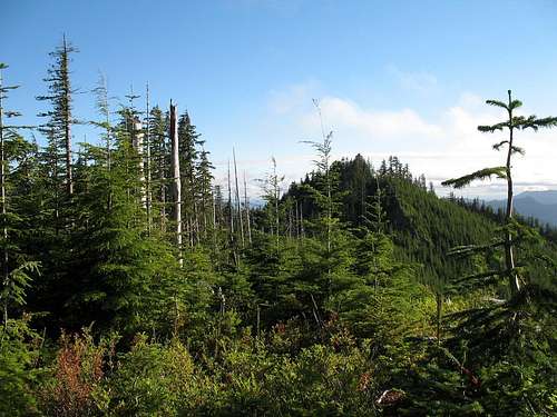 The Southwest Summit Hill (Without Snow)
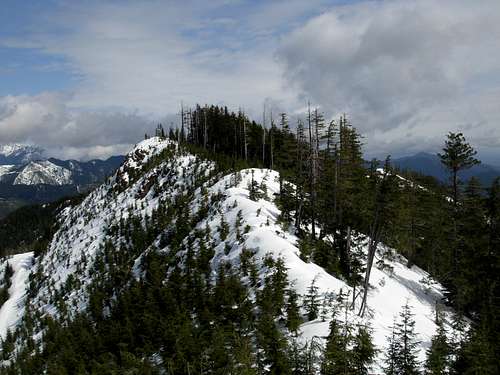 The Northeast Summit Hill (With Snow)
 The Northeast Summit Hill (Without Snow)
Each summit hill has an elevation contour ranging between 3320' elevation and 3360' elevation. So although the peak has 2000' of clean prominence, it is possible the prominence could be up to 40' greater. Without an exact elevation for either summit contender, it is difficult to determine with certainty which peak is actually higher. The northern views from the summit hills are much better than the average person might expect, with many notable peaks of the Olympic Mountains range easily seen.
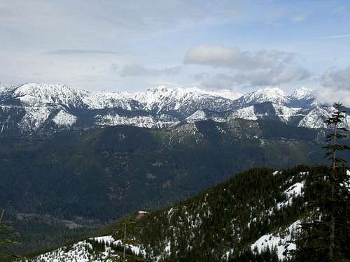 NNE Summit View...
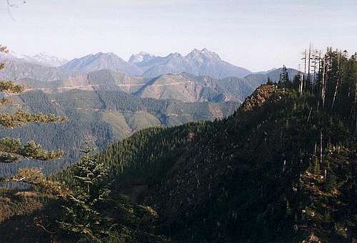 NE Summit View...
Getting There
FROM THE INTERSECTION OF HIGHWAY 101 & EAST WALLACE KNEELAND BOULEVARD IN SHELTON, WA:1) Head north along Highway 101.
2) After 5.5 miles, before crossing the Purdy Creek Bridge, turn left onto Skokomish Valley Road.
NOTE: This is an intersection for a state fish hatchery.
3) After 5.4 miles, veer right onto Forest Service Road 23 (FS-23).
4) After 6.8 miles along FS-23, turn left onto FS-2351.
5) After 1.1 miles along FS-2351, turn right onto FS-2352.
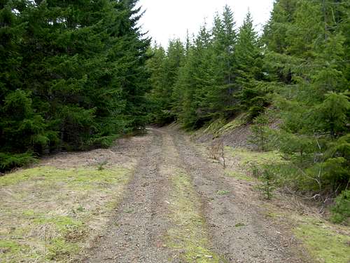 Following FS-2352...
6) Follow FS-2352 for approximately 5.5 miles until near or below the western slopes of the Rock Peak summit hills. Park alongside the road, making certain not to block potential road access for other vehicles.
 Potential Parking Spot Near NE Summit Hill
------------
7) Steeply ascend, bushwhack, and/or scramble up to one of the summit hills or main saddle ridge connecting those hills. Make certain to visit both summit hills, to claim a successful summit attempt.
NOTE: With deep snowpack and snowshoes, the ridge traverse between summit hills might only take 10-15 minutes on average. However, during snow-free periods the ridge traverse between summit hills is congested with young evergreen forests and can take much longer... possibly an hour or more.
 Ascending Steep Slopes Of NE Summit
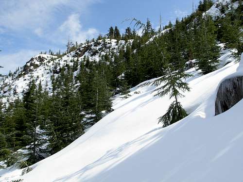 Ascending Steep Slopes To Saddle Ridge...
Red Tape
No permits or fees are required for the standard approach to Rock Peak.If parking beyond the final upper slopes of the mountain, such as if snow or some sort of slide (rock, mud, or snow) prevents near access, it is recommended to have a Northwest Forest Pass (parking pass) in the vehicle so it does not appear abandoned.
 Atop The SW Summit