
-
 11133 Hits
-
 79.78% Score
-
 11 Votes
|
|
Mountain/Rock |
|---|---|
|
|
47.07200°N / 13.56060°E |
|
|
Hiking, Skiing |
|
|
Spring, Summer, Fall, Winter |
|
|
8139 ft / 2481 m |
|
|
Overview
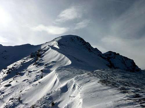
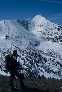 DoJo - Kareck from Tschaneck
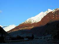 Southern walls
What's New On This Page?
> Nov 28th, 2022: Interactive map embedded.
> Jan 17th, 2019: Design corrections
> Feb 6th, 2013: SP V3 design updates.
> Jan 9th, 2011: Images attached.
> Aug 1st, 2005: Interactive Google map inserted.
> Oct 13th, 2004: Three more pictures added.
Kareck Presented
Kareck is the last high, rocky peak in the mountain crest extending from the main Tauern peaks towards Katschberg Pass (1641 m), where the group of Hohe Tauern ends. It is true, that just above the Katschberg Passs there is also Tschaneck, 2020 m, but it's gentle slopes, chained up with modern tourist devices can hardly count as a considerable mountain peak. But Kareck is different. Towards the south, its slopes are very steep and more than 700 m high, no marked path is coming from that side. Towards the northeast it sends a moderately steep ridge, ideal for skiing in winter and for a normal mountain access in summer. And of course the main crest is going from west to east - the eastern ridge is also being appropriate for summer ascent.
 Kareck from the SW
With all due respect of summer ascents, Kareck is for me in the first place an excellent tour skiing summit. It has one attribute, not mentioned so far - it's norteastern slope is in good conditions ideal for skiing. Up to 40 degrees steep, 600 m high, usually covered with powder snow is a constant temptation for every mountain skier, sitting at home and dreaming of endless left-right turns. Being also close to the touristic resort on Katschberg Pass, the summit of Kareck is in good conditions often ascended, but still there was never a crowd although we reached the peak in good conditions.
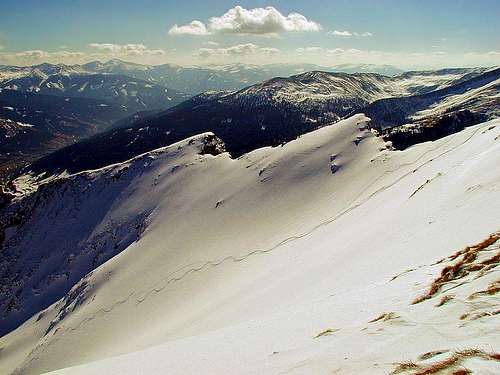
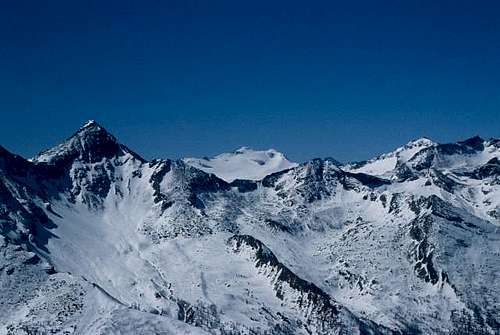
Summit Panorama
From its summit there's also nice view around. The higher mountains of Hohe Tauern on one side, the hilly Nockberge and the fine Niedere Tauern on the other side.
 The NE slope The NE slope |
 DoJo - Towards Hochalmspitze DoJo - Towards Hochalmspitze |
Getting There
| See full screen | The highway Villach - Salzburg crosses Alps through two tunnels. Looking from Villach, the first one is Katschberg. Just before the tunnel you go in Rennweg off the highway (or, if arriving from the north in St. Michael), then drive by the Katschberg Pass road (opened all the year) to the Pass where you can find good parking places (ski resort). |
Routes Overview
 DoJo - Kareck NE ridge
- In summer, you can ascend the Kareck peak by the Northeast ridge (easy, marked, 3-3,5 h) or by the East ridge (exposed in some places, 3 h).
- In winter and spring, you can reach the Kareck peak most comfortably by the Northeast ridge, all the way possible with skins on your skis.
- Skiing from the summit: If conditions are good (no avalanche danger) and if you are a good skier, the northeastern slope is the ideal choice. If conditions are not good, you can of course ski down by the northeastern ridge (the route of ascent).
You can see a detailed map on: http://www.austrianmap.at/.
Red Tape
No limitations. If you wish, in winter or spring you can take a ski lift up to the Tschaneck peak, shortening the approach to 2.5-3 h.
When To Climb
Left aside the summer season (the best months are June to October), Kareck is ideal for tour skiing. For this, the best months are March to May (even in May you can find ideal powder snow in Kareck's northern slopes). If conditions are very good, also January and February are worth of consideration. If there is enough snow, you can ski down to Rennweg, which means more than 1200 m of altitude.
Camping
No need for camping, because all the routes are short. On Katschberg Pass there are many hotels and nearby huts (Gamskogel Huette, 1850 m, Gasthof Bacher, 1720 m), in Gantal, spreading NE of Kareck, there is a Gasthof Almfried, 1750 m. But for the ascent you will not need a mountain hut