
|
|
Mountain/Rock |
|---|---|
|
|
31.87700°N / 111.214°W |
|
|
Pima |
|
|
Hiking |
|
|
Spring, Fall, Winter |
|
|
6188 ft / 1886 m |
|
|
Overview
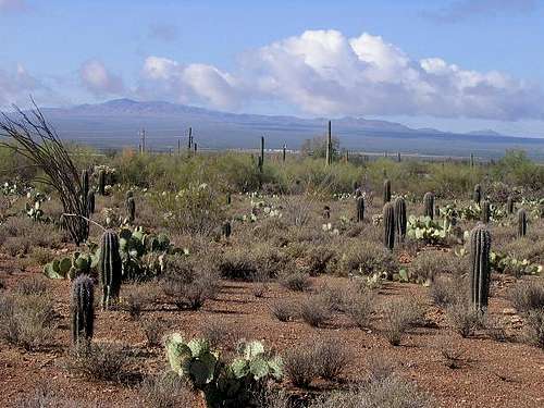
Keystone Peak is the highest point of the small but interesting Sierrita Mountains, located in southern Arizona about 30 miles southeast of Tucson. The Sierritas are a mix of public, state and private lands, generally ignored by the hiking community since the bigger and more famous Mounts Wrightson and Baboquivari dominate the skyline. Historically the range and surrounding foothills and valleys were (and are) home to a number of mines, some still in production. A small community called McGee Settlement is the only "town" near the range.
 Keystone Peak and the Sierrita Range
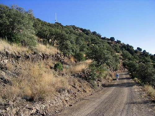
Although nominally a "desert" peak, the summit at Keystone Peak, just under 6,200 feet elevation, is high enough to be covered in thick grasses and stands of forest of juniper and some low pine. Not surprisingly, radio towers sit atop the peak and a fairly good road leads to the top; this will be the hiking route. What Keystone lacks in challenges, it makes up for in beautiful views. At various points in the hike the vistas open through the various canyons out east toward Mount Wrightson, west toward Babo, or south into the Pajarito Range and off into Mexico. The hike istelf is an easy half-day outing; in fall or spring when the weather is cool and bone dry, the conditions can be outstanding. There are opportunities to hike adjacent summits, including North Keystone Peak at 6,180', Placer, and Pit View Peak 5,816'. According to a local we met while suiting up for the hike, the McGees and other families settled this area around 1901 and many still live here. The McGee Settlement is simply a handful of homes with no public services. Locals who live here have access beyond the locked gates and often drive their vehicles up on the mountain roads. Outsiders can park near a water tank in McGee Settlement and hike the road to the top. Access is open to the public. The range is close enough to the Mexican border (about 25 miles) where bands of crossers have been caught hiding therein. The probability of actual violence is extremely low, however.
Getting There
From Tucson, drive south on Interstate 19 to Exit 75. Drive west on Helmut Peak Road about five miles to Mission Road. Turn left, and drive south about five miles to McGee Ranch Road. Turn right, and drive west up the road about five miles to McGees Settlement and park at a locked gate near a large water tank. The elevation here is about 4,700’. An alternative from Tucson is to drive west on Ajo Highway (AZ-86) to Mission Road, then take it south through the San Xavier del Bac historic church/mission site. It's worth a visit to this old church with its decorative interior.
 The water tank in McGee Settlement (by streeyyr)
 The gate at the trailhead
Mountain Conditions
Contact the Tucson Field Office of the BLM for the latest information. Their number is 520-258-7200. Topo Map: Samaniego Peak.
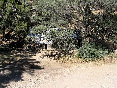 Old cabin along the hike!
Camping
The best camping option nearby is the Gilbert Ray Campground in the Tucson Mountains Park. From here you can easily see the Sierritas off to the south. There are no public campgrounds within the Sierritas and car-camping is probably not suggested due to most lands being private or just not that appealing with all the mining.
External Links
Arizona Prominence Map Keystone Peak Trip Report (www.surgent.net)
 Coming down from the summit (upper left), Nov 06