
|
|
Mountain/Rock |
|---|---|
|
|
36.10870°N / 51.04167°E |
|
|
Mountaineering |
|
|
Summer |
|
|
13478 ft / 4108 m |
|
|
Overview
Click for Introduction to Central Alborz Mountains.Click for Detailed Map of Central Alborz Mountains.
Click for a Map of the Naz area.
Name Alert: Many maps refer to this mountain as "Sikzo". Mountain climbers know it as "Naz".
 Overview
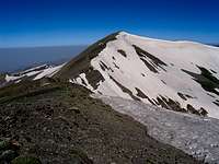 Summit of Naz 4108 m
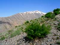 Peak 4050 m
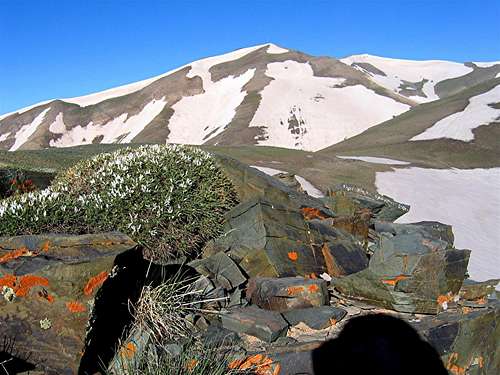
Naz is the highest of a local group of peaks that rise to the north of the Karaj River Reservoir in the Central Alborz Mountains of northern Iran. To the east, Naz is connected to a nameless 4050 m peak. On their northern slopes, Naz and Peak 4050 m create an alpine bowl that goes down to around 3700 m. In snow-melt season, a small pond forms at the bottom of this bowl.
 (L) Peak 4050 m & (R) Naz 4108 m
 4050 & Kahar Small
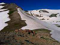 Naz & 4050
Ease of access and proximity to the cities of Tehran & Karaj, make Naz, along with its neighbors the Kahar Peaks, popular destinations for mountain climbers. The usual starting point is the village of Kalvan (2200 m) to the south. From Kalvan, you will follow a well-established trail up the southern ridgeline of Peak 4050 m to its summit and then to the top of Naz. Alternatively, you could follow a trail up the southeastern ridgeline of Kahar the Great Peak to its summit (4015 m) and then follow a ridgetop to the summit of Naz (The second option is the route described here). For the return trip, I highly recommend that you descend the northern slopes to reach the Gateh Deh Village (2300 m). These slopes are much less traveled (no established trail here) and will provide you with spectacular views of Naz and Kahar Peaks as well as those of the high peaks of the Takhte Soleyman Massif.
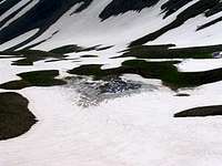 Pond
Pond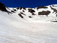 Bowl
Bowl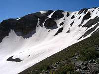 Peak 4050 m & Bowl
The summit of Naz remains hidden from view until higher elevations. Peak 4050 m, on the other hand, is well-visible from the villages of Kalvan & Gateh Deh and is often mistaken for Naz.
Getting There
From downtown Tehran, drive the Karaj Freeway 40 Km west to the town of Karaj and then take the Karaj-Chalus Rd (Route 59) exit north. Drive the Karaj-chalus Rd roughly 40 Km past the tail end of the Karaj Reservoir to the village of Sira. On the left (northwestern) side of the road, you will find a side road that is probably not signed. Drive this road around 10 Km to its end at the village of Kalvan.Red Tape
No fees or permits needed.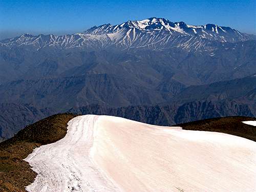 Alam Kooh from the summit of Naz