
-
 40307 Hits
-
 89.39% Score
-
 29 Votes
|
|
Route |
|---|---|
|
|
37.23877°N / 118.68433°W |
|
|
Hiking |
|
|
Spring, Summer, Fall |
|
|
Most of a day |
|
|
Overview
 |  |
 Piute Pass seen from the trail
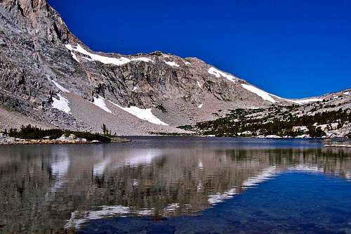 Piute Lake
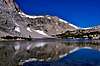
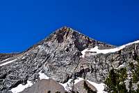 peak 12,707
 Loch Leven
Piute Pass Trail is the most direct line to Humphreys Basin and surrounding peaks such as Muriel Peak, Mount Emerson and Mount Humphreys in the Sierra Nevada Range, California.
Not quite as popular or scenic as the South Lake to Bishop Pass Trail, Piute Pass Trail to Humphreys Basin has its own fan base. The trail is generally low angle and easy to travel on. It passes by a number of lakes and meadows making it a desirable destination for anglers, pack horses and hikers. For those going deeper into the wilderness, this trail provides an easy access into the back country. During a summer weekend you have a great chance of running into dozens of groups traveling in both directions. These groups all pass over Paiute Pass and don't be surprised to see dozens of people on the pass resting and taking photographs.
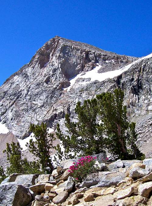
Piute Pass Trail generally hugs the southern flank of Mount Emerson and follows the northern banks of North Fork of Bishop Creek, Loch Leven and Piute Lake. The only peak making a prominent presence is an unnamed mountain to the southwest of Paiute Pass. This peak may not be very high, but its rugged and rocky eastern and northern slopes with a sharp summit make for a great view and ideal for photography. On a calm day with no waves, the reflection of this peak on the nearby lakes will be an awesome sight. During the late spring and early summer months, the wildflowers along this trail will overload your senses. Piute Pass Trail is about five miles long, one way, and gains only 2,150 feet. It's obvious that this trail is quite gentle and great for pack horses, a tradition to this trail for many decades.
Route map and description

 North Lake
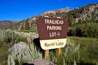 North Lake Trailhead sign
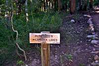 Fork on the trail
Route Description:
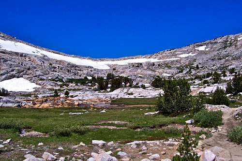
Start your hike at North Lake, elevation 9276. Head toward North Lake Campground on a dirt road. At the end of the dirt road there are bathroom facilities where the road turns into a trail. Shortly after the trailhead, the trail forks. The left one leads to Lamarck Lakes and Lamarck Col. The right fork goes straight and heads for Piute Pass. The trail crosses the creek on logs a few times, but it continues directly westward following the north fork of Bishop Creek. After nearly three miles you reach your first major landmark, Loch Leven, a lake at an elevation of 10,750 feet. This is a great place to photograph peak 12,707 and its reflection on the lake. Following the trail, you will pass by several green meadows and small lakes. These lakes are sections of the creek passing over low angle terrane. Looking up the valley, you get a distant view of Piute Pass.
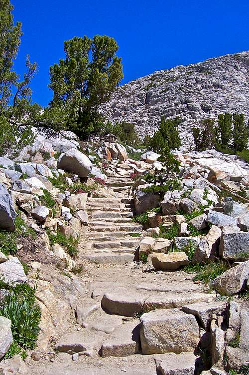
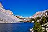
Your next objective is Piute Lake another mile up the trail. Piute Lake, at an elevation of nearly 11,000 feet, is scenic and a great place to rest. Climb up steps made of granite rocks with wildflowers on both sides.
Piute Pass is clearly visible and less than a mile from here.
Trail specs
| Benchmark | North Lake to Piute Pass Trail | elevation | Distance from trailhead |
 North Lake North Lake | N 37.23050--------W 118.61890 | 9276 | 0 |
 Loch Leven Loch Leven | N 37.23121-------- W 118.65311 | 10,750 ft | 3 mile |
 Piute Lake Piute Lake | N 37.23504--------W118.67182 | 10,963 ft | 4 miles |
 Piute Pass Piute Pass | N 37.23877--------W118.68433 | 11,460 ft | 5 miles |
How to get there
 |  |  |
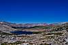
 Humphreys Basin
From the town of Bishop, along Highway 395 in California, take Highway 168 westbound toward the Sierras. After about 12 miles you will see a 3-way. The left fork takes you to South Lake. Go straight for another 7 miles to North Lake.
Note: The road to North Lake turns to dirt just before reaching Lake Sabrina. This is a good dirt road, but be careful with the rocks and boulders that often fall from the steep hillsides.
There are bathroom facilities near the parking lot.
Note: I have seen lots of bear activity in this area during the spring thaw. No bear boxes here.
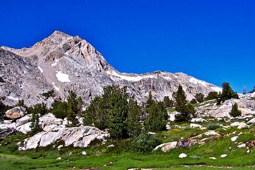
 Muriel Peak Muriel Peak |  |  Mount Humphreys Mount Humphreys | 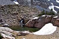 |
SoCalHiker - Nov 4, 2010 7:35 pm - Voted 10/10
Road to trailheadI would add that the road to North Lake trailhead is a good dirt road leaving the main Lake Sabrina Road before reaching Lake Sabrina.
Marcsoltan - Nov 4, 2010 7:42 pm - Hasn't voted
Re: Road to trailheadThank you Guido. I will add that to the "How to get there" chapter.
ldysrvyr - Jun 30, 2014 4:36 pm - Hasn't voted
best vehicle??Hi, How is the dirt road? Can a car drive on the road?? or do I need my truck?? we are going 4 JUL 14. thanx
Marcsoltan - Jul 2, 2014 11:01 am - Hasn't voted
Re: best vehicle??Hello Idysrvyr, the unpaved section of the road to North Lake is just fine for regular cars. You do not need a truck with high clearance to drive on it. The only problem you may have are rocks of varying sizes on the road. In many occasions I have seen this road littered with rocks and branches.