
-
 52796 Hits
-
 85.87% Score
-
 21 Votes
|
|
Route |
|---|---|
|
|
36.77280°N / 118.3398°W |
|
|
Hiking |
|
|
Spring, Summer, Fall |
|
|
Half a day |
|
|
Overview
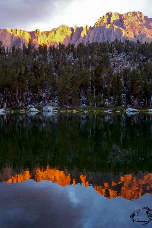
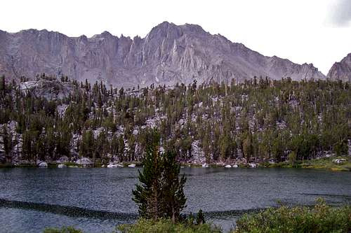
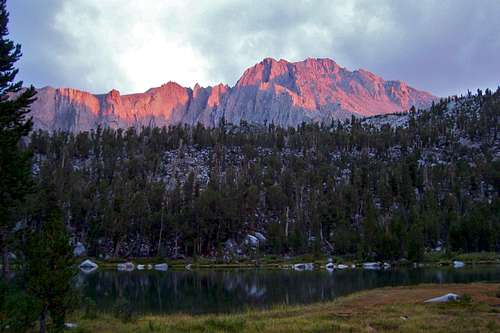
Sunset on Flower Lake
Approaching Electrical storm
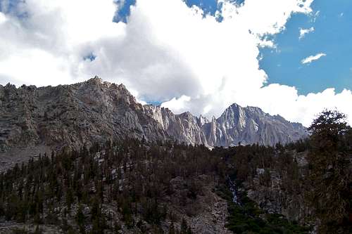
Kearsarge Pass Trail is one of the easiest and shortest ways to connect Inyo National Forest to Kings Canyon National Park in the Sierra Nevada Range. This extremely popular trail is only 4.7 miles long and gains about 2,660 feet in elevation. The mountain views along the trail are spectacular and the camping options on the first half of the route are plentiful. Kearsarge Pass itself is the gateway to many peaks, lakes, rock pinnacles and a rock dome in the back country. In addition, this pass is an excellent way to connect with the famous and much sought after John Muir and Pacific Crest Trail. Many parties traveling on the Pacific Crest Trail use the Keasarge Pass to Onion Valley Trail for resupplying and resting before they continue on their journey.
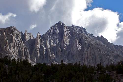
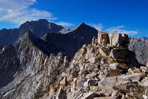
From the Pass you get a breathtaking view of the peaks and lakes on the west side. The most prominent feature of the west side are the Kearsarge Pinnacles and Kearsarge Lakes directly to the southwest. Beyond Kearsarge Pinnacles, you will make out many more peaks such as West Vidette and East Vidette. You will get a clear view of Mount Bago and Charlotte Dome to the west and Mount Rixford to the northwest.
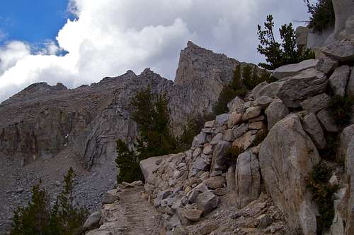
![The last section of the trail]()
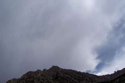
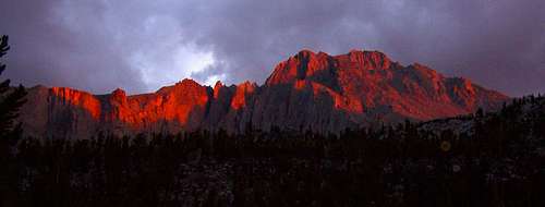
Ominous Clouds over Kearsarge Pass
![University Peak]()
The last few seconds of visible light after a huge thunderstorm on University Peak. A few minutes after this shot was taken it rained for hours.
If going as a day hike: Comfortable pair of hiking shoes, sun and rain gear, plenty of water-there is no water after Flower Lake, a flashlight, emergency pouch.
 section of the trail near Heart Lake section of the trail near Heart Lake |
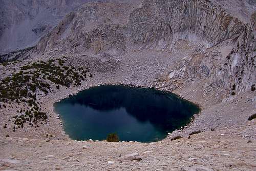
 Heart Lake Heart Lake |
 Kearsarge Pass Kearsarge Pass |
Getting There
 |
 |
 |
 |
 |
 |
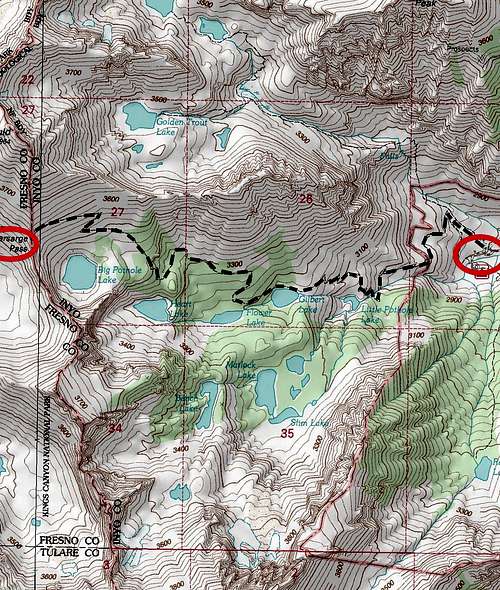
Onion Valley Trailhead:
From the town of Independence, along Highway 395 in California, drive some 13 miles west on Market Street that soon becomes Onion Valley Road to the trailhead. There is a running creek, a campground, many bear lockers and bathroom facilities near the trailhead. Stay safe and enjoy your hike.
Route Description
Ominous Clouds over Kearsarge Pass
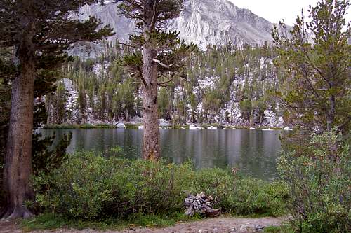
The trail begins at Onion Valley, elevation 9,185 feet. Shortly after the trailhead the trail to Golden Trout Lake separates from the Kearsarge Pass Trail marked by an old wooden sign. The main trail rises gently for some one and a half miles to the first lake, Little Pothole Lake. Another one half of a mile brings you to Gilbert Lake with many campsite possibilities. After a short walk, you will see a sign for Mattlock Lake with an arrow pointing toward a visible lake. That is not Mattlock Lake, it's Flower Lake. Flower Lake is another great location to camp, especially for people getting a late afternoon start from Onion Valley.
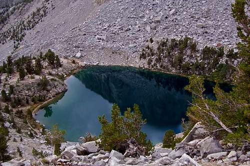
Flower Lake may very well be your last source for water until you get well into the west side of the Pass. The trail to Kearsarge Pass continues with a sharp turn to the right before turning back toward your destination. Some distance before reaching the next major lake, you will be passing by some steep rock buttresses. Looking downhill from this point, you may see a running creek and a small pond. This small pond is easily accessible from the trail. It's best not to count on this water source as the location may be difficult to find. Climbing rather steeply, the trail will give you an awe inspiring view of Heart Lake. This lake is not easily accessible from the trail.
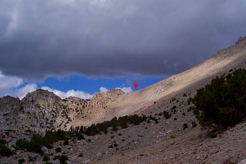
Continue hiking past Heart Lake to a long traversing part of the trail heading west and your first view of Kearsarge Pass. Enjoying the views of the mountains will make this section of the trail feel less tedious. The last major landmark is Big Pothole Lake deep below your feet before reaching Kearsarge Pass some 4.7 miles from Onion Valley.
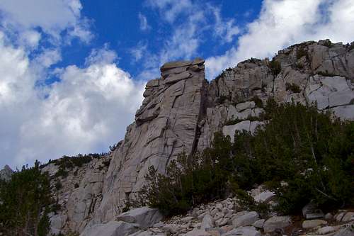 Rock buttress before Heart Lake Rock buttress before Heart Lake |
 |
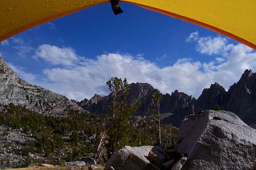 View from the camp on the west side View from the camp on the west side |
 Big Pothole Lake before the pass Big Pothole Lake before the pass |
 One of many rainstorms One of many rainstorms |
 View from Flower Lake View from Flower Lake |
Essential Gear
The last few seconds of visible light after a huge thunderstorm on University Peak. A few minutes after this shot was taken it rained for hours.
If going overnight: Everything you need for an overnight stay.
hightinerary - Sep 3, 2013 7:22 am - Voted 10/10
Directions from IndependenceFirst one needs to turn west on Market Street, which becomes Onion Valley Road. There used to be a traffic light at the intersection of Main Street and Market Street to make it obvious, but the light has been removed.
Marcsoltan - Sep 12, 2013 11:24 am - Hasn't voted
Re: Directions from IndependenceThank you for the comment hightinerary. I made changes to reflect your directions.
tonyo - Sep 12, 2013 9:33 am - Voted 10/10
Great trailI've found this trail to be an excellent introduction to the Sierra for friends who've never really explored the area. In terms of views/lakes per mile, right from the parking lot, it's hard to beat. An overnight at Matlock Lake was how I introduced my young children to backpacking.
Marcsoltan - Sep 12, 2013 11:31 am - Hasn't voted
Re: Great trailI agree 100%. This trail and Bishop Pass trail are two of my family's favorite trails in the Eastern Sierras. Thank you for visiting and the vote.
zrowgz - Mar 2, 2014 6:36 pm - Hasn't voted
Leaving PCT/JMTHow heavily used is this trailhead? I'm planning on using this as an exit for a hike on the JMT/PCT and would hopefully be able to hitchhike into Independence. Or how is the walk?
Marcsoltan - Mar 2, 2014 11:34 pm - Hasn't voted
Re: Leaving PCT/JMTThis is one of the most traveled trails I have seen in the Sierras. I think the season and the weather will go a long way to dictate how many people you will run into. On a busy day, I think there are many people who come up to Onion Valley for fishing or day hiking. You have a good chance of catching a ride down to Independence.
WaynesWhirled - Mar 18, 2014 1:39 pm - Hasn't voted
T-junction with PCT over Kearsarge Pass?Does anyone have a link to a good map (for purchase as well) or information on the distance to meet up with the PCT over Kearsarge Pass? Am looking to resupply some friends who are doing the PCT and will be near the pass in late June. Any information appreciated.
Marcsoltan - Mar 18, 2014 2:57 pm - Hasn't voted
Re: T-junction with PCT over Kearsarge Pass?I'm looking at the map "Tom Harrison Maps" and I see there are two trails from Kearsarge Pass to PCT, the upper trail 2.6 miles, and the lower 2.4 miles. The lower one passes by Bullfrog Lake, the upper bypasses the lake. These maps are really great because they are cheep, water proof and light. They sell these all over, especially if you check the mountaineering shops in Lone Pine or Bishop.
WaynesWhirled - May 1, 2014 4:08 pm - Hasn't voted
Re: T-junction with PCT over Kearsarge Pass?Thanks so much for the info! I will grab that map. I assume it is the Kearsarge Pass one that they have, and that it continues to the west?
Marcsoltan - May 1, 2014 7:03 pm - Hasn't voted
Re: T-junction with PCT over Kearsarge Pass?My pleasure, glad to help. Yes, the "Kearsarge Pass-Rae Lakes Loop" map is the one I was looking at. Yes, the map shows another 12 miles west beyond the intersection with JMT. In fact, this map shows the entire Rae Lakes Loop on the west side as well as Onion Valley to Kearsarge Pass on the east side.
WaynesWhirled - May 5, 2014 1:54 pm - Hasn't voted
Re: T-junction with PCT over Kearsarge Pass?Thanks so much! Will buy it.
WaynesWhirled - May 5, 2014 1:54 pm - Hasn't voted
Re: T-junction with PCT over Kearsarge Pass?Thanks so much! Will buy it.
rfisher45 - Nov 18, 2019 4:49 pm - Hasn't voted
Question re trail conditions/ difficultyI went to Golden trout and early on in that trail there was some fairly difficult elevation gain coupled with loose gravel areas. Are there spots like that on way to Kearsarge Pass?
Marcsoltan - Nov 20, 2019 1:36 pm - Hasn't voted
Re: Question re trail conditions/ difficultyYes, there are sections on this trail that are steep and gravel covered.