
|
|
Route |
|---|---|
|
|
39.07000°N / 106.95°W |
|
|
Hiking, Mountaineering, Bouldering, Scrambling |
|
|
Spring, Summer, Fall |
|
|
Half a day |
|
|
Class 4 |
|
|
II |
|
|
The Approach
 | ||
Leave the Maroon Lake Trailhead (9,600ft) and start down the well-maintained class-1 trail. A quick word of warning, this trailhead is BUSY in the summer. I'd recommend getting there early to secure a parking spot. Plus, come 8:00am, the rangers close Maroon Lake road to private vehicles and it becomes bus/shuttle only. Just an FYI.
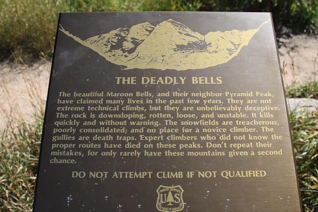
Parallel with Maroon Lake, there is a small resting area with bench off to the right along with a couple of trail signs and an over-sensationalized brass plaque reading, "The Deadly Bells". Launch out from here up the Crater Lake Trail as it gradually ascends the valley through aspen. The approach trail will switchback gradually with some trail (erosion) mitigation work visable. A sign-in is located on the left side of the trail not far from the official 'Maroon Bells-Snowmass Wilderness' sign. The approach trail is quite beautiful offering great views.
After 1.3 miles, look for a thigh-high cairn located on the left side of the trail. Last time up here, a small pika had made this cairn its' home! This is the start of the CFI trail that will take you up into the rock amphitheater under Pyramid’s imposing North Face. This relatively new trail switchbacks frequently and is a staunch and wondrous improvement over the old climbers trail which, thanks to the CFI trail crew and the mountain itself, has all but disappeared back into the terrain. The new trail is a wonderous improvement over the old social trail.
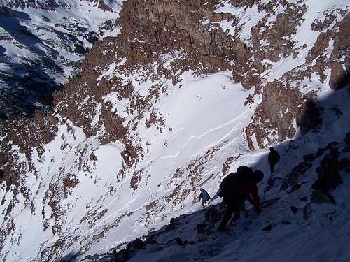
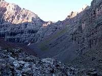 The upper rock amphitheater.
Once in the cirque, continue hiking over large talus and boulders straight towards Pyramid. Once the lower lip of the cirque is attained, there are several massive cairns marking the entrance. These are new and attributable I believe to the CFI. The general path is lightly cairned after these, but it is almost impossible to get lost at this point. Start to glance up at the Northwest Ridge (hiker's right) once you’re roughly half way across the cirque. Leave the general path and start to veer right up the gradually steepening slope. The talus will get smaller almost to the point of ball-bearings. A prominent notch and a wide, scree covered gully should now be quite apparent.
In the late summer months, this gully is frequently vegetated lower down (helps a bit with traction). Higher up, it is impossibly loose and traction is hard to come by. Step diligently.
Leave the comfort of the cirque floor at around 11,800ft. or at points
39° 04.745N, -106° 57.365W.
This is where the Northwest Route begins.
Route Description
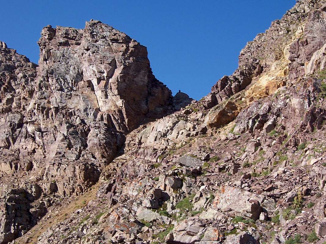
 Inquisitive company on Pyramid Peak |
The Northwest Ridge isn't too much harder than the standard but it does offer much more route-finding. So in that, this is a great route to practice said skills.
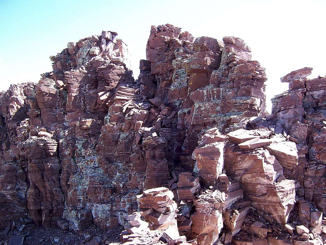
Scramble up the wide gully on exceptionally loose terrain for 945ft. The terrain is composed of aggravatingly loose rock on hardpan dirt. Traction is difficult and this is the least enjoyable part of the route. There are no cairns and past footprints are scarce. However, good route finding will lead you to the correct notch/access point for the ridge proper. Keep scrambling on an upward traverse linking solid rock when available.
Once the top is reached, the first of two small surprises awaits you. The top, when viewed from the cirque bottom, isn’t actually the ridge itself. It’s the top of a small eastern-protruding fin. Finish it up with a short but exposed ascending traverse to the notch (12,745ft.) on the Northwest Ridge. This short traverse is at the head of a steep hardpan gully. If you fall or slide here, chances are you won't die but you'll have a lot of vert. to re-climb. The rock on this short traverse is questionable. Treat it with suspicion.
Once the notch is reached (39° 04.535N, -106° 57.391W), the route ahead is only visible from the 'immediate vicinity'. Absorb the magnificent views of the Maroon Bells from here. They are in view almost the whole time while on this route. One of the finer aspects of this route actually. The view back down the wide gully looks steeper than what it is (but such things usually are).
Continue to follow the scant climbers trial as it plays with the ridge crest but often just below and to the right (west).
These initial portions of the route are marked adequately with small cairns. The trail only stays near the ridge for the first few hundred feet at best before it starts to veer towards the West Face and the first of two very loose gullies.
After rounding a slight convexion, the “Keyhole Couloir” will come into view; angle up into the couloir. As you climb up this impossibly loose and steep couloir, stay to the sides if possible as the center is a loose mess (climbing straight up the center is more work than it's worth). If you care to climb to the 'False Keyhole' (13,280ft), keep initially to the left. It’s a short climb to this small notch with huge exposure on the other side. Looking out across Pyramid's North Face from here is exilerating and awesome! To my knowledge, The North Face still hasn't seen a complete climb to the summit.
There actually is a scant trail leading to the Keyhole. The coordinates of the Keyhole are 39° 04.408N, -106° 57.171W. Be careful, this small notch is often windy and as said, exposure on the other side is extreme. Down climb ~20ft. back into the couloir and do a short traverse next to the rock face to gain the right hand branch. Cross over to the right side of this upper branch and continue your climb up into the narrowing couloir for an additional ~150ft. This tight upper portion will top out on a small notch marked with a cairn. Up to now, all the climbing has been either class-2 or loose class-3. The routes technical crux must now be negotiated, a short ~25ft. class-4 headwall directly to the right (south).
The holds on this wall are small & narrow but long (lengthwise). The rock is solid and secure. A fall to the right, back down into the Keyhole Couloir would result in numerous cuts, bruises & possibly a broken bone or two but none the worse for wear. However, a fall to the left, off the North Face; I seriously doubt you’d ever touch the cliff face before you hit bottom.
Once the headwall has been climbed (13,573ft), keep to the right. There is a small, rocky crest that you have to scramble over. A few cairns will come into view and the climbers trail picks back up again for a short time. Begin a series of southern traverses interspersed with up-climbs. Once in this second gully, DO NOT be tempted to traverse around (horizontally) to the top of the cliff band immediately in front of you. This is NOT the route. Keep to the ascending climbers trail (nothing more than scuffled rock and dirt really) and follow the cairns when available. This second gully is confusing. About half way out into the center of this gully, the trail completely disappears as do the cairns. If you need to, explore. The terrain here is steeper and much looser.
It is very similar to the terrain on the west side of Maroon Peak or the rock inside of “The Remarkables” on McClellan Mountain (Steven's Gulch).
About 15 feet past the center point of this gully, look up. On the rock face above you, there will be two small fluorescent orange CFI trail tags clinging to the rock. They are difficult to see unless you retrace your steps back to the entrance point for this gully and actively look for them. Climb this short, loose rock wall (class-3) to a flat perch where a cairn is there to greet you. Just remember, these gullies cliff out at the bottom.
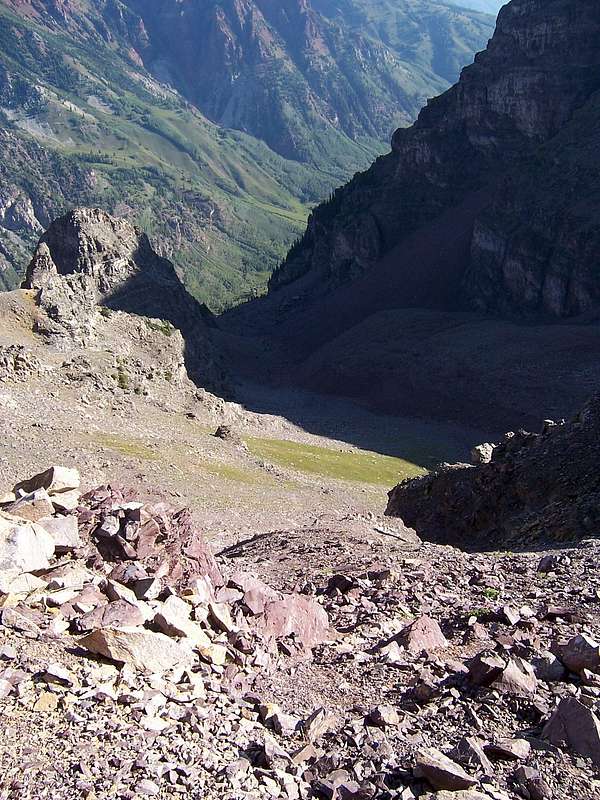
 The Upper Ampitheater
The cairns pick up again with slow but increased frequency and others’ exploits, scuffed rock, kicked steps in the dirt are now apparent again. Keep the ascending traverse going on the climbers trail up into the heart of Pyramid’s upper West Face Amphitheater
(39° 04.345N, -106° 39.965W). The route in this small bowl is a little ambiguous. The pitch lessons also. Angle up towards a large cairn located on the other side on a flat area.
Congratulations! You are now on the South Ridge. The traverse over to Thunder Pyramid is partially visible from here. The summit is only ~350ft. to the north.
Walk towards the rock pinnacle. Feel free to explore a little and have a peek on the other side but do not climb to the summit ridge from this vantage point (east side). Retrace your steps back to the South Ridge through the pinnacle and look up towards the summit ridge. This is the second little surprise. There is a class-4 chimney that must be climbed. The rock is really good and holds are great. Climb the ~35 feet topping out on the southern end of the summit ridge. You’ll see a creatively place cairn near the chimney towards the top. Scramble the remaining distance on blocky plate rock to Pyramid’s rewarding summit! The views off Pyramid's summit are probably some of the best of any Colorado 14er.
Of Colorado’s 14ers, Pyramid has one of the best summits to be had. Either descend your ascent route or continue on down the standard NE route to make a grand Tour de Pyramid.
Last thoughts
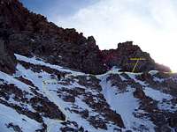 A Labeled View
All the gullies on the West Face cliff out near the bottom. I wouldn’t necessarily say this route is exposed but in the places where exposure is imminent, it is extreme.
I also wouldn’t feel comfortable down-climbing the class-4 headwall located at the top of the Keyhole Couloir unless I had my climbing shoes with me due to the exposure. Rapelling this short 20'-30' section is definitely the way to go if descending this route. A 30m rope would be sufficient. It may only be class-4 but if one took a fall off this short face, it would likely be your last.
This is a great alternative to the oft used Northeast Ridge Route and solitude can be expected. This is a 'good' route (though not the best) for working on one's route-finding abilities and pushing the comfort level on consistant 3rd class, loose rock. Although 3rd class in the Elk Mountains is completely unlike anything found in the Sawatch, Sangre de Cristo or Front Range.